The Churches of Britain and Ireland
|
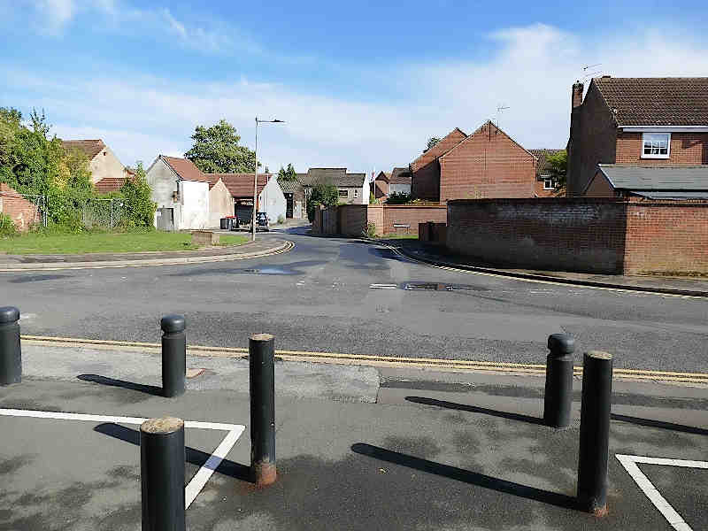
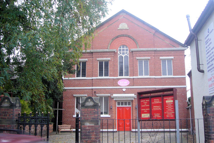
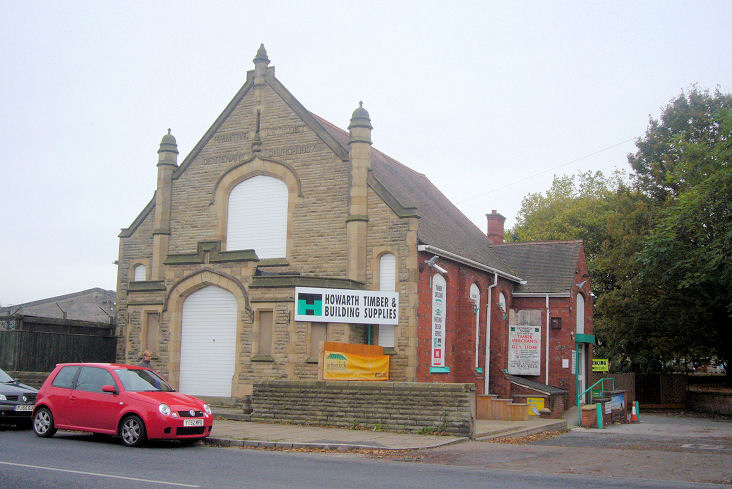
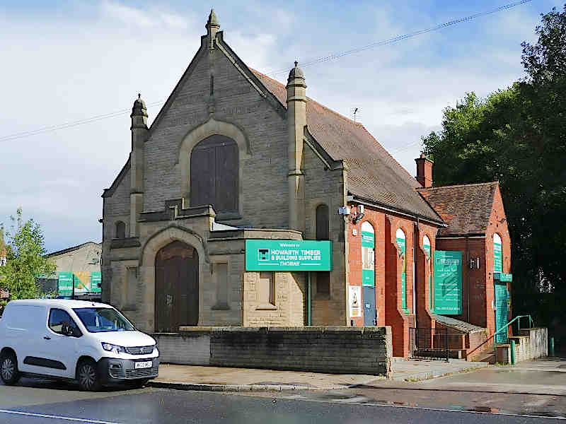
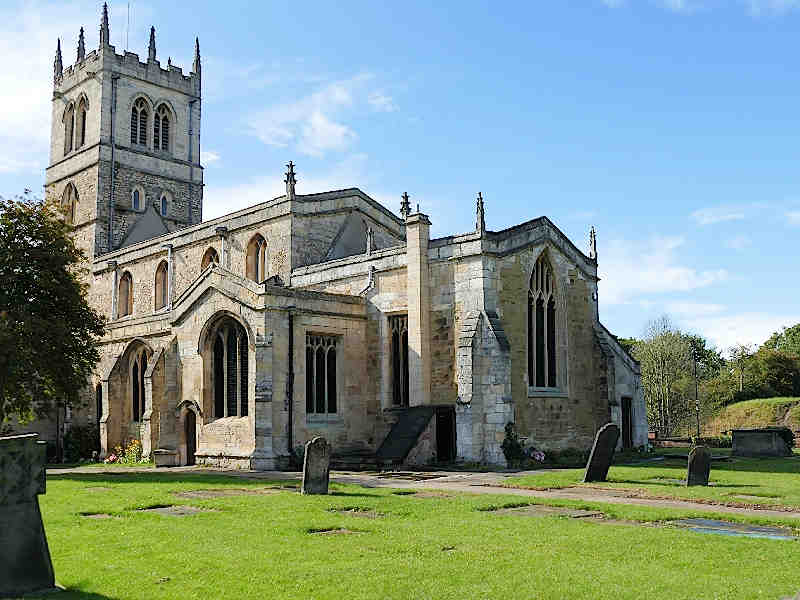
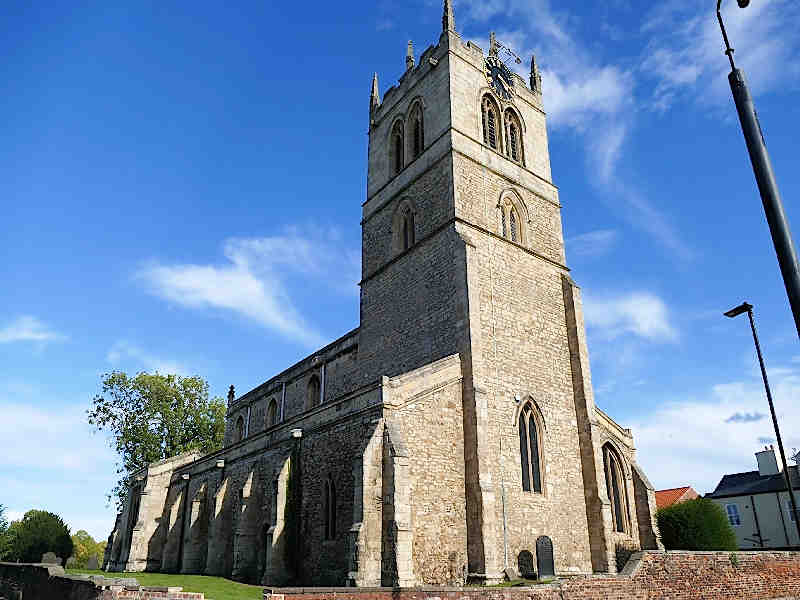
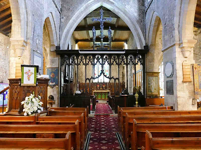
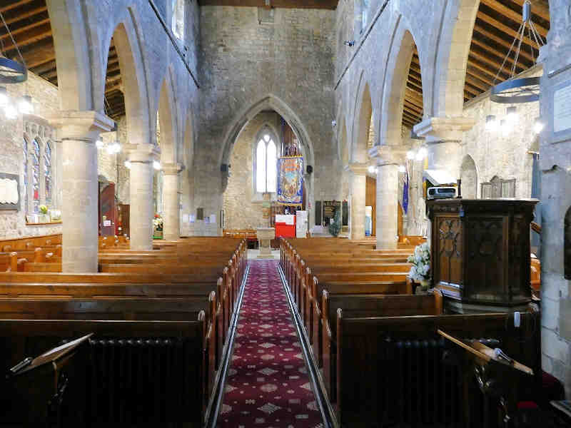
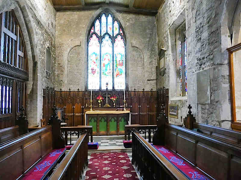
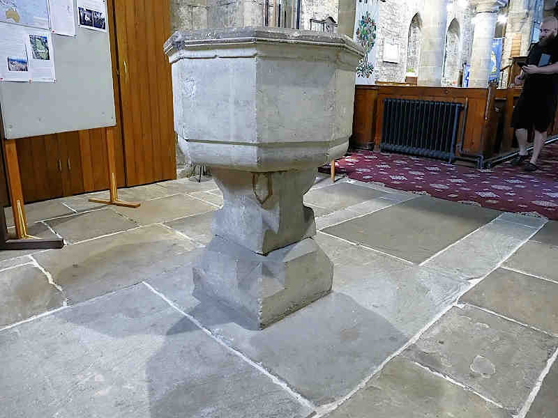
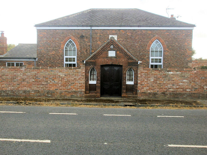
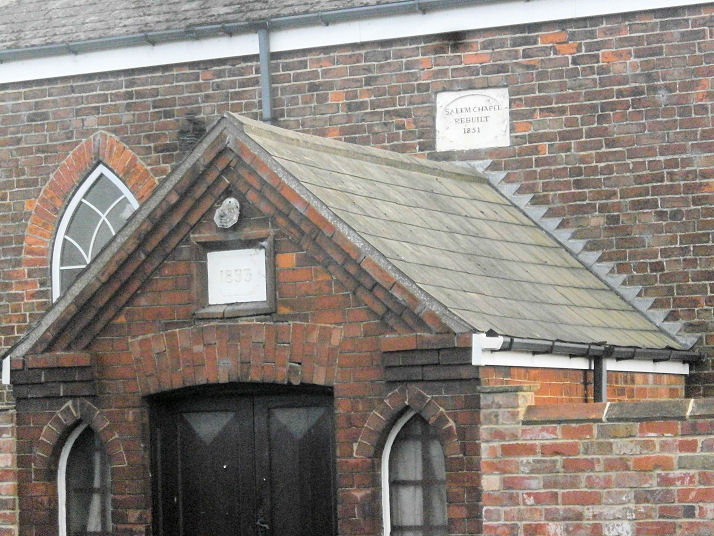
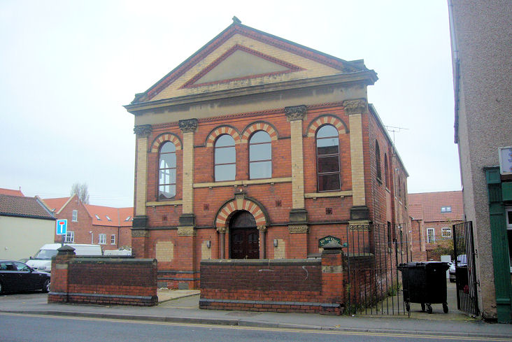
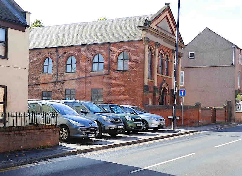
Thorne, South Yorkshire The Church Hall, set well back from Church Street and Stonegate, is a former Congregational Chapel. So named on a map of 1892, one of 1906 labels it as Mission Ch. It was still in active use (U.R.C.?) in the mid-20th century. SE 6894 1321. © David Regan (2025). An earlier Congregational Chapel stood on Orchard Street (its site at now lies under the road and adjacent grassed area). It had previously been Unitarian (pre-dating a map of 1853). It went out of use in the mid-20th century. SE 6864 1320. © David Regan (2025). A Friends Meeting House is shown on some O.S. maps, set well back from Church Street behind other buildings. Aerial views suggest it hasn't survived, and the building or its site can't be seen on Streetview. I haven't been able to find a photo of it either. Kingdom Hall of Jehovah's Witnesses, on Grange Road and Northgate, Moorends, as seen by Streetview in 2023. SE 6964 1574. The Methodist Church on King Street. It has a date-stone declaring itself to be Wesley Chapel 1826. SE 6871 1337. © James Murray. Link. Moorends Spiritualist Church on Newholme Drive, Moorends, as seen by Streetview in 2023. SE 6941 1539. Facebook. The cemetery on Southfield Road has a Mortuary Chapel (2023 Streetview). SE 6914 1294. Genuki includes an entry for "the former Pentecostal Church". This survives on Church Street, and was seen by Streetview in 2023. Close examination of the inscription below the left window reveals it to say "Travis's Charity School", and all available maps also show it to have only been a school. Can you confirm whether this was indeed also a church at some point? Primitive Methodist Centenary Church (1907) on South Parade. SE 6878 1306. © James Murray. Another view, © David Regan (2025). This source dates its closure to 1970, and says there had been a predecessor of 1822. It also acknowledges that there is some mystery here, with a possible third chapel, and doubt about the earlier date. On a map of 1853, and almost across the road from the site of the 1907 chapel, is a side road named Providence Row (now Horse Fair Green) - could one of these earlier chapels have stood here? It's also interesting to note that the 1906 map marks a building directly across the road from the junction of Horse Fair Green and South Parade as Chapel. It may survive in secular use - 2023 Streetview. What was it? SE 6880 1309. St. Joseph and St. Nicholas (R.C.) on Bloomhill Road, as seen by Streetview in 2023. SE 6926 1522. Link. St. Nicholas on Church Street. SE 6896 1327. © Bill Henderson. Two more views - 1, 2, three of the interior - 1, 2, 3, and the font, all © David Regan (2025). Link. Grade I listed. See here for related listed features. St. Wilfrith (2023 Streetview) is on West Road at Moorends. SE 6953 1542. Link. Standing outside the village at SE 7175 1063 is the former Salem Methodist Chapel. The 1853-5 and 1893 maps shows it as Methodist New Connexion, and as "Methodist Ch" on the 1962 edition. The date-stones for 1833 and 1851. © Howard Richter (2017). The former United Methodist Chapel (Bethesda) on King Street is dated 1893, and now converted into flats - The Old Chapel. SE 6864 1336. © James Murray. Another view, © David Regan (2025). Older O.S. maps show a Wesleyan Methodist Chapel on Moorends Road at SE 6925 1645. Pre-dating a map of 1853, it seems to have been enlarged or re-built before 1904, but had gone out of use before 1951. Demolished, its site was seen by Streetview in 2023. Mid-20th century maps mark a place of worship on Northgate and Garden Road, Moorends, at SE 6965 1568, just a little way south of the later Kingdom Hall (see above). Evidently converted from the church, Moorends Community Centre now occupies the site. 2023 Streetview. Can you advise what it was?
|
||
29 September 2025
© Steve Bulman
Contact Details