The Churches of Britain and Ireland
|
|
Somercotes, Derbyshire Most of the dates given below are
from this
source, which has more extensive histories on the churches listed
below. Numbers at the end of each entry below [1] etc, refer to the numbering
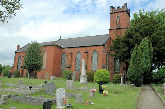
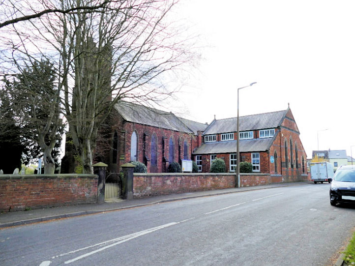
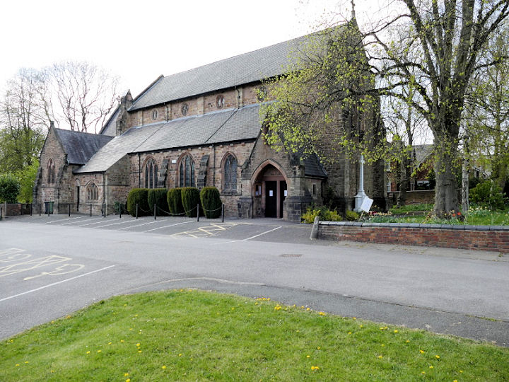
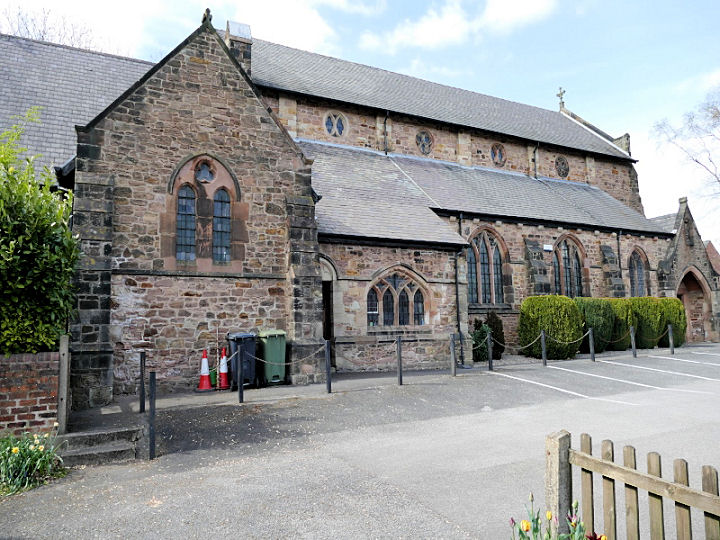
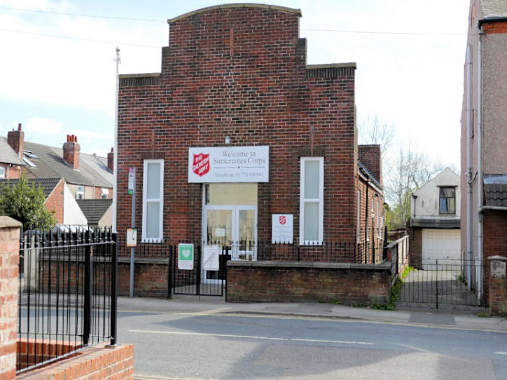
used in the source. Birchwood Methodist Church of 1853 on Birchwood Lane. It was built as Wesleyan Reform, and was later United Methodist. Another view. SK 4289 5397. Both © Alan Craxford. Another view, © David Regan (2021). [5]. Discussed in the source at the head of this page is a Christadelphian Hall (circa 1900-circa 1935) on Leabrooks Road. It suggests that it may have stood at the corner of Leabrooks Road and Mansfield Street, in what is today a snooker club. However, there are maps available for the early 20th century, and a hall isn't labelled at this location, and Christadelphian Halls are usually marked on O.S. maps. In any event, assuming that the snooker club has remained in the same premises, it stands on Mansfield Street, but not on the corner with Leabrooks Road - it can be seen here in a Streetview from 2011. [2]. A Free United Methodist Chapel once stood on Sleetmoor Lane at SK 4207 5391. In this 2019 Streetview, its corner plot can be seen - it's footprint included the house, lawn, and part of today's roadway. It was built as Salem in 1867, and closed in 1971. [13]. Another Free United Methodist Chapel stood on Chapel Street, at SK 4198 5337. Built in 1859 and re-built in 1896, it was closed in 1973. Maps suggest it was demolished in the late 1970's or the 1980's. Housing has been built on the site, as seen here in a 2009 Streetview. Its gable-end stood at not quite a right angle to the road. [3]. A Mission Room (1893-1940) is marked on the 6" O.S. map of 1900 at SK 4346 5420. The road on which it stood is un-named on any maps I have access to, but the source at the head of this page calls it Muckram Lane (off Birchwood Lane). It was a tin tabernacle, and it stood on the concreted area seen here on a Streetview of 2019. [6]. The Cemetery on Cemetery Road has a Mortuary Chapel (1895). It isn't visible on Streetview, but a photo is available here [4]. SK 4180 5357. The source given at the top of this page lists a Non-Denominational Hall with "a front facade facing Cemetery Road at Leabrooks", and "due to its size and architecture it can still be distinguished from the surrounding buildings". There are no buildings opposite the western end of Cemetery Road, and no obvious candidates opposite its eastern end, and no maps from before the 1960's indicate a place of worship hereabouts. It suggests a closing date of the 1960's or 1970's. [8]. Peniel Christian Church stands off Leabrooks at SK 4210 5338. A small extension partly hides the original Primitive Methodist Chapel of 1905. [10]. A map of 1880 shows a Primitive Methodist Chapel (1839-1890's) on Lower Somercotes, at circa SK 4301 5336. The housing built on the site can be seen on a Streetview of 2019. [9]. It was succeeded by another P.M. Chapel of 1898 on Somercotes Hill at SK 4260 5361. The source above says that it was demolished in the 1960's and re-built, this then closing circa 2005 and also subsequently demolished. [11, includes a photo of the chapel]. It also says that a small part of the original chapel survived - this can be seen here on a 2009 Streetview to the right of the 1960's church. St. Thomas (1901-2) on Nottingham Road. Another view. SK 4236 5380. Both © David Regan (2021). Link. The preceding church on the same site, also St. Thomas, was adapted from a pre-existing Methodist Chapel of 1849. There is a photo of the first St. Thomas on the source mentioned at the head of the page. [1]. The Salvation Army Church on Sleetmoor Lane, at SK 4216 5384. It pre-dates a map of 1900, where it's marked as S.A. Barracks. © David Regan (2021). Link. [12].
|
|
21 July 2025
© Steve Bulman
Contact Details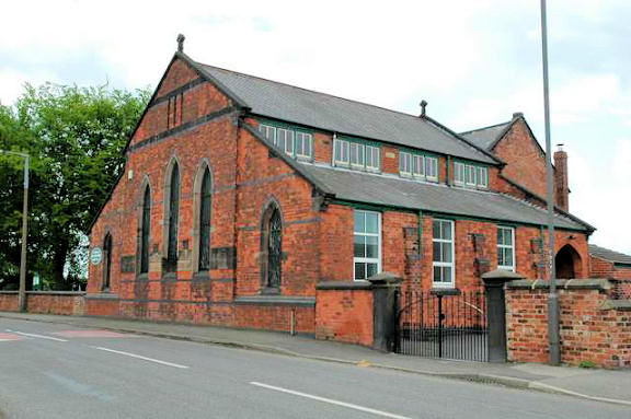