The Churches of Britain and Ireland
| Redcliffe (including Temple), Bristol
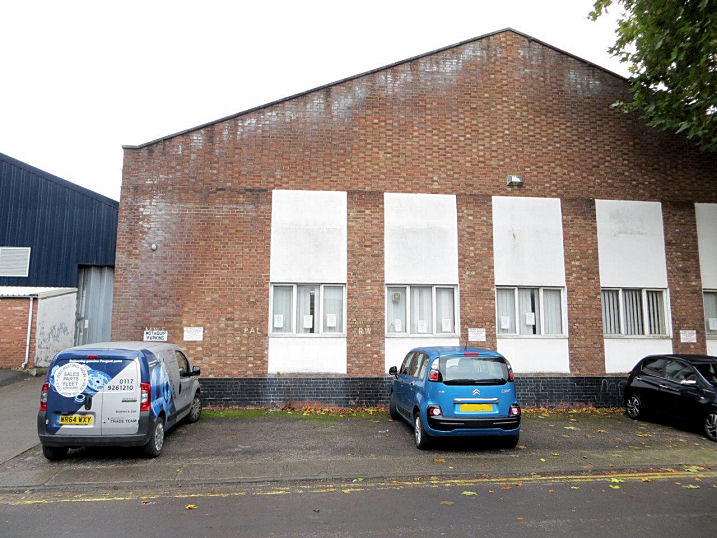
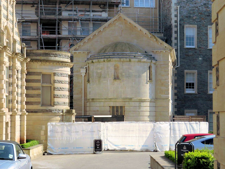
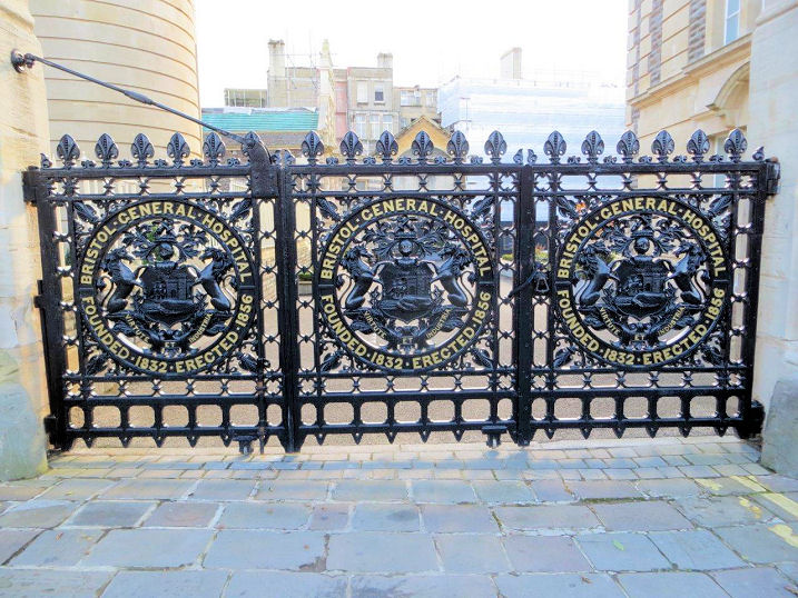
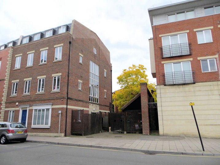
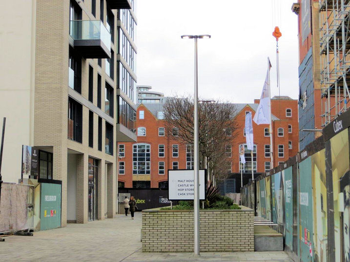
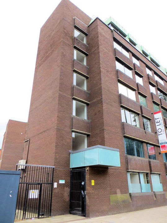
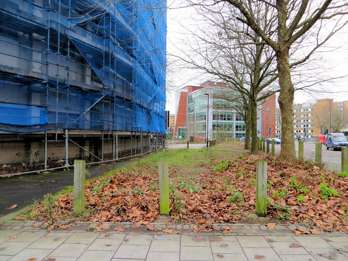
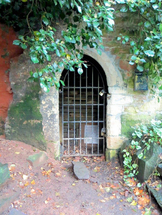
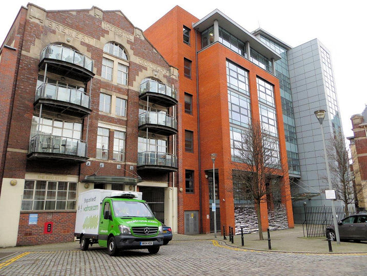
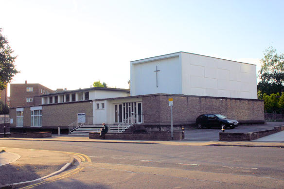
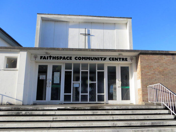
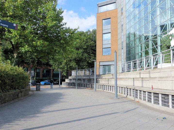
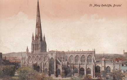
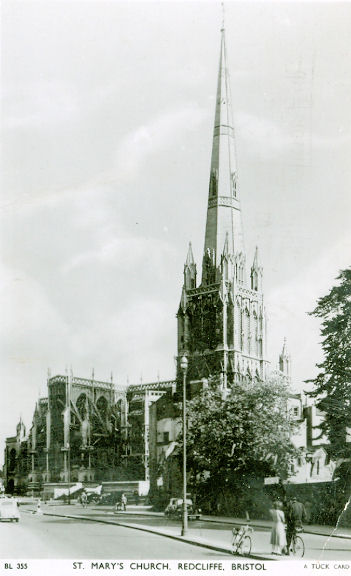
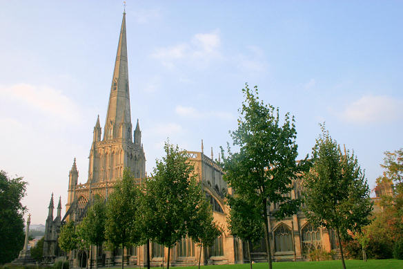
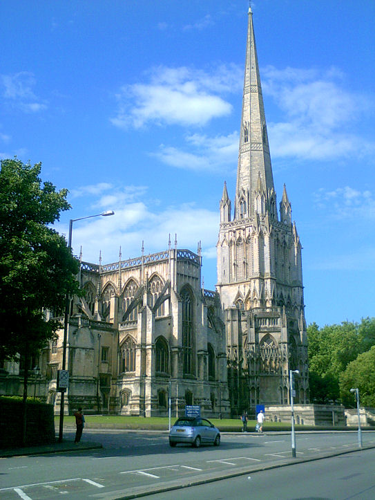
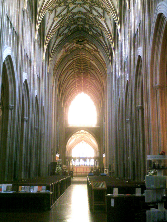
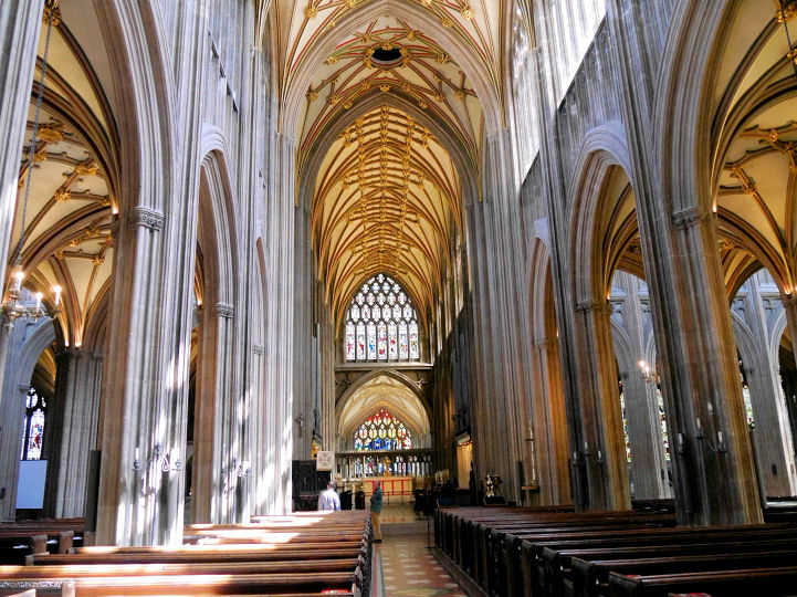
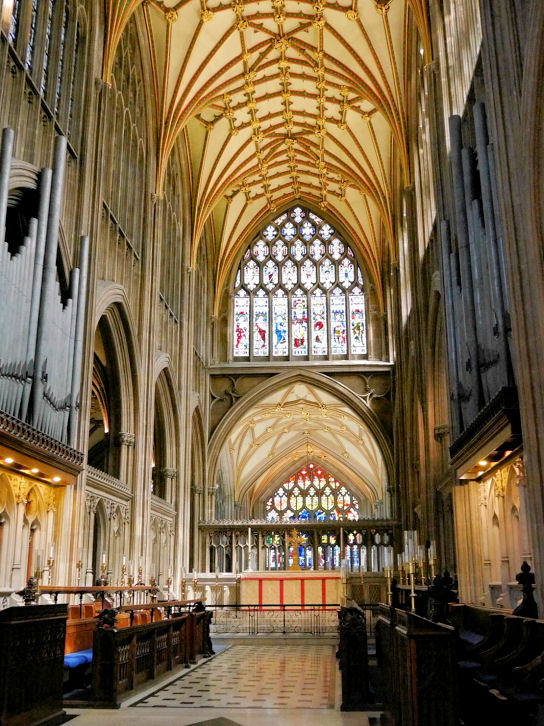
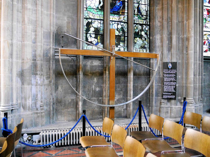
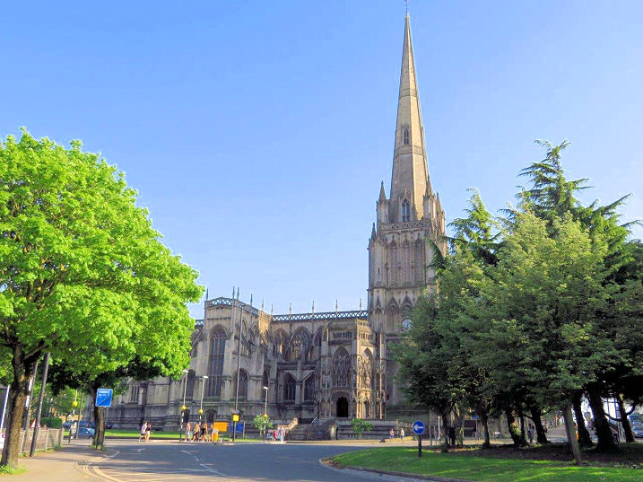
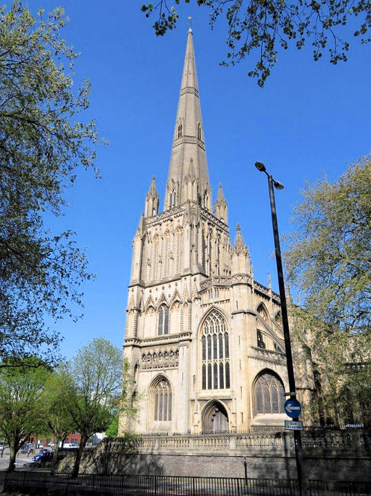
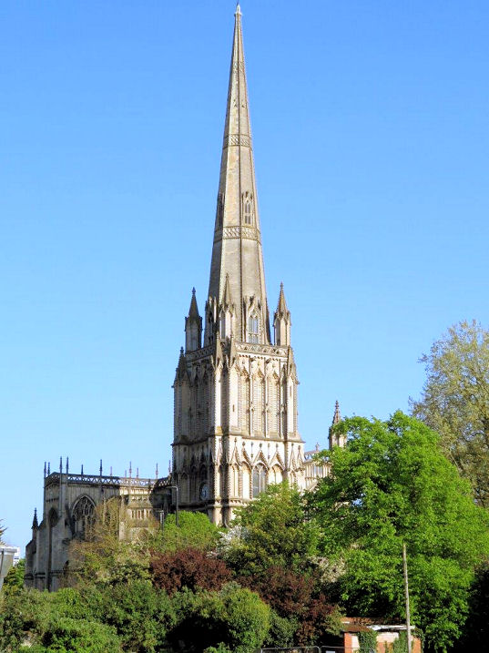
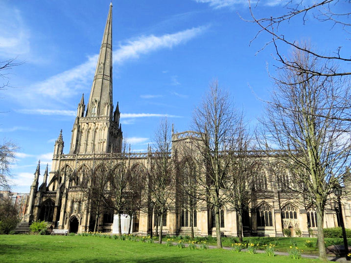
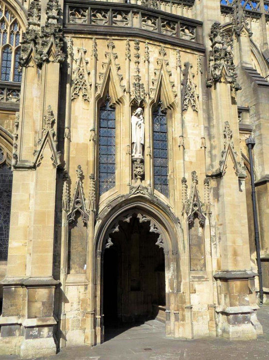
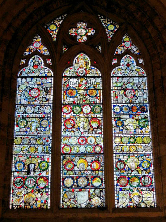
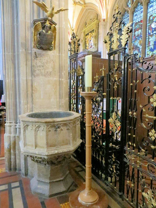
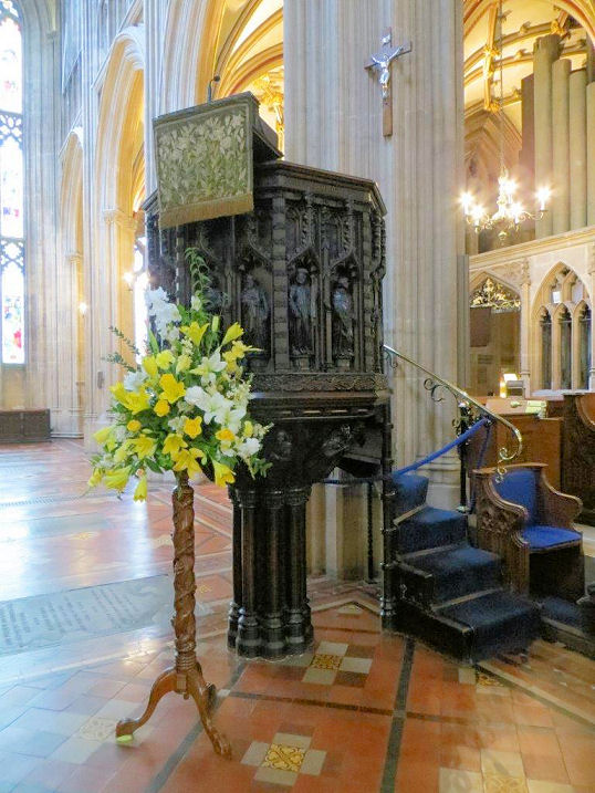
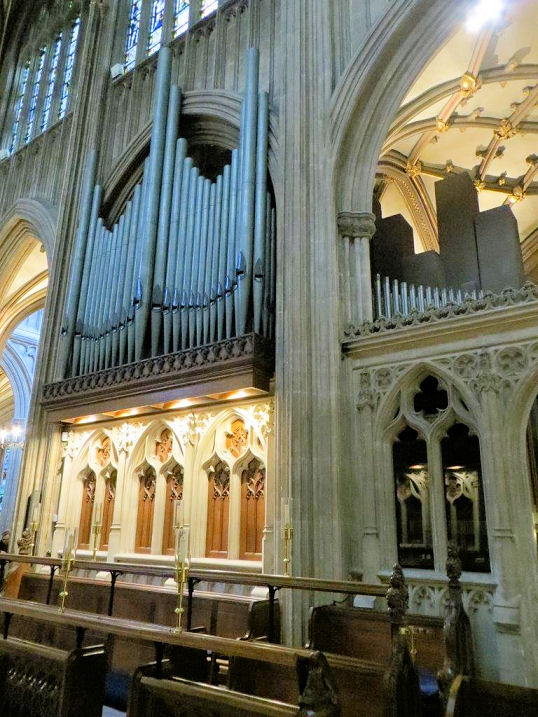
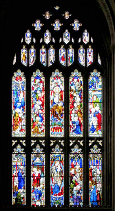
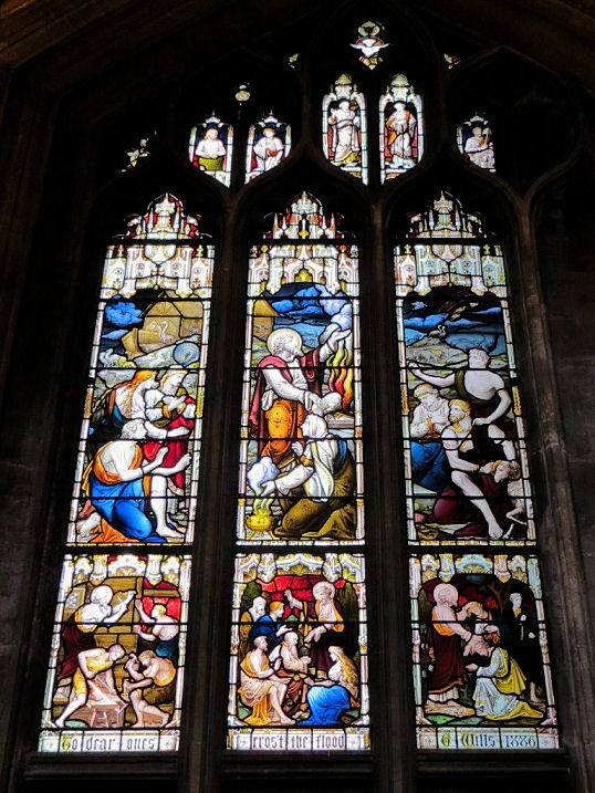
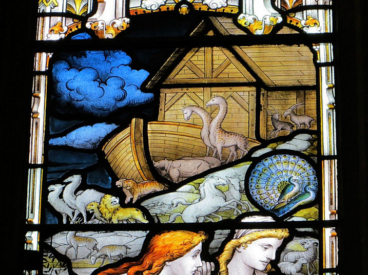
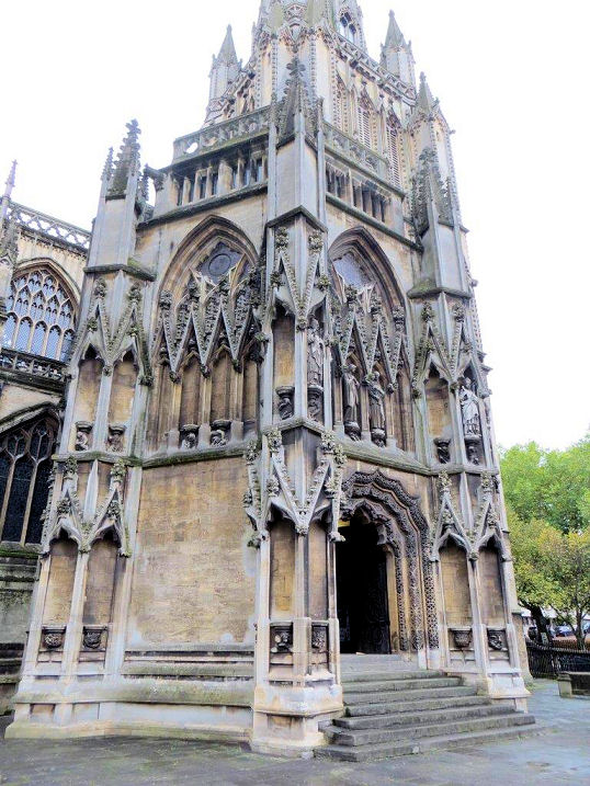
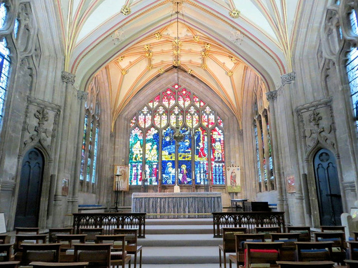
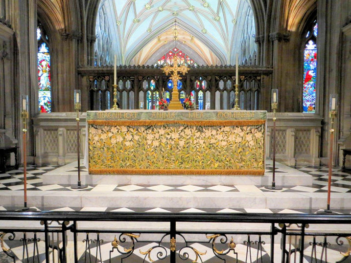
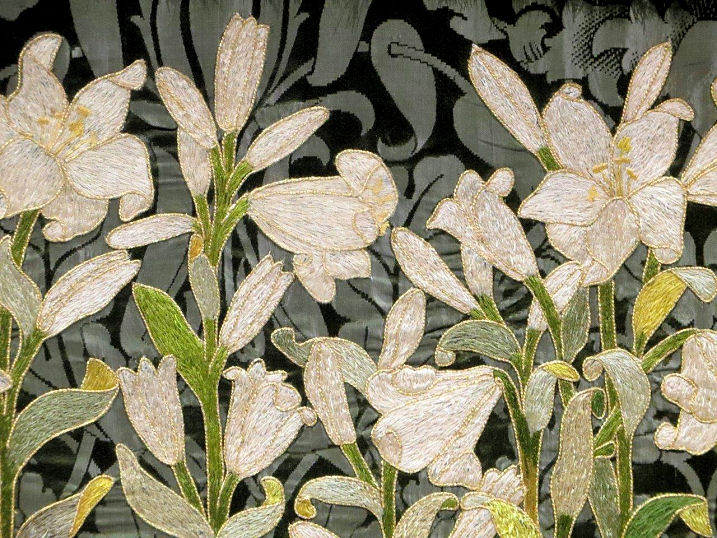
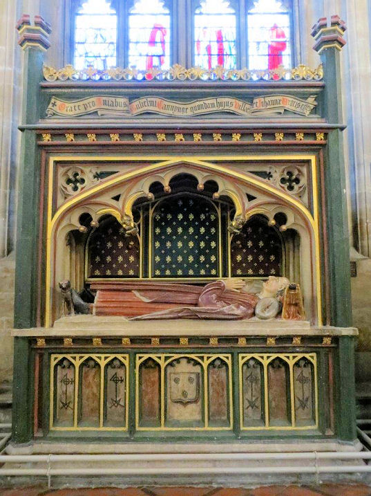
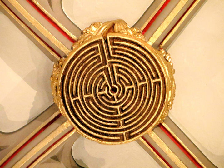
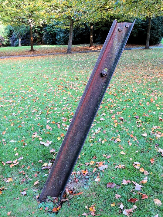
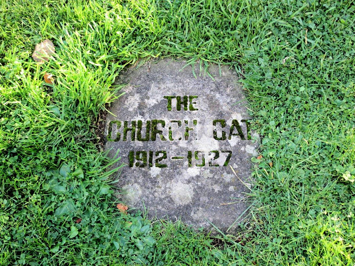
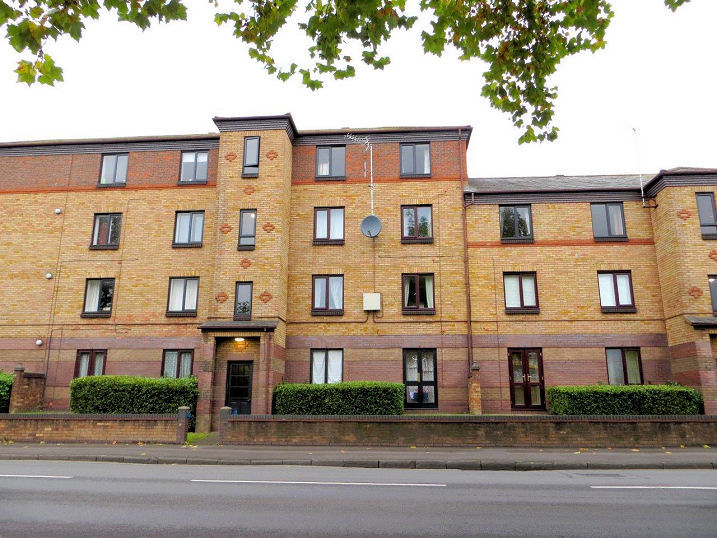
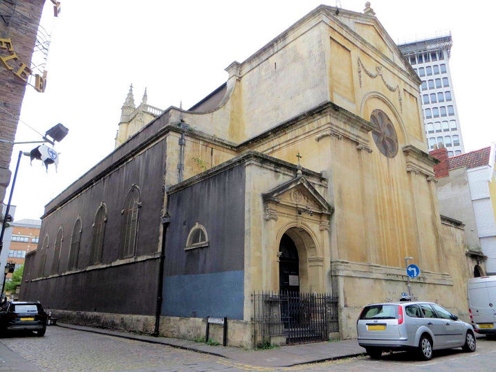
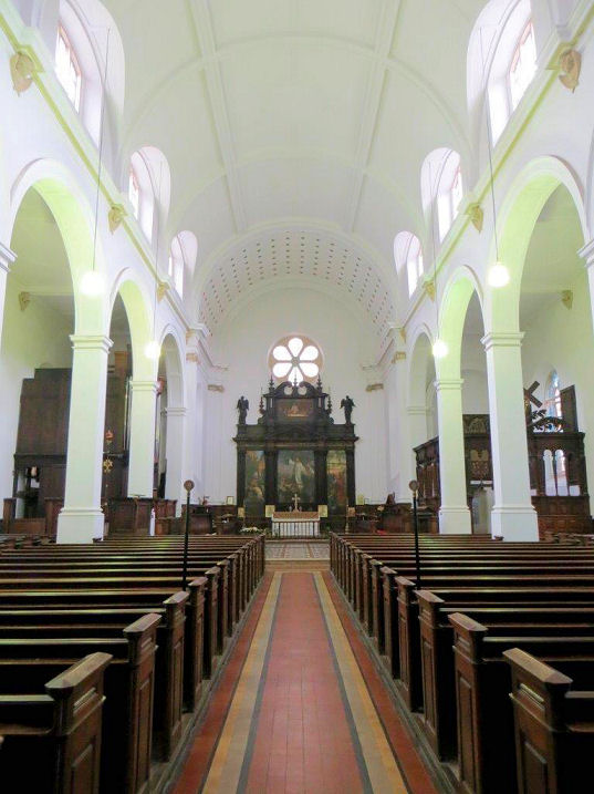
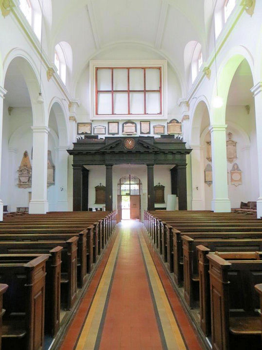
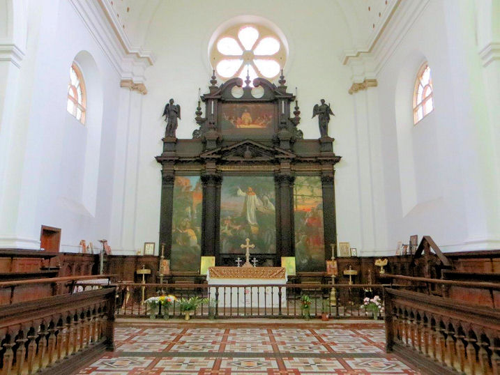
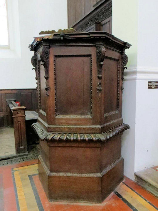
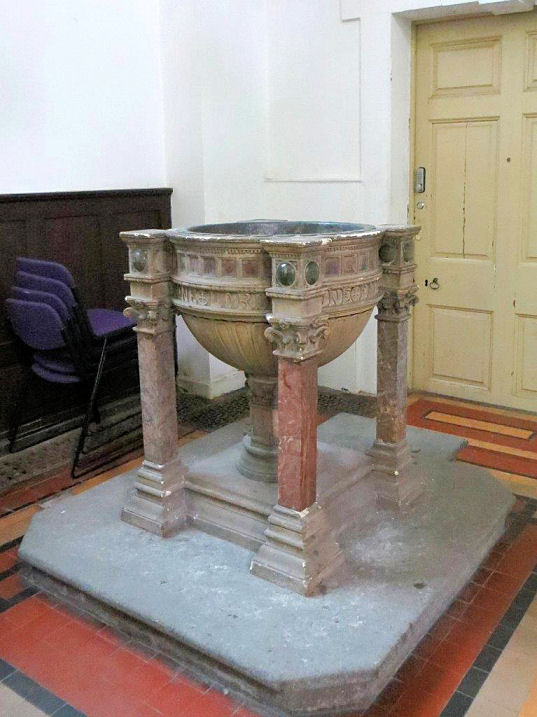
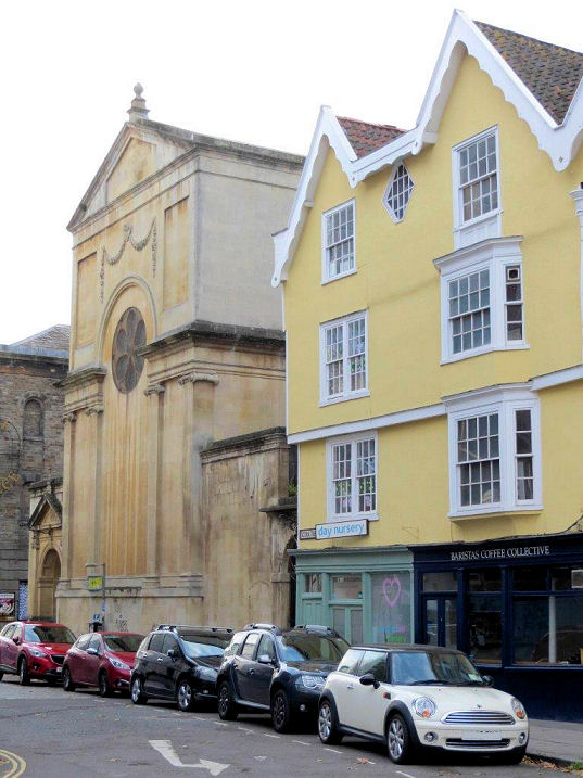
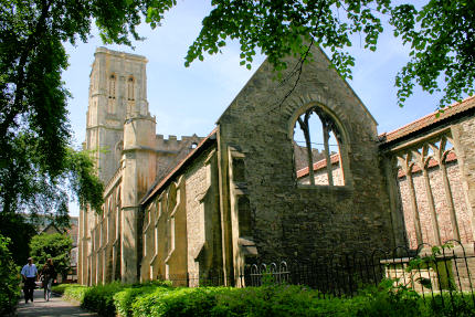
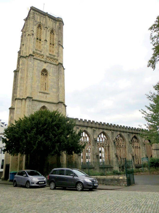
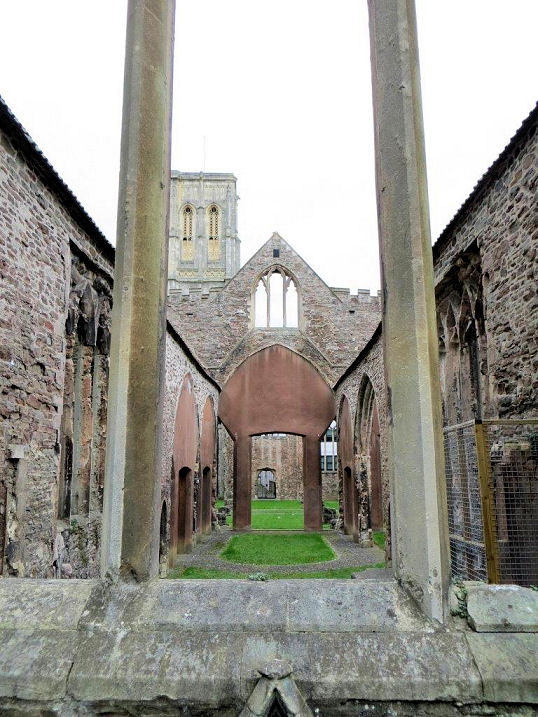
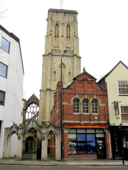
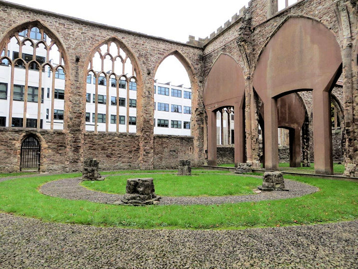
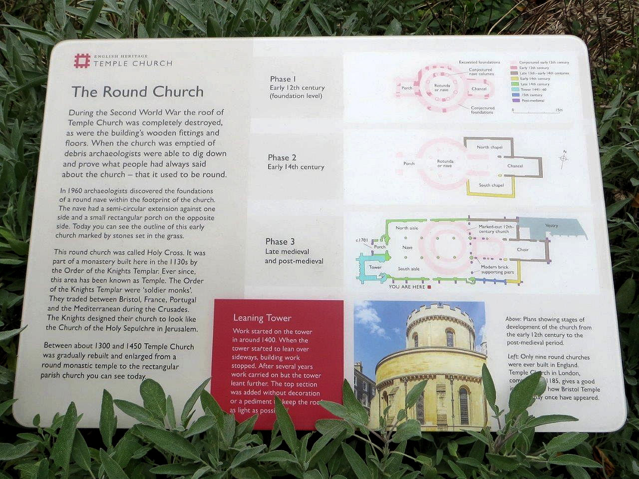
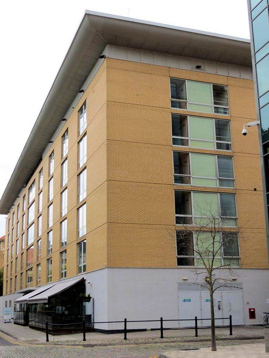
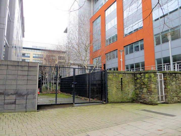
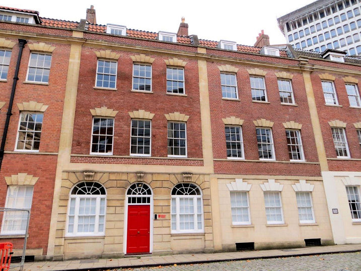
Austin Friars Monastery was founded in 1313, and like so many others, fell victim to Henry VIII. It is commemorated in the modern street called Friary, and the actual site of the monastery now lies beneath an office block. ST 59507 72527. © Carole Sage (2017). Bristol General Hospital Chapel was built, along with the hospital, in the mid 19th century. The hospital was closed in 2012, and the buildings, including the chapel, are being converted into flats and houses. The gates to the site, with the chapel visible behind. ST 58855 72165. All © Carole Sage (2016 and 2018). An old photo of the interior is available here. The site of Canynge's Chapel which was part of Canynge House, which stood on Redcliffe Street. Canynge was a very wealthy Bristol merchant, and five times Mayor of Bristol, in the 15th century. His house, which seems to have survived the blitz, was demolished as part of redevelopment, and the site now mainly of the gap between the office buildings shown in the photo. in The Loxton Collection has an illustration of the interior. ST 59079 72543. © Carole Sage (2016). The site of Counterslip Baptist Chapel (1810), which was a splinter from Pithay Baptist Chapel (for which, see the main Bristol City page). Built on a street called Counterslip, the roads have since been re-aligned. ST 59205 72923. The second Counterslip Baptist Chapel was built in 1878 on Victoria Street at ST 59318 72580. Severely damaged in WWII, it was eventually replaced by the third Counterslip Chapel in Whitchurch (and for which, see the Whitchurch section on the main Bristol City page). The site of the second chapel is now occupied by a office block. Loxton made a drawing, which shows a rather handsome building. Both © Carole Sage (2016). Although the exact position of the Eremites Friary (14th century) is not known for certain, it's known to have stood inside the city walls, east of the Temple Gate. The monks cultivated a large area of land, known as the Great Gardens. Temple Way cuts through the site of these gardens, and this is shown in this photo. ST 59462 72580. © Carole Sage (2017). The long gone, and short lived, Friary of the Sack was established in 1266, and only lasted for about 20 years. The order was known as the Friars of the Sack, or Brothers of Penance of Jesus Christ. Although the exact location of the monastery isn't known for certain, their church stood outside Bristol's Temple Gate. An illustration of the gate (now also gone) is available here. These two photos - both © Carole Sage (2017) show the site of the Temple Gate - 1, 2. ST 59396 72403Link. Thomas Lord Berkeley established a hermitage in a cave in the red cliff from which the area is named, in 1346. The first hermit was installed to pray for Berkeley and his family, and there was a hermit here until the 17th century. In 1665 the land in front of the hermitage was given to the Quakers to use as a burial ground (the cave is visible at the right), and that continued until 1923. In 1950 it was donated by the Quakers to Bristol City Council, who cleared the headstones and stacked them in the cave, and created a small park here. ST 59014 72331. Both © Carole Sage (2016). The site of Holy Cross Chapel (R.C.), which stood on Victoria Street. Built in 1872-4, it was successor to an earlier (and smaller) Holy Cross Chapel in Bedminster, for which, see the Bedminster page. The road layout has since changed, and the site is now under a large traffic island. The date of demolition is uncertain, but was probably in the post-war years. It was succeeded in 1922 by the third Holy Cross Church on Dean Lane in Southville, for which see the Southville section of the Bristol page. ST 59410 72443. © Carole Sage (2016). A photo is available here. The site of the Hospital of St. John the Baptist, a monastery of 10th century foundation, and a victim of the Dissolution. The porch of St. Mary Redcliffe can just be seen at the right. ST 59077 72390. © Carole Sage (2016). The site of the Langton Street Wesleyan Methodist Chapel, which opened in 1882, and fell victim to the Luftwaffe. Loxton made a drawing of it, and it can also be glimpsed in an old photo here (St. Mary Redcliffe can be seen in the distance). ST 59365 72117. © Carole Sage (2016). Another church about which very little is recorded is the Plymouth Brethren Meeting Room on Tucker Street. It cannot date to before the 1820's (the Brethren formed in the late 1820's), when only a short length of Tucker Street survived. The Meeting Room must have stood either in Carole's photo or been close to it. ST 59086 72893. © Carole Sage (2017). The site of Portwall Lane Chapel (United Free Methodist). Information is scarce about this chapel, but Carole has found references to it in Methodism in Late 19th-Century Bristol by M.J. Crossley Evans. "In 1859 the congregation meeting at Thomas Street moved to Portwall Lane". This suggests that they moved into a pre-existing building, and the available map evidence agrees with this. The same book also says that “A new chapel in Southville was opened in January 1894 to supersede the premises in Portwall Lane.” A 1906 photo of Portwall Lane is available here, and comparison with maps of that time suggest that the white-fronted building behind the cart near the centre of the photo was the chapel. The building was probably demolished around 1950 when the area was re-developed. ST 59144 72450. © Carole Sage (2018). The site of Prewett Street Baptist Mission Hall, now in use as a car park. Map evidence shows it was built prior to 1881, and the building was still extant in 1912 (though no longer marked as a place or worship). The building had gone by 1949. ST 59327 72298. © Carole Sage (2016). Redcliffe Methodist Church on Prewett Street, dates from 1962. ST 59185 72206. © Andrew Ross. Since Andrew took his photo, the church has been re-named as Faithspace Community Centre. © Carole Sage (2016). Link. The site of Rose Street Methodist Chapel. Built before 1874 (from map evidence), it must have been demolished before WWI, when the area was cleared to make way for an extension to a railway goods yard. Re-developed again more recently, the site is now a pedestrian area in front of an office block. ST 59478 72524. © Carole Sage (2016). St. Mary Redcliffe (O), on Redcliffe Hill. ST 59128 72313. From an old postcard in Steve Bulman's Collection. Another old postcard view, this one from Reg Dosell's collection. A modern view, © Andrew Ross. Another view, and an interior view, both © Simon Edwards. Two interiors - 1, 2, the chaotic pendulum, and an explanatory board, all © John Balaam (2015). Three additional views - 1, 2, 3, the South front, the south porch, the stained glass windows in St. John's Chapel (made up from surviving fragments of the medieval windows destroyed during Henry VIII's campaign's against the catholic churches), and the font, which came from St. John's in Bedminster. Another font, the pulpit, the organ and its console, the West window and the Noah's Ark window (detail), hexagonal North porch, the Lady Chapel, High Altar and a close-up of the altar frontal, the tomb of William Canynge, a ceiling boss is decorated with a labyrinth. A statue of Elizabeth I. An unusual feature in the churchyard is a length of tramline, blown over the intervening houses and left where it landed when a bomb hit Redcliffe Hill in 1941. Also here is the grave-marker for Tom, the church cat (1915-1927). All © Carole Sage (2016, 2017 and 2018). Link. Grade I listed. Loxton drew the church frequently - 1, 2, 3, 4, 5, 6, 7, 8, 9, 10. Another old illustration shows the church without it's spire. The medieval one collapsed following a lightning strike in 1446 - it wasn't replaced until 1872. The site of St. Mary's Mission Church stood on Clarence Road and Barnard Place (Barnard Place has since gone). It was a mission from St. Mary Redcliffe, founded in 1879, and map evidence suggests that it changed from being a church to a "hall", presumably a church hall, between 1949 and 1971. The area was subsequently redeveloped, and a block of flats built on the site. ST 59480 72127. © Carole Sage (2016). The St. Thomas Street Chapel was short-lived, and nothing is known about it other than the fact that it was marked on a map of 1874. The site was redeveloped after WWII, and is undergoing redevelopment again today. Flats are being built on the site. ST 59185 72611. © Carole Sage (2016). St. Thomas the Martyr on Thomas Lane and St. Thomas Street. The tower is 15th century, but the rest of the church is of the re-build of the late 18th. Closed in 1956, it's now in the care of the Churches Conservation Trust. The church is in use for worship again, as the Trust leases it to a Romanian Orthodox congregation. Another view, and three interiors - 1, 2, 3, the pulpit and the font. The adjacent houses which date from circa 1456. ST 59121 72768. All © Carole Sage (2016). Another view, © Andrew Ross. Link1. Link2. The Loxton Collection has several illustrations - 1, 2, 3. A rotatable and walk-through view. Grade II* listed. The Salvation Army (Bristol No. 4 Corps) met at 73 Redcliffe Hill between 1881 and 1908. Rob Kinnon-Brettle advises that the building no longer exists. Can you provide a photo? The site of a synagogue, which stood in an alley off Temple Street. This had previously been a Friends' Meeting House. Marked on an 1855 map as "Jews Synagogue", it had closed by 1871. Redeveloped after the war, the site is now under the Victoria Street. ST 59234 72735. © Carole Sage (2016). There had been two predecessor synagogues in Redcliffe. The earliest was a room known as the Stone Kitchen in Bose Tavern. This was only used between 1756 and 1758. The congregation then moved to Weavers Hall on Temple Street, where they stayed until 1842. This had originally been an almshouse for widows of weavers, but was in use as a Wesleyan Methodist Chapel prior to the synagogue taking over. None of these buildings survive. The site of Weavers Hall, at ST 59373 72563. © Carole Sage (2017). Temple Church on Temple Street and Church Lane. Dating from the 15th century, it was another victim of the Luftwaffe, and is now in the care of English Heritage. ST 59328 72733. © Andrew Ross. Three additional views - 1, 2, 3, all © Carole Sage (2016), and another, © Carole Sage (2017). The lean of the tower isn't very evident in Carole's photos, but it is in this link. Grade II* listed. Loxton made a number of drawings - 1, 2, 3. The church stands on the site of an earlier round Templar Church, Holy Cross (1130's). The foundations were discovered during an archaeological investigation in 1960, and the site of those foundations are now marked in the grass. A notice board gives some more information. Both © Carole Sage (2016). Temple Church Mission Room once stood on Church Street and Tower Street at ST 59435 72642. Founded before 1855, it shows on the 1880's O.S. map, and the building survived WWII, but when it closed is, so far, unknown. The site has been redeveloped, and is now occupied by an office block. © Carole Sage (2016). The site of Tower Street Baptist Chapel. Although apparently founded in 1878, a Mission Hall is shown on the same position on a map of 1874. Whether the Baptists took over the existing building, or built anew on the same site, is unknown at present. Similarly obscure is its date of closure, and (so far) no photos or illustrations of it have come to light. ST 59517 72598. © Carole Sage (2016). Link, which says the land was cleared for redevelopment in 1913. The site of Tucker Street Presbyterian Meeting Room, on what is now Bath Street. The building shows on a map of 1750, and there are references to it having been founded in 1686. It had been a theatre before this. Closed in 1786 to make way for the building of Bath Street, a row of townhouses were built on the site of the Meeting Room. These are now in use as offices. For the successor to the Tucker Street Chapel, see Bridge Street Chapel in the main section of the Bristol page. ST 59122 72881. © Carole Sage (2016). A Wesleyan
Methodist Chapel once stood on Guinea Street. Dating from the early 19th
century (probably before 1828, as it seems to be shown on a map of that
year), by 1848 it had become the Wycliffe Congregational Chapel. By the
early 20th century it is shown as Parish Rooms (presumably for
the nearby St. Mary Redcliffe). Loxton made a drawing of it, and the
former chapel shows
here as the right hand part of the building. It still appears as
Parish Rooms on the 1949 O.S. map, but the 1971 edition finally has
it as St. Mary Redcliffe Church Hall. The
site is now
covered by part of a hotel and conference centre. ST 58976 72205.
© Carole Sage (2016).
|
||
04 March 2023
© Steve Bulman