The Churches of Britain and Ireland
|
Pontlottyn, Caerphilly
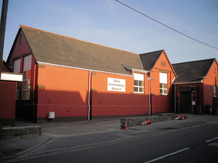
The former English Calvinistic Methodist Chapel on The Square. Coflein, rather than Methodist, calls it Bethel Baptist - so was it both at different times? It dates it to a re-build of 1932 of an earlier chapel of 1874. SO 1167 0623. © Gerard Charmley (2011). Elim Community Church on Waterloo Terrace. Old maps show it to have originally been an infant school. Coflein calls it Salem Independent Chapel (Elim Pentecostal), however the grid reference provided points to what old O.S. maps show as an otherwise unlabelled Capel, adjacent to the school, now demolished. Genuki too calls it Siloim/Salem Ind chapel (Elim Pentecostal), and dates it to the early 19th century. Elim wasn't founded until the 20th century, so it must mean that it was originally an Independent/Congregational Chapel, and possibly later Elim, before the congregation moved into the former school. The site of Salem was seen by Streetview in 2022. SO 1180 0582. © Gerard Charmley (2011). Mount Zion Primitive Methodist Chapel stood on Farm Road at SO 1168 0595. Its perhaps the building dated on Genuki to 1850. The house built on its site was seen by Streetview in 2021. Old maps show a Capel on Merchant Street at SO 1167 0609. I haven't been able to identify it. Its site was seen by Streetview in 2011. Further north, and just off Farm Road on Queen Street was another unidentified Capel. Its grassed-over site was seen by Streetview in 2021 - note the surviving burial ground to the left. SO 1151 0620. Zoar Baptist Chapel (2021 Streetview) on Chapel Street. A Capel shows here on a map of 1901, the predecessor of the present church. It also shows a hall on what is now the car park. A photo of both can be seen here. SO 1154 0627.
|
||
23 June 2023
© Steve Bulman
Contact Details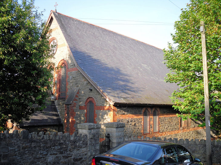