The Churches of Britain and Ireland
|
Mexborough, South Yorkshire
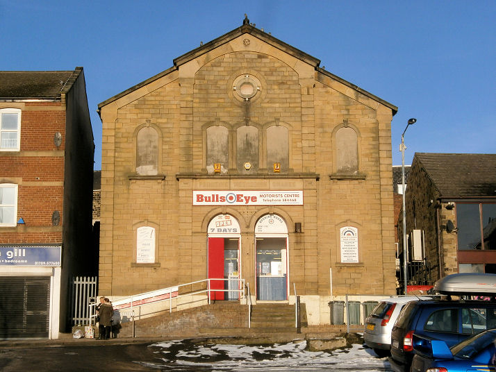
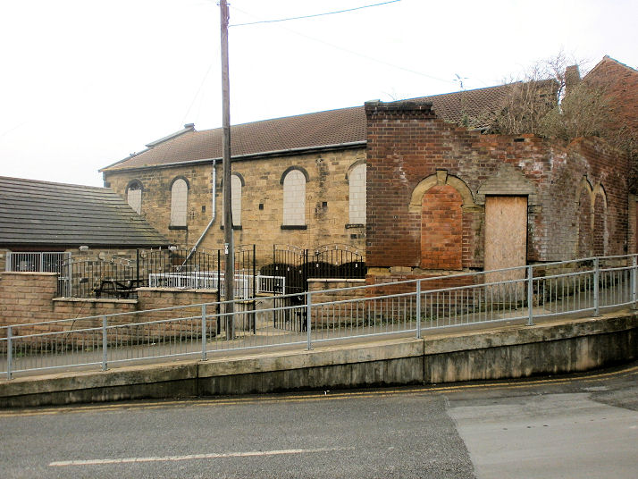
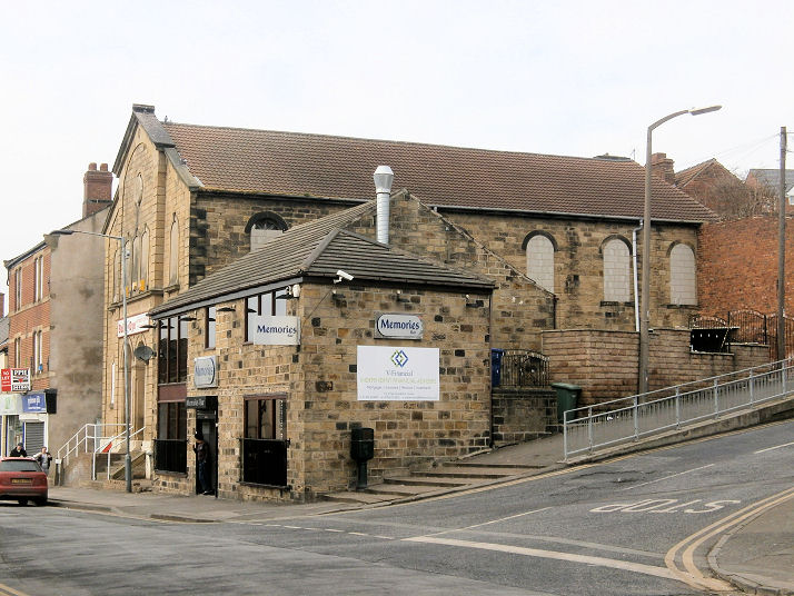
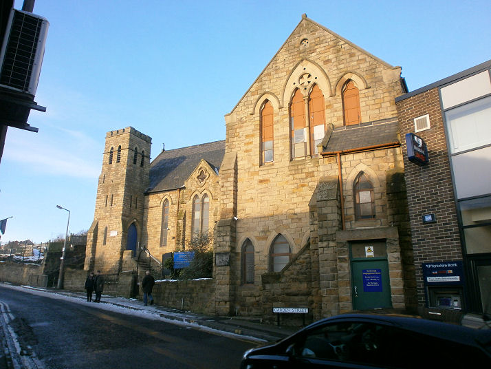
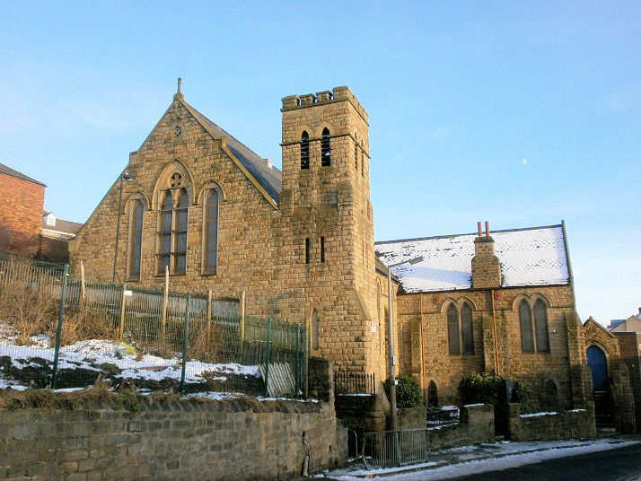
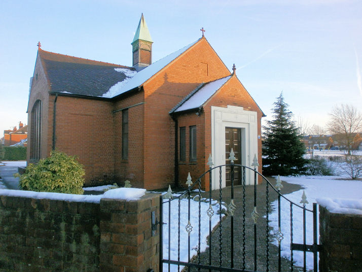
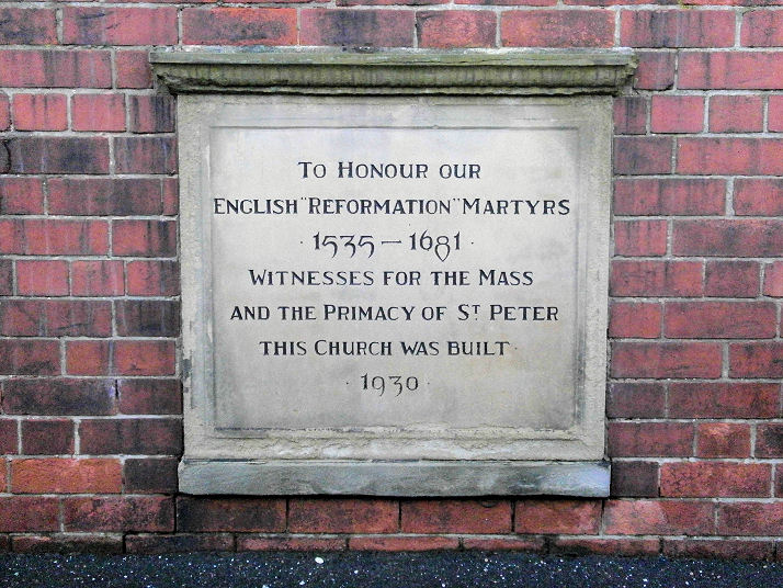
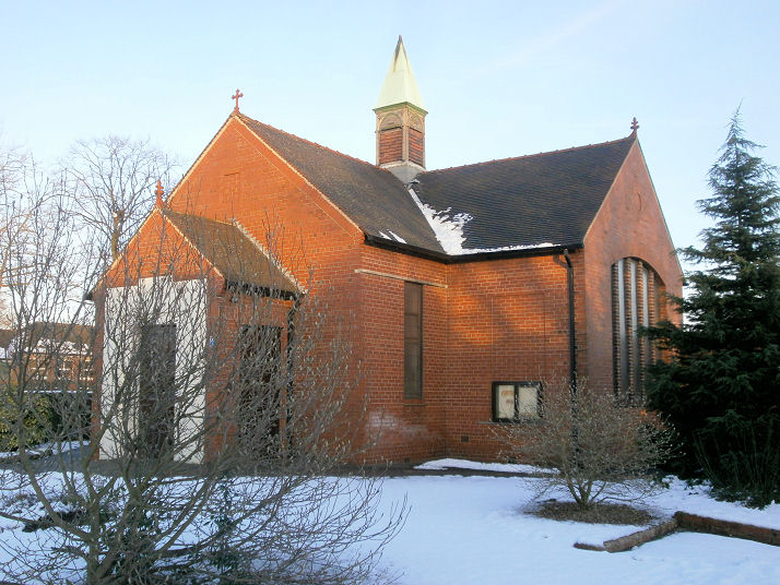
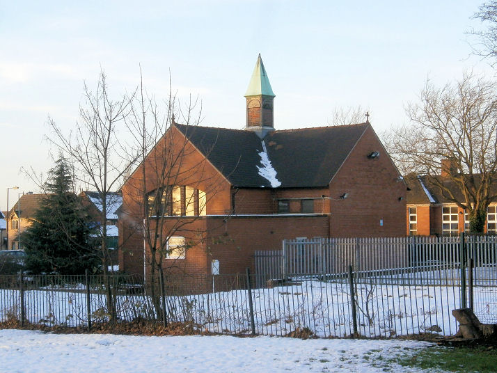
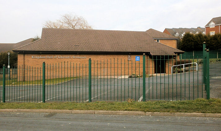
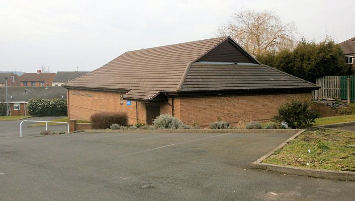
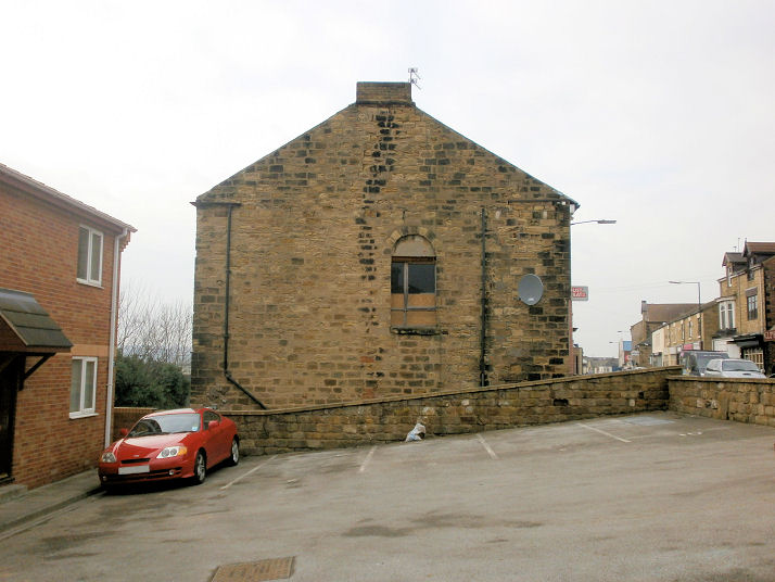
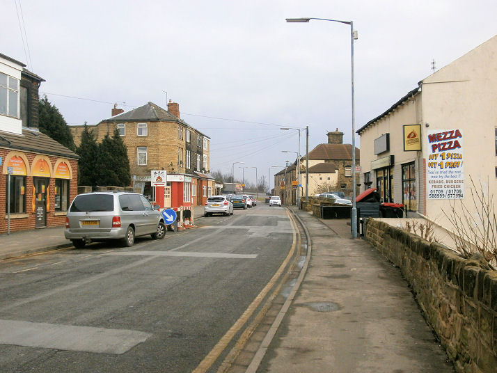
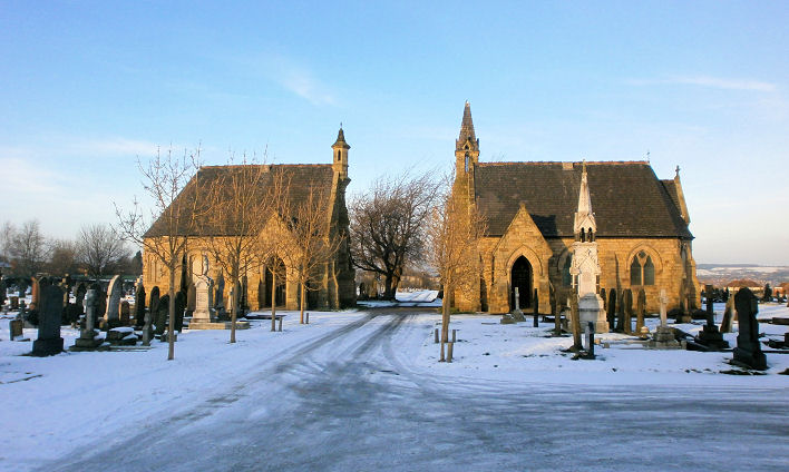
The former Brunswick Methodist Church on Wath Road, now in residential use. SE 464 001. © James Murray. Some pre-conversion interior views are available here. The former Central Methodist Church (built as Primitive Methodist) on Bank Street, now in commercial use. From such limited evidence as Howard has been able to find, he tentatively assigns dates of 1907-1961. SK 4767 9882. © Howard Richter (2014). Two additional views - 1, 2, both © Howard Richter (2015). Congregational Church (1867) on Garden Street. Apparently now holds the only Methodist services in the town. Another view. SK 473 999. Both © Howard Richter (2014). Link (see pages 15 and 16). English Martyrs (1930 - date-stone) on Cemetery Road and Park Road. Two additional views - 1, 2. SE 4715 0045. All © Howard Richter (2014). Link. Chapel House (a private residence) on College Road stands on the site of a Free Christian (Unitarian) Church at SE 4772 0005. Howard tentatively provides dates of 1912 - 1999. © Howard Richter (2015). A photo of the church is available on the Unitarian Historical Society website. Kingdom Hall of Jehovah's Witnesses on Lower Dolcliffe Road. Another view. SE 4697 0013. Both © Howard Richter (2015). Two Methodist Chapels stand almost directly opposite each other on Bank Street. The first, now in commercial use, was originally Wesleyan, and dates from before 1854, as it shows on an OS map of that year. Two additional views - 1, 2. SK 4756 9978. More information here, on pages 27 and 28, which includes an old photo of the building (with portico, on the right of the photo). Also see here for what is probably a pottery model of the chapel in the form of a money box, and here for a view of the rear of the building. The former Bank Street Methodist Church opposite (at SK 4758 9980) dates from about 1964, following the demolition of the previous Trinity Methodist Church, and conversion of the church hall to form the new church. Another view. What appear to be the lower masonry courses of Trinity Church survive where the site fronts onto the street, though gates have replaced the original doors. The old photo mentioned earlier also shows the demolished church, with small corner spire, and there is further information on page 41 of the document. All that can be said of its dates at present is that it doesn't show on the 1901 map, but it is on the 1928 map as Meth. Ch., and that it was demolished in 1964. The current status of the present church is uncertain, as Mexborough Methodists seem now to meet in the Congregational Church (see above). Lastly, a photo approximating to the same view as the photo on page 28 of the document mentioned earlier. All © Howard Richter (2014). Link - estate agents advert for the sale of the chapel, taken when the cross and a notice board were still in place. Mexborough Cemetery has two chapels, the Non-Conformist at left, Anglican at the right. SE 473 005. © Howard Richter (2014).
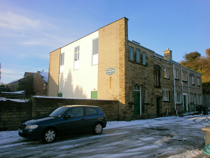
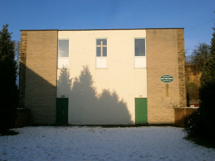
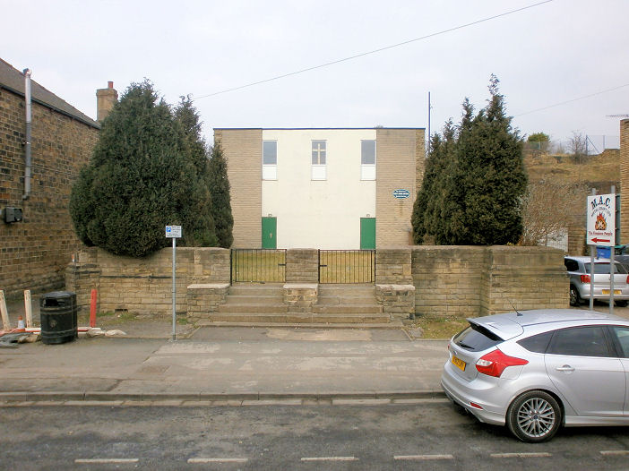
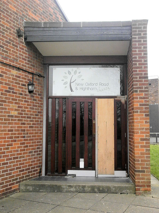
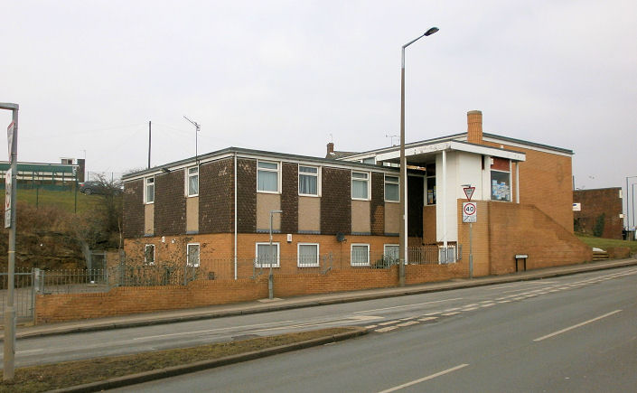
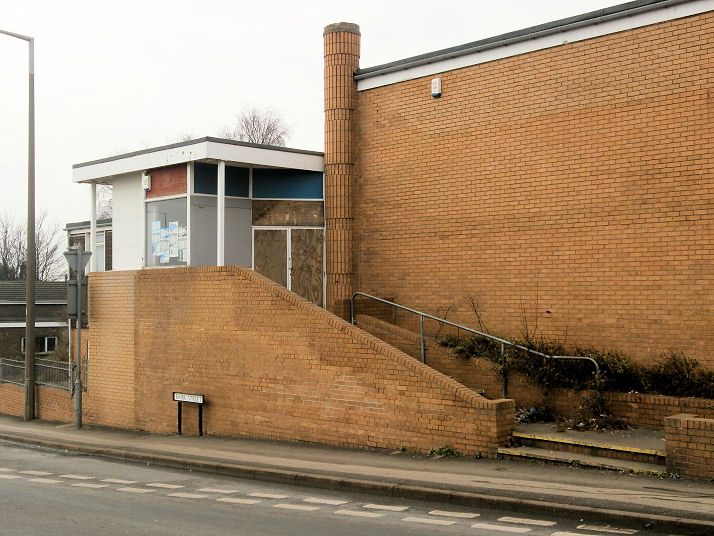
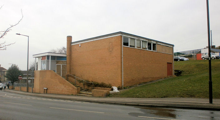
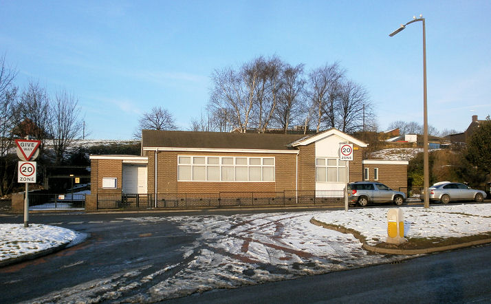
New Oxford Road Wesleyan Reformed Church, on New Oxford Road, is a
replacement for one which stood in the town centre on Oxford Road (at about SK 4743 9976), and demolished for road improvements. Two additional views -
1, 2. All © Howard Richter (2015).
Link - the church website
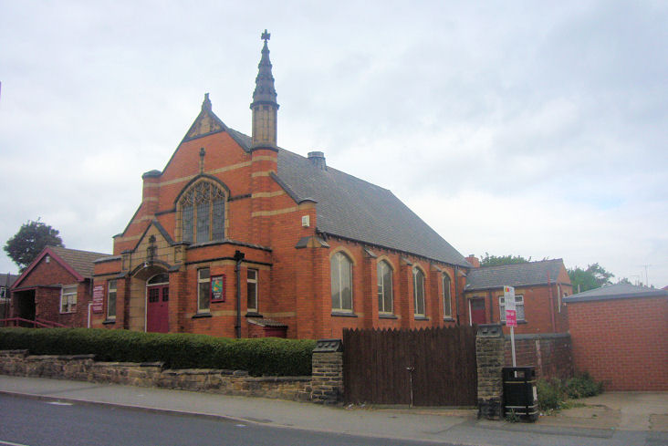
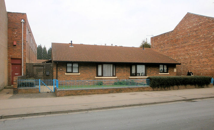
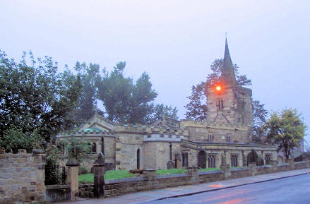
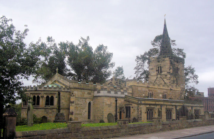
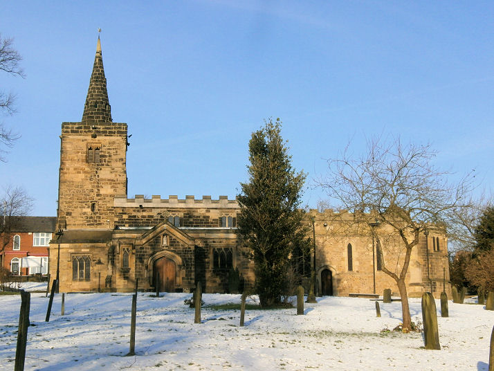
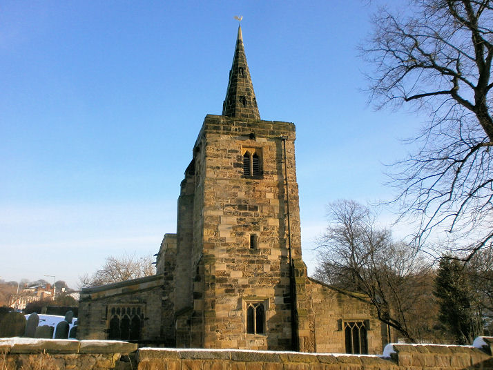
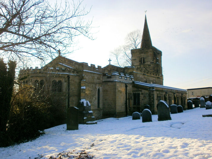
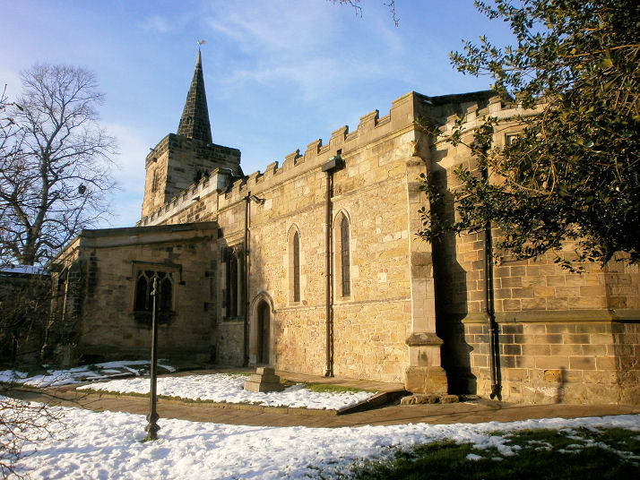
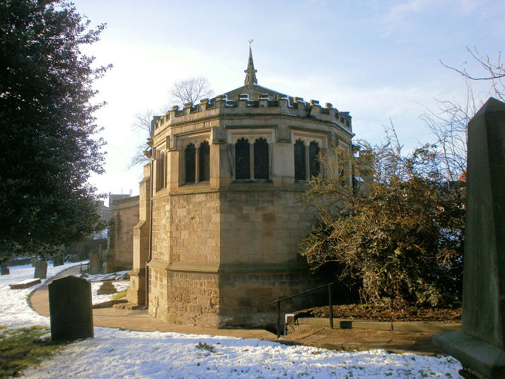
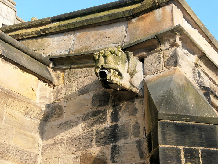
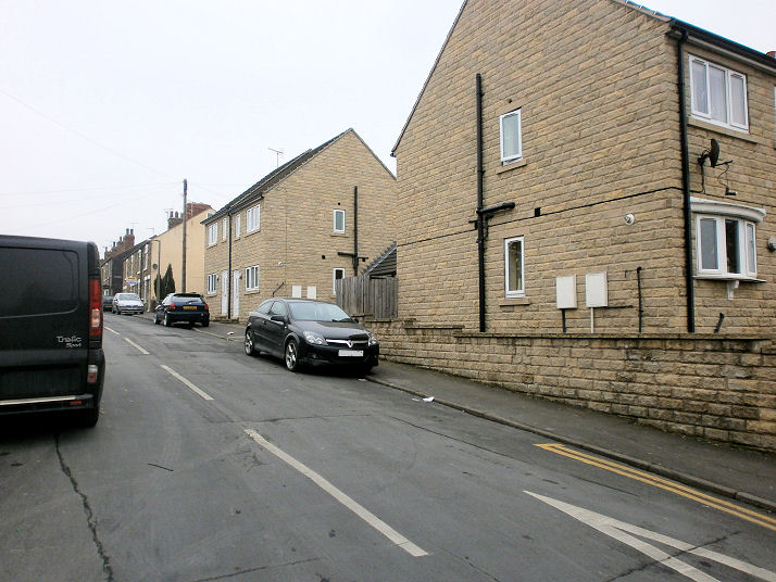
listed on the link does not appear to be working. The site of the Primitive Methodist Chapel on Wath Road. From a study of old maps, Howard has deduced a little history; built before 1892 towards the rear of the site, by 1930 another building had been added nearer to the road - this was now the chapel, with the original chapel now demoted to Sunday School. By 1957 what appear to be the same buildings are now a Printing Works, with no further change for the 1964-71 map. The chapel perhaps became redundant with the merger in 1932 of the Primitive, Wesleyan and United Methodist churches - in which case the congregation may have united with the Brunswick Church (see above) which stands nearby. Date of demolition is currently not known. SE 4618 0013. © Howard Richter (2015). Part of the site of the demolished St. George (Anglican) on Main Street is now occupied by two bungalows. Doncaster Council Archive holds material for 1906-76 relating to this church, but the church had evidently been built a few years earlier as it appears on the 1903 OS map (but not on the previous edition of 1892). A photo of the interior is available here. SK 4682 9998. © Howard Richter (2015). St. John the Baptist on Church Street. SK 480 997. © Pete Day. Another view. © James Murray. Five additional views - 1, 2, 3, 4, 5, and a gargoyle, all © Howard Richter (2014). Grade I listing, which says "C12 core, otherwise C13, C14 and C15; aisle rebuilt and apse added 1891." The former Salvation Army New Citadel on Bank Street, for sale following closure. There was a previous building on a different site, demolished to make way for road improvements. Two additional views - 1, 2. SK 4775 9981. All © Howard Richter (2015). Spiritualist Church on Bank Street. SK 477 998. © Howard Richter (2014). Link. The site of the former United Methodist Church (earlier United Methodist Free Church) on Hall Gate, now occupied by housing. The church occupied a site extending from roughly where the telegraph pole is, just behind the black car, up to the corner just out of sight at the right of the photo. The land closest to the camera was open ground, the church itself was roughly where the further house is today - i.e., this side of the telegraph pole. Built sometime after 1854 (not shown on a map of that vintage), it shows as two building by 1892, labelled as "Meth. Chap". The 1930 map has the smaller of the two buildings as "Sun. Sch". Still showing on the 1958 map, they had gone by the time of the 1968-76 edition. Doncaster Council Archive holds records for 1882-1958, so it presumably closed in 1958. Another document is concerned with its sale in 1963. SK 4814 9991. © Howard Richter (2015).
|
||
13 October 2023
© Steve Bulman
Contact Details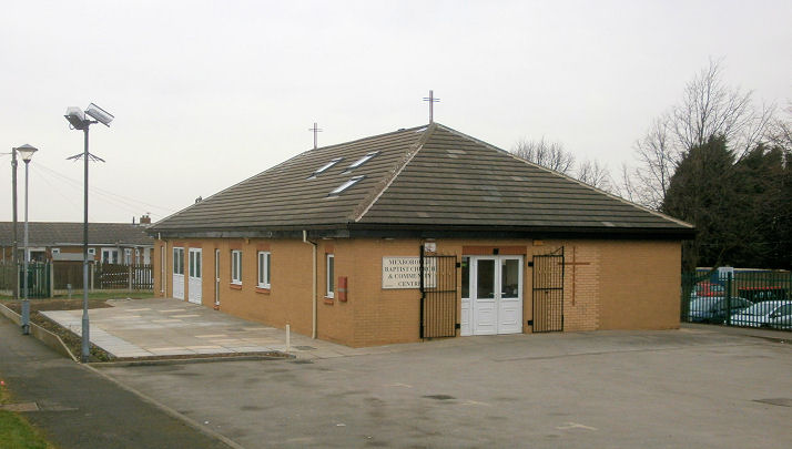