The Churches of Britain and Ireland
| Lanark, South Lanarkshire
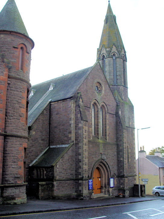
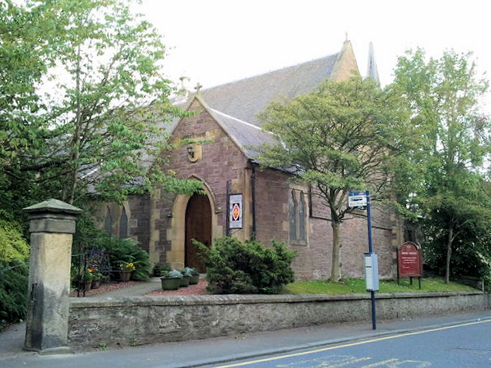
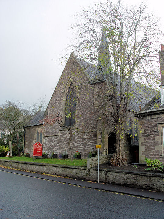
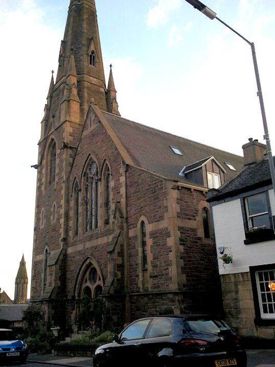
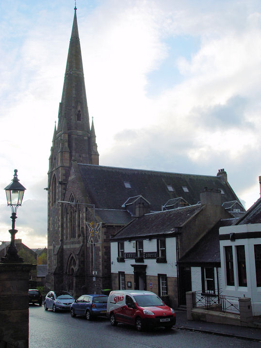
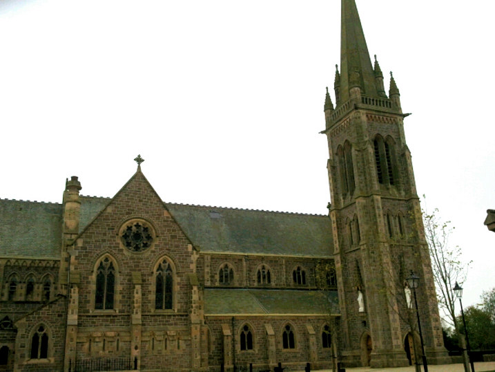
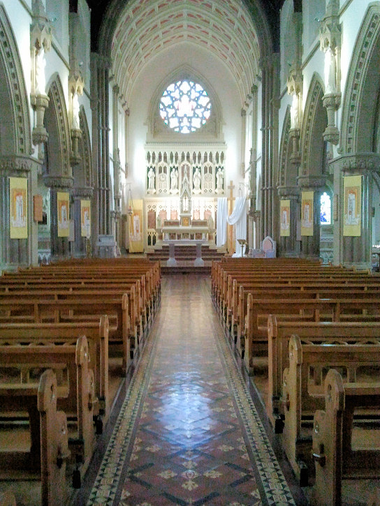
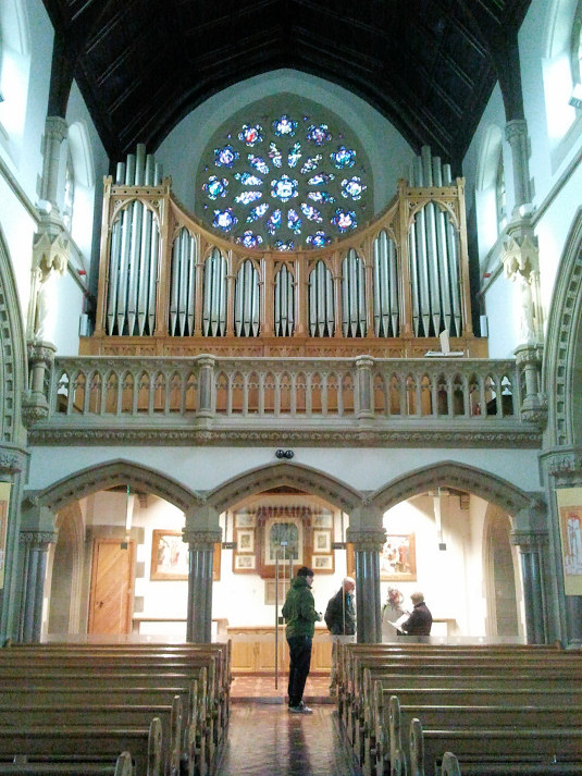
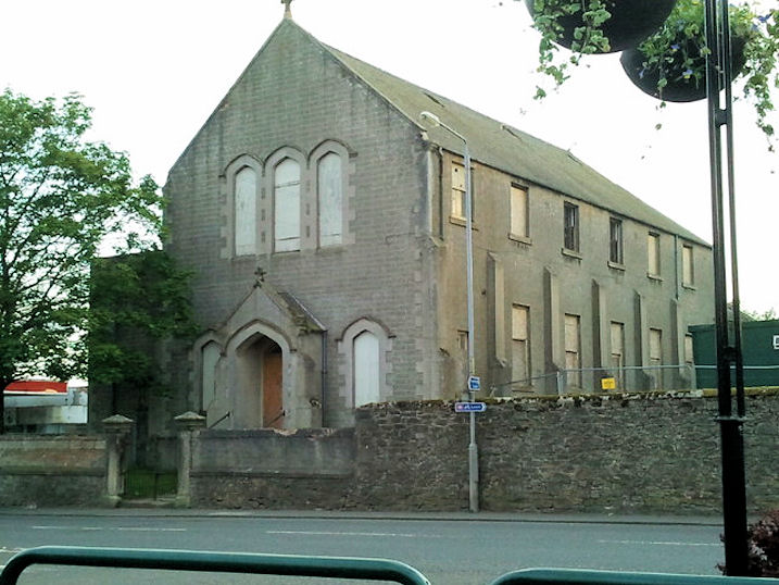
Greyfriars Church of Scotland (1875) on Bloomgate was previously known as Cairns Church. NS 8799 4371. © Steve Bulman (2013). Link. Category B listed. An Art Nouveau Cemetery Chapel of 1912 stands in the cemetery on Hyndford Road, and it is Category A listed. NS 8888 4321. A photo of this extraordinary building is available here. Christ Church (1858, Scottish Episcopal) on Hope Street. NS 8809 4388. © Alan Mathew (2011). Another view, © Steve Bulman (2013). Link. Category B listed. Evangelical Union Kirk (Congregational, 1785) on West Port. NS 8789 4376. © Alan Mathew (2011). Category C listed. Gospel Hall on Smyllum Road, as seen by the Streetview van in 2010. NS 8935 4391. The Kingdom Hall of Jehovah's Witnesses on High Street can be seen here on a Streetview from 2018. NS 8836 4366. A New Life Christian Centre stands down an alleyway (Duncan's Close) off High Street. The alleyway, and the black sign indicating the way to the church, can be seen to the left of the big red shop sign here, in a 2017 Streetview. A news article includes a photo from within Duncan's Close, possibly showing the doorway to the NLCC on the right. NS 8818 4370. Link. The former St. Kentigern (1883, CoS) on Hope Street, was previously a Free Church, and is now used as offices. NS 8805 4380. © Alan Mathew (2011). Another view, © Steve Bulman (2013). Category B listed. The ruins of the 13th century St. Kentigern stand on Hyndford Road on the site of the church supposedly founded by the saint himself in the 7th century. NS 8878 4325. Link. A short video documentary. Category B listed. The site of the demolished St Leonard (circa 1840) on Bannatyne Street, as seen by the Streetview van in 2016. A small old photo of the church can be seen here, and a scan of an old postcard here (in late 2020). NS 8858 4363. St. Mary (R.C.) on Bannatyne Street. Its Category A listing advises that it was originally built in 1856-9, but had to be re-built in 1908-10 following a fire in 1907. Two interior views - 1, 2. NS 8855 4352. All © Alan Mathew (2012). Link. A possible former church or church hall, in the grounds of St. Mary (R.C.). NS 8866 4349. © Alan Mathew (2011). A news story reports on its demolition following a fire in 2011. St. Nicholas (1774) on High Street can be seen on Streetviews here and here (both in 2018). NS 8813 4367. Link. Category B listed. The former Salvation Army Citadel on West Port. Its POWiS entry says the Army left at some point, when it was replaced by a Pentecostal Church, and later came under the S.A. again. At the time that entry was written (2003), it was in use as a museum, which a later (2008) Streetview confirms, but by 2015 the museum sign had gone, and at the time of the Streetview vans visit in 2018, it wasn't apparent to what use the building was being put. NS 8797 4375 Smyllum Park was an R.C. orphanage, with a private chapel. Its POWiS entry dates it to 1883, "probably by Peter Pugin". The chapel has been demolished, and housing built on the site, which can be seen here in a 2010 Streetview. NS 8932 4362. A United Presbyterian Church stood on Broomgate, at NS 8797 4350. A Streetview of 2010 shows the buildings which have been built on the site. This website details the complicated history of the U.P. churches in Lanark. A former United Presbyterian Church stands on Hope Street, at NS 8806 4385, and is now in use as offices. Its category B listing dates it to 1836, when it was built as a Relief Church (learn about that church here), becoming U.P. in 1888. It can be seen on a 2017 Streetview here.
|
||
04 March 2023
© Steve Bulman