The Churches of Britain and Ireland
| Keynsham,
Somerset
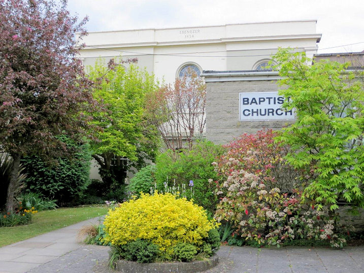
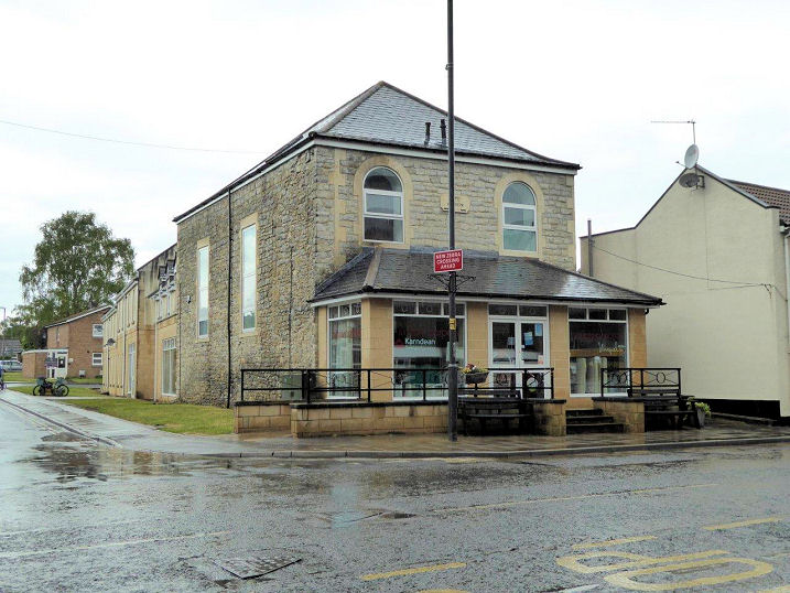
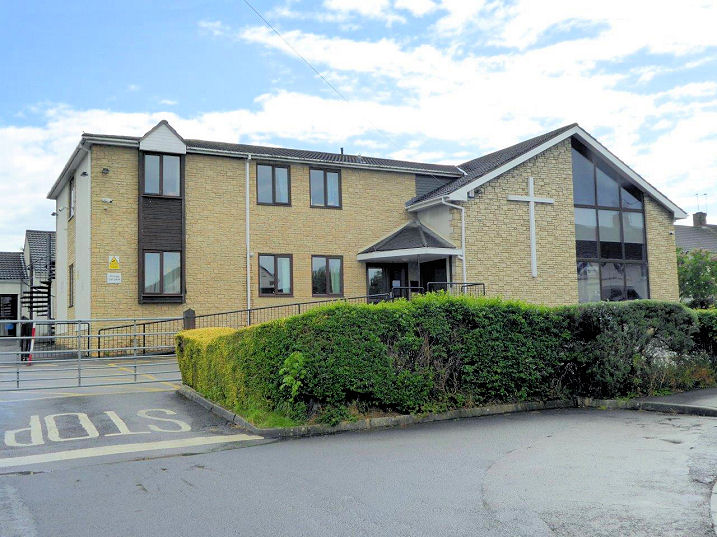
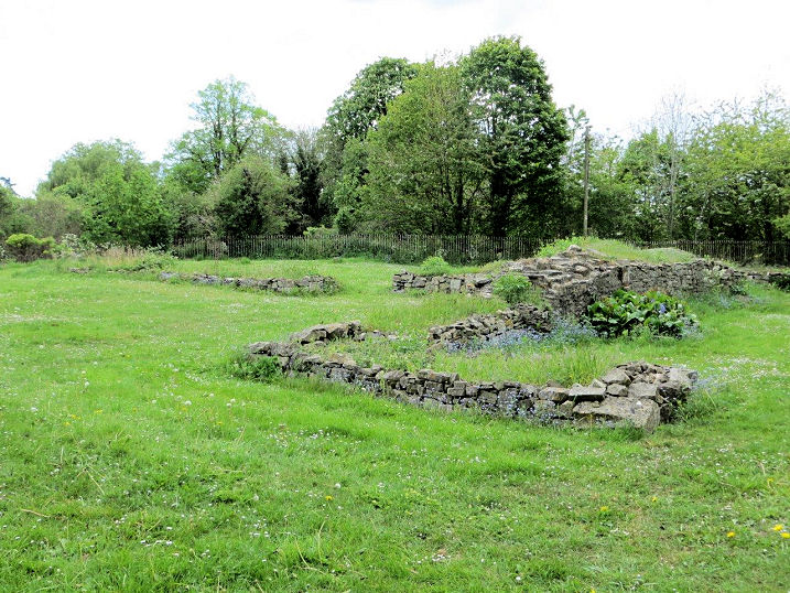
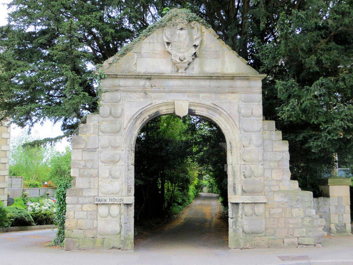
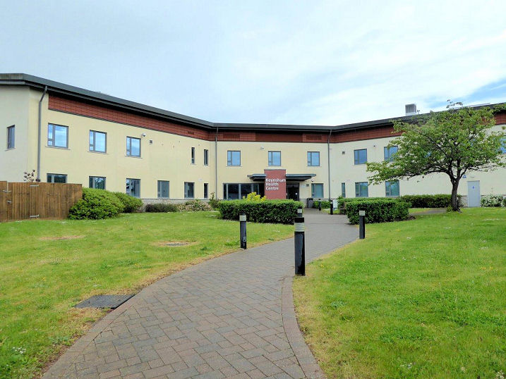
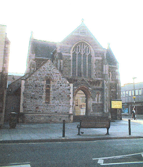
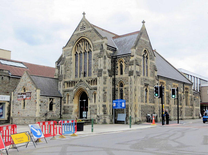
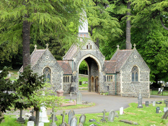
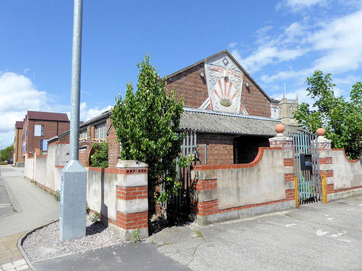
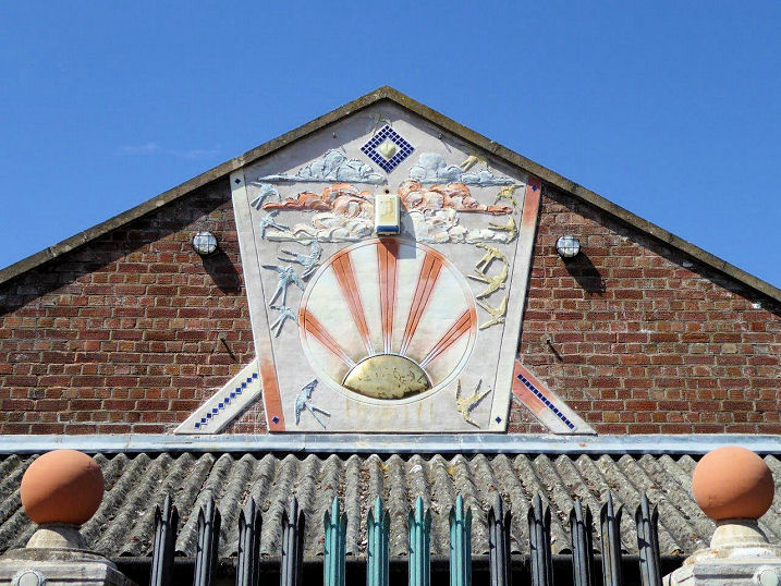
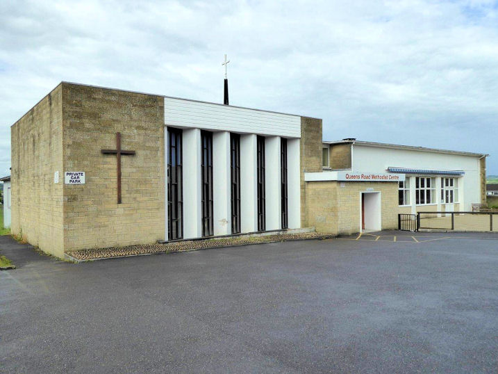
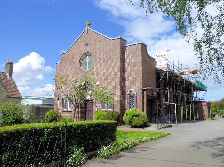
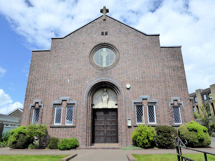
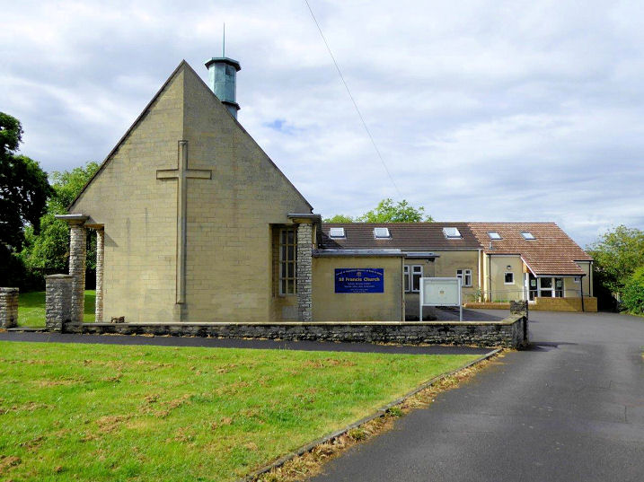
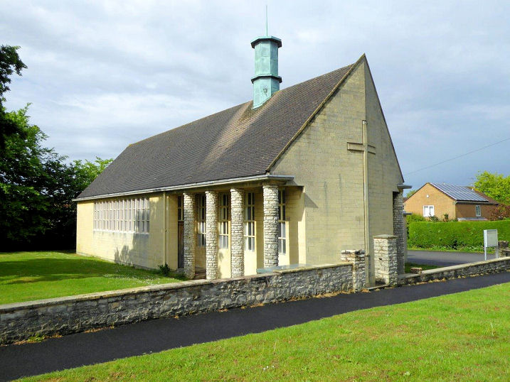
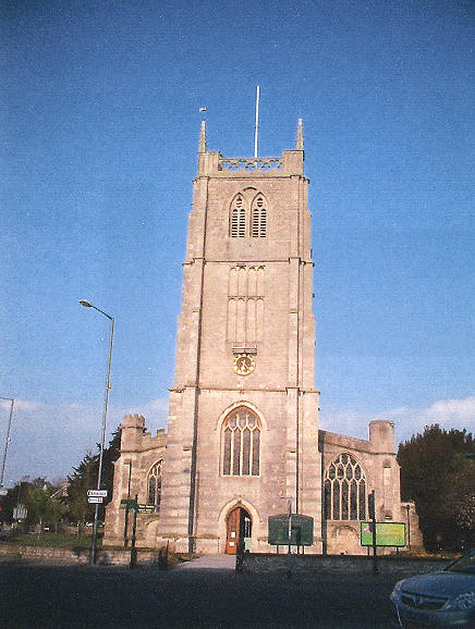
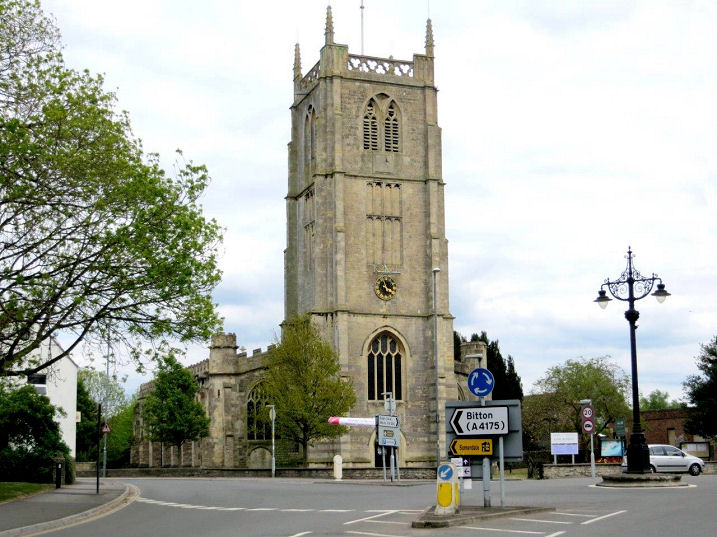
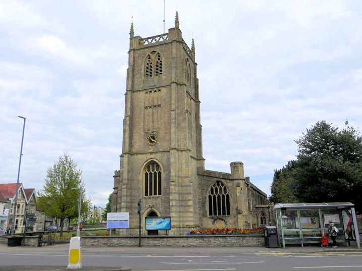
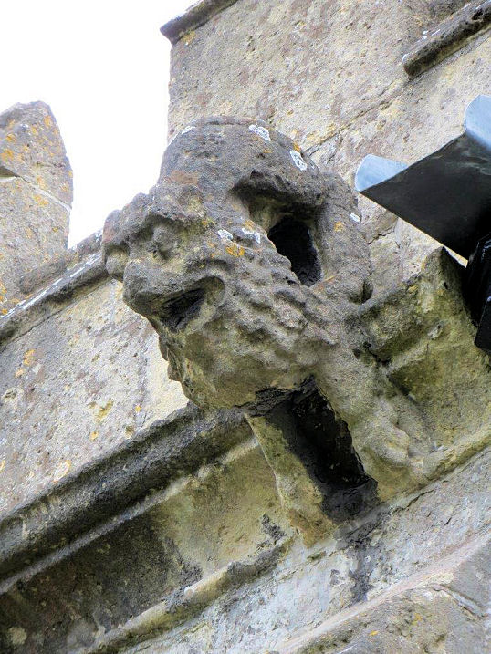
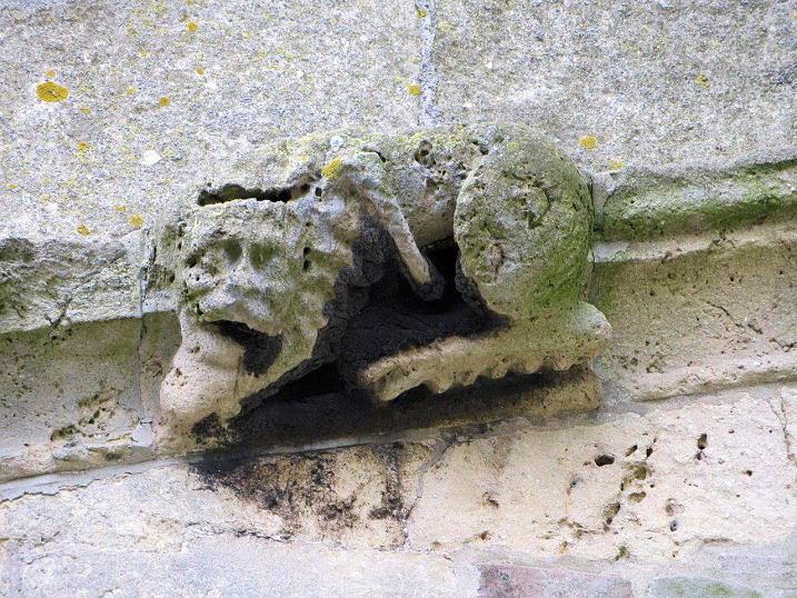
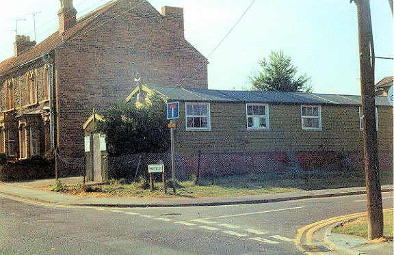
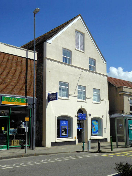
Baptist Church, built as Ebenezer Chapel in 1834, replacing an earlier church of 1807. ST 65456 68692. © Geoff Watt. Another view, © Carole Sage (2017). Link. Grade II listed. The former Bethesda Chapel (1860) on Temple Street is now in commercial use. All that Carole has been able to find out about the congregation is that they were a splinter from the Methodists. From map evidence, it seems to have closed between 1946 and 1967. ST 65489 68318. © Carole Sage (2017). The site of a demolished Chapel on Temple Street, where it joins Dapps Hill. Marked on old maps, unfortunately none of them specify a denomination. Later O.S. maps show the building went out of use as a chapel between 1946 and 1967. Can you offer any additional information? ST 65575 68149. © Carole Sage (2017). Elim Pentecostal Church on Balmoral Road. ST 65352 67727. © Carole Sage (2017). Link. The remains of Keynsham Abbey. Of 12th century foundation, it fell victim to Henry VIII in 1539. Some of the stones from the abbey were used to build an archway to a property on Station Road. ST 65600 68811. Both © Carole Sage (2017). Link. A reconstruction of the abbey can be seen here. The site of Keynsham Union Workhouse, which had its own chapel. The workhouse was built in 1837 on Union Road (now St. Clement's Road). Eventually, it was converted into a hospital, and the last of the workhouse buildings were demolished in 2007, to be replaced by the present Keynsham Health Centre. The grid reference is for the workhouse, not the chapel, whose exact location Carole is unaware of. ST 65500 67956. © Carole Sage (2017). Photos of the workhouse are available here. Methodist Church on Charlton Road and High Street. Built as Victoria Methodist Church in the late 19th century, it replaced an earlier Wesleyan Chapel on High Street (for which, see below). ST 65395 68683. © Geoff Watt. Another view, © Carole Sage (2017). Link. Mortuary Chapels (1877/8) at Keynsham Cemetery. ST 64530 69259. © Carole Sage (2017). Grade II listed. New Kingdom Hall on Danes Lane was a Kingdom Hall of Jehovah's Witnesses. Built some time after WWII, it has been disused for many years, but planning permission was granted in 2017 to redevelop the site for flats, so will presumably be demolished. A close-up of the decorative feature on the gable end. ST 65331 68741. Both © Carole Sage (2017). Queen's Road Methodist Centre. It pre-dates the 1967 O.S. map. ST 64753 67935. © Carole Sage (2017). Link. St. Dunstan (R.C., 1935) on Bristol Road. Another view. ST 65246 68929. Both © Carole Sage (2017). Link. St. Francis (CoE, 1970's) on Warwick Road. Another view. ST 64899 67837. Both © Carole Sage (2017). Link. St. John the Baptist. A 13th and 14th century church. The original tower collapsed during a storm in the 17th century. ST 65421 68832. © Geoff Watt. Two additional views - 1, 2, and two examples of gargoyles - 1, 2, all © Carole Sage (2017). Link. Grade II* listed. The former Salvation Army Hall, now used by St. John's Ambulance. © Rob Brettle. The former Wesleyan Methodist Chapel on High Street. It was succeeded by Victoria Methodist Church (see Methodist Church, above). Now in use as a Building Society, is this the original chapel building? If it is, then it pre-dates an 1868 entry in a gazetteer. ST 65453 68616. © Carole Sage (2017).
|
||
13 October 2023
© Steve Bulman
Contact Details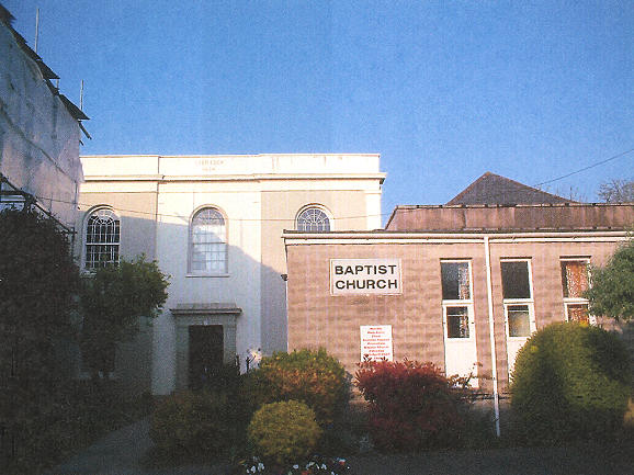