The Churches of Britain and Ireland
| Hertford, Hertfordshire
Many more photos of Hertford churches are available here for extant churches, and here for some vanished churches.
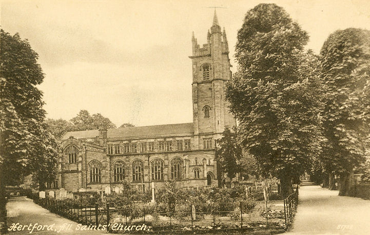
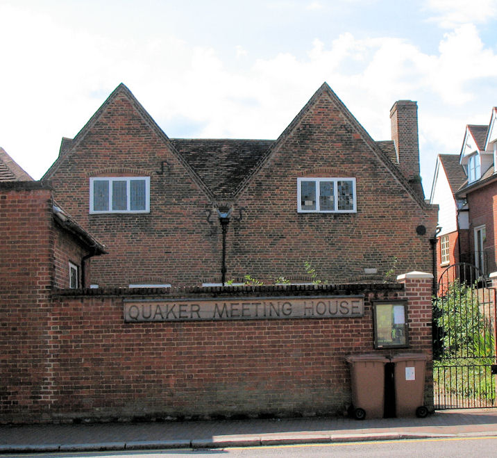
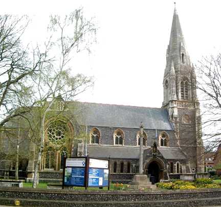
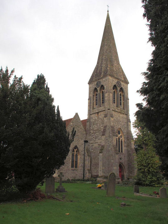
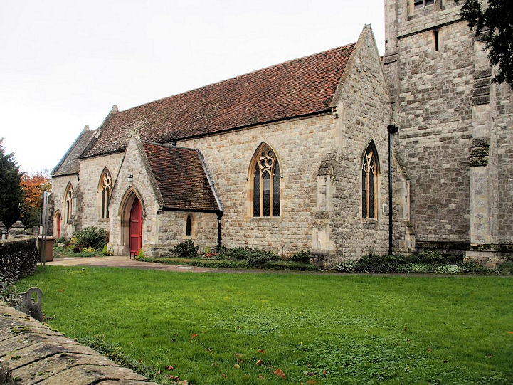
All Saints with St. John on Queen's Road. TL 3280 1246. © Thomas Curtis. An old postcard view, from Reg Dosell's Collection. Streetview provides modern views in 2019 - 1, 2. Link. Its grade II* listing dates it to 1893-5, replacing an earlier church destroyed in a fire in 1891. A number of churchyard features are listed separately - they can be seen here. Wikipedia advises that it was of pre-Norman foundation, that the church destroyed in the fire was of the 15th century, and that the parish was merged with that of St. John in the 17th. The Baptist Church (originally General Baptist) is on Cowbridge, and was seen by Streetview in 2018. TL 3230 1284. Link. Grade II listed, wherein it's dated to 1905-6. A Brethren's Meeting Room stands on the west side of Nelson Street at TL 3191 1309. Streetview saw it in 2014. Some earlier photos are available here. Christ Church once stood on a plot bounded by Balfour Street, Port Vale and Russell Street, at TL 3210 1298. It's dated here to 1868-1960's. The site can be seen on a Streetview from 2018. Perhaps surprisingly for a large church demolished within living memory, I've been unable to find any photos of it on-line. Christ's Hospital (a school) Chapel used to stand adjacent to surviving school buildings, on Railway Street at TL 3290 1284. A 2019 Streetview shows the site, behind the boundary wall and to the left of the tall building with the arched windows. This source has a photo of the Girls School Chapel on Ware Road. It dates it to 1906-1985. Exterior and interior drawings of it are available here (slow to load). It's site now lies under a corner of a supermarket car park, seen here in a 2016 Streetview. Ebenezer Particular Baptist Chapel has stood on two sites, and both have been demolished. The earlier (1773) stood at the junction of North Crescent and Hertingfordbury Road, at TL 3220 1257. Demolished to allow for works associated with road widening, the second chapel was built almost opposite, across North Crescent, at TL 3222 1258. A Streetview from 2020 shows the sites of both chapels - the nearer white block of flats on the site of the older chapel, with its apsidal end in roughly the same position as the apse of the chapel, and the further white flats on the site of the second chapel. The Friends Meeting House on Railway Street is said to be the oldest surviving anywhere. TL 3281 1270. © Janet Gimber (2014). Link. Grade I listed, wherein it's dated to 1670. The adjoining former Women's Meeting House of 1738 (just seen at the left foreground in the photo) is also grade II listed. It's better seen in a Streetview from 2017. A former Friends Burial Ground stands on Port Hill, at TL 3233 1301, and it can be seen here in a Streetview from 2009. More photos here. There's a comprehensive history (with several photos) of the Hertford Friends here. The former Goldings Chapel stands a little way to the north-west of the city, at TL 3096 1418. It hasn't been seen by Streetview, but photos are available here in an Estate Agent's notice. Its grade II listing dates it to 1923. Hertford Castle, of which only the gatehouse survives, is known to have had a chapel, mentioned in 1202. A 2020 Streetview, from just inside the gatehouse, presumably shows the area within which the chapel stood. TL 3250 1250. Hertford Community Church - see U.R.C., below. The former Hertford Hospital Chapel has been converted to residential use. It stands behind the block to the right in a Streetview from 2014, but photos of the chapel itself are available here (scroll down). TL 3190 1260. Hertford Town Church (Evangelical) is on Hartham Lane, at TL 3244 1278. It was seen by Streetview in 2009 and 2019 (with the U.R.C. visible to its left). Link. Immaculate Conception and St. Joseph (R.C., O) on St. John's Street. It stands just south of the site of St. Mary's Priory, for which see below. Its grade II listing dates it to 1859-61. Not well seen on Streetview because of vegetation (here and here), more exterior and many interior photos are available here. TL 3284 1294. Link. Kingdom Hall of Jehovah's Witnesses on Mimram Road, as seen by Streetview in 2009. TL 3180 1240. The Methodist Church is on Ware Road, and dates from 1963 (with a new frontage from 2010 - source). Adjacent to the current church is its Wesleyan predecessor of 1865. Both can be seen here in a Streetview from 2017. TL 3320 1281. Link. Old O.S. maps show a Mission Hall on Bull Plain at TL 3263 1270. It first shows on a map of 1898, and the last of 1923. The building on the site today (which looks old enough to be the same building as the Mission Hall) can be seen in a Streetview from 2019. The cemetery on North Road used to have a Mortuary Chapel. Now demolished, it stood on the path directly behind the gate, seen in a 2021 Streetview. TL 3143 1326. The demolished Port Vale Calvinist Chapel stood on Port Vale, at TL 3216 1293. It's dated here to 1836-1922. The house on the site today can be seen in a Streetview from 2009. St. Andrew on St. Andrew Street. TL 3234 1257. © Bill McKenzie. Link. Grade II listed, wherein it's dated to 1869-70, incorporating a 15th century doorway from its predecessor. The tower and spire were also retained, but replaced in 1874. There's a photo of the old church here. The long vanished St. John stood next to the Priory. Its parish was amalgamated with All Saints around 1640, although the medieval St. John's seems to have been demolished and replaced with a much smaller church about 20 years earlier. The later church was also demolished before the end of the 17th century. Floor plans of both churches can be seen here. The 25" O.S. map of 1898 marks its site at TL 3284 1287. A car parking area between St. John's Street and Mitre Court now covers the site, but it can't be seen on Streetview. St. Mary the Less stood at the northern end of Old Cross, at TL 3247 1270. Photos of the surviving fragments can be seen here. Nothing survives above ground of St. Mary's Priory. A comprehensive history can be found here. TL 3285 1297. The medieval St. Nicholas stood north of Maidenhead Street, the 25" O.S. map of 1898 marking its site at TL 3258 1265. Its history here quotes a source saying it was "ruined and decayed" in 1630. Another source dates it demolition to 1675. A former Salvation Army building stands on Baker Street at TL 3316 1273. Seen by Streetview in 2015 and 2017, it's now used by the Red Cross and R.V.S. Built in the h1980's, the S.A. left around the year 2000. They had previously had a building on Bircherly Green. The U.R.C. on Cowbridge was originally Congregational, and was seen by Streetview in 2014. TL 3236 1276. Link. Grade II listed, wherein it's dated to 1862-3. Hertford Community Church meets in the adjacent Hall (1891-2), seen here in 2014. Link. Grade II listed.
Bengeo
|
||
04 March 2023
© Steve Bulman
Contact Details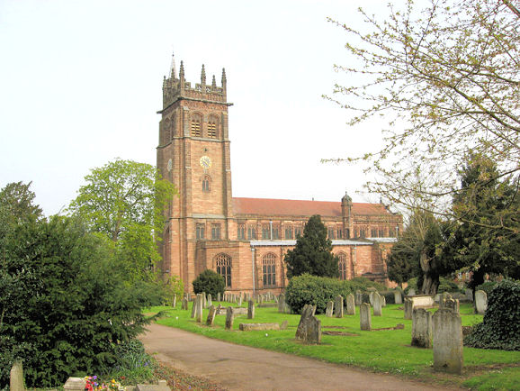