The Churches of Britain and Ireland
| Herne Bay,
Kent
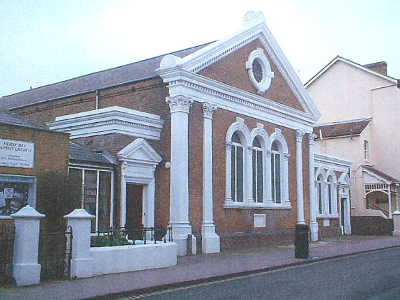
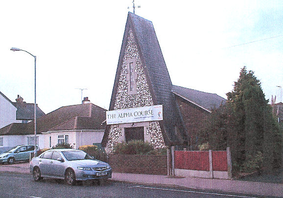
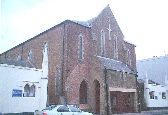
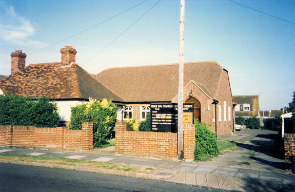
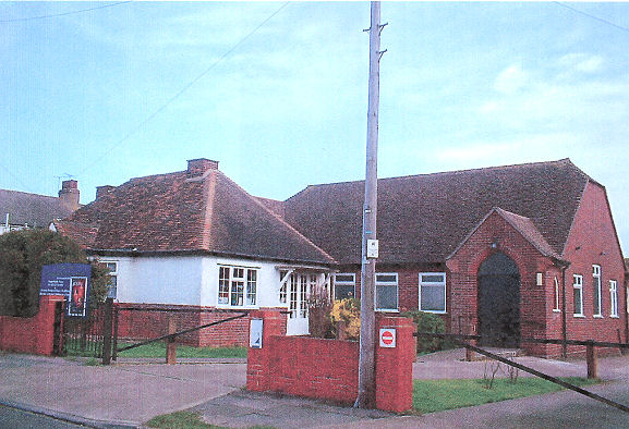
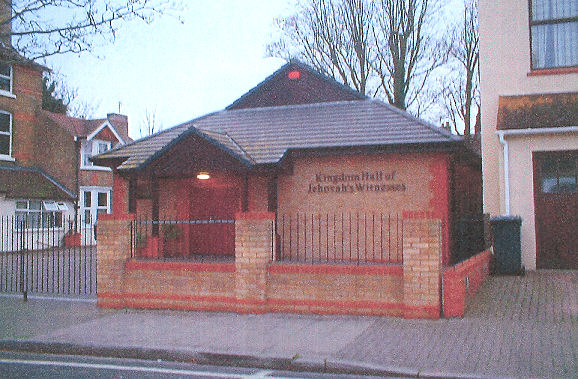
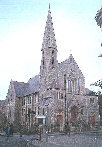
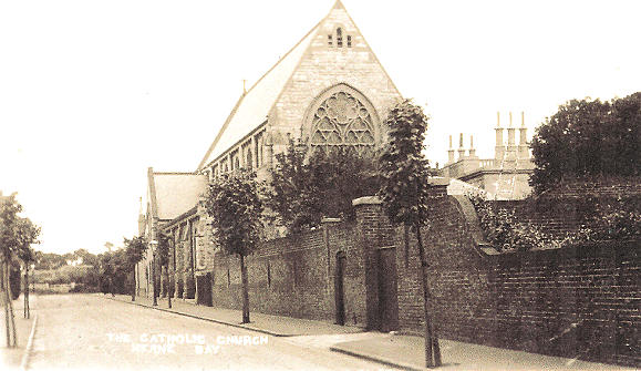
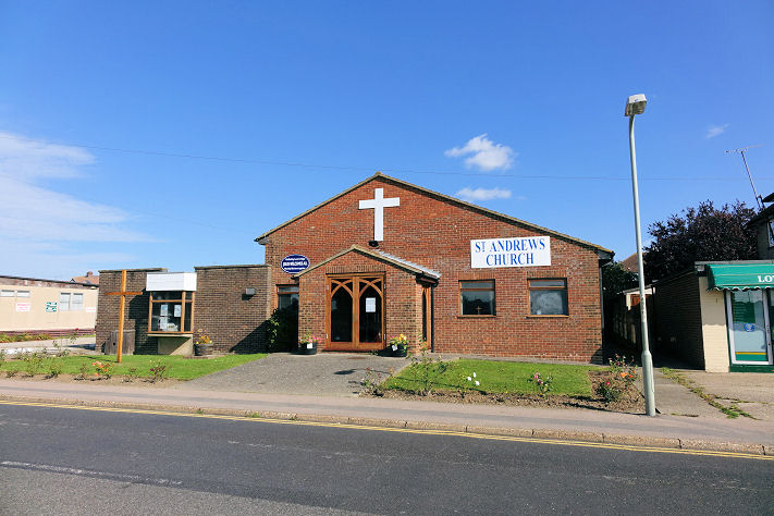
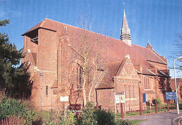
Baptist Church (dating from 1878-9) on High Street. TR 1776 6824. © Geoff Watt. Link. Grade II listed. Beacon Church (Evangelical) on Sea Street. TR 1673 6778. © Geoff Watt. Their website says that they now meet in VIBE on Central Parade, seen here in a Streetview from 2019. The building in the photo had, at the time of a visit from Streetview in 2019, a sign saying "The Beacon Centre". Are services still held here? Link. Beltinge Baptist Church on Reculver Road and Church View, as seen by Streetview in 2017. TR 1932 6776. Link. Christ Church on William Street. TR 1787 6813. © Geoff Watt. Link. Grade II listed, wherein it's dated to 1834-5, with later additions. Evangelical Free Church on Sunnyhill Road. TR 1618 6774. © Alan Taylor. Another view, © Geoff Watt. Link. Herne Bay Christian Spiritualist Church, on Avenue Road. All references refer to it as being at 22 Avenue Road, which a 2018 Streetview shows to be part of a terrace - the building with the navy blue door. In fact the church is in a small building behind 22 Avenue Road, and it can just be seen from behind the terrace - also in a 2018 Streetview. TR 1722 6820. Link. Kingdom Hall of Jehovah's Witnesses on Station Road. TR 1735 6804. © Geoff Watt. The Methodist Church on High Street and Beach Street has been converted into flats, as the 2018 Streetview shows. Originally Wesleyan, this source dates it to 1885 - circa 2002. After closure, the congregation joined with that of the U.R.C., then re-named as United Church (for which, see below). TR 1770 6824. © Geoff Watt. A former Mission Room stands on Hanover Square at TR 1781 6818. It pre-dates a map of 1906, and was in use as an Army Cadet Force and Air Training Corps hut when seen by Streetview in 2015. Another, now vanished, Mission Room once stood on the west side of Hampton Pier Avenue at TR 1578 6782. Perhaps the predecessor of St. Andrew, which stands a little way to the south, its site was seen by Streetview in 2009. Our Lady of the Sacred Heart (R.C.) on Clarence Road. TR 1693 6805. From an old postcard in Geoff Watt's Collection. Its grade II listing dates it to 1889. A Streetview from 2009 provides another view. Link. Nearby, on Western Avenue, Google Maps mark Sisters of Charity. Whether it has a connection with the catholic church, or whether services are held here is so far unclear. TR 1698 6797. It was seen by Streetview in 2019. St. Andrew on Hampton Pier Avenue. TR 1582 6757. © Steve Bulman (2014). Link. St. Bartholomew on King Edward Avenue and Dence Park. TR 1878 6787. © Geoff Watt. Streetview provides another view from 2009. Link, which dates it to 1913-32, on the site of an earlier wooden church of 1908. The site of St. John the Evangelist on Brunswick Square, as seen by Streetview in 2016. TR 1741 6809. A useful history of the church bells here (with a photo of the church), and Wikipedia (which has another photo from an almost identical position) dates the church to 1898-9, demolished in 1974. St. Peter at Greenhill. TR 164 669. © Geoff Watt. Link. Salvation Army Church on Richmond Street, as seen by Streetview in 2016. It has a date-stone for 1907. TR 1755 6807. Link. United Church on Mortimer Street. Originally Congregational, and later U.R.C., it acquired its current name when the Methodist congregation joined with the U.R.C. in circa 2002 after the closure of their church. It was seen by Streetview in 2009. TR 1790 6828.
|
||
19 February 2022
© Steve Bulman