The Churches of Britain and Ireland
| Frome, Somerset
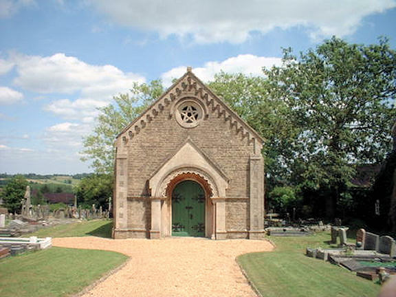
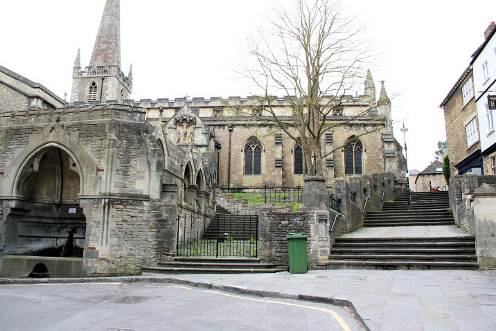
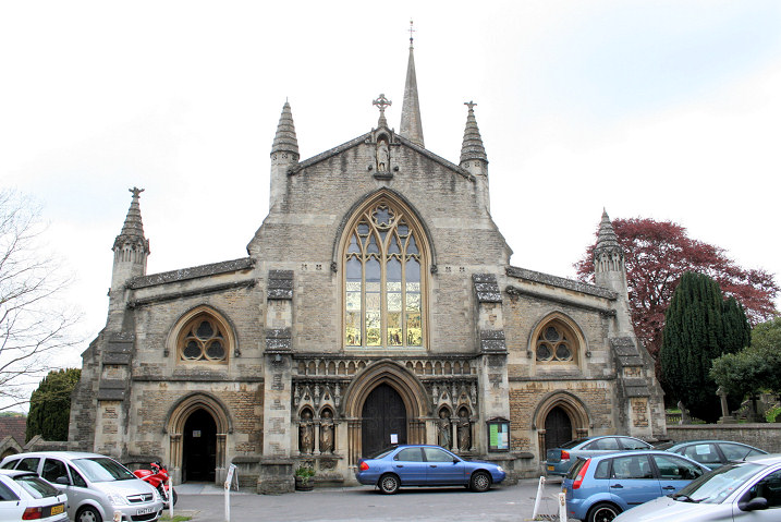
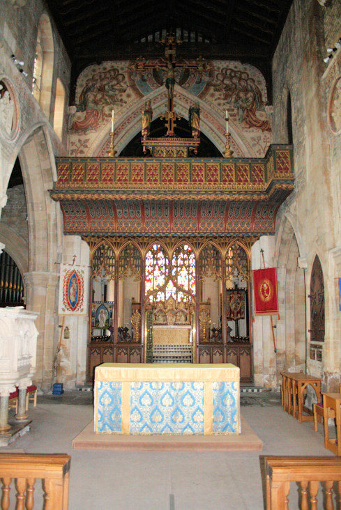
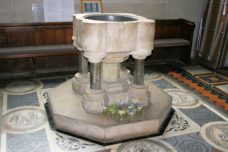
The former Badcox Chapel (Baptist) on Catherine Street. Its grade II listing dates it to 1813. Another view. ST 7740 4804. Both © Steve Bulman (2023). According to a plaque, the building to which it is attached (on Catherine Hill) was also used for Baptist worship "before the erection of their church in 1708". It was also "traditionally associated with the medieval chantry chapel of St. Katherine". ST 7748 4803. Both © Steve Bulman (2023). Another Baptist Church is mentioned here, as Nash's Street Baptist Church, from 1835. I can find a Naish's Street, and old maps show a chapel there at ST 7713 4819. A map of 1886 labels it as Baptist Chapel (Particular) (Seats for 500). It was seen by Streetview in 2009. The present day Baptist congregation meets in The Key Centre on Feltham Lane, which I think is the building seen in a 2014 Streetview. Link. The former Bethel Chapel (2018 Streetview) on The Butts. A map of 1903 labels it as Wesleyan, and it's dated here to 1858 to the 1950's. ST 7730 4738. Christ Church on Christchurch Street. Two more views - 1, 2. ST 7733 4787. All © Steve Bulman (2023). Close up detail of a carving on the east wall, © Janet Gimber (2023). Link. Grade II* listed, wherein it's dated to 1817-18, with later additions. Gate piers and walls are listed separately as grade II. Clink Evangelical Church, on Clink Road, as seen by Streetview from Forest Road in 2016. Link. The Frome Dissenters Cemetery Chapel on Vallis Road. ST 7683 4849. © JP Parsons & Trustees of Frome Dissenters Cemetery. Link. Holy Trinity Church stands at the end of Trinity Street. Another view. ST 7720 4835. Both © Steve Bulman (2023). Link. Grade II* listed, wherein it's dated to 1837. Kingdom Hall of Jehovah's Witnesses (2018 Streetview) on Delta Close and Welshmill Lane. ST 7759 4849. Earlier large scale O.S. maps show Monastery of St. John the Baptist (Remains of) though on none of them is it clear exactly what precise site is meant. The general area is in Lower Keyford, west of Culverhill, roughly at ST 7754 4704. Aerial views show what appears to be an industrial estate on the site today. The former Portway Methodist Church, which stands at the junction of Portway and Alexandra Road. A 2022 news item says it was closed in 2021, and this source says it was originally United Methodist, of 1910. ST 7795 4773. © Steve Bulman (2023). The local Quaker Meeting takes place in Christ Church Hall on Park Road. ST 7734 4776. © Janet Gimber (2023). The Old Meeting House (2018 Streetview) on South Parade is a former Friends' Meeting House. ST 7740 4792. The former Rook Lane Congregational Chapel on Bath Street. It bear a date-stone for 1707. ST 7753 4787. © Steve Bulman (2023). Grade I listed. The boundary gates and railings etc. are listed separately as grade II. St. Catharine of Alexandria (R.C.) stands on Park Road at ST 7738 4774. Another view. Both © Steve Bulman (2023). Link includes an interior view. This source (#12) dates it to 1967-8, successor to a tin chapel of 1928 now used as the church hall (2017 Streetview). St. John the Baptist on Bath Street. ST 7770 4791. From an old postcard in Steve Bulman's Collection. Two modern views - 1, 2, interior view, and font, all © Dennis Harper (2010). A beautiful roundel, and interior stairs, both © Janet Gimber (2023). Link. Grade II* listed. For other listed features associated with the church, see here. Near the church, on Vicarage Street at ST 7777 4787 is the Bennett Centre, the church hall. It looks a convincing former church, but the available early maps only show it as a school. Another view. Both © Janet Gimber (2023). Some interior views are available here. St. Mary on Innox Hill, as seen by Streetview in 2018. ST 7767 4878. Link. Its grade II listing dates it to 1864. The former Shepherd's Barton Chapel (General Baptist), so named on a map of 1886. It stands between South Parade and Wine Street at ST 7741 4795 and dates from a re-build in 1851 of a chapel first built in 1708. It closed in 2001. The photo is of the South Parade frontage. The Wine Street frontage is of the church hall. Both © Janet Gimber (2023). Grade II listed. Sun Street Chapel - the sign reads Sun Street Chapel Frome Gospel Hall. According to this source, it was originally Primitive Methodist (1832-1982, at which time it was presumably Methodist). ST 7742 4814. © Steve Bulman (2023). The former U.R.C. (previously Zion Congregational Church), seen from Catherine Hill. This source says it was originally Moravian. The gateway has dates of 1810 and 1893. Another view and the interior. ST 7747 4811. What appears to be a small chapel stands in the adjacent former burial ground, at ST 7748 4808, but its grade II listing calls it a Sunday school, and dates it to 1875. All © Steve Bulman (2023). The main chapel is grade II listed. Wesley Methodist Church is on Wesley Slope. It was (unsurprisingly) Wesleyan Methodist, and dates from 1812 according to its grade II listing. This source (#10) says that it was preceded by a chapel of 1779 on an adjacent site, seen by Streetview in 2018. ST 7756 4772. © Steve Bulman (2023). Link.
|
||
15 March 2024
© Steve Bulman