The Churches of Britain and Ireland
|
Falmouth, Cornwall
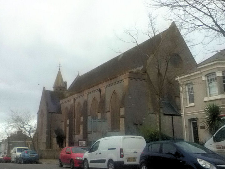
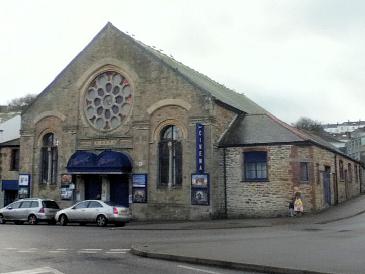
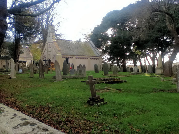
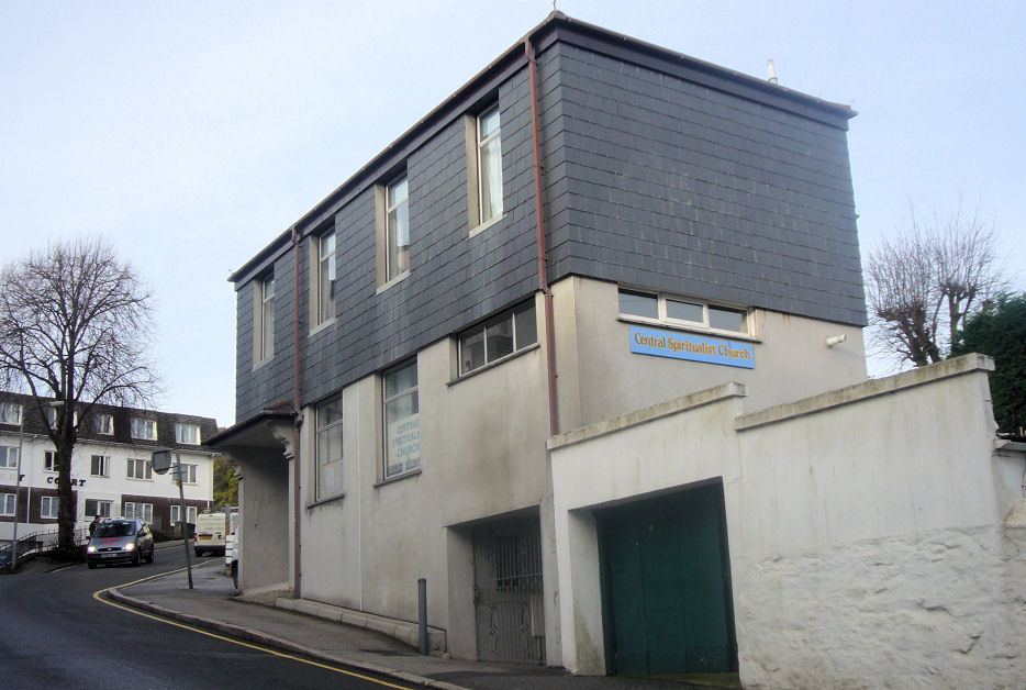
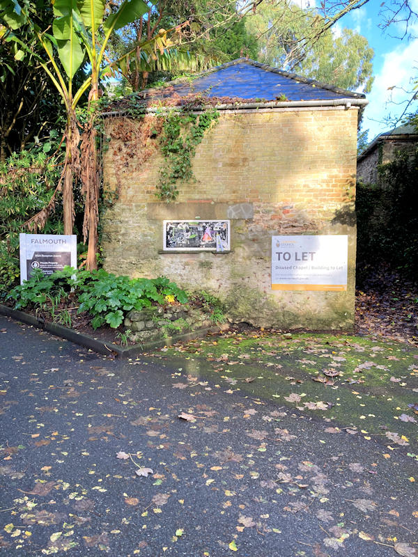
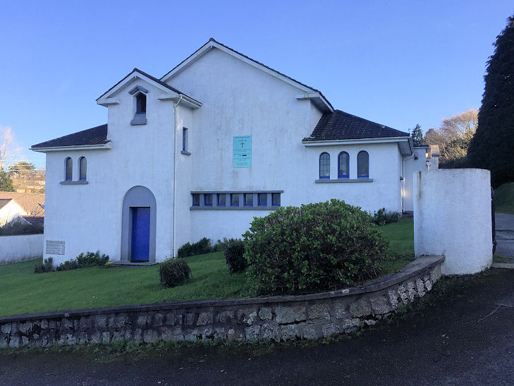
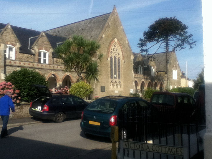
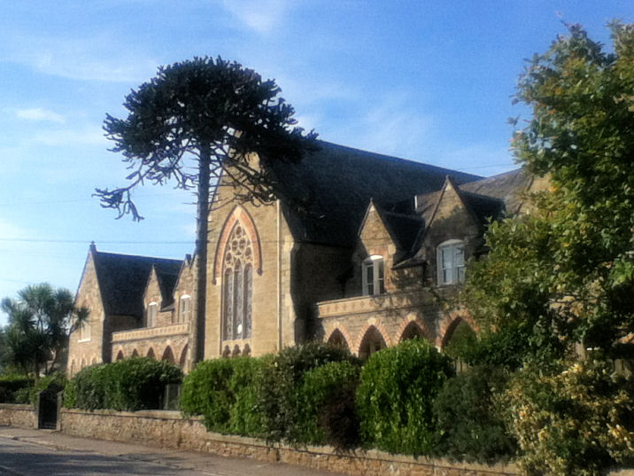
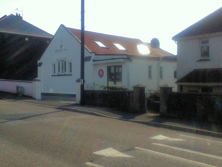
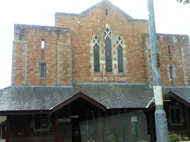
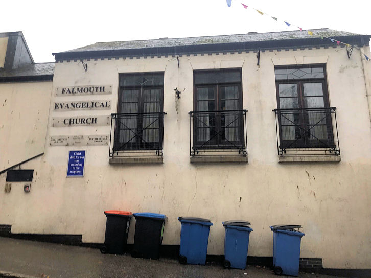
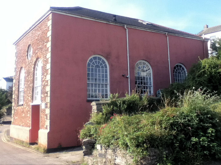
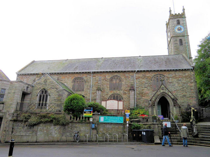
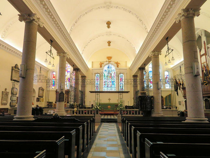
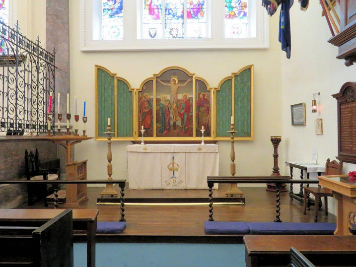
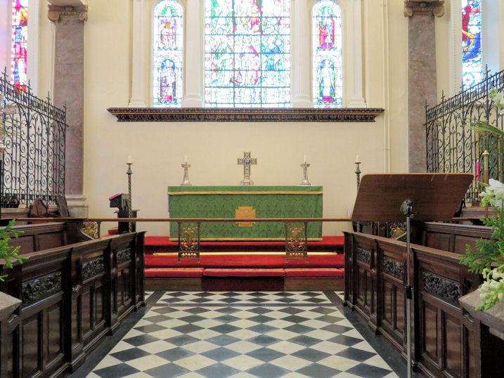
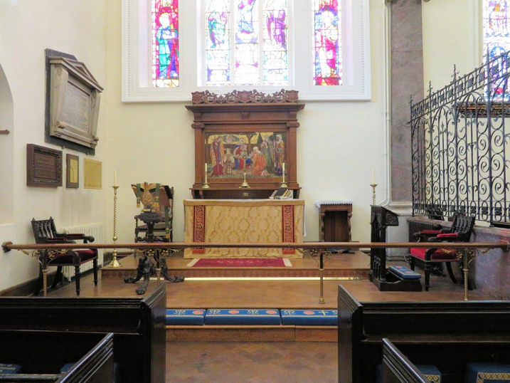
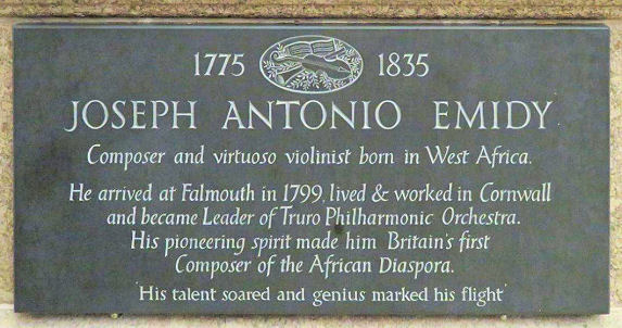
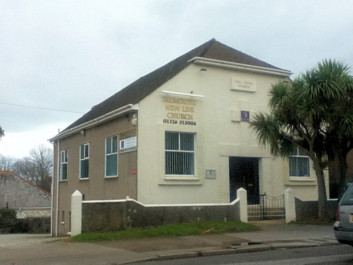
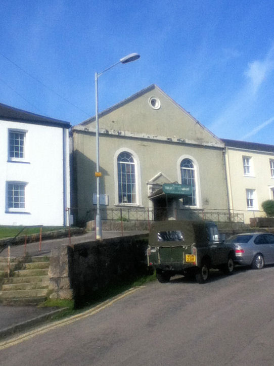
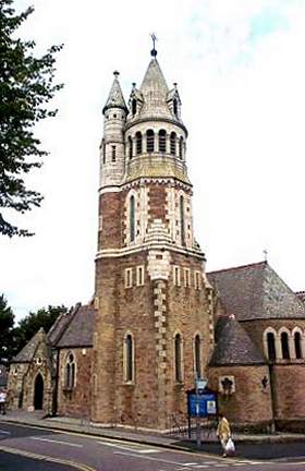
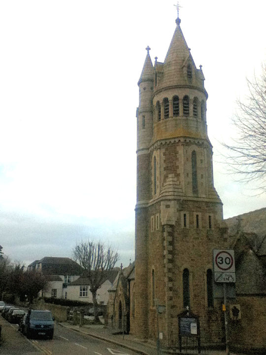
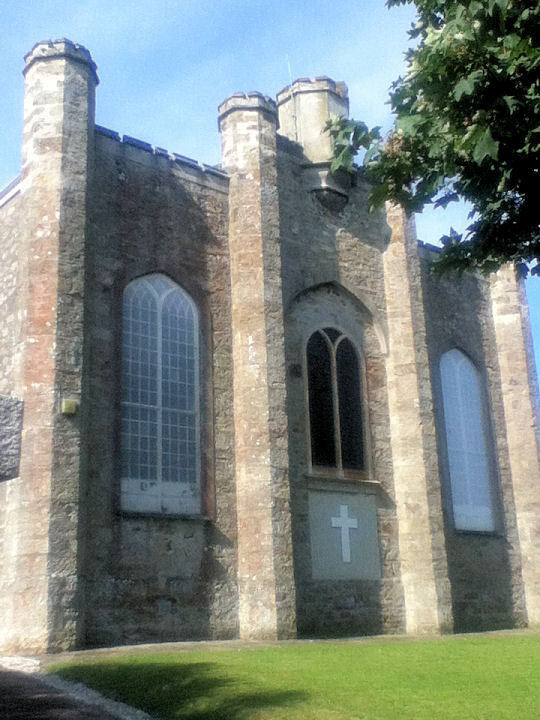
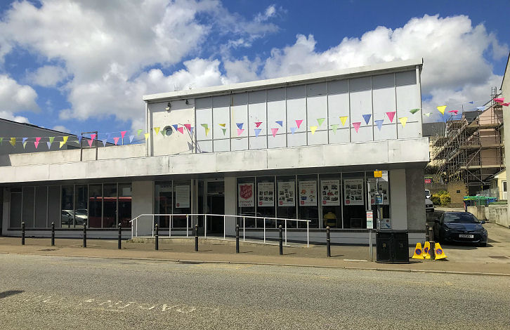
A former Bible Christian Chapel was at one point a drill hall, and is now a cinema. Identified by Janet Gimber. It stands on Brook Street and Berkeley Vale. SW 8049 3274. © Paul E. Barnett (2014). Cemetery Chapels in Falmouth Cemetery. They're identified on large scale O.S. maps as Nonconformist at SW 8037 3175 and Church of England at SW 8037 3171. © Paul E. Barnett (2015). Central Spiritualist Church and Healing Sanctuary on Quarry Hill. SW 8054 3284. © James Murray (2009). Another view, © Paul E. Barnett (2024). Link. Spotted by Paul Barnett on a recent trip to Falmouth is this former Chapel, near the university, on Fox Rosehill Gardens. Not marked on any available map, I've been unable to find out anything about it, and, at the time of writing, the link mentioned on the signage wasn't bringing anything up about the building. The relevant page is here. SW 80806 32076. © Paul E. Barnett (2026). Can you add anything to this entry? An old directory of 1844 mentions a Chapel of Ease on Stratton Place. I can find no trace of it on the earliest available map (1896). However, it's possible that St. Michael and All Angels on what is now Stratton Terrace is meant, for which see below. Church of the Holy Spirit on Laburnum Drive. SW 7970 3331. © Paul E. Barnett (2020). A 2012 News story. Earle's retreat chapel and almshouses (1869) on Trelawney Road. Another view. SW 8071 3246. Both © Paul E. Barnett (2016). Grade II listed, wherein it's dated to 1869. The former Ebenezer Hall on Trevethan Road, now in commercial use. Although not marked as a place of worship on any available maps, this source says that it is a former chapel. Can you supply a little history? SW 8033 3290. © Paul E. Barnett (2016). Emmanuel Baptist Church (1939) on Western Terrace. SW 8035 3220. © Paul E. Barnett (2014). Link. Evangelical Church on Killigrew Street. SW 8056 3276. © Bill Henderson. Another view, © Paul E. Barnett (2021). Link. The former Falmouth Synagogue (1808-1880) on Vernon Place. SW 8082 3276. © Paul E. Barnett (2016). Link. Grade II listed. The 25" O.S. map of 1935 shows a Friends' Meeting House on Gyllyng Street at SW 8100 3249. A building with the same footprint survives on the site, called Gyllyng Hall, and seen by Streetview in 2023. This source confirms that this was the Quaker building, dating from 1873. King Charles the Martyr, consecrated in 1665. Another view, the interior, Warrior Chapel, altar, side-chapel altar, East window, the heavily carved wooden pulpit, and the font. The coat of arms for Queen Anne is apparently fairly rare. There is a memorial to the composer Joseph Antonio Emidy (who I have to confess I wasn't aware of). His is an interesting story - see here on Wikipedia. SW 8095 3262. All © Carole Sage (2017). Link. Grade II* listed. The Methodist Church on Killigrew Street, and its interior. Originally Wesleyan. SW 8069 3289. Both © James Murray (2009). Link. The About Us page dates it to 1876, the third on the site, following chapels built in 1791 and 1937. New Life Church on Dracaena Avenue. The name-stone says "Full Gospel Church". SW 7999 3268. © Paul E. Barnett (2015). By 2022 the church had closed, and the building was being used commercially. The former Primitive Methodist Chapel, now in use as theatrical rehearsal rooms. It's dated here to 1832-1939. SW 8077 3279. © Paul E. Barnett (2016). St. Mary Immaculate (R.C.) stands at the corner of Kimberley Place and Killigrew Road. SW 8041 3261. © Bill Henderson. Another view, © Paul E. Barnett (2015). Link. Grade II listed. St. Michael and All Angels (1827) on Stratton Terrace, Penwerris. SW 8030 3371. © Paul E. Barnett (2016). Some more photos are available here, where it's labelled as "The Holy Spirit". Grade II listed. Salvation Army on Brook Street. SW 8046 3273. © Paul E. Barnett (2014). By 2022 the Army had also taken over the former Argos building nearby on Berkeley Vale - Salvation Army Church. SW 8051 3279. © Paul E. Barnett (2022). The U.R.C. (1867) on Berkeley Vale was originally Bible Christian, later Methodist. A 2020 news item shows that it is now closed. SW 8041 3274. © Paul E. Barnett (2014). Grade II listed. Paul Barnett spotted a narrow lane (extreme left of photo) leading off from Church Street to Old Chapel Yard. Although not leading to a place of worship on any available map, a little research has shown that it still leads to the converted former Waterside Wesleyan Chapel. Not visible to Streetview, a photo of it can be seen here, where it's tentatively dated to the 18th century. SW 8101 3267. Older O.S. maps show a Wesleyan Methodist Chapel, and adjacent Sunday School, on Pike's Hill, at SW 8099 3240. It pre-dates a map surveyed in 1877, and survived in active use at least into the 1950's. This source (which includes photos) dates it to 1865-1979. Housing has been built on the site - the chapel occupied a site at the left end of the terrace - 2018 Streetview.
|
||
12 January 2026
© Steve Bulman
Contact Details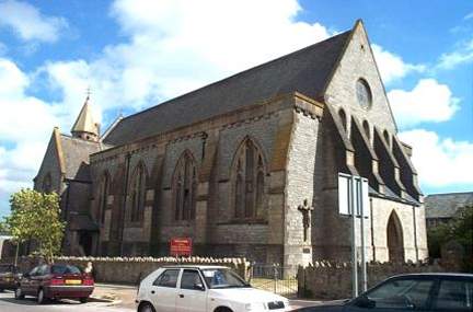