The Churches of Britain and Ireland
| Easton & Eastville, including
Baptist Mills, Upper and Lower Easton, Greenbank and Upper Eastville, Bristol
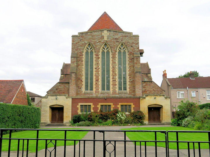
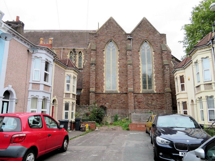
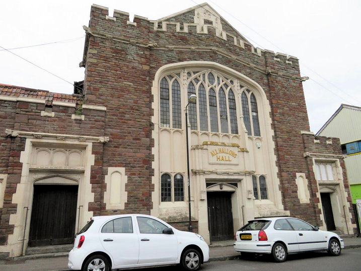
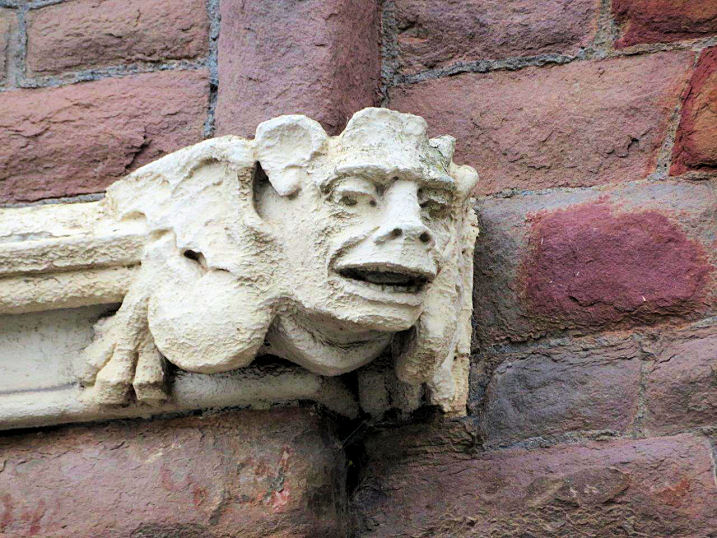
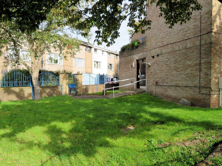
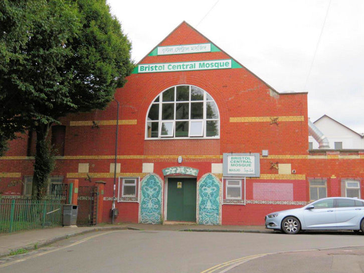
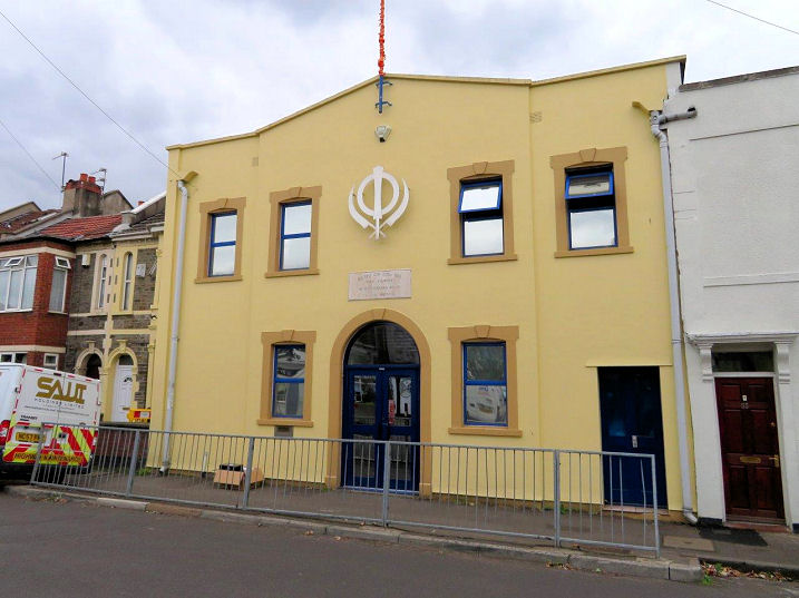
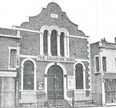
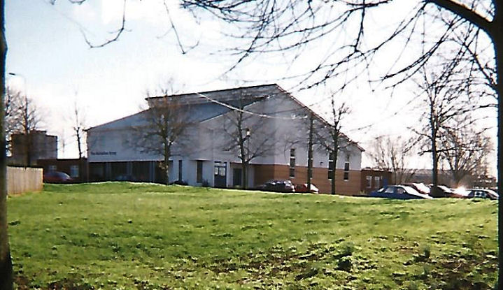
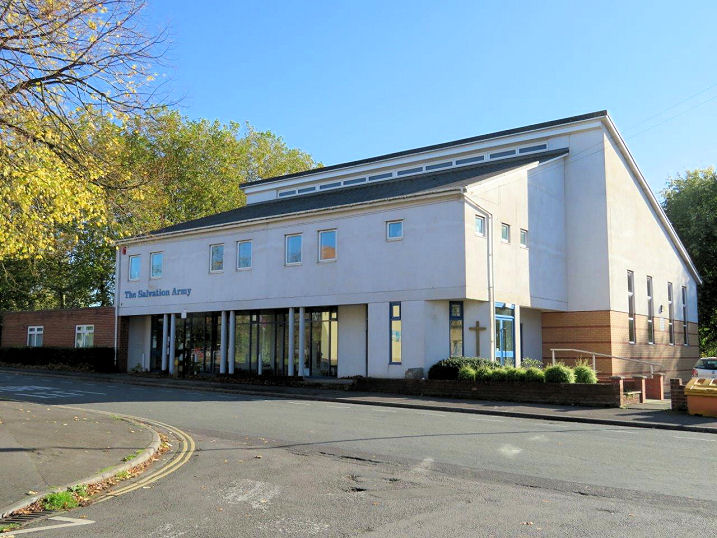
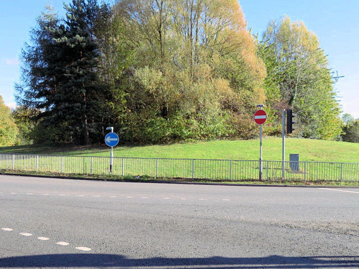
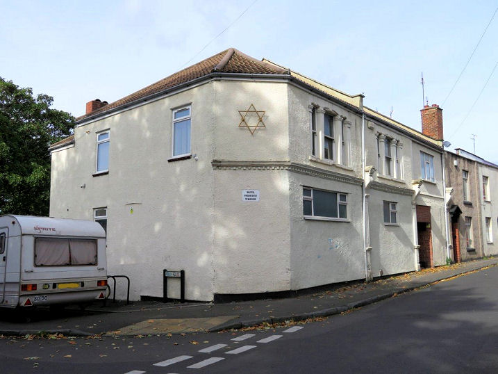
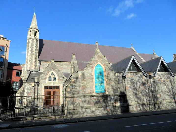
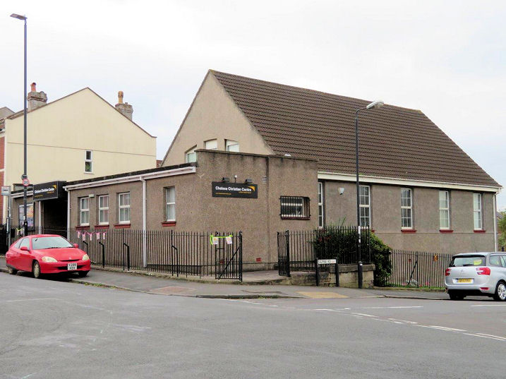
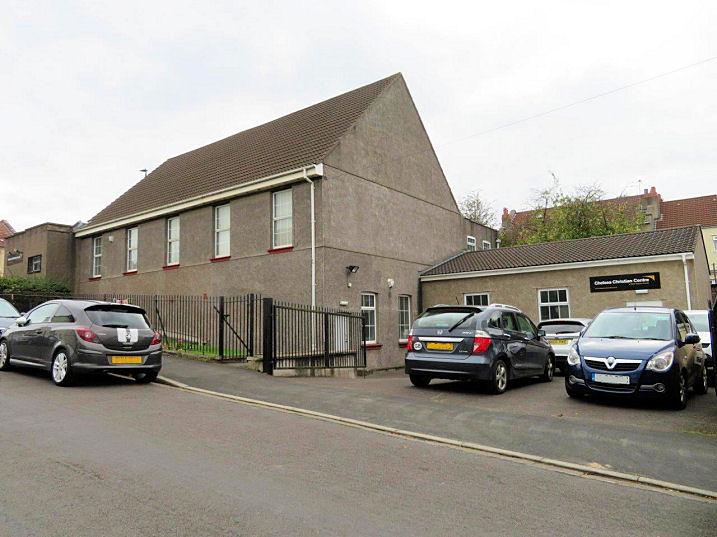
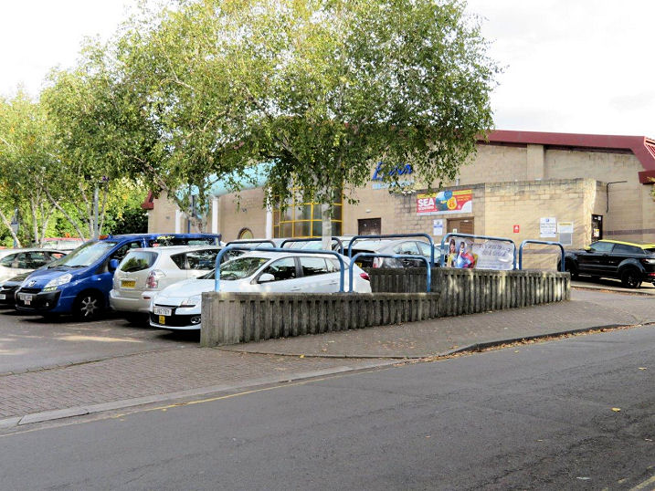
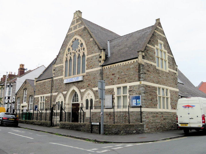
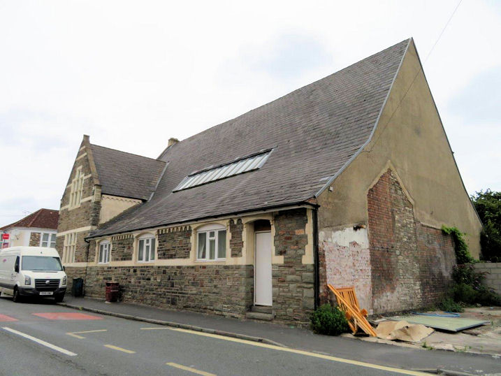
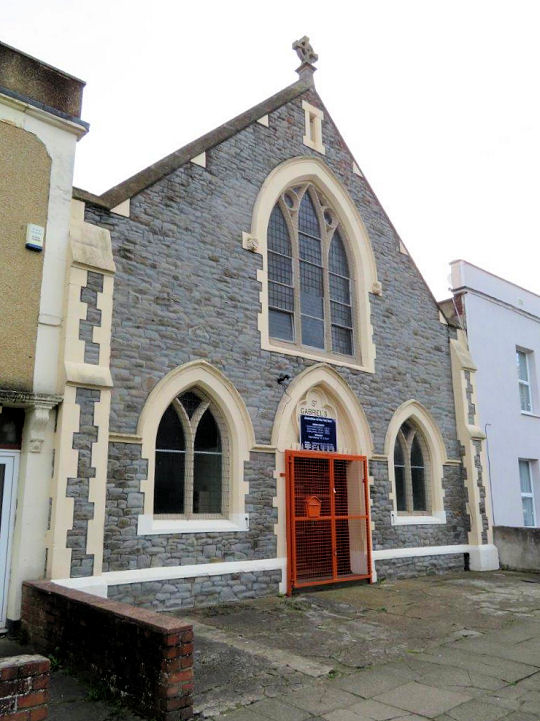
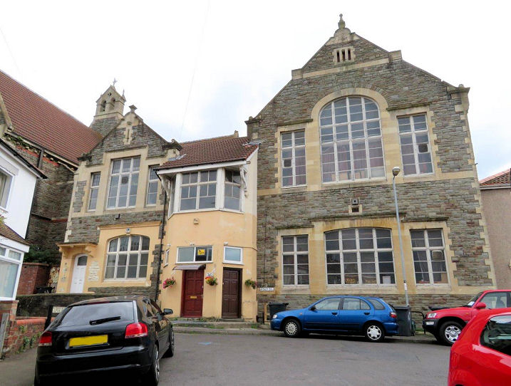
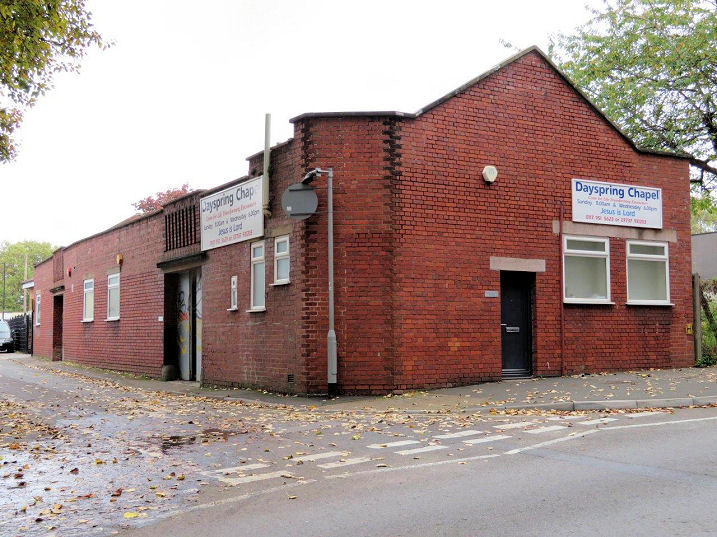
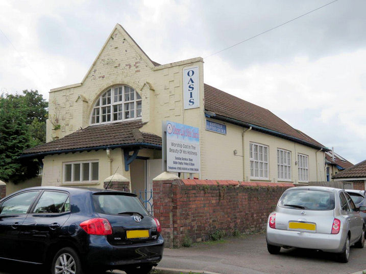
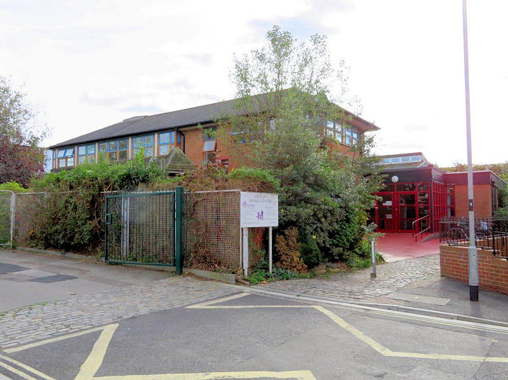
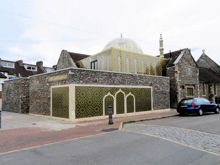
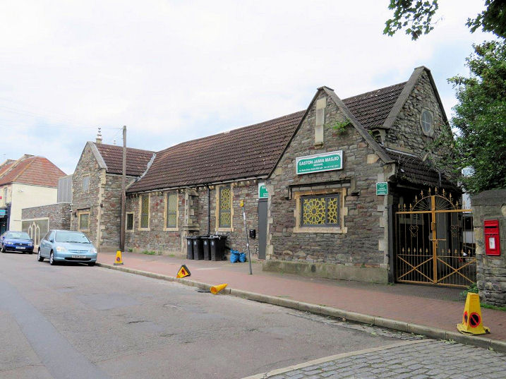
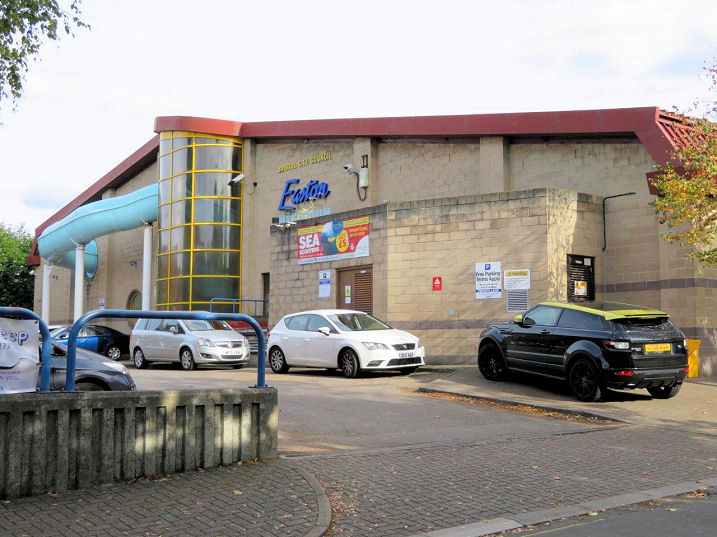
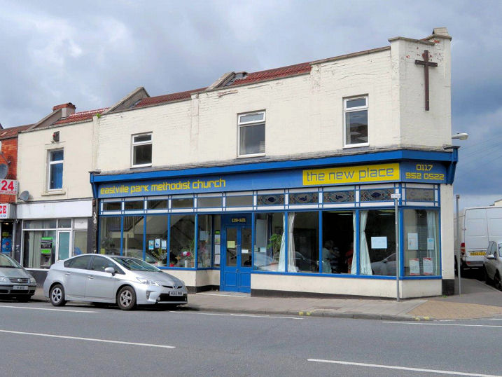
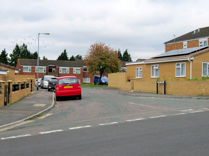
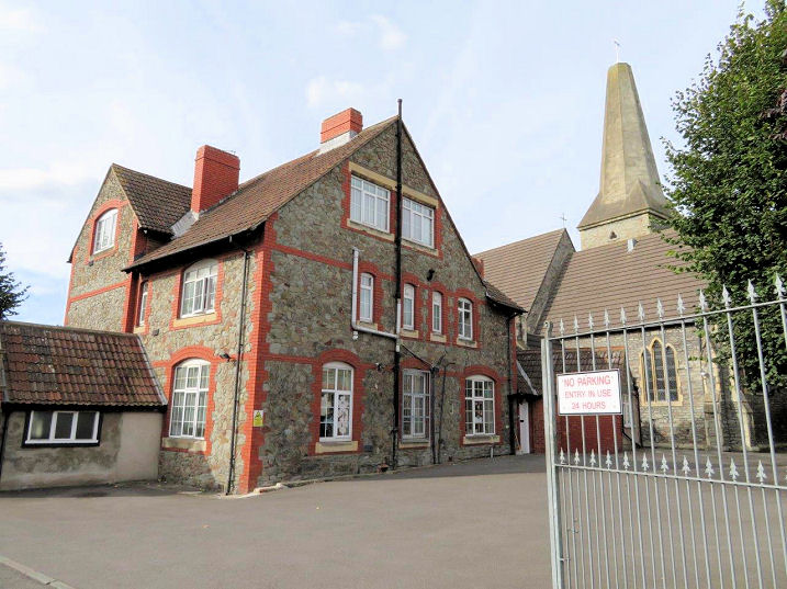
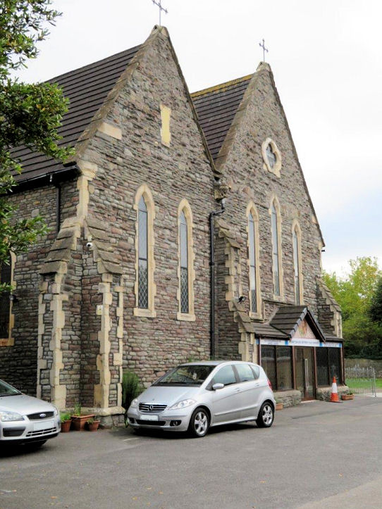
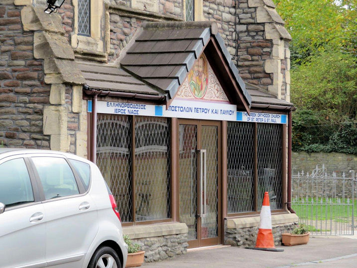
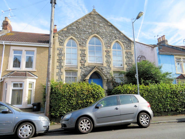
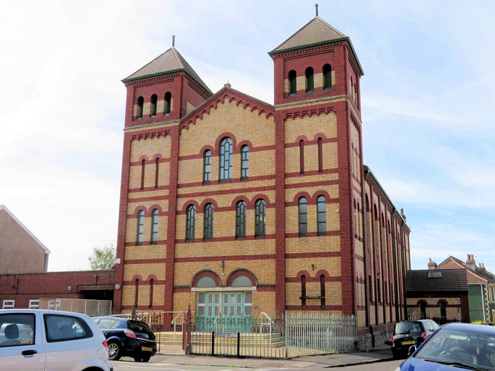
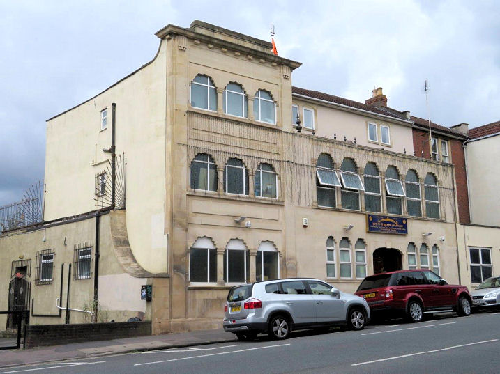
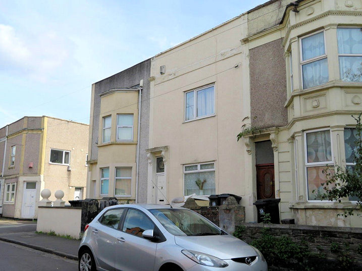
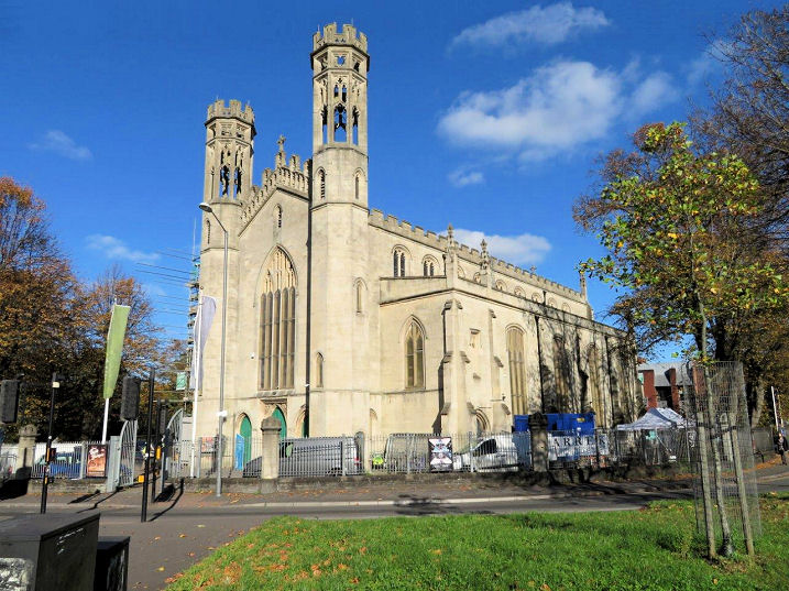
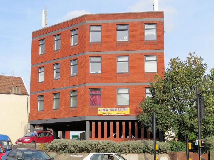
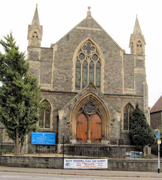
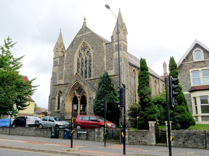
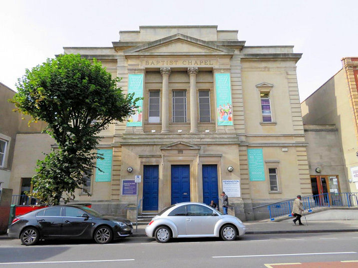
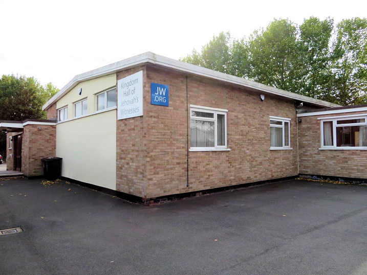
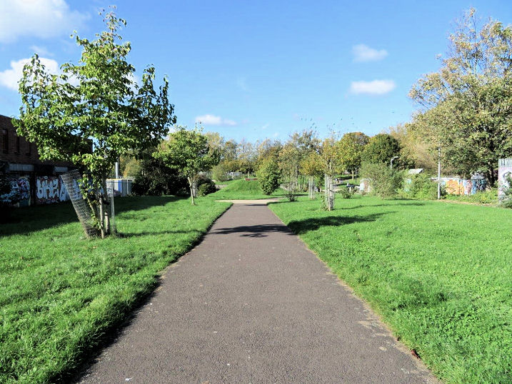
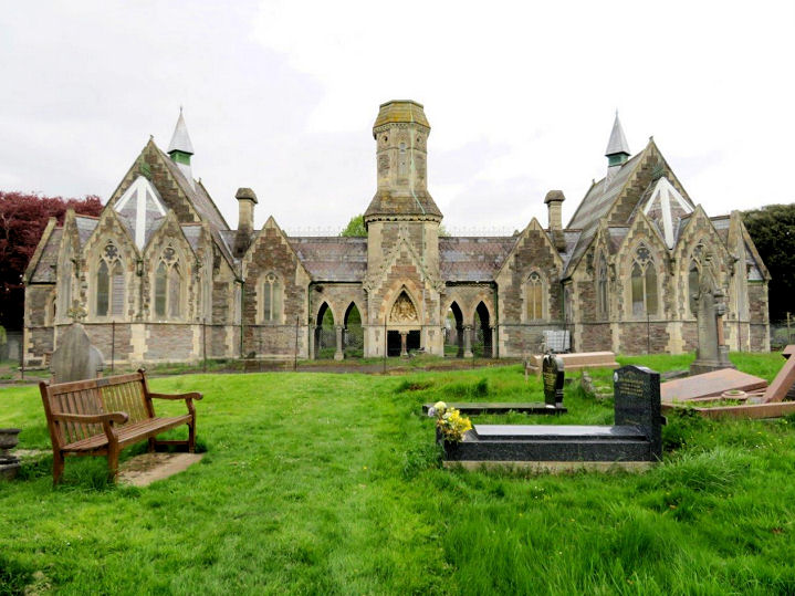
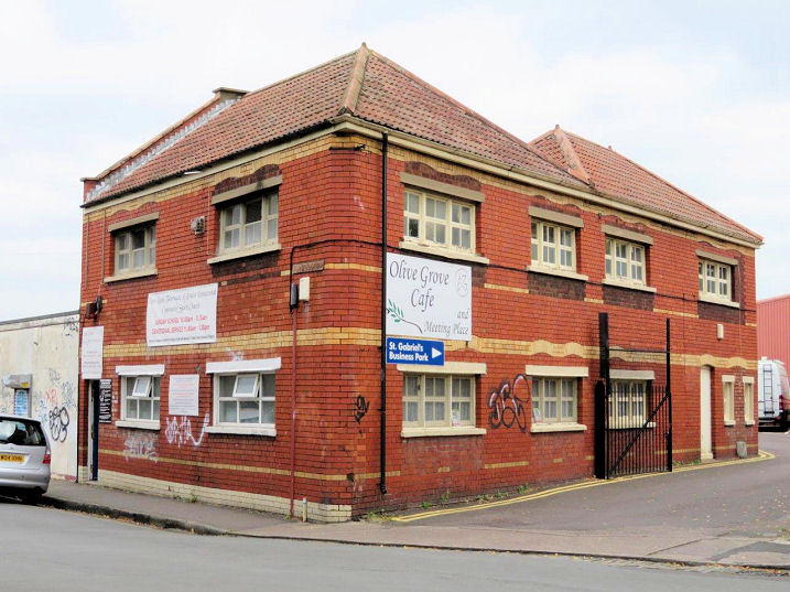
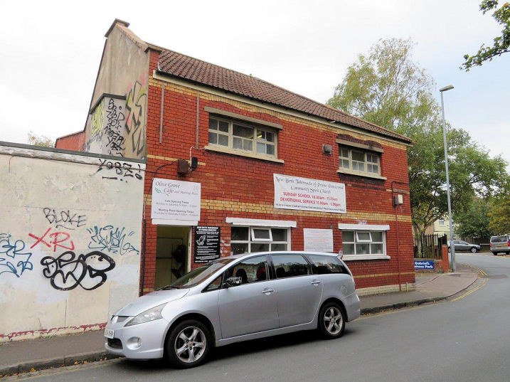
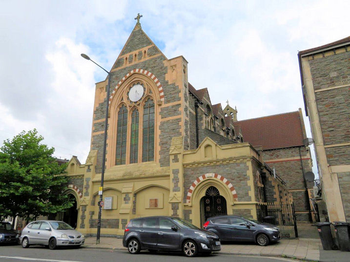
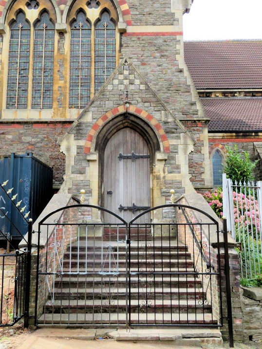
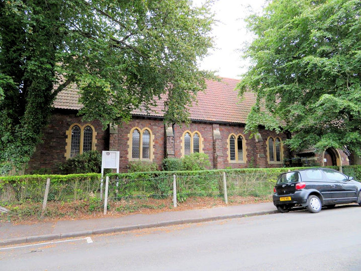
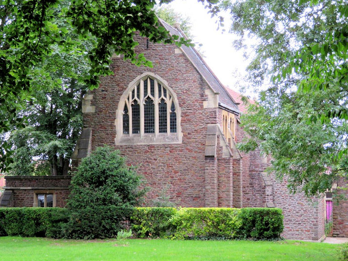
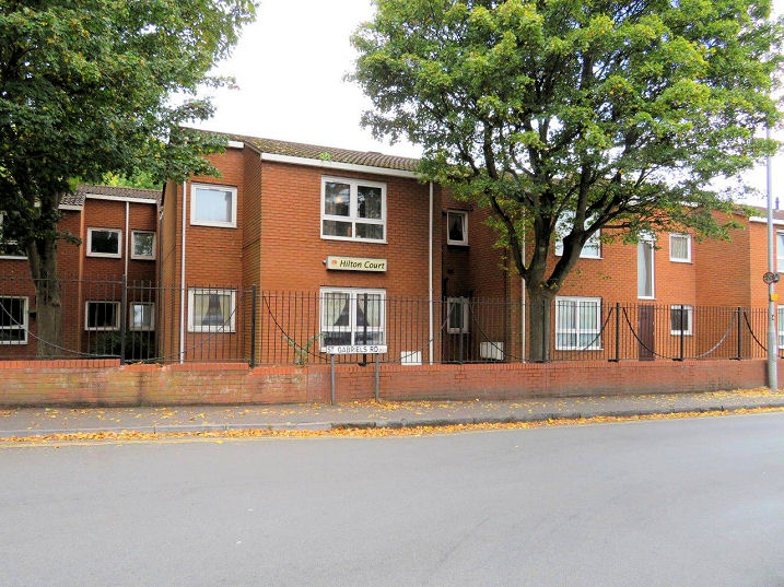
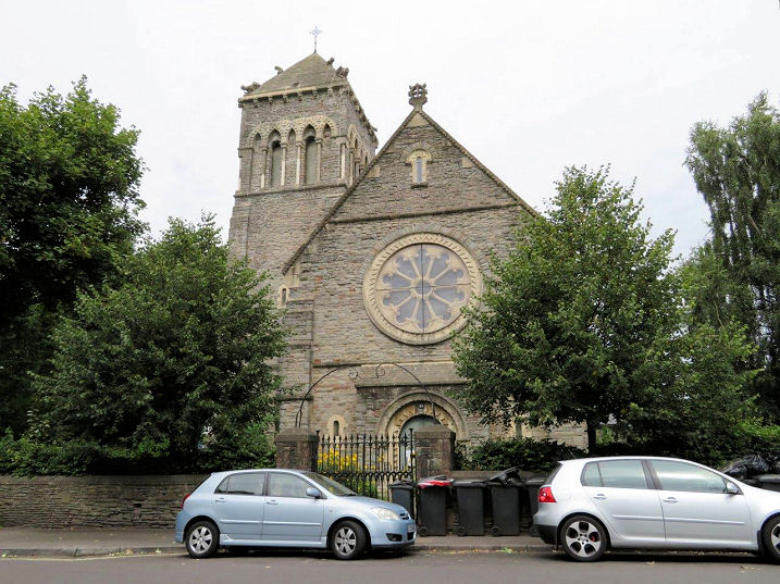
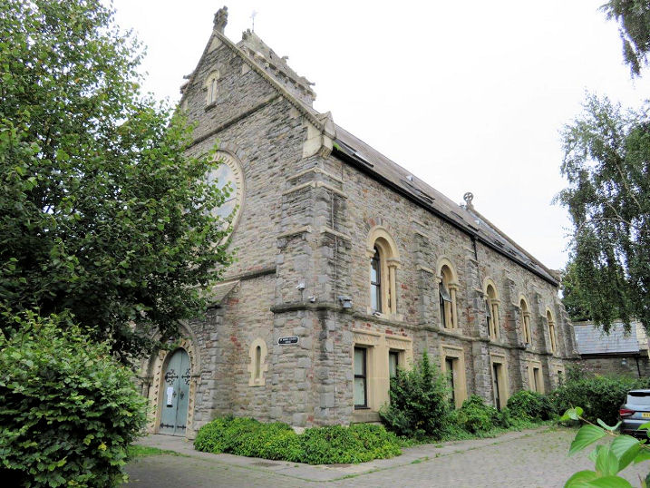
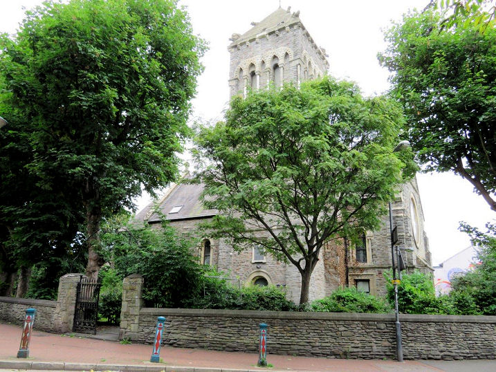
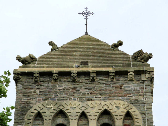
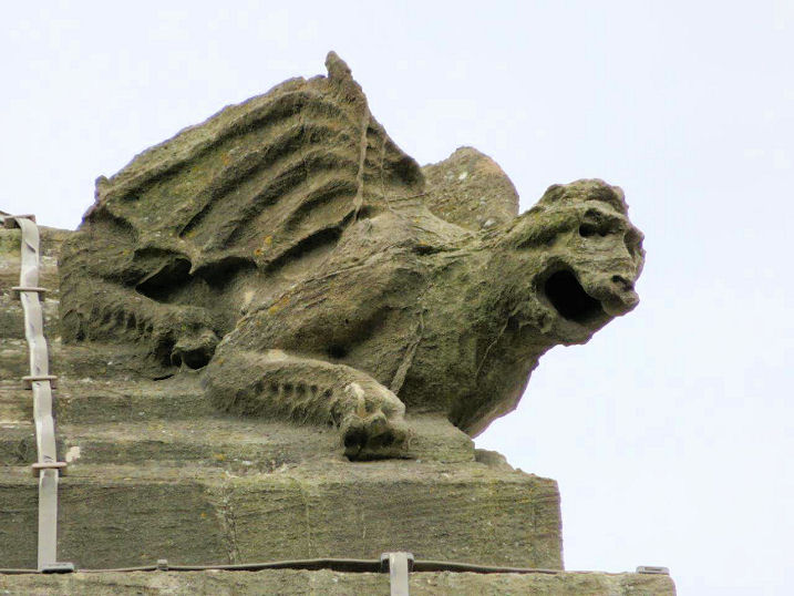
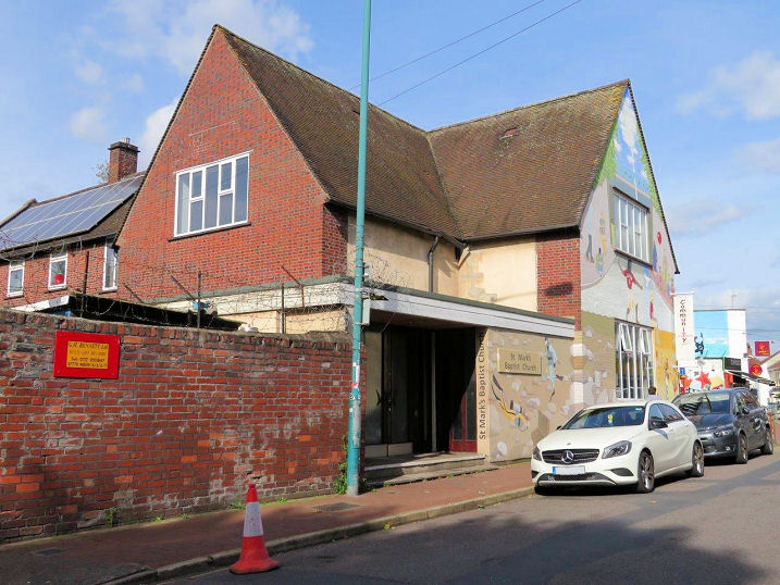
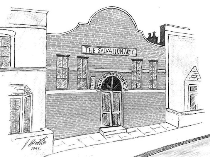
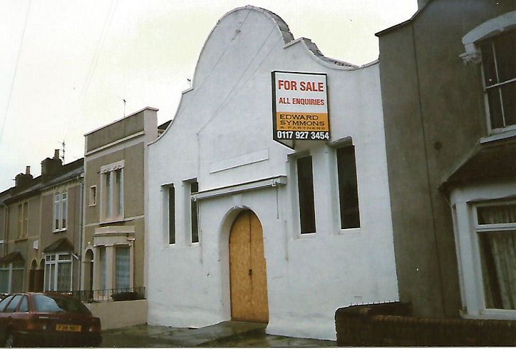
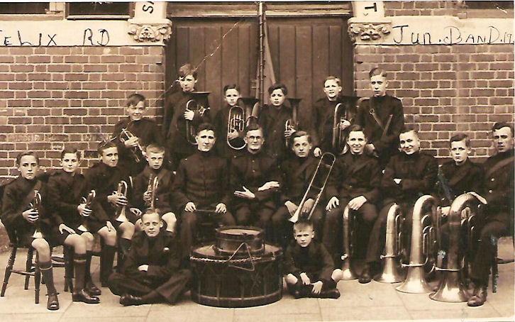
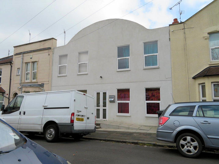
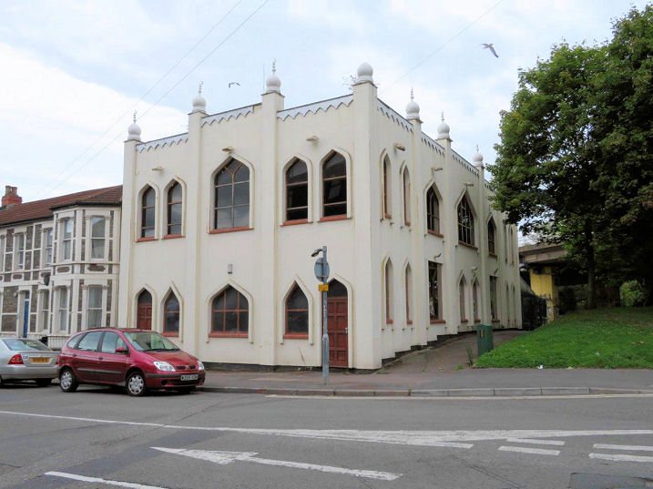
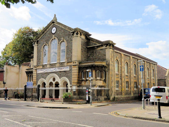
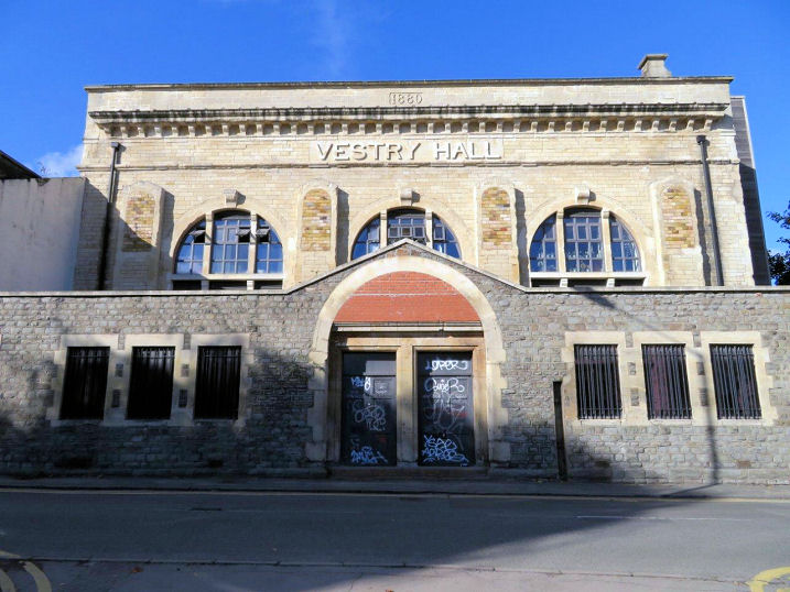
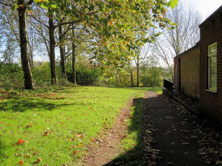
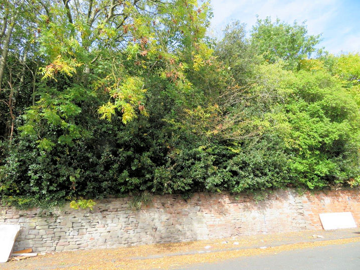
A Bible Christian Chapel used to stand on the now-vanished Gladstone Street. Founded in 1861, it was still shown as such on the 1969 O.S. map, but it had closed by 1971, and the area subsequently redeveloped. The site of the chapel is now a small open space next to a block of flats. ST 60347 73687 © Carole Sage (2017). Bristol Central Mosque on Owen Street, Chelsea Road and Kilburn Street opened in 2003 in what had been an old Bristol City Mission building (1879-2001). ST 61005 73820. © Carole Sage (2017). Link. Bristol Ramgarhia Sikh Temple (1981) on Chelsea Road occupied the site of two terraced houses and their gardens. ST 60948 74058. © Carole Sage (2017). Bristol's Salvation Army No. 3 Corps met in a building on Easton Road, which had been preceded by a hall in St. Phillip's from 1883 to 1908, which also had an outpost ministry on a barge at St. Phillip's Marsh. Rob is not aware of any surviving photos of either of these. The Easton Road building was subject to a Compulsory Purchase Order to enable it's demolition to make way for a new road. From Rob Kinnon-Brettle's collection. The current hall on Hassell Drive opened in the early 1970's and is called Bristol Easton Corps and Community Church. ST 60376 73283. © Rob Kinnon-Brettle. Another view, © Carole Sage (2017). The site of the Easton Road building now lies beneath Lawrence Hill roundabout. ST 60357 73483. © Carole Sage (2017). Link. Bristol and West Progressive Synagogue on Bannerman Road opened in 1975, the property having been converted from three former houses. The congregation had previously met in the Redland Friends Meeting House (for which, see the Redland section of the main Bristol page). ST 60729 73914. © Carole Sage (2017). Link (a comprehensive history). Catholic Church of St. Nicholas of Tolentino on Lawfords Gate. A mid-19th century chapel, map evidence shows that it was either re-built or extended at some time between 1855 and 1874. Gargoyles on the small spire. ST 59959 73502. Both © Carole Sage (2017). Link. Chelsea Christian Centre (Evangelical) on Devon Road and Alpine Road dates from 1930, although the congregation is older (1901) and had previously met in Chelsea Road Gospel Hall. Carole suspects that this may have been the mission hall which is now in use as Bristol Central Mosque (see above), but would appreciate confirmation of this. Another view. ST 61330 74157. Both © Carole Sage (2017). Link. The site of Church of Christ (Unsectarian) which once stood on Thrissel Street - at least it is so named on the 1951 O.S. map. Not present on a map of 1881, a building with the same footprint had appeared by the time of the 1903 map. It had closed before 1970, when a "depot" is shown at the same spot. It stood partly beneath the car park in the photo, extending almost to the building. Information about this church (and photos of it) seems to be absent on-line, so any additional information you could supply would be welcome. ST 60186 73598. © Carole Sage (2017). Church of God of Prophecy (aka House of Praise, Pentecostal) on Tudor Road and Bellevue Road was originally a Wesleyan Chapel, dating from 1895. The Methodist Church closed in 1964, and the present occupants took over shortly afterwards. Another view. ST 61133 74271. Both © Carole Sage (2017). Link. Interior photos are available here - scroll down to "Tudor Road, Lower Easton". Church of the Assemblies of the First Born on Goodhind Street. This is the former St. Gabriel's Mission, a plant in the early 1900's from St. Gabriel in Easton. It may have closed in 1974, when the parent church closed. ST 60241 73903. © Carole Sage (2017). Link. An old photo of the mission is available here (scroll down to the bottom). Darul-Imaan Hosseinieh Foundation (or Darul Imann Hussaini Foundation) on Apsley Street. It was established in 1999 in what was originally the parish rooms for St. Thomas the Apostle (for which see New Testament Church of God, below). ST 61262 75019. © Carole Sage (2017). Link. Dayspring Chapel stands at the junction of Millpond Street and Baptist Street in Baptist Mills. The congregation was founded as a "House Fellowship" in 2004. Whether that coincides with their occupancy of the present building is not clear. The building looks as if it might originally been used for business or light industry. ST 60295 74314. © Carole Sage (2017). Link. Deeper Life Bible Church at Freeland Buildings in Eastville. The building was previously Eastville Baptist Church. It was built in 1906, though the congregation was founded in 1889 in a former Methodist Mission Room nearby. The present occupiers moved in in about 2013 or 2014. ST 61305 74917. © Carole Sage (2017). Link. Easton Family Centre on Beaufort Street is home to Easton Christian Family Centre (Evangelical). Although the congregation is several decades old, Easton Family Centre is of fairly recent date. Do you know where the congregation used to meet? ST 60245 73628. © Carole Sage (2017). Link. Easton Jamia Masjid on St. Mark's Road. Founded in 1982, it's one of the oldest mosques in the South-West, and is in what was St. Mark's church hall and school. Another view. ST 60878 74406. Both © Carole Sage (2017). Link1. Link2. Easton Leisure Centre used to be the meeting place for Faith Life Church (Pentecostal) before their move to Horfield (for which see Faith Life Church on the Horfield page). ST 60219 73588. © Carole Sage (2017). The site of Easton Road Methodist Chapel (Free United) is now occupied by a block of flats. Founded in 1879, it was closed in 1968. ST 60740 73779. © Carole Sage (2017). A photo of the church is available here (scroll down). Eastville Park Methodist Church on Fishponds Road is a former shop. This is the church's fourth home in Eastville. Founded in 1840 in a Mission Room (see Wesleyan Reform Mission Room, below), they built a new Free Methodist Chapel at the Fishponds Road/Gloucester Street junction in 1872. Re-built on the same site in 1901/2, this was their home for about 95 years until their most recent move, prompted by escalating maintenance costs, in about 1997. After moving out of their old home, it was then acquired by its present owners, International Pentecostal City Mission, for whom see below. ST 61249 74963. © Carole Sage (2017). Link. A photo of the 1872 church is available here (scroll down). The site (ST 61265 74795) of the Anglican Chapel of Eastville Workhouse. The workhouse was built in 1847 on Fishponds Road, and eventually became Maytrees Home for the Elderly, before being demolished in 1972, and subsequently re-developed for housing. The Roman Catholic chapel had the same fate (the site is now under the road, near the junction), and stood at ST 61250 74850. Map evidence indicates that it was a later foundation than the Anglican chapel. What is now a piece of public open space was once the workhouse burial ground, and a simple slate memorial commemorates those buried there. All © Carole Sage (2017). A photo is available here, and some history of the workhouse, with photos, here. The Greek Orthodox Church of St. Peter and St. Paul on Lower Ashley Road, Baptist Mills. The spire was reduced in 1996, following safety concerns. The congregation was formed in 1960, in the former St. Simon the Apostle. St. Simon had been dedicated in 1847, and closed in 1960 when its parish was joined with that of St. Agnes in the neighbouring St. Paul's. 1, 2, 3. ST 60308 74218. All © Carole Sage (2017). Link, which includes numerous interior photos, and the Church Crawler website entry has photos of the church when it was St. Simon. The former Greenbank Congregational Church on Hinton Road. Founded in 1890, it closed in 1972 and was converted to residential use. ST 61319 74436. © Carole Sage (2017). Loxton made a drawing. Greenbank Masjid (aka Easton Islami Darasgah) on Greenbank Road and Kingsley Road. The building was originally Castle Green Congregational Church (1901), successor to Castle Green Independent Chapel in central Bristol, (for which see the main Bristol page). It was commonly referred to as "The Lego Church". Subsequently U.R.C., it closed in 2008. Prior to their occupancy here, the mosque had been located in a shop on Roman Road (ST 60886 74300). ST 61347 74476. © Carole Sage (2017). Link. There's more on the Congregational church here, including interior photos (scroll down to "Castle Green, Greenbank". Gurdwara Sri Guru Nanak Prakash (Singh Sabha), or Bristol Sikh Temple, on Fishponds Road. The temple was founded as Sri Guru Nanak Prakash Singh Saba Gurdwara in 1958 in a terraced house (ST 60639 74254) on St. Mark's Road. They moved to their present premises in 1997, into what had been the offices and staff accommodation of a bus depot. ST 61132 74882. Both © Carole Sage (2017). Link. The former Holy Trinity Church on Trinity Road and Clarence Road is now a music and arts venue. ST 60082 73389. © Carole Sage (2017). Link (with photos). Grade II* listed. The House of Healing Ministries meet in office space in Ashbourne House, at the junction of Fishponds Road and Stapleton Road. It stands on the site of a Primitive Methodist Chapel, which was founded in 1873 and closed in 1971. Another view. ST 60957 74773. Both © Carole Sage (2017). Link. An illustration of the P.M. chapel is available here. International Pentecostal City Mission Church at the Fishponds Road/Gloucester Street junction. See also Eastville Park Methodist Church (above), which the present owners acquired in 1997. ST 61477 75113. © Graeme Harvey. Another view, © Carole Sage (2017). Link. Jalalabad Islamic Centre on Fishponds Road opened in 2011. ST 61316 75028. © Carole Sage (2017). Link. Kensington Baptist Church (1888) on Stapleton Road (ST 60483 74114). The congregation moved here from a smaller chapel on Thrissel Street (ST 60263 73485), the site of which is now occupied by a commercial building on a business park. Opened in the early 1830's, it had to be re-built in 1854/5 following a fire. After the congregation's move to their present home, the Thrissel Street Chapel was bought by an engineering firm, and perhaps demolished between the wars when a large works was built. Both © Carole Sage (2017). Link. Kingdom Hall of Jehovah's Witnesses on Claremont Street, Baptist Mills. ST 60338 74169. © Carole Sage (2017). The site of a Mission Hall which stood between Peel Street and Canning Street in Easton. It shows on maps from 1903-1971, but Carole has not been able to find any additional information about it. 2017. ST 59985 73811. © Carole Sage (2017). The Mortuary Chapels at Greenbank Cemetery date from the founding of the cemetery in 1871, but are no longer in use. In this view, the chapel at the left was non-conformist, with the Church of England chapel at the right. ST 61623 74666. © Carole Sage (2018). Grade II listed. New Birth Tabernacle of Praise Pentecostal Community Spirit Church (aka New Birth Tabernacle of Praise) occupies the surviving part of a circa 1920's industrial building. Here since 2010, the congregation previously met in a house on St. Gabriel's Road. Another view. ST 60575 73832. Both © Carole Sage (2017). Link. New Testament Church of God (Pentecostal, 1979) on Fishponds Road was originally St. Thomas the Apostle (1889-1977). The present church moved here from Montpelier (see New Testament Church of God in the Montpelier section of the main Bristol page). St. Thomas was closed when its parish was merged with that of St. Ann (see below). ST 61286 75027. © Graeme Harvey. Two further views - 1, 2, both © Carole Sage (2017). Link. More photos (including interiors, and history) here. The site of Newtown Free United Methodist Chapel, which stood on Trinity Place. The site itself lies under the road, towards the left in Carole's photo. Founded in 1855, the 1949 O.S. map marks it as a chapel, but the 1951 edition shows it as a hall, suggesting a change of use by then. It was demolished as part of a housing development scheme in the late 1960's. ST 60129 73308. © Carole Sage (2017). The approximate site of the People's Mission Hall on Easton Road. Not marked on maps as far as Carole can determine, it was mentioned in a directory of 1914. The grid reference identifies the entrance to the bus station, which now occupies the site. ST 60680 73710. © Carole Sage (2017). St. Anne on St. Leonard's Road, Greenbank. Founded in 1901 as a mission from St. Mark (see below), it became the parish church of its own parish in 1926. It merged with St. Thomas the Apostle (see New Testament Church of God, above) in 1976, and with St. Mark in 1982, so the parish is now The Parish of St. Anne with St. Mark and St. Thomas. St. Thomas Mar Thoma Church has also worshipped here (link). Another view. ST 61401 74551. Both © Carole Sage (2017). Link. The site of the demolished St. Gabriel, on St. Gabriel's Road. Founded in 1870, the parish was merged with that of St. Lawrence in Lawrence Hill in 1954, and re-dedicated as St. Gabriel and St. Lawrence. It was closed in 1974, and housing built on the site. Carole's photo shows where the East end of the church would have been. ST 60542 73829. © Carole Sage (2017). Photos and a good history of the church are available here. St. Mark on St. Mark's Road and High Street dates from 1848. Forced to close by dry rot in the early 1980's, the building was subsequently converted to serve as supported housing. Three additional views - 1, 2, 3. The stone carvings on the tower roof ridge-lines are unusual; a close-up of one of the carvings. ST 60867 74358. All © Carole Sage (2017). An old photo is available here, and more photos (some of the interior) and a good history here. Grade II listed. St. Mark's Baptist Church on St. Mark's Road was originally built as Easton Baptist Mission in 1911. The congregation was founded in 1899, so presumably had an earlier home, but Carole hasn't discovered where that was, as yet. Another view. ST 60860 74425. Both © Carole Sage (2017). Link. St. Simon the Apostle - see Greek Orthodox Church of St. Peter and St. Paul, above. The approximate site of St. Simon's Mission House on Lower Ashley Road, Baptist Mills. It occupied a pre-existing property for some years in the early 20th century. ST 60488 74299. © Carole Sage (2017). St. Thomas the Apostle - see New Testament Church of God, above. The site of Salem Chapel (United Free Methodist) on Lower Ashley Road, Baptist Mills. Founded in 1853, possibly as a replacement for the earlier Reformed Wesleyan "Baptist Mills Chapel", it was closed in 1950 following the merger of Salem, Wesley Chapel (see below) and Brookland Chapel, to form Parkway Methodist Church in St. Werburgh's (for these latter two, see the St. Werburgh's section on the main Bristol page). The building survived until around 1970, and Carole's photo would have shown the chapel face-on. ST 60357 74277. © Carole Sage (2017). The former Salvation Army Hall (Bristol No. 6 Corps) on Felix Road (formerly Coalpit Road), drawn by Joseph Brettle in 1999. It was originally built as a jam factory, and became S.A. in 1882. ST 60668 73960. © Trustees of the estate of Joseph Brettle. A photo taken in 1999, © Rob Kinnon-Brettle. The Junior Band in 1935, from Rob Kinnon-Brettle's collection. Another view, after conversion to residential use, © Carole Sage (2017). Shah Jalal Jame Mosque (2007) on Stapleton Road. Another view. ST 60921 74791. Both © Carole Sage (2017). Link. Stapleton Road Chapel (Congregational Centre) was founded as a Congregational Church in 1867. It stands at the junction of Stapleton Road and Newton Street. It didn't join the United Reformed Church, instead choosing to remain independent. Crisis Centre Ministries also meet here. ST 60110 73593. © Carole Sage (2017). Link. Trinity Tabernacle of Hassell Drive was built in the early 1970's, opening in 1974, as a replacement for an earlier church of 1957 on Lawrence Hill, which was demolished for road improvements. ST 60380 73320. © Carole Sage (2017). The Gloucestershire Places of Worship website lists Vestry Hall on Pennywell Road as having once been registered as a place of worship. Built as a gym in 1880, by 1914 it had become a public hall, and had other uses in later years. Details are hard to verify, but there seems to have been some connection with Holy Trinity, perhaps as a Mission. The same website also mentions that the hall was used at some point by the Bristol Church of Christ. Another view. It was converted into flats somewhere around 2008. ST 59950 73594. Both © Carole Sage (2017). The site of the vanished Wesley Chapel (1837) which once stood on a now-vanished section of Lower Ashley Road. This was reputedly built on the site where John Wesley first preached. It was closed in 1970 in connection with the construction of the M32. Baptist Mill Court Flats have since been built here; and the chapel stood where the letters "E" and "F" show on the photo. ST 60223 74295. © Carole Sage (2017). Photos of it are available here (scroll down), on the Church Crawler website. The site of Wesley Hall, a short-lived chapel in a pre-existing building, on a now-vanished section of Barrow Road at its junction with Morley Terrace, Newtown. It opened in 1953, but had closed by 1961. The plot it stood on is now adjacent to, and partly under, the Salvation Army Church on Hassel Drive. ST 60390 73271. © Carole Sage (2017). The
site of the
Wesleyan Reform Mission Room, which was part of the long-vanished
Freeland Buildings. Founded in 1840, it flourished, and the congregation
outgrew their first building, and built Eastville Park Methodist Church
in 1872 - see
International Pentecostal City Mission Church
(above) for a photo, and Eastville Park
Methodist Church (above) for some more history.
The Wesleyan
building was subsequently acquired by the Baptists, but they too moved
on in 1906 (for which, see Deeper Life Bible Church, above). It seems
not to have continued in religious use, as maps subsequent to that date
don't mark it as such, but it (or a building with the same footprint)
seems to have survived until the area was cleared for redevelopment in
the 1970's or 1980's. It's now a densely vegetated piece of apparently
unused land.
ST 61425 74830. © Carole Sage
(2017).
|
||
04 March 2023
© Steve Bulman