The Churches of Britain and Ireland
|
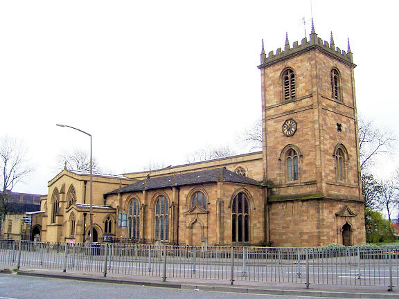
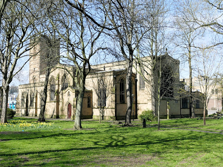
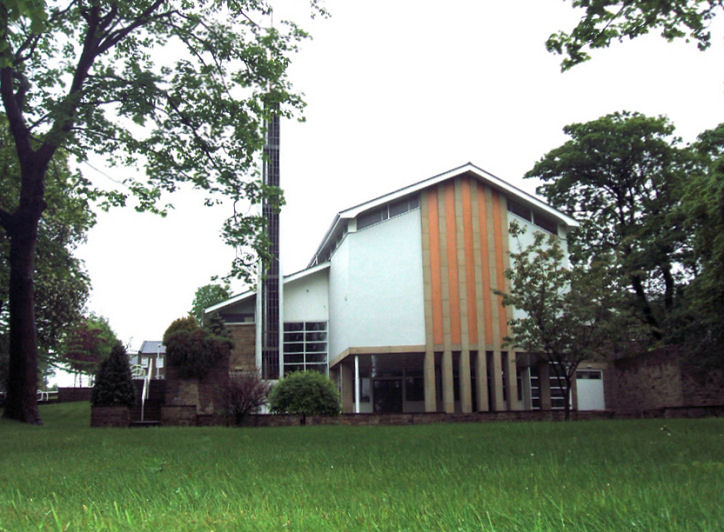
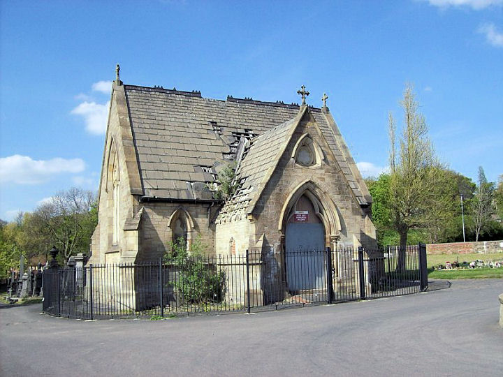
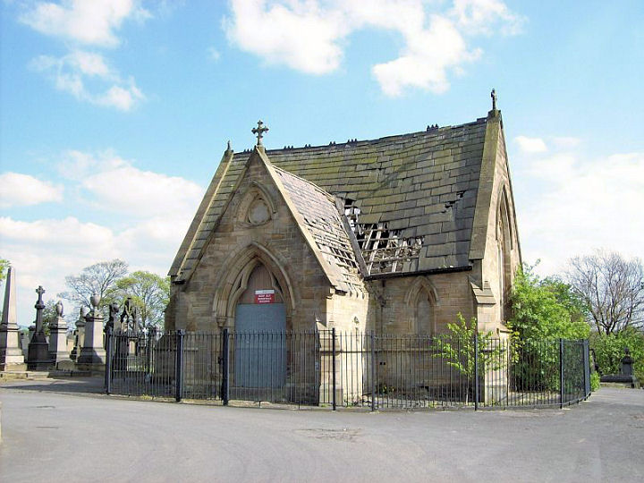
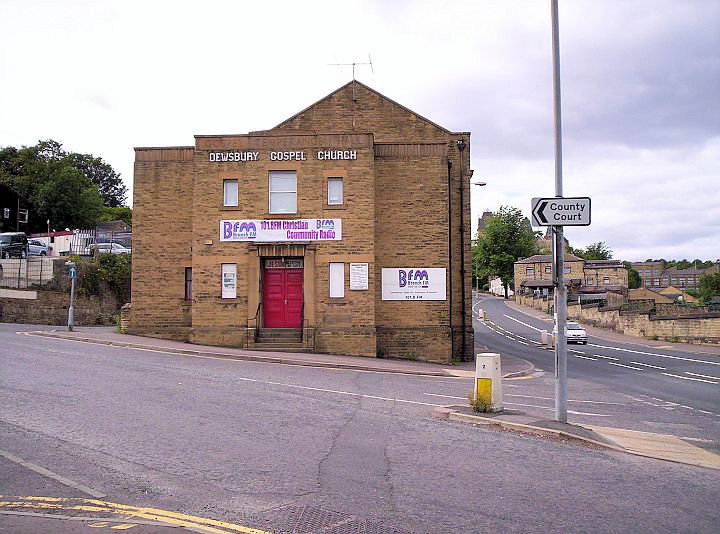
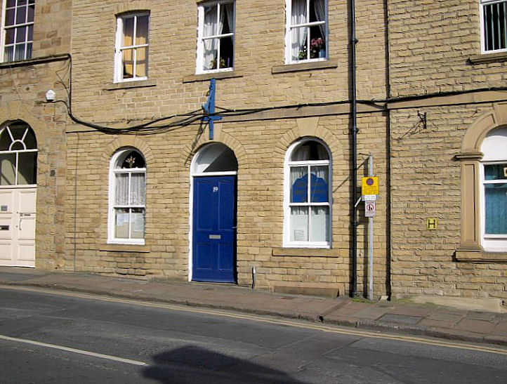
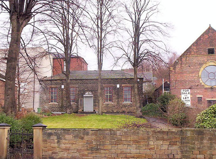
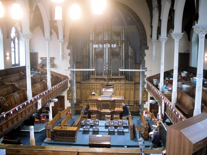
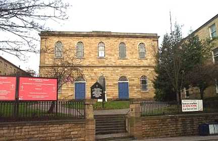
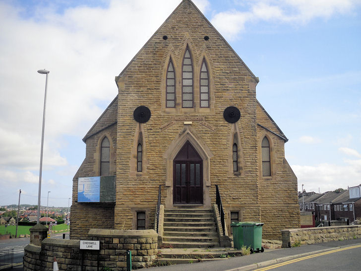
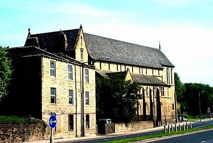
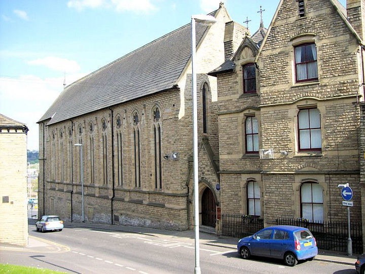
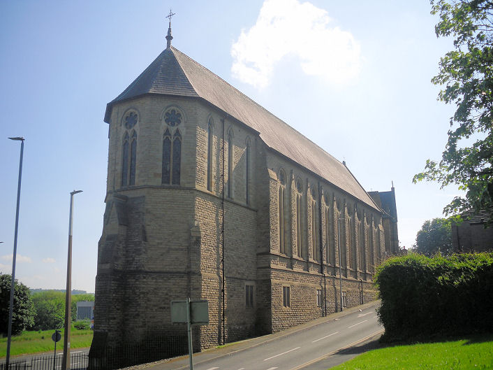
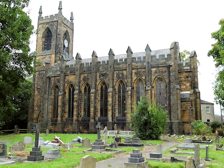
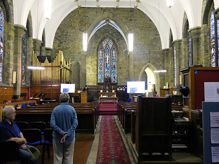
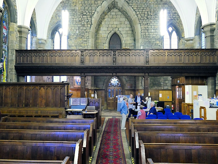
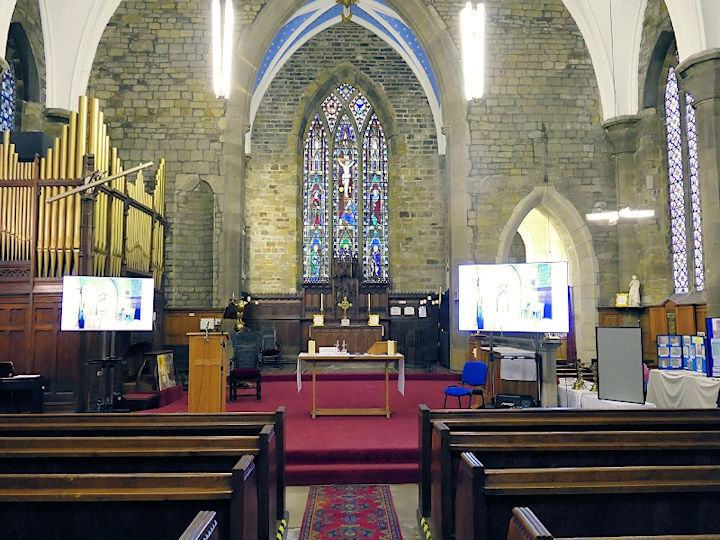
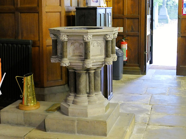
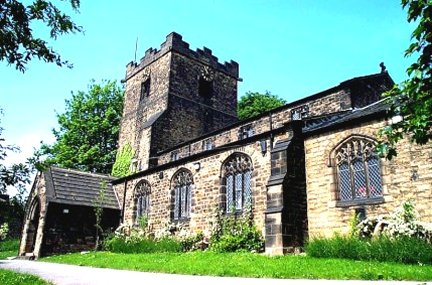
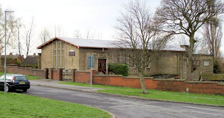
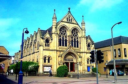
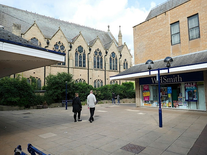
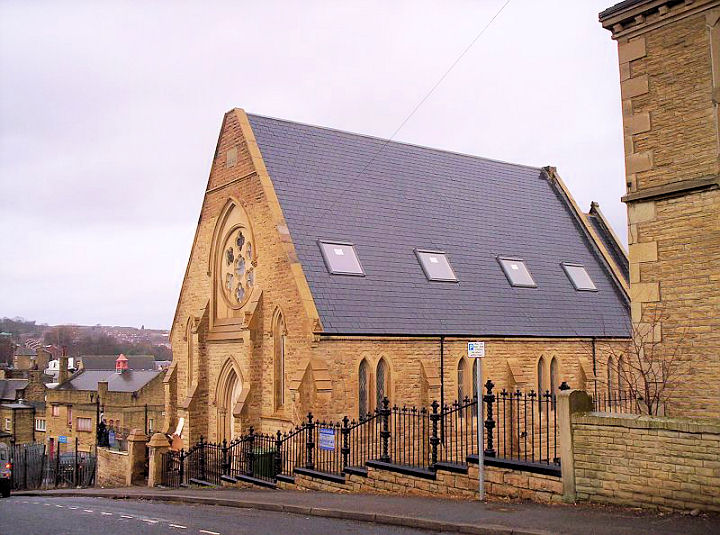
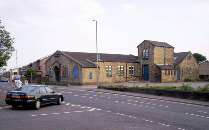
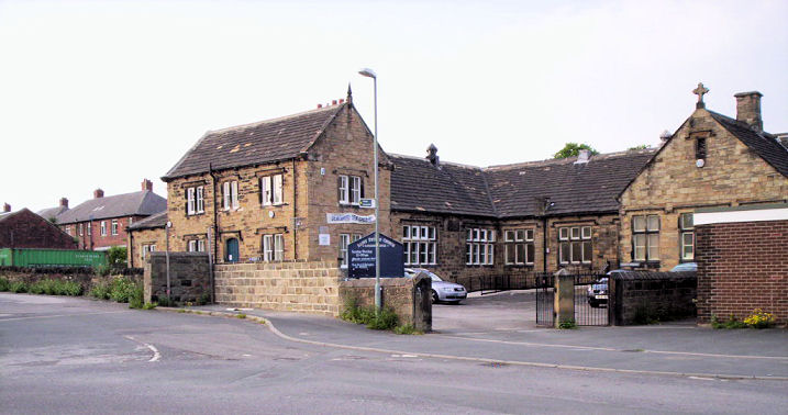
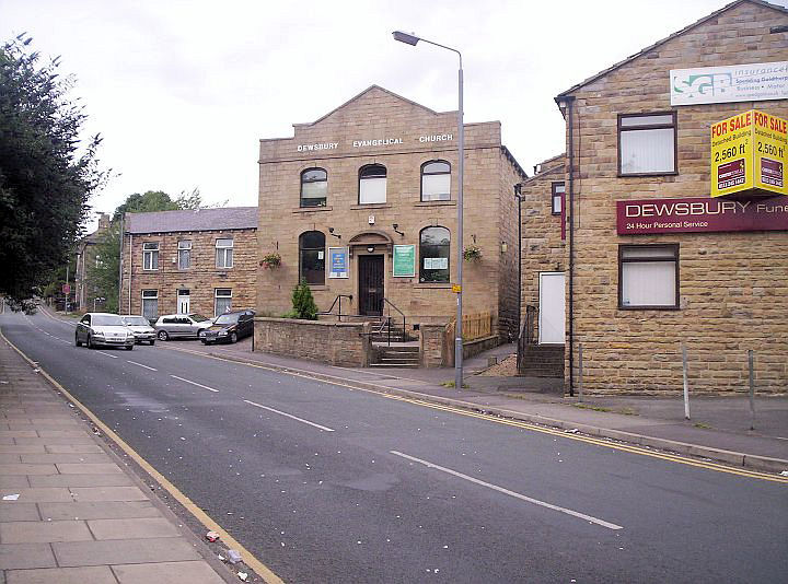
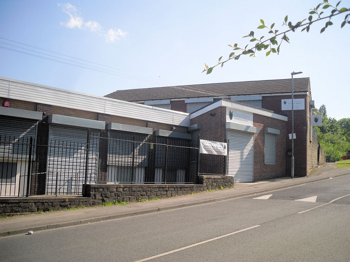
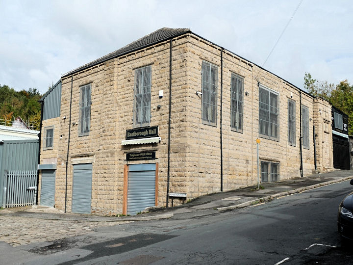
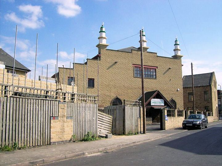
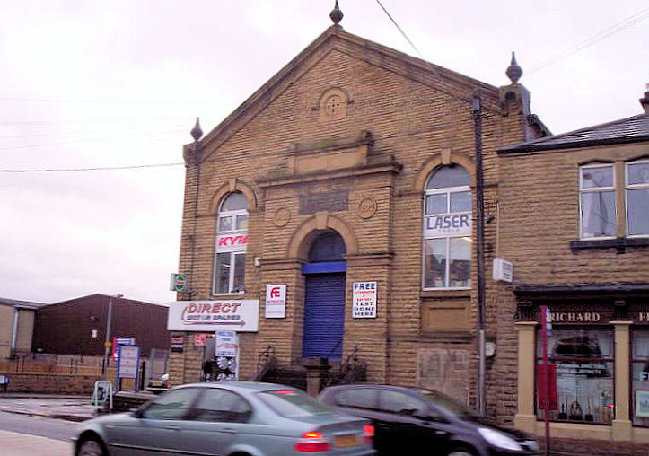
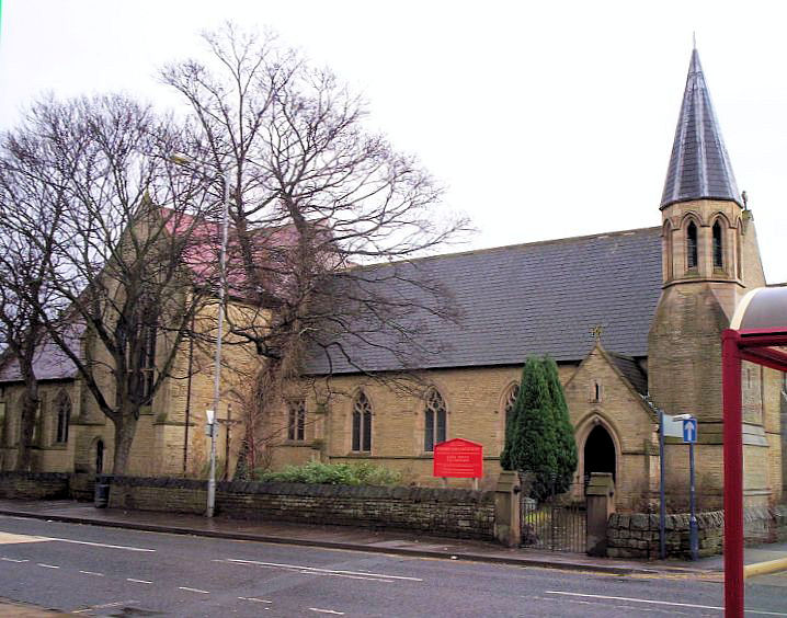
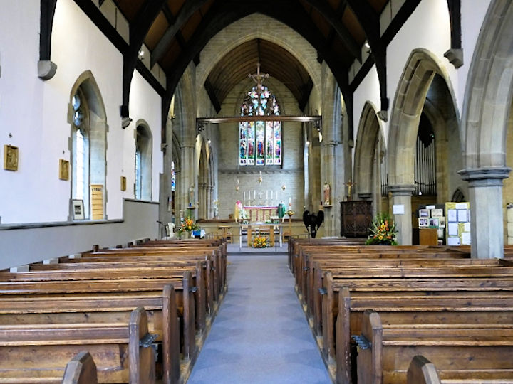
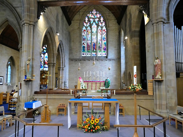
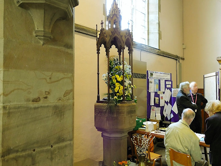
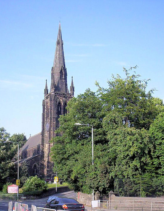
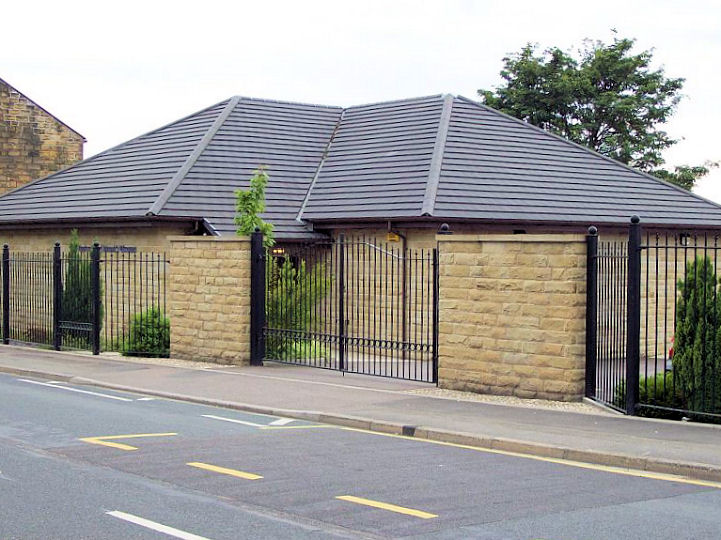
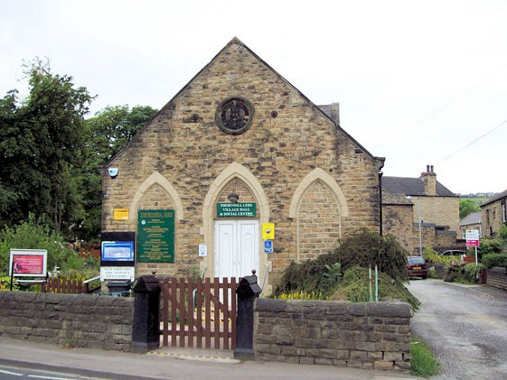
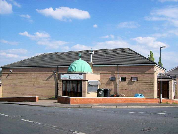
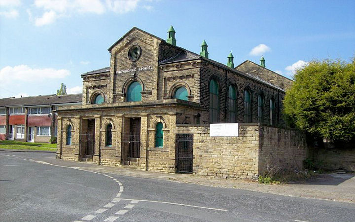
Dewsbury, West Yorkshire Churches at Earlsheaton, Eastborough, Ravensthorpe, Thornhill Lees, West Town. All Saints Minster. Although probably founded in the 7th century, the present building is mostly from the rebuild of 1767 by John Carr. SE 2459 2153. © Bill Henderson. Another view, © Stan Walker, and another, © David Regan (2021). Link. Grade II* listed. Baptist Church on Manor Street. SE 2479 2183. © Bill Henderson. Another view, © David Regan (2020). Two interior views - 1, 2, both © Gerard Charmley (2023). Grade II listed, wherein its opening is dated to 1871. Church of Jesus Christ of Latter-day Saints, on Halifax Road. SE 2385 2263. © Bill Henderson. Church of the Nazarene, a former textile workers club on Old Westgate and Webster Hill. SE 2427 2151. © David Regan (2010). Dewsbury Cemetery, on Ravenshouse Road and Burgh Mill Lane has two chapels - North Chapel (Nonconformist, SE 2325 2115) and South Chapel (CoE, SE 2326 2112) , both derelict. Both © David Regan (2011). Both chapels date from 1859, and both are listed as grade II - North, South, Dewsbury Gospel Church on Halifax Road and Willans Road, in a former Temperance Hall. SE 2431 2205. © David Regan (2010). By 2012 the Dewsbury Gospel Church sign had been taken down (Streetview), and in 2023 it was Charis Bible College (Streetview). Dewsbury Revival Centre (Branch Christian Ministries), formerly St. Mark, on Halifax Road. Its grade II listing dates it to 1862-5. SE 2391 2236. © Bill Henderson. When Bill took this photo, St. Mark had ceased to be used as a church. David Regan advised in 2011 of the D.R.C. church having opened in 2010 - see Link. Wallace Hartley, famously the band leader on the Titanic, played the organ at St. Mark's. Another view, © David Regan (2023). Dewsbury Spiritualist Church on Wellington Road. Circa SE 2437 2171. © David Regan (2011). Link. Friends Meeting House on Bradford Road. SE 2447 2228. © David Regan (2011). The former Glory Band Tabernacle on Bradford Road was a dance hall in the 1940's. SE 2448 2226. © David Regan (2010). Longcauseway Church (Methodist and U.R.C.) on Longcauseway was originally Ebenezer Congregational Church (and later U.R.C.), of 1884. Two interior views - 1, 2. SE 2463 2167. All © Gerard Charmley (2023). Link. Grade II listed. Madni Masjid, which stands between Halifax Road and Northgate, was originally Salem Methodist Chapel. The photo is of the Northgate frontage - the Halifax Road frontage can be seen on the appended listing. SE 2451 2195. © David Regan (2010). Link. Grade II listed, wherein it's dated to 1863. The shared central Methodist and Elim Pentecostal church. © Bill Henderson. David Regan has advised (in 2011) that the building has now been bought outright by Elim, and that the Methodists no longer worship here. The 25" O.S. map of 1907 show a Mission Room at the junction of Boothroyd Lane and Hanover Street at SE 2376 2172. The two houses at the centre of this 2015 Streetview stand on its site. Moorend Lane Chapel at Dewsbury Moor, in 1910. Photo is on an external website. Link advised by David Regan. Janet Gimber has been looking at old maps, and advises that the church has been demolished, and housing built on the site. The church was built in 1874, and re-built in 1934, so the photo shows the earlier building. It still shows as surviving on the 1989 map. Janet has also found evidence for it having finally closed in 1994. It was variously known as Zion Primitive Methodist Chapel, and later Kilpin Hill Zion Primitive Methodist Church. Link. Moorlands Wesleyan Methodist Chapel used to stand on Boothroyd Lane and Moorlands Road, at SE 2382 2179. It's dated here, where there is an illustration, to 1877. As it seems to be an architects drawing, the church may have differed, but I can't find a photo to prove it one way or the other. Its site is seen here (2020 Streetview) - the chapel stood where the tallest tree is, behind the house. There were school buildings associated with the church, a little further west along Boothroyd Lane. An illustration can be seen here (the bottom right quarter). Mount Tabor Community Church (1864) at Shaw Cross. It shows on a map of 1893 as Mount Tabor Chapel (Meth New Connexion). SE 2637 2318. © Gerard Charmley (2017). Link. Our Lady and St. Paulinus (R.C.) on Cemetery Road and Huddersfield Road. SE 2379 2129. © Bill Henderson. Another view, © David Regan (2011), and another, © Gerard Charmley (2023). Link. The site of the Primitive Methodist Chapel, which stood at the junction of Wellington Road and Wheelwright Street. Its My Primitive Methodists entry dates the original chapel to 1865-6, replaced on the same site by a re-build of 1886, and closure circa 1944. The surviving Sunday School is shown in David's photo; the chapel stood in what is now the car park to the right, gable-end to the road. SE 2424 2162. © David Regan (2020). Another Primitive Methodist Chapel stood on School Lane, Dewsbury Moor at SE 2275 2223. Its site (beneath the house and extending to the right) was seen by Streetview in 2023. It's mentioned here at the bottom of the entry as having dates 1860-1968. St. James's Mission Church used to stand on Vulcan Road. The road used to carry on along what is now the grass strip between the two rows of house seen in a 2022 Streetview. The church stood about half way along the grass, extending under the housing to the right. It pre-dates a map of 1884, and survived into the 1950's at least. SE 2410 2175. The site of the demolished St. John the Baptist at Daw Green, as seen by the Streetview van in 2015. Dates are 1885-1960's (source). A photo of the church is available here. SE 2390 2155. St. John the Evangelist on Boothroyd Lane, Boothroyd. Three interior views - 1, 2, 3, and the font. SE 2316 2178. © David Regan (2024). Link. Grade II listed, wherein it's dated to 1823-7. St. Joseph (R.C.). © David Regan (2011). Link. The former St. Mary at Savile Town, demolished in the mid-1960's. Photo is on an external website. Link advised by David Regan. The former St. Matthew on Cemetery Road and Huddersfield Road is now used as sheltered accommodation. SE 2372 2122. © Bill Henderson. St. Thomas More (R.C.) at Chickenley. © David Regan (2011). Link. The former Springfield Chapel on Halifax Road, demolished in the 1950's. Photo is on an external website. Link advised by David Regan. The demolished Trinity Chapel (1870). This was Congregational, and stood on Halifax and Wellington Roads, at SE 2447 2198. The congregation merged with Dewsbury Ebenezer, forming Dewsbury United Congregational Church in 1907-8. While both churches continued in use for some years, Trinity Chapel went out of use in the early 1920's, and by 1933 it was a cinema, becoming the Rex Social Club in the 1980's. It was knocked down in the 1985 to make way for a new road. Photo is on an external website. The site today can be seen here on Google Streetview, and the people on the central reservation would have been standing close to the nearest corner of the church railings in the photo.
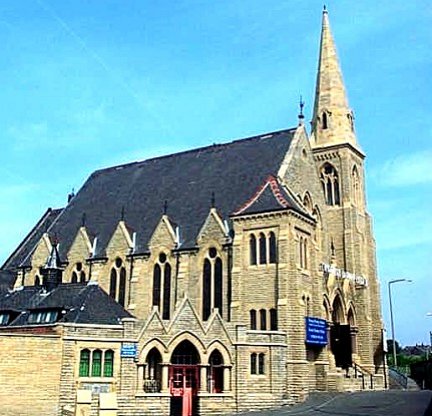
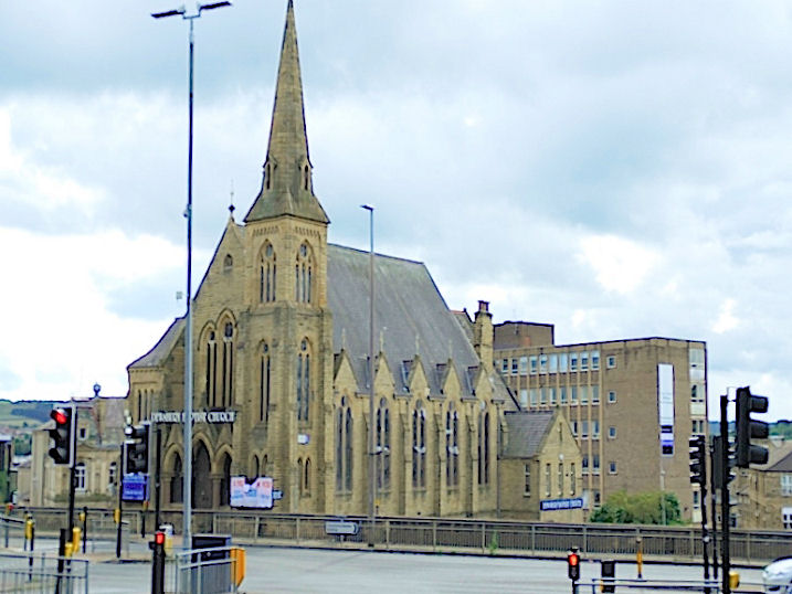
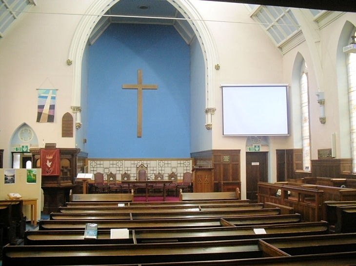
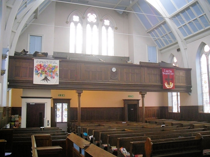
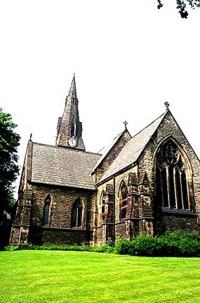
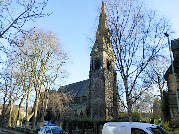
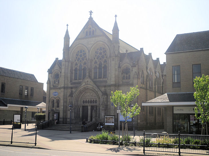
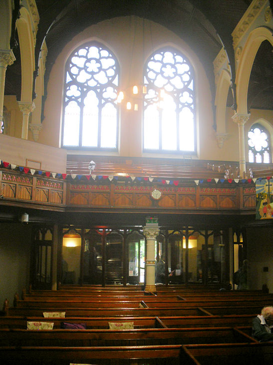
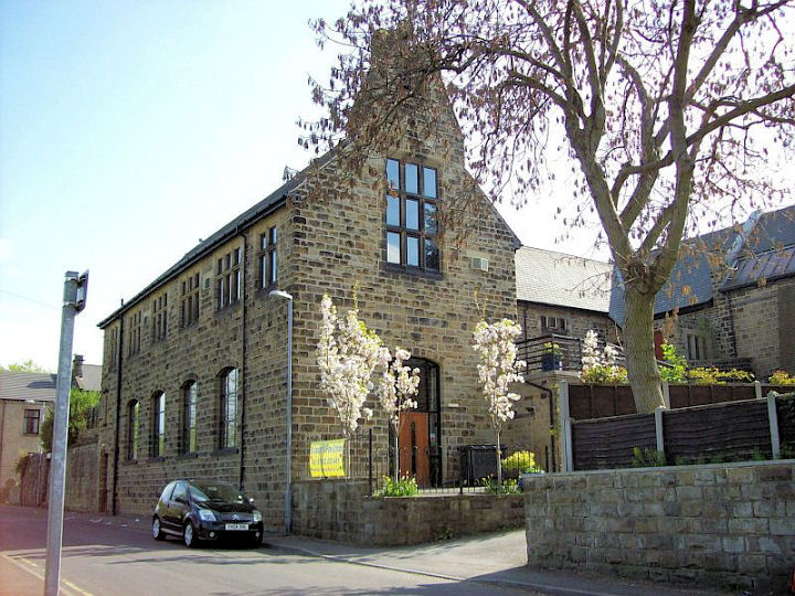
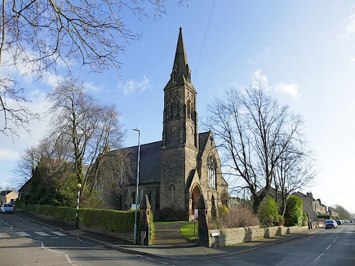
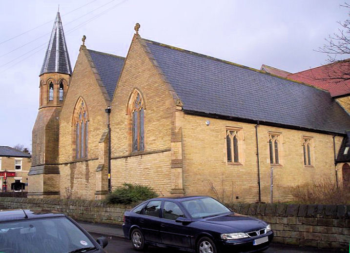
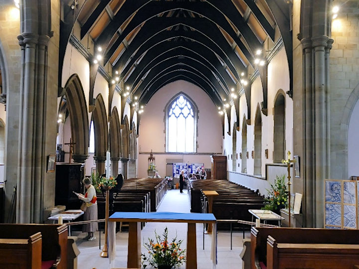
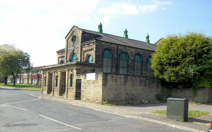
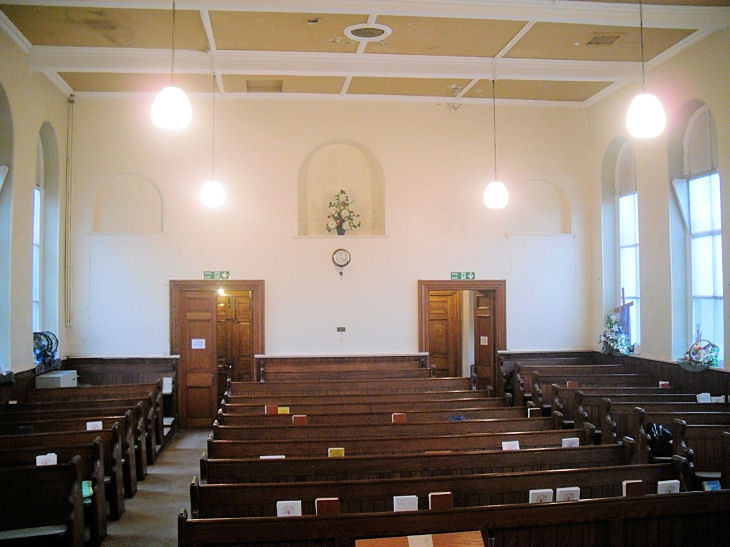
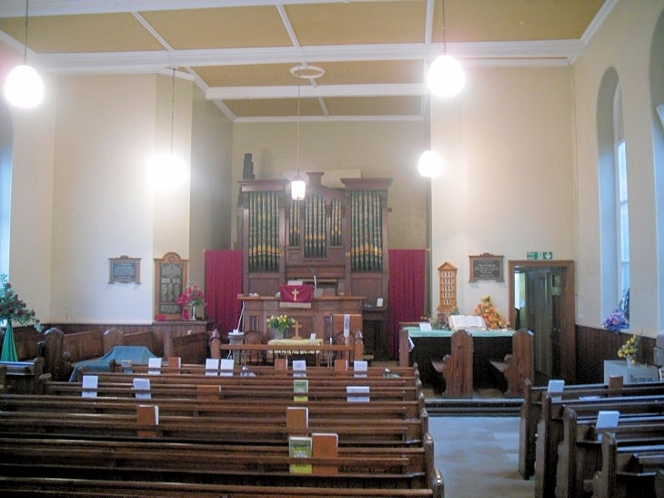
U.R.C. on Long Causeway.
This was originally Ebenezer Congregational Church. SE 2464
2167. ©
Bill Henderson. Another view,
© David Regan (2020).
Link.
Grade II listed. Westborough Methodist Church on Green Lane, Westborough. David advises that this was originally United Methodist. SE 2325 2246. © David Regan (2023). Grade II listed, wherein it's dated to 1876. Former Church on Swindon Road. This was at one time Elim Pentecostal Church. It was then leased to New Horizons church, which has since moved out. David says it has obviously been extensively restored recently, but he doesn't know what its intended future use will be. To judge by appearances, the church is also older than its use by the Elim Church. SE 2434 2199. © David Regan (2011). In fact it was a Unitarian Church (1866). © unitarian.co.uk. These, and many other old engravings on this website, are reproduced from the downloadable books on the Unitarian Church Headquarters website here. The books are Pictures of Unitarian Churches by Emily Sharpe (1901) and the 1914 edition of Nonconformist Church Architecture by Ronald P. Jones M.A, (Oxon), and the images are reproduced by kind permission of James Barry of Unitarian Church Headquarters. My appreciation also to Mike Berrell for his efforts in this regard. Old O.S. maps show an otherwise
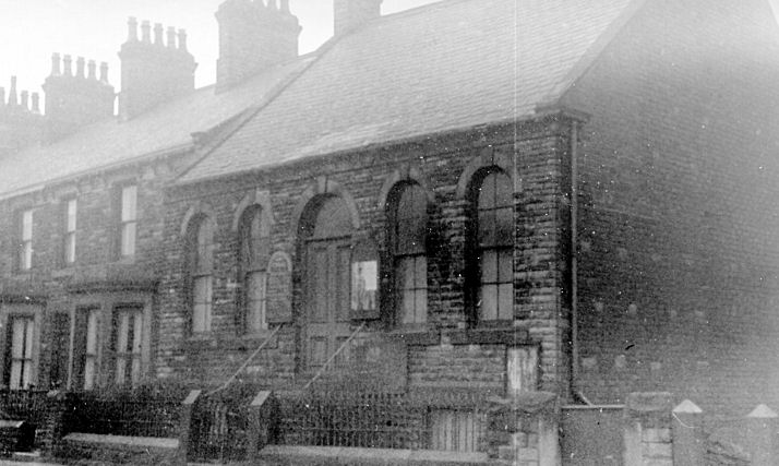
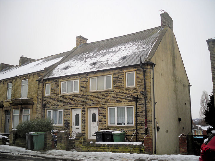
un-labelled Chapel on Boothroyd Lane at SE 2354
2178. Pre-dating a map of 1907, it shows as active until the 1" edition of 1955,
and seems to have gone out of use by 1961. Seen
here in an old photo
from Gerard Charmley's Collection, it has been
converted into a
house (some minor
architectural similarities show that it wasn't just a demolition and new build).
© Gerard Charmley (2023), who advises that the
chapel was Zoar Strict Baptist Chapel, dating from
1873-1949, a splinter from Staincliffe Baptist.
Earlsheaton
Eastborough
Ravensthorpe
Thornhill Lees
|
||
19 July 2025
© Steve Bulman