The Churches of Britain and Ireland
|
Coxhoe, County Durham
There used to be a useful resource for local church history
here
(but it's no longer available) -
many of the dates below are from this source. More detailed information about local
Methodist history can be seen
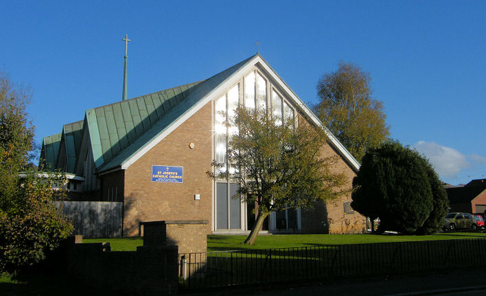
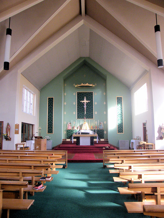
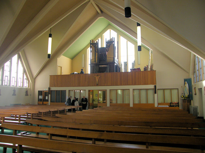
here. Coxhoe Methodist Church (2007) on the main road, as seen by Streetview in 2009. NZ 3207 3576. Link. Preceding it on the same site was a Wesleyan Methodist Chapel of 1871, on later maps (from 1962) labelled as St. John's. A photo of it is available here. This was in turn successor to an 1840 Wesleyan on a different site. The buildings on the site today (with the same footprint) can be seen here from 2016. Does anything of the chapel survive? NZ 3195 3605. A Gospel Hall (1922-1964) once stood on Cornforth Lane, at NZ 3176 3535. The site, now a garden, can be seen here on a Streetview of 2010. The source mentioned at the top of the page say that they had previously met in a tent, also on Cornforth Lane, but whether it was on the same site as the later hall isn't specified. The village has had two Primitive Methodist Chapels. The first, dating from 1839, stood on the main road at NZ 3185 3620. Demolished, the site was seen by Streetview in 2016. It stood partly under the grass, and also beneath the two parked cars. The second chapel, of 1865, also on the main road, but a little further to the south-east, at NZ 3198 3590. Known as Central Methodist Chapel by 1940, its My Primitive Methodists entry explains that it was closed following their amalgamation with the Wesleyan St. John in 1964, to form St. Andrew's. It survives, in commercial use, and can be seen here in a Streetview of 2010. Sts. Joseph, Patrick and Cuthbert (R.C., 1966) stands immediately opposite the second P.M. Chapel listed above. Two interior views - 1, 2. NZ 3203 3592. All © Mike Forbester. Another view, from Streetview in 2016. Link. St. Mary (1868) on the main road, as seen by the Streetview van in 2010. NZ 3200 3583. Link. As mentioned in the source at the top of the page, the Salvation Army held meetings in a Temperance Hall on Foundry Row (which has gone, but the site is somewhere behind the trees seen on the right of the road here, in a 2016 Streetview), and later in The Tabernacle - a tent. They moved again to a Nissen hut behind a shop opposite West Parade (there's a photo with a glimpse of the hut here). This was closed in 1939, and its site can be seen here in a 2010 Streetview. NZ 3179 3612.
|
||
19 July 2025
© Steve Bulman