The Churches of Britain and Ireland
| Clitheroe, Lancashire
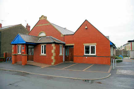
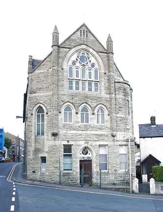
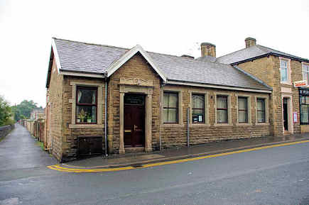
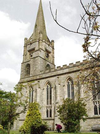
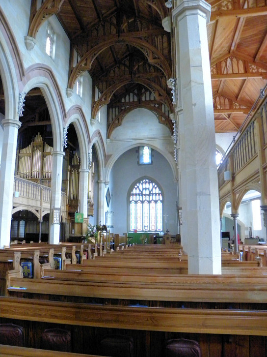
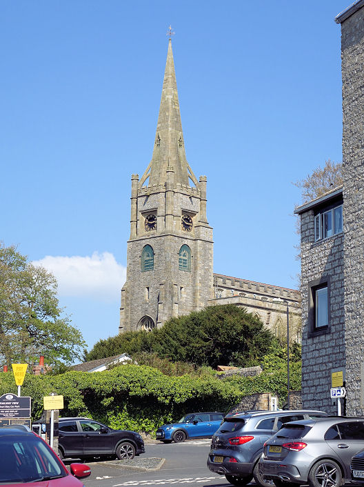
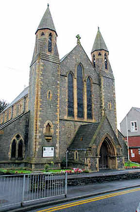
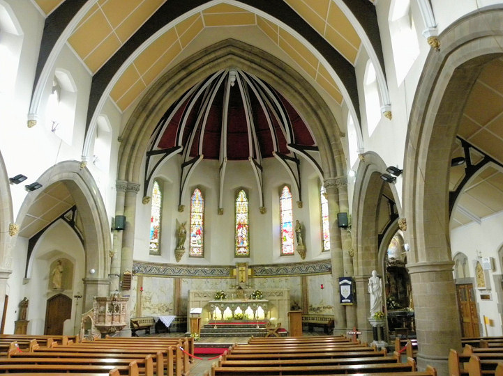
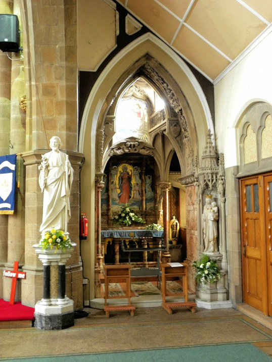
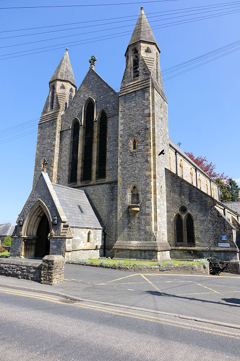
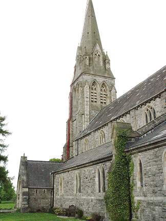
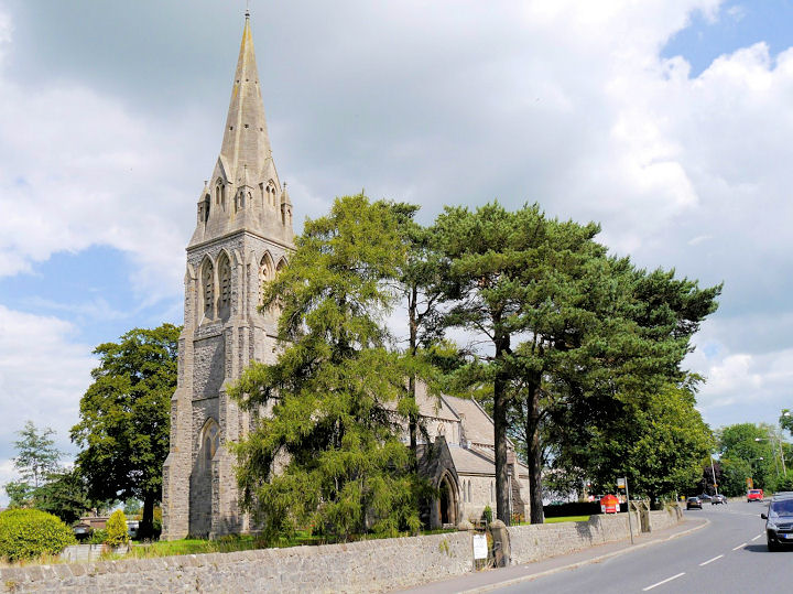
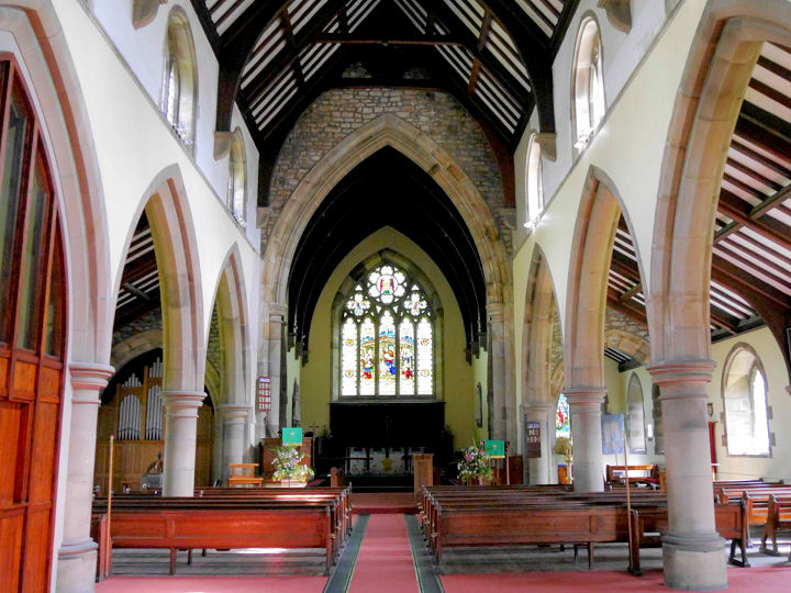
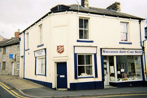
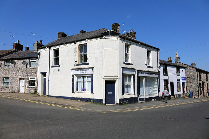
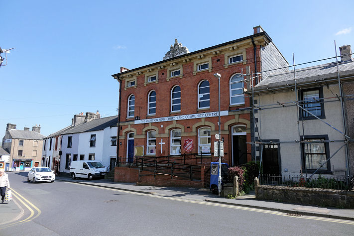
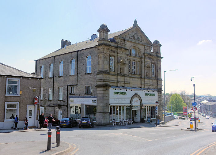
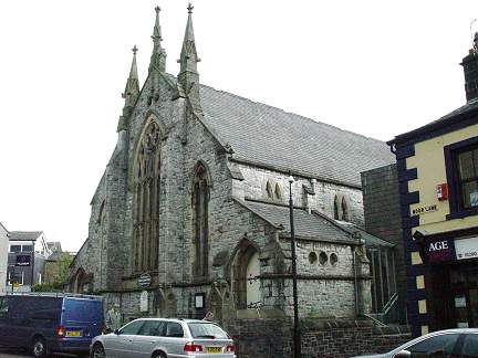
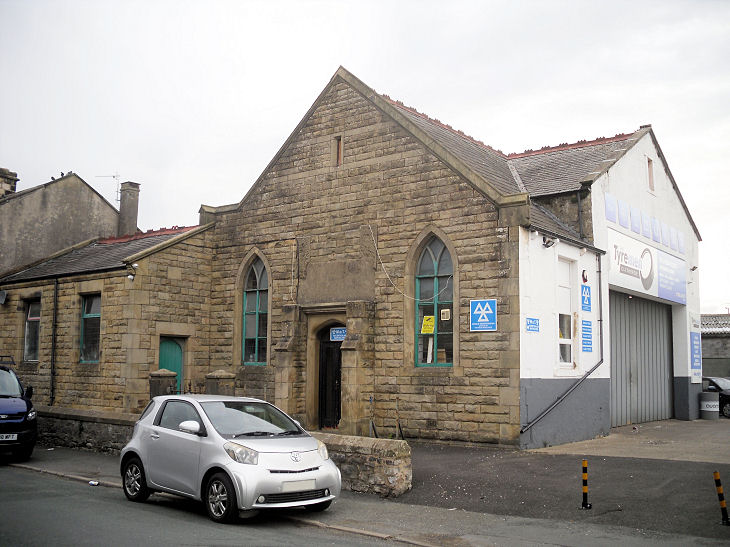
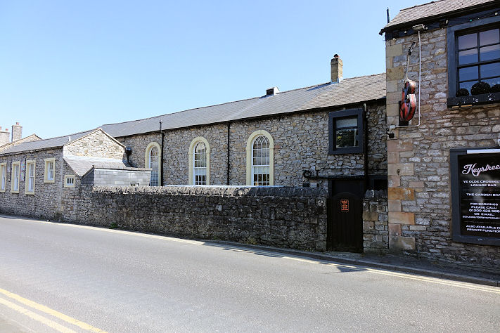
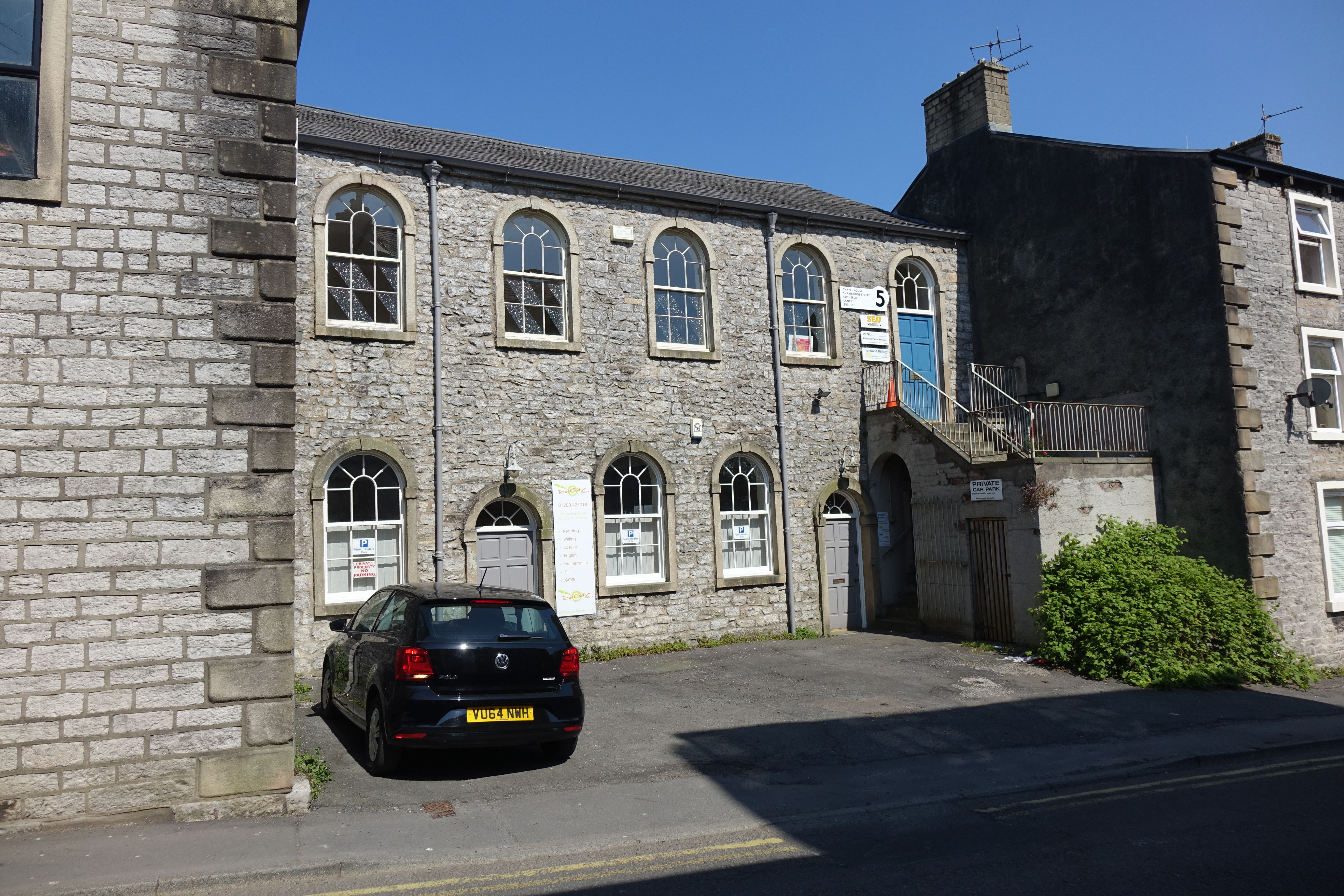
Mount Zion Primitive Methodist Chapel on Lowergate and Highfield Road closed around 1960, and was later used as a factory. This source dates it to 1846. SD 7435 4161. © Philip Kapp. Thanks to Raven Wenner who has advised that the building is to be converted into a mosque - though there were no obvious signs of it being in use as such at the time of a visit in 2022. Progressive Spiritualist Church on Greenacre Street. SD 7410 4135. © Philip Kapp. Link. St. James on St. James's Street. SD 7431 4114. © Philip Kapp. Link. Grade II listed, wherein it's dated to 1839-42. St. Mary Magdalene on Church Brow. SD 7443 4207. © Steve Bulman. The spire is currently (2012) being re-built - see a news story here. Interior view, © John Balaam (2012). Another view, © Steve Bulman (2022). Link. Grade II* listed. St. Michael & St. John (R.C.) on Lowergate. SD 7439 4169. © Philip Kapp. Interior view, and side-chapel, both © John Balaam (2012). Another view, © Steve Bulman (2022). Link. Grade II listed, which dates it to 1847-50, with later additions. St Paul on Edisford Road, Low Moor. Another view. SD 7321 4155. Both © Steve Bulman. Another view, and an interior, both © John Balaam (2015). Another view, © Mike Berrell (2016). Link. Salvation Army Hall (on the 1st floor) on Lowergate and King Lane. © Rob Brettle. Another view, © Steve Bulman (2022). In 2022 the building across the road had a sign saying Salvation Army Church and Community Centre. SD 7449 4181. It seems unlikely that both are in use as their church, so which is currently active? SD 7448 4183. Both © Steve Bulman (2022). Trinity Methodist Church on Parson Lane. Older maps label it as Wesleyan. This source (which includes an old photo) says the congregation was founded before 1796, though the chapel looks more recent than that. SD 7411 4170. © Philip Kapp. The former United Methodist Chapel on Moor Lane, so called on a map of 1912. This source calls it the Moor Lane Wesleyan Association Chapel, and dates it to 1837-1962. It's now in commercial use. SD 7431 4153. © Steve Bulman (2022). U.R.C. on Castle Gate. On older O.S. maps it's labelled as Congregational. SD 7435 4174. © Steve Bulman. Link. The former Wesleyan Methodist Chapel on Salthill Road, now in use as a garage. Its Genuki entry says it was founded before 1890, but whether the chapel dates from then isn't clear. It certainly pre-dates a map of 1912. SD 7475 4219. © Gerard Charmley (2021). A building on Lowergate caught my eye during a visit in 2022. According to the oldest available O.S. map (1912) it was an Infant School, but was it in its earlier days a chapel? SD 7435 4173. Another building on Shawbridge Street has a chapelly look about it, though the 1912 maps only labels it as Hall. SD 7457 4183. © Steve Bulman (2022).
|
||
04 March 2023
© Steve Bulman