The Churches of Britain and Ireland
| Cleator Moor, Cumbria
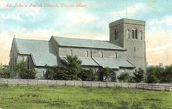
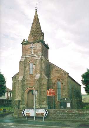
The former Congregational Chapel on Ennerdale Road. Now converted to commercial use, it can be seen as it was in 2009 here. NY 0257 1466. The 25" 1899 O.S. map shows a Church on High Street at NY 0214 1495. It's labelled as Presbyterian, and it can be seen in 2009 here, in use as a nursery. The same map shows a Methodist Chapel (Free United) on The Crescent at NY 0114 1566. It's presumably the iron chapel listed here as dating from 1887 and closing "by 1941". Its site was seen by Streetview in 2022. The former Primitive Methodist Chapel on Ennerdale Road, at NY 0229 1483. The My Primitive Methodist entry for this church says that it was closed in 1965 (built in 1865), and modern buildings erected on the site. However, what appears to be a chapel was still to be seen when the Streetview van passed in 2009. St. John the Evangelist. NY 0148 1531. From an old postcard (franked 1912?), in Steve Bulman's Collection. Link. Closure news item (2014). Grade II listed. The Salvation Army had a presence in the town from no later than 1896 to at least 1913. In the latter year they are noted as being on Ennerdale Road. Do you know exactly where they were? The Wath Brow Mission Church (Anglican). NY 0278 1456. © Dave Westrap. Link. The 25" 1899 O.S. map shows a Wesleyan Methodist Chapel at the junction of Earl Street and Crag Road. On the site today is the current Methodist Church, which My Wesleyan Methodists says stands on the site of a predecessor of 1880. NY 0189 1498. Its 2009 Streetview can be seen here. Link. The same website also lists an earlier un-located W.M. Chapel of 1866 here.
|
||
02 April 2024
© Steve Bulman