The Churches of Britain and Ireland
|
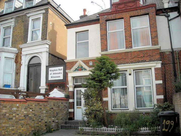
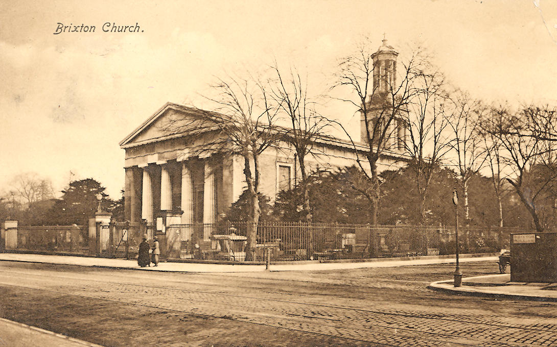
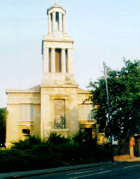
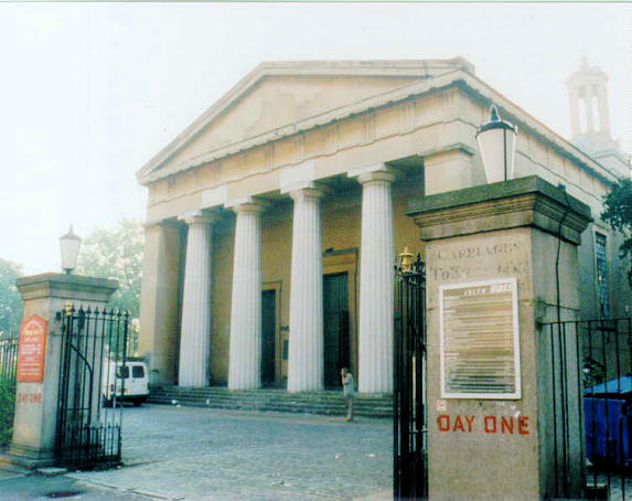
Brixton, Greater London Beacon Church (Evangelical) meets in the Clapham Park Centre on Kingswood Road, see by Streetview in 2022. TQ 3022 7382. Link. Bible Truth Church of God is on Hetherington Road, and seen by Streetview in 2025. The 25" map of 1897 shows that it stands on the site of Immanuel Church, identified here as Primitive Methodist in 1910. Since this was the date of registration, it must be possible that it was under different ownership before then. TQ 3013 7522. Facebook. Brixton Baptist Church (2025 Streetview) stands on Solon Road. Its date-stone reads "Kenyon Baptist Church 1884". TQ 3033 7531. Link. Grade II listed. Brixton Community Church (New Testament Church of God) is on Lambert Road and St. Saviour's Road - 2025 Streetview. This was originally St. Saviour. TQ 3053 7460. Link. Grade II listed, wherein it's dated to 1874-5. Brixton Hill Methodist Church on Elm Park, as seen by Streetview in 2025. TQ 3069 7416. Link, in which the following history can be read - the first chapel was built on the same site in 1824, replaced in 1856, bombed in 1940, with the present church dating from 1957. Exterior and interior photos of the 1856 church can also be seen. Brixton Seventh-day Adventist Church (2025 Streetview) stands on Santley Street, Ducie Street and Tintern Street, at TQ 3050 7529. A map of 1916 labels it as St. Paul - a Wikipedia entry dates the building to 1881, and says it was "exchanged" with the current 7-DA church in 1980. Link. Brixton Tabernacle Baptist Chapel in on Stockwell Road, and seen by Streetview in 2023. TQ 3096 7573. Link. The History page dates it to 1975, a replacement for its 1871 predecessor (there is an illustration of it) which stood nearby (at the junction of Stockwell Road and Stockwell Park Road), demolished to allow for road changes. In a 2025 Streetview, the site of the chapel stretches along the low wall to the right, and extending further left across the pavement. TQ 3093 7580. Celestial Church of Christ (2025 Streetview) on Coldharbour Lane. TQ 3195 7585. Facebook. Christ Embassy Brixton Church meets in Ark Evelyn Grace Academy (2012 Streetview) on Shakespeare Road. TQ 3180 7523. Church of the First Born on Allardyce Street, as seen by Streetview in 2022. What appears to be the same building is labelled on old O.S. maps as Hall. TQ 3061 7539. Facebook. O.S. maps show a Congregational Church on Coldharbour Lane at TQ 3195 7580. This source (which has an illustration - scroll down) shows that it had been built by 1861. Demolished at some point, Sureway International Christian Ministries (2025 Streetview) now stands on its site. Link. Kingdom Hall of Jehovah's Witnesses on Coldharbour Lane. Circa TQ 321 759. © Mehmood Naqshbandi (2009). The signage disappeared in 2018 or 2019, re-appearing on Padfield Road around the corner. A new church (or perhaps the old one, extended) had evidently been built at the same time - 2019, 2018 (Streetviews). TQ 3207 7585. St. Matthew stands on a plot of land bounded by Brixton Hill, St. Matthew's Road and Effra Road. TQ 3098 7510. From an old postcard (franked 1919) in Steve Bulman's Collection. A modern view, and another, both © Tim Tomlinson. Link, and the history page, which dates its consecration to 1824. Grade II* listed, and see here for related listed features. St. Paul (2024 Streetview) is on Ferndale Road and Glendall Street. TQ 3064 7547. See also the entry for Brixton Seventh-day Adventist Church (above). It has to be assumed that the present St. Paul was formerly the Seventh-day Adventist Church. Link. Trinity Congregational Church stands on St. Matthew's Road was seen by Streetview in 2024. Pevsner dates it to 1828. TQ 3101 7487. Link. Grade II listed. Truth Temple Outreach Ministries on Coldharbour Lane. TQ 321 759. © Mehmood Naqshbandi (2009). As of 2026 I've been unable to locate this church on Coldharbour Lane, but a missing section on Streetview hasn't helped. Unitarian Chapel on Effra Road. TQ 3114 7480. © unitarian.co.uk. This, and many other old engravings on this website, are reproduced from the downloadable books on the Unitarian Church Headquarters website here. The books are Pictures of Unitarian Churches by Emily Sharpe (1901) and the 1914 edition of Nonconformist Church Architecture by Ronald P. Jones M.A. (Oxon), and the images are reproduced by kind permission of James Barry of Unitarian Church Headquarters. My appreciation also to Mike Berrell for his efforts in this regard. The old church was demolished at some point, replaced by this building seen by Streetview in 2025. Link. The Chapel History page dates the old chapel to 1839, destroyed in WWII bombs in 1940, and its replacement built in 1962. Universal Pentecostal Church on Acre Lane, as seen by Streetview in 2025. A 2013 news article shows that the church was in residence at that time. TQ 3088 7525.
|
||
26/01/2026
© Steve Bulman