The Churches of Britain and Ireland
|
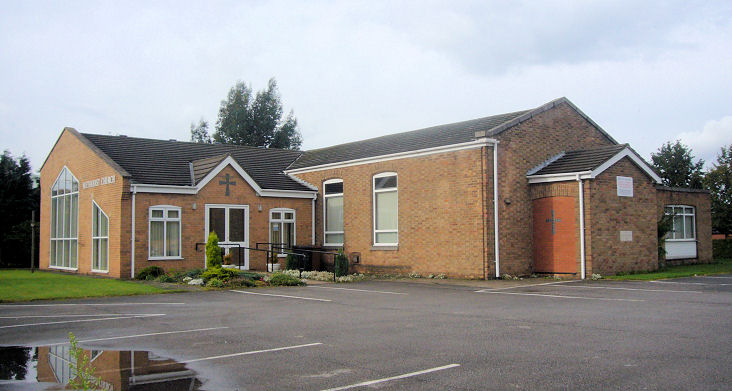
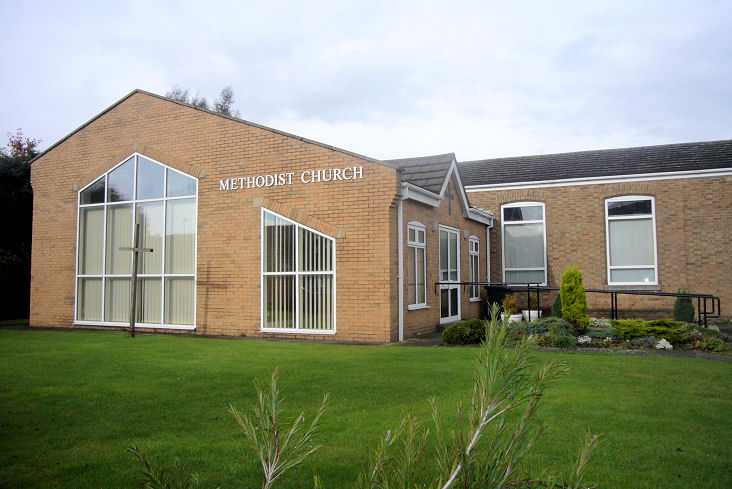
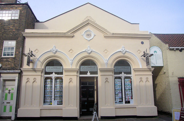
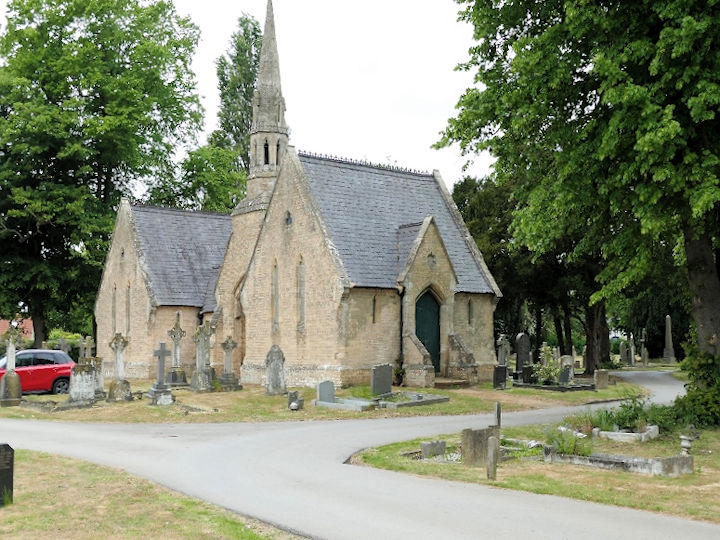
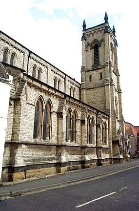
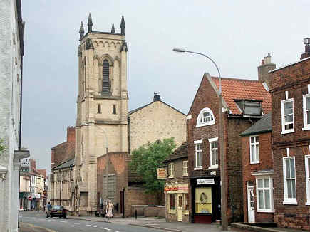
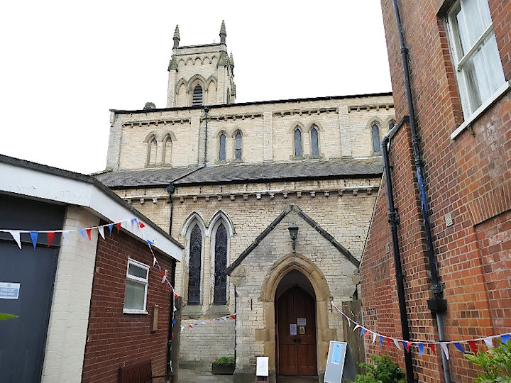
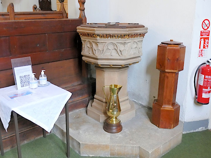
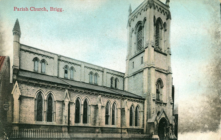
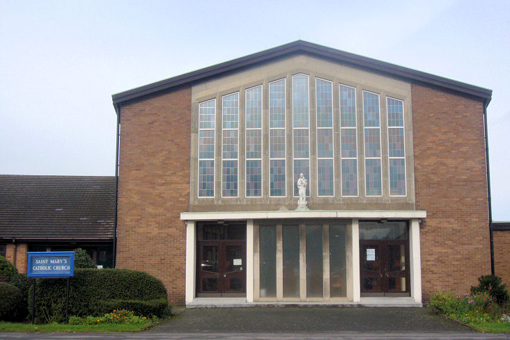
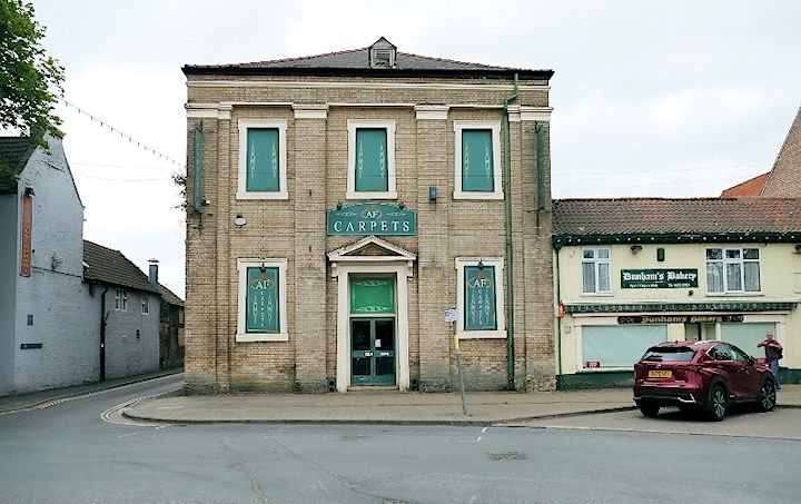
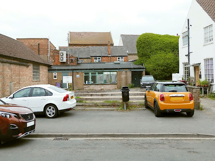
Brigg, Lincolnshire Brigg Methodist Church on Wesley Road and Barnard Avenue. Another view. TA 0004 0744. Both © James Murray. Link. The former Congregational Church on Wrawby Street is dated 1813 (not 1815 as stated in its grade II listing), and is now in commercial use. TA 0013 0726. © James Murray. Glandford Brigg Union Workhouse, just to the east of the town as it was then, had a Chapel, dated here to 1873. It had been demolished no later than 1953, the rest of the former workhouse following by 1981. Its site now lies beneath a car park, just beyond and to the left of the tree seen in a Streetview from 2022. TA 0036 0734. The cemetery on Wrawby Road has a double Mortuary Chapel, Nonconformist closest to the camera, and Anglican. TA 0070 0759. Scawby Brook, just west of Brigg, had a Primitive Methodist Chapel, at SE 9836 0660. A photo of it can be seen here, where it's dated to 1879-2002. It has since been demolished- it effectively stood in the garden of the bungalow seen by Streetview in 2022. St. John the Evangelist on Bigby Street. TA 0005 0719. © Bill Henderson. Another view, © Dave Hitchborne, another, an interior, and the font, all © David Regan (2025). An old postcard view from Reg Dosell's Collection. Link. Grade II listed. St. Mary (R.C.) on Barnard Avenue and Ash Grove. Another view. SE 9996 0744. Both © James Murray. Interior view, © Mike Forbester. Link. Older maps show an earlier R.C. Chapel just off the south side of Bigby Street at TA 0008 0714. It's dates here to 1875-1965, when the present church was opened. Its site is behind the buildings seen in a 2025 Streetview. The same source also mentions an earlier chapel on Scawby Road, built in the early 19th century, and demolished in 1968. The 1886 O.S. map shows it to have stood at the roadside SE 9904 0689, and its site was seen by Streetview in 2022. An otherwise unidentified Chap. shows on O.S. maps from the early 20th century (it is also probably on the map of 1886, though unlabelled), to the latest available on-line map of 1954, on Bridge Street, at SE 9971 0709. Genuki identifies it as Wesley Chapel (Wesleyan Methodist), dating it to 1776. Although this site calls it Primitive Methodist, the photo there (scroll down) is undoubtedly of this chapel (see the building to its right, still extant in the Streetview from 2022. There is also some confusion regarding a former Chapel further east along Bridge Street. Unfortunately, none of the available on-line maps label it other than Chap. or Chapel. This source says it was Primitive Methodist (Genuki agrees), but Pevsner says Wesleyan. Perhaps it was both at different times. SE 9978 0712. Can you clarify the story of these two Bridge Street chapels? © David Regan (2025). Just a few yards east of St. John was another Chapel, not identified any further on available maps, at TA 0008 0719. Its site is a car park today. A photo of the church can be seen here (4th row, 1st photo), where it says it was Wesleyan Reform (later United Methodist), of 1865-1962, demolished 1966. © David Regan (2025).
|
||
29 May 2025
© Steve Bulman