|
|
Brentwood, Essex
Brentwood on Wikipedia.
Churches
in Great Warley, Hutton, Shenfield.
Brentwood Baptist Church
(2024 Streetview) on Kings Road and Kings Chase. TQ 5928 9337.
Link. What may be its
predecessor shows on older O.S. maps just a little way to the south, on Queen's
Street, at TQ 5933 9322. It had gone out of use by the mid-20th century. The
building on its site was seen by
Streetview in 2018,
Brentwood School Chapel stands on Ingrave Road,
directly opposite the earlier St. Helen, and was seen by
Streetview in 2024. TQ
5979 9378.
Brentwood Spiritualist
Church is on Primrose Hill, and was seen by Streetview in 2020. TQ 5940
9352. Link.
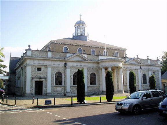
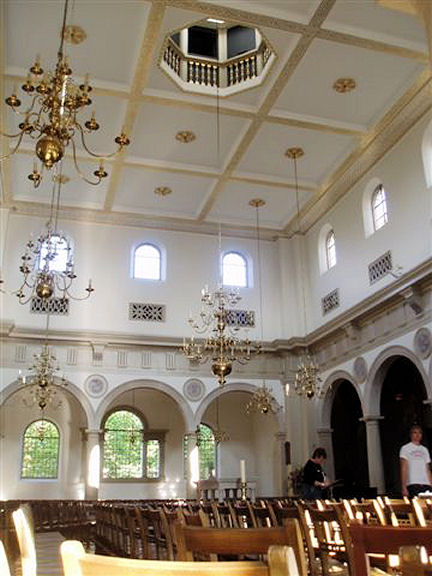
The
Cathedral of St. Mary and St.
Helen (R.C.) on Ingrave Road. It's marked on older maps as St. Helen's
R.C. Chapel, and it was raised to cathedral status in 1917. Built 1860-1, it
was enlarged in 1989-91 Another
view, and the interior.
TQ 5977 9372. All © Aidan McRae Thomson.
Link.
Grade II* listed. The predecessor of St. Helen (also St. Helen) stands close
by on its northern side, at TQ 5975 9376. Dated to 1836-7 by Pevsner, it was
seen by Streetview in
2024. It has a
grade II listing, where it's described as the Parish Social Club.
Doddinghurst Road Community
Church (2024 Streetview). TQ 5923 9478.
Link.
The
Kingdom Hall of Jehovah's
Witnesses (2014 Streetview) is on an apparently un-named side road off Kings
Road, at TQ 5925 9331.
St. George the Martyr
(2009 Streetview), on Ongar Road. Pevsner dates it to 1933-4. TQ 5878 9466.
Link.
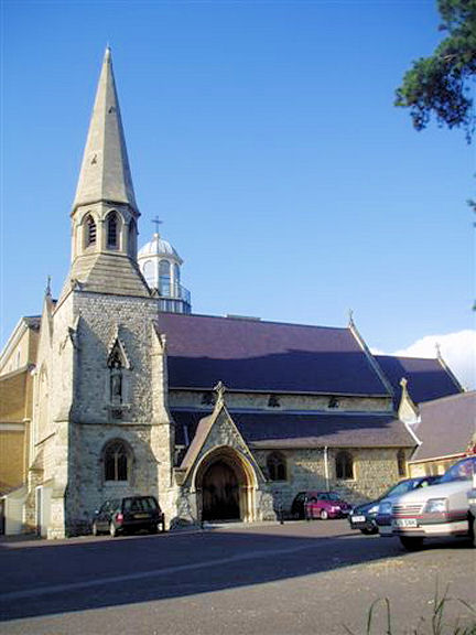
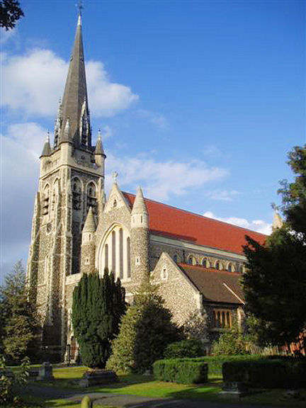
St. Thomas of Canterbury on
St. Thomas Road.
TQ 5965 9372. © Aidan McRae
Thomson.
Link.
Grade II* listed, wherein it's dated to 1881-7.
Sawyers Church, on
Sawyers Hall Lane (2024 Streetview). TQ 5981 9405.
Link.
The former
U.R.C. on New Road, as
seen by Streetview in 2024 - a handsome building in the classical style. A map
of 1881 labels it as Congregational. A June 2023
news report tells of its intended closure the following month. TQ 5951 9359.
Great Warley
Brentwood Mosque
(2024 Streetview) on Warley Hill is labelled on some older O.S. maps as a
Methodist Chapel. It seems to have closed as Methodist fairly recently, as a
photo of it
here is dated "circa 2020". It dates it to 1892, and says the predecessor
Wesleyan chapel of 1878 survived at the rear of the later chapel, and was
subsequently used as a schoolroom. Closure is dated to 2021. TQ 5929 9292.
Link.
Older O.S. maps
show a Chapel adjacent to the cemetery for the
County Lunatic Asylum, at TQ 5878 9245. It survives, presumably converted to
residential use, on Pastoral Way, and was seen by
Streetview in 2024.
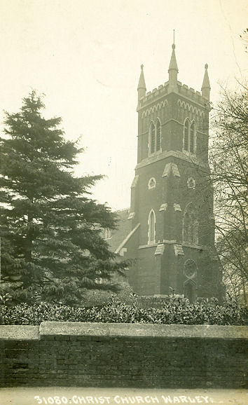
Christ Church
on Warley Hill. TQ 5906 9192. From an old postcard in Reg Dosell's collection. A
2024 Streetview provides
a modern view. Link.
The
Essex Regiment Chapel
(2024 Streetview) stands on Clive Road at TQ 5924 9142.
Link. Its
grade II listing dates it to 1855, campanile added 1955.
Holy Cross and All Saints (R.C.) stands a little
way south and across the road from Christ Church, at TQ 5897 9188. It was seen
by Streetview in 2020.
Link.
Grade II listed, dates it to 1881, enlarged 1886.
The
cemetery on Woodman Road has a Mortuary Chapel, at
TQ 5974 9235. I think it's (barely) visible to
Streetview in 2024, from
Conifer Drive (just its roof).
St.
James originally stood in the grounds of Fairsteads (source),
and so can be identified with the Mission Church shown on a map of 1898 at TQ
5889 9008. It was subsequently moved to, and is presently at, Baildon in West Yorkshire
- see the Baildon page for a photo.
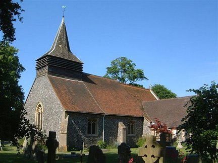
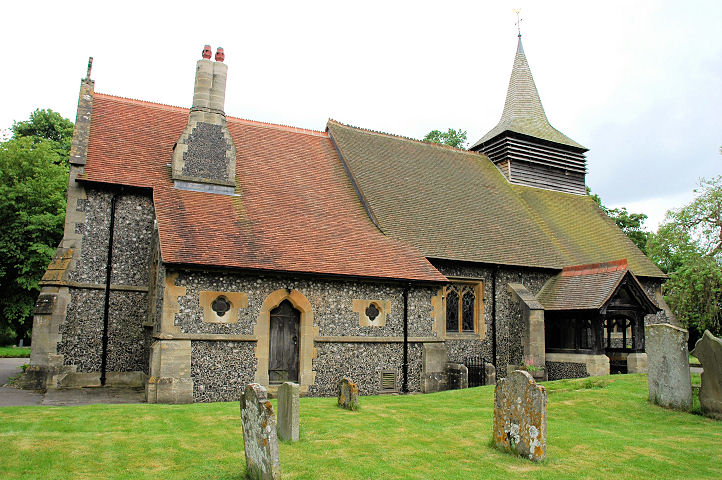
St. Mary the Virgin, is
almost completely hidden from Streetview by trees, but numerous photos can be
seen here.
TQ 5889 8999. Link.
Grade I listed, wherein it's dated to 1902-4. The lych-gate is also listed,
as
grade II*.
Hutton
All Saints. TQ 6351 9434. © Bill McKenzie.
Another view, © Karel Kuča (2007).
Link.
Grade II* listed.
Hutton and Shenfield Union Church on Roundwood
Avenue hasn't been seen by Streetview, but a photo can be seen on the
history page (scroll down)
of the church website. TQ 6137
9445.
Hutton Free Church
(2024 Streetview) is on Hanging Hill Lane. TQ 6241 9467.
Link.
Shenfield
Brentwood Friends Meeting House is on Hutton Road, at TQ 6099 9482.
It was seen by Streetview in
2015. Link.
RCCG Shining Light Christian Connections
meets in
Shenfield Parish Hall (2020 Streetview), also on Hutton Road. TQ 6087 9484.
Link.
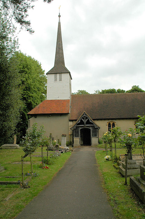
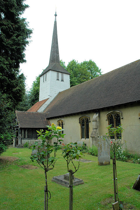
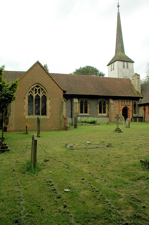
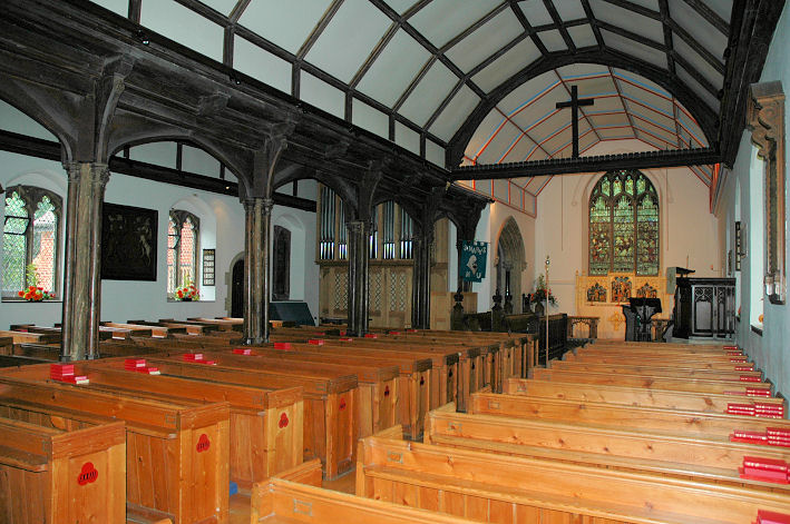
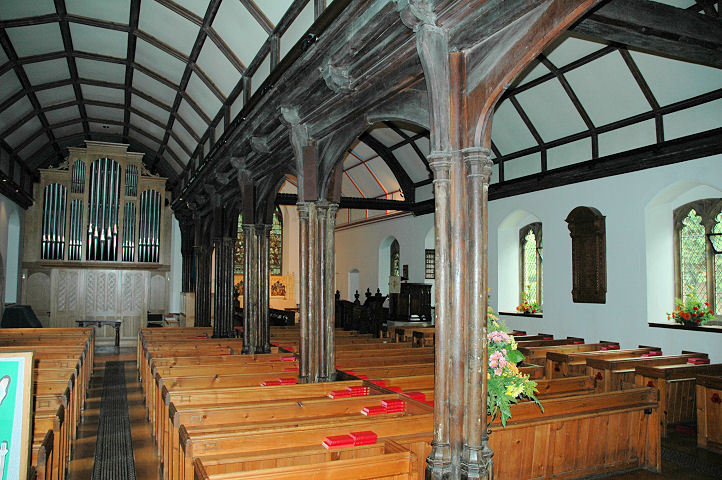
St. Mary the Virgin. Two
more views - 1,
2, and two of the interior -
1,
2. TQ 6055 9512. All © Karel Kuča
(2007). Link.
Grade II* listed. For two listed tombstones, see
here.
|
|