The Churches of Britain and Ireland
|
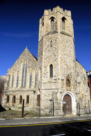
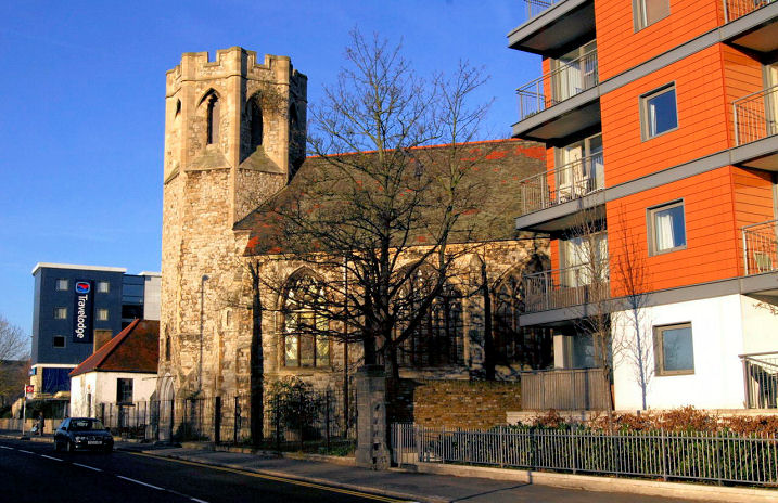
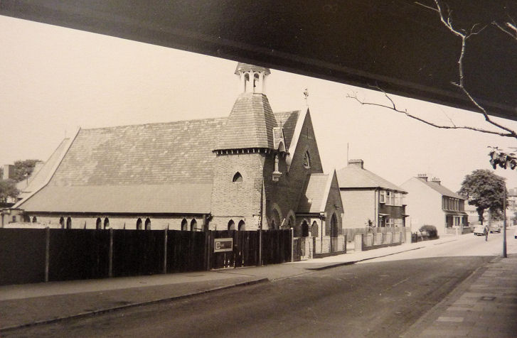
Brentford, Greater London Brentford Free Church stands on Boston Manor Road, and was seen by Streetview in 2024. It has a date-stone for 1782. TQ 1763 7766. Link. The former Brentford Methodist Church (2018 Streetview) stands on Clifden Road. Labelled by Google as "permanently closed" in 2026, an undated estate agent's notice lists it as sold. Its appearance in the 2018 Streetview suggests that it was still active at that time. Curiously, Google Maps labels it as a Baptist church. TQ 1764 7784. Older O.S. maps show that, before the church had been built, there was a Methodist Church on the next plot of land to the west, at the junction of Clifden Road and Windmill Road, at TQ 1761 7783. A map of 1915 labels it as Wesleyan. It hasn't survived - the housing on its site was seen by Streetview in 2020. Ealing Road Baptist Church, as seen by Streetview in 2024. TQ 1806 7803. Link. The who we are page dates it to 1914, and says that they merged with North Road Baptist in 2002, providing a likely date for the closure of the latter. See also the history link in the North Road Baptist entry, below. Hanuman Hindu Temple (2024 Streetview) on Beech Avenue and Hornbeam Crescent. This source says it was bought in 2016. TQ 1688 7735. Immanuel Church meets in a school (2018 Streetview) on St. Paul's Road. TQ 1777 7757. Link. Old O.S. maps show an unidentified Chap. on North Road at TQ 1837 7784. It's identified here (there is a small photo) as the former North Road Baptist Chapel. Streetview saw it in 2024, now converted to housing. A history. The former St. George, on High Street, which until recently housed a museum of musical instruments. Pevsner provides dates of 1887-1959, with the tower added in 1913. Another view. TQ 1845 7785. Both © David Gallimore. St. Faith stands on the B452 (Windmill Road), and was seen by Streetview in 2018. TQ 1736 7824. Link. Grade II listed, wherein it's dated to 1906-7 St. John the Evangelist (R.C.) on Boston Park Road. Old O.S. maps show it to have been built between 1864 and 1894 - its grade II listing says 1866. TQ 1731 7809. © Christopher Skottowe (1968). Link. The former St. Lawrence survives on High Street. None of the available Streetviews are very good, but here is one from 2022. This source (which has some photos) says it was closed in the 1960's. TQ 1742 7729. Link. Grade II* listed. St. Paul, on St. Paul's Road, as seen by Streetview in 2024. Dated here to 1867-9, and extended in 1992. TQ 1771 7757. Link.
|
||
25/01/2026
© Steve Bulman