The Churches of Britain and Ireland
|
Bolton, Greater Manchester See also Farnworth.
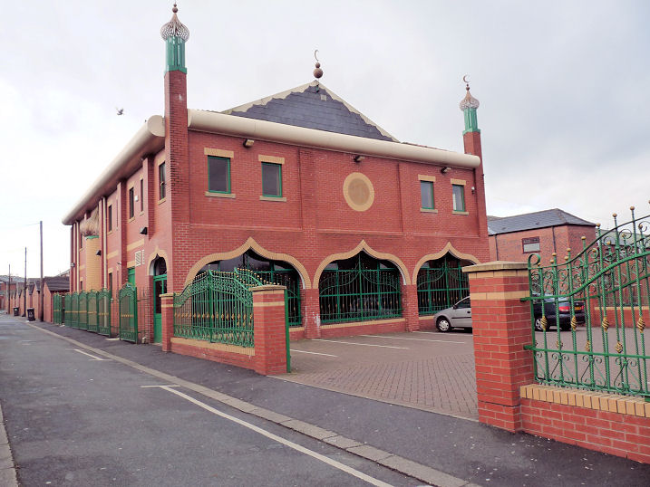
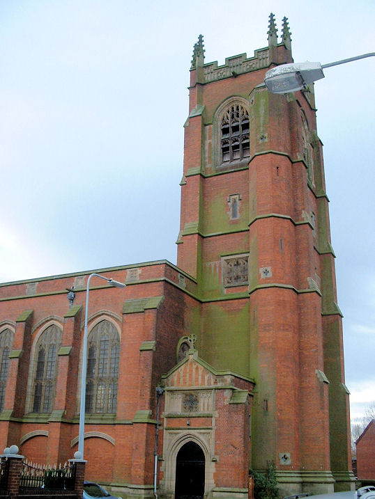
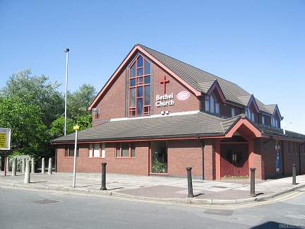
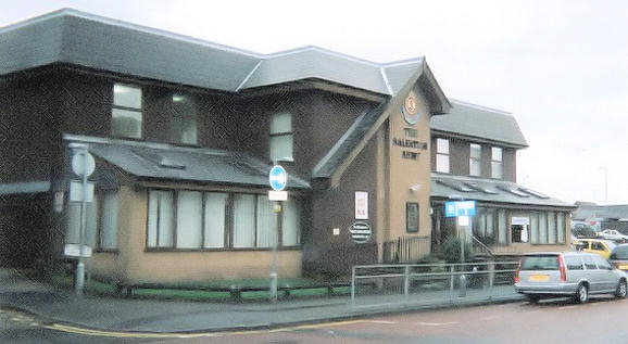
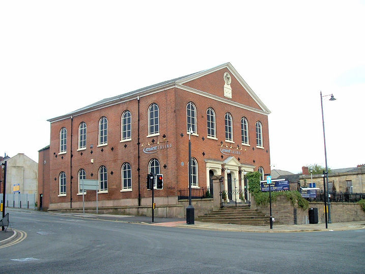
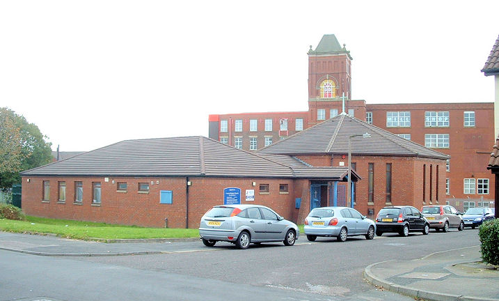
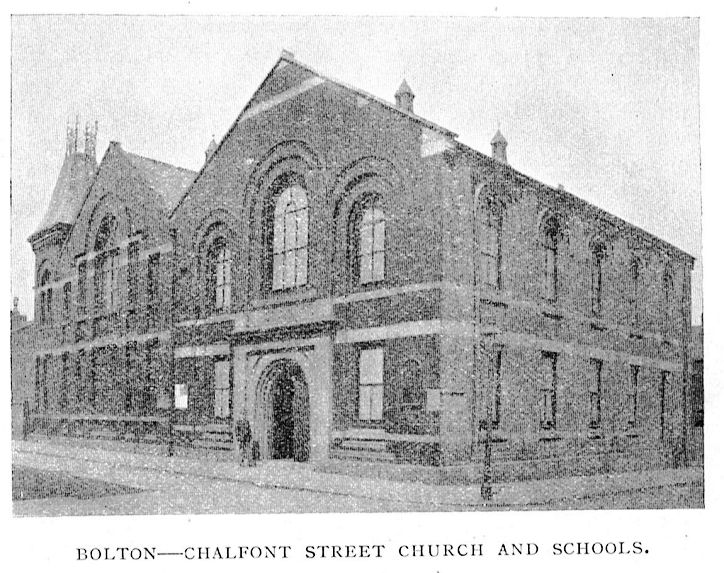
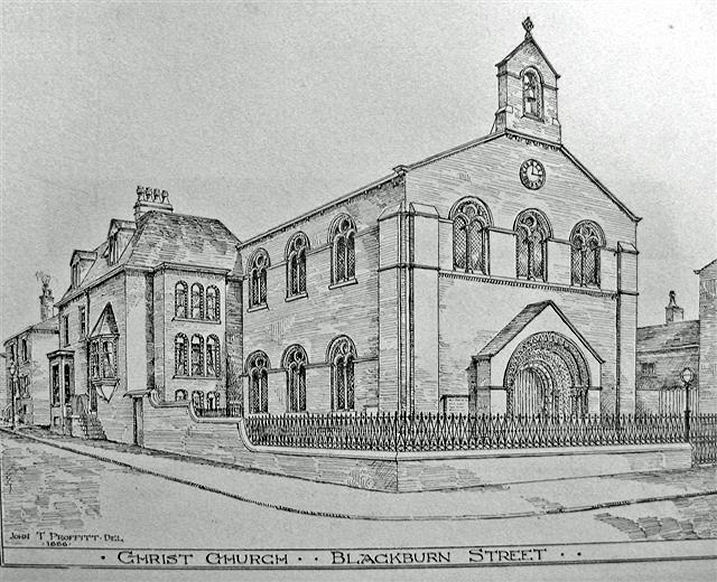
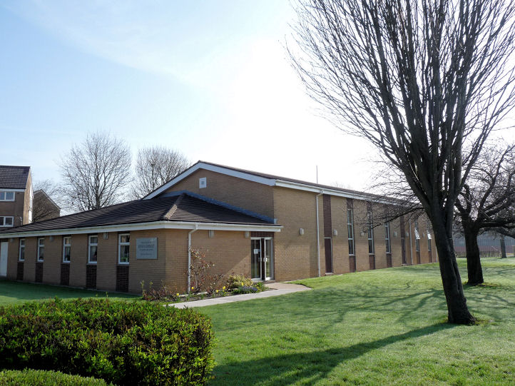
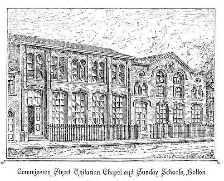
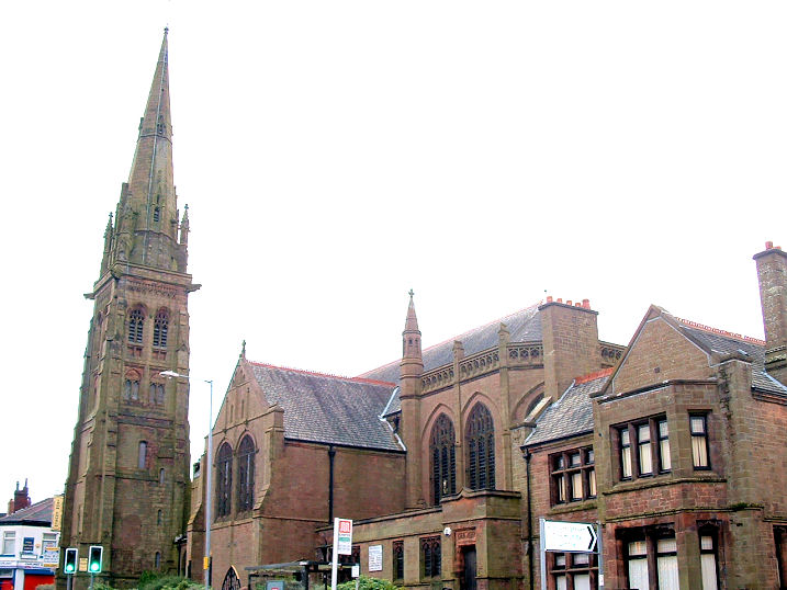
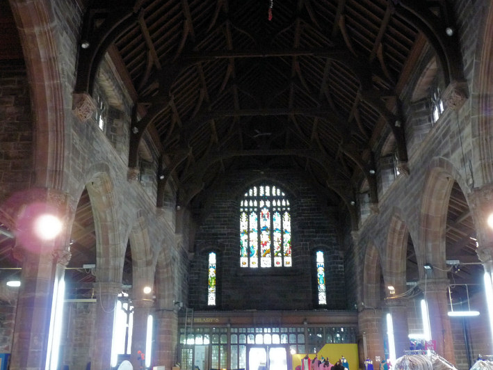
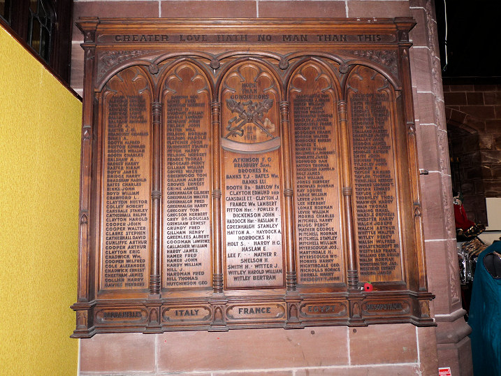
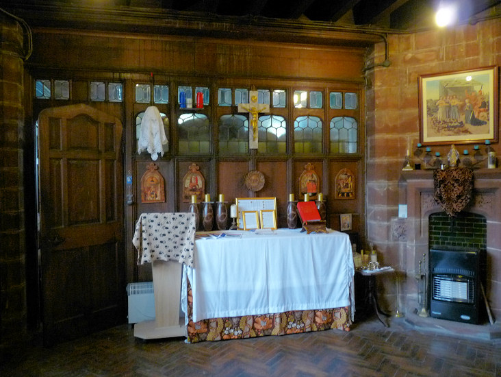
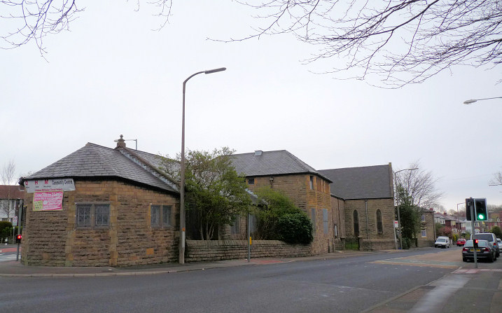
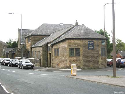
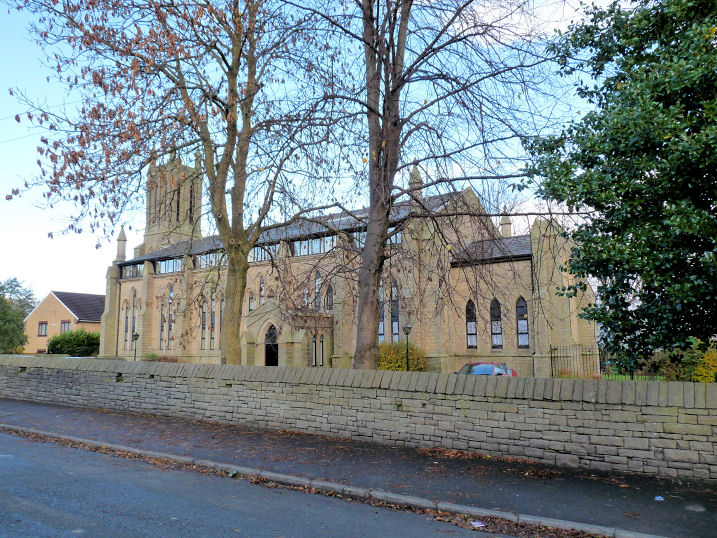
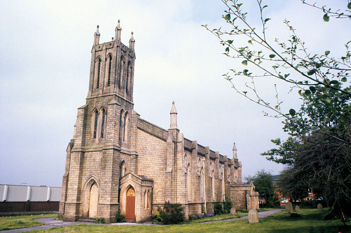
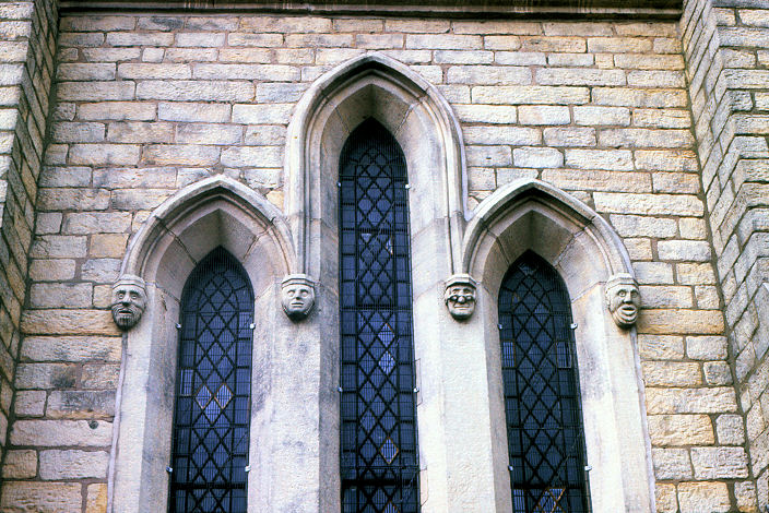
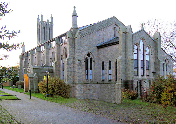
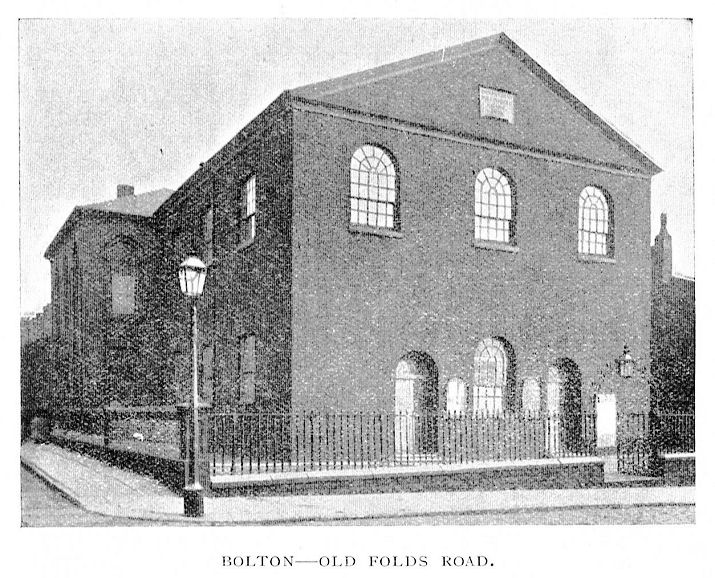
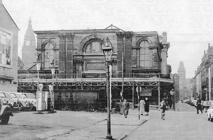
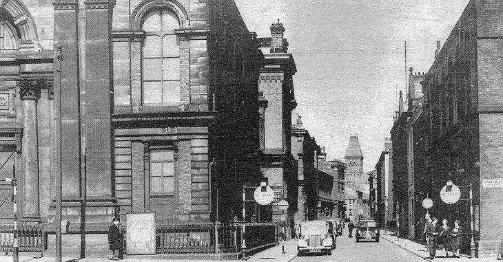
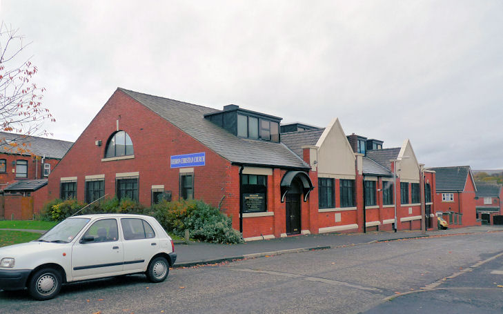
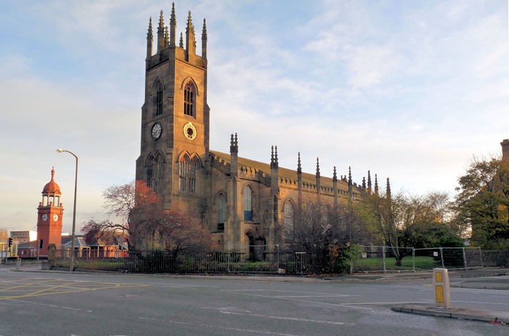
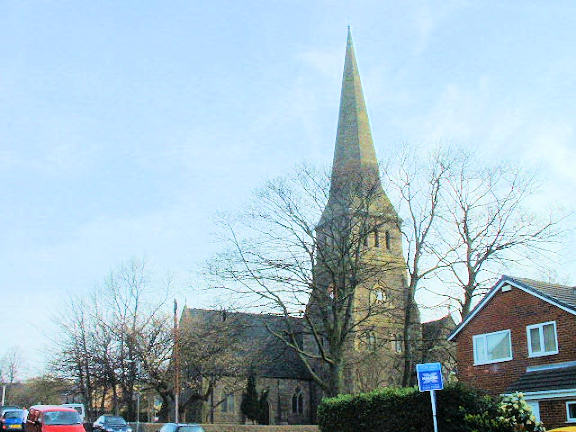
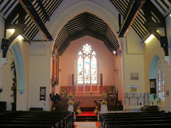
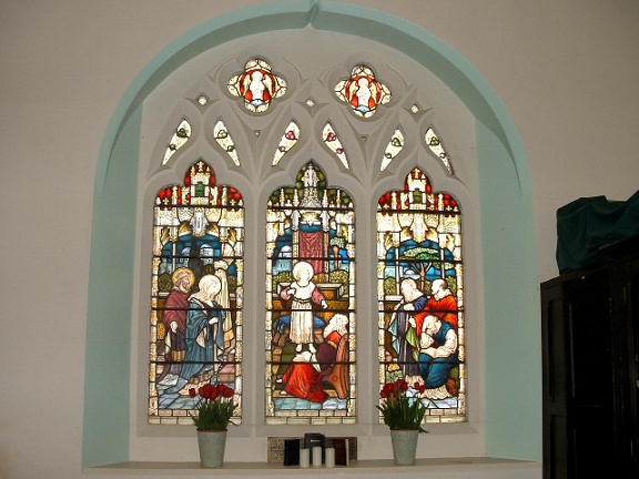
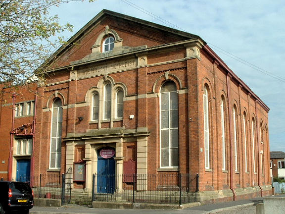
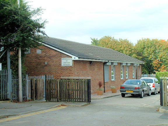
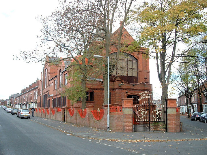
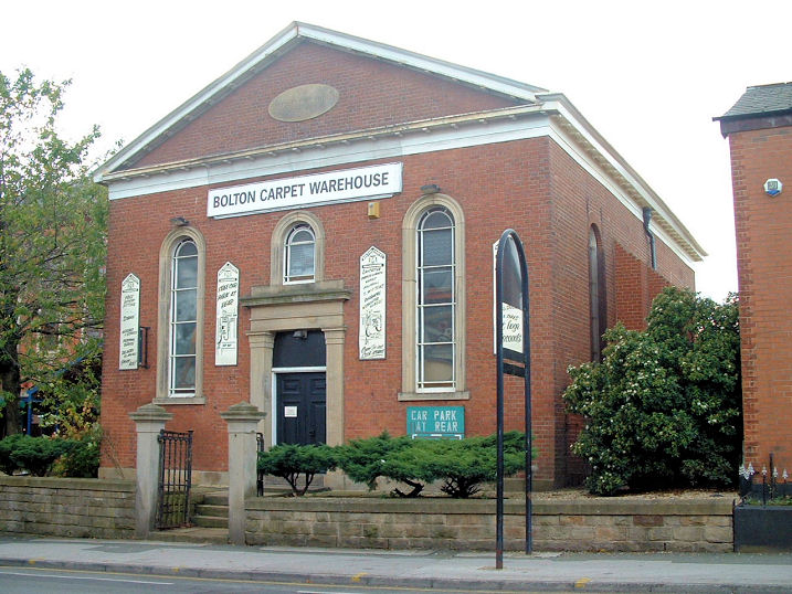
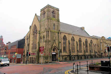
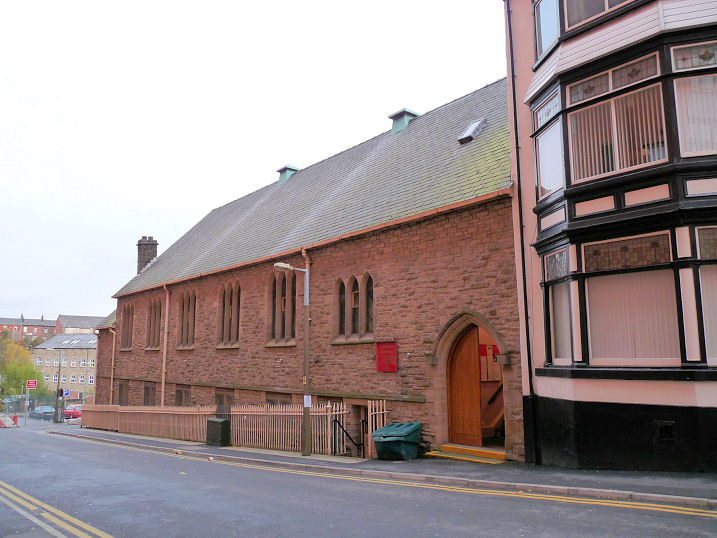
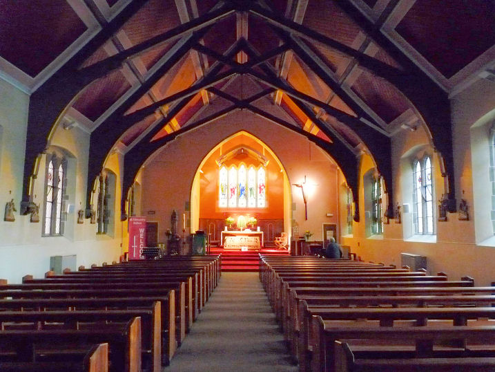
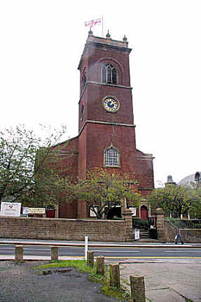
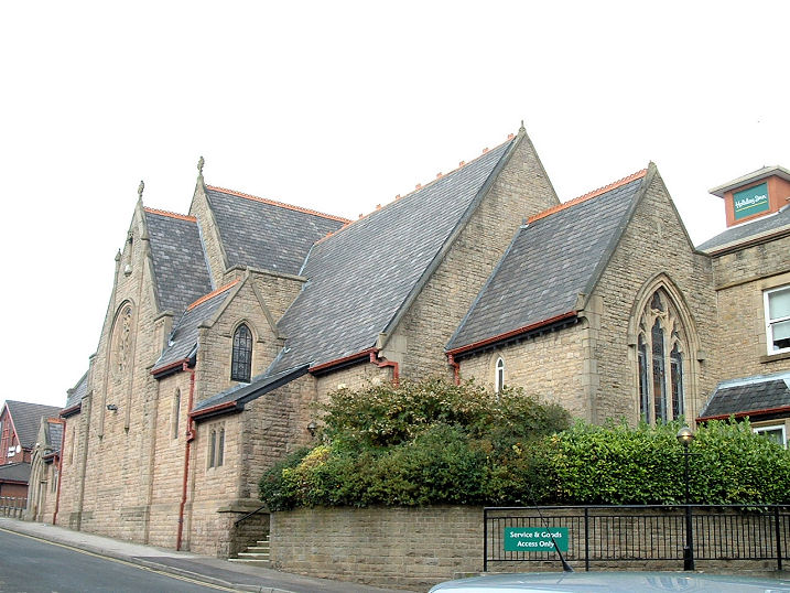
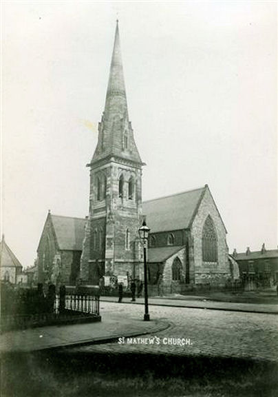
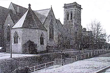
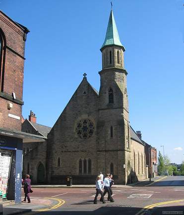
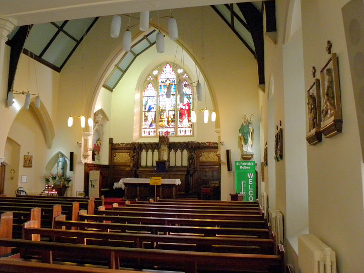
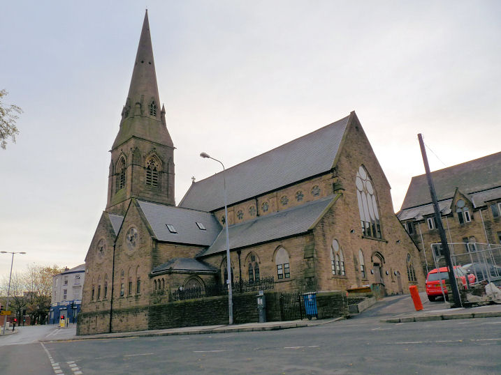
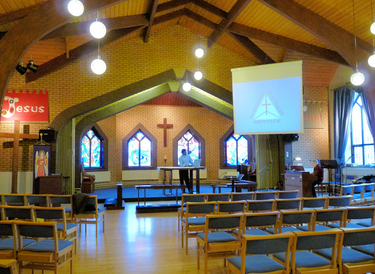
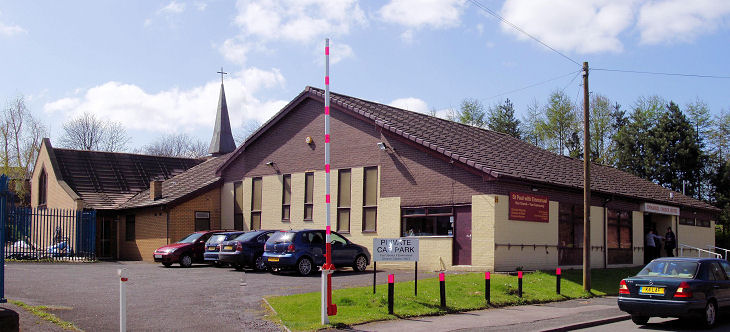
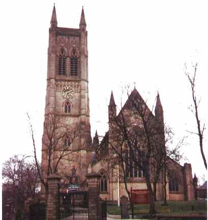
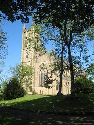
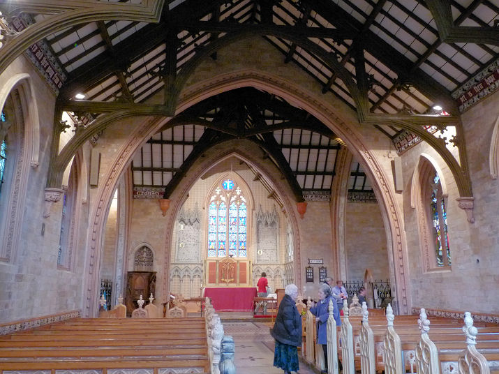
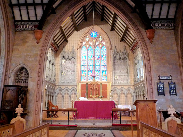
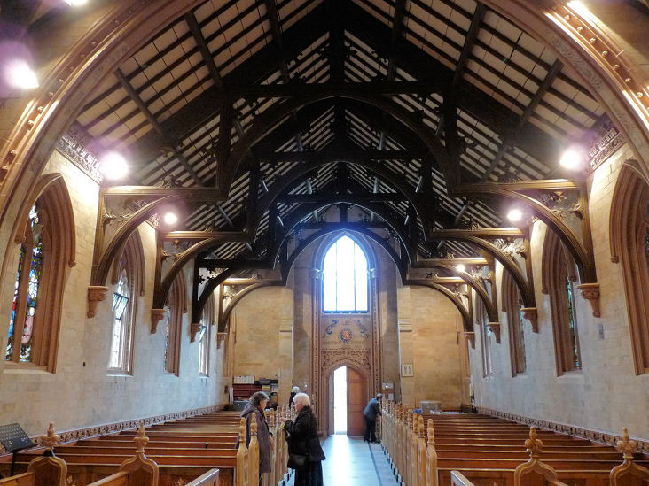
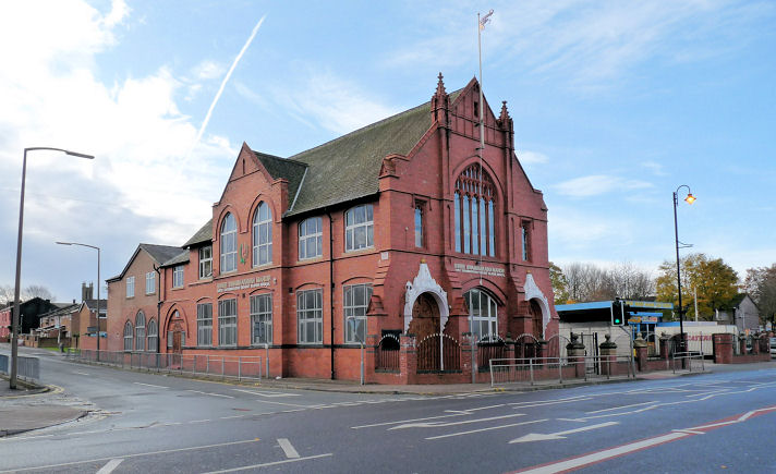
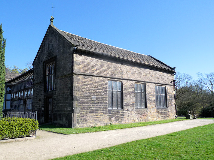
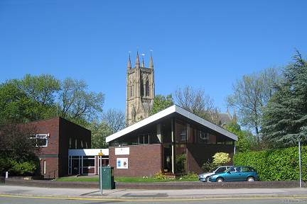
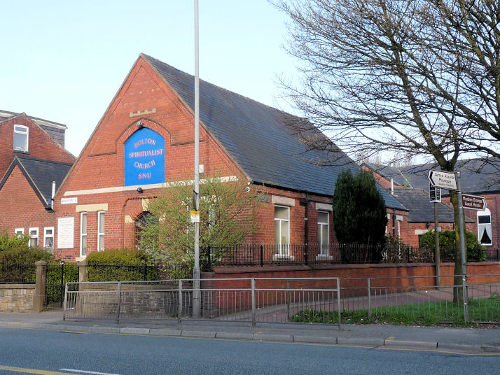
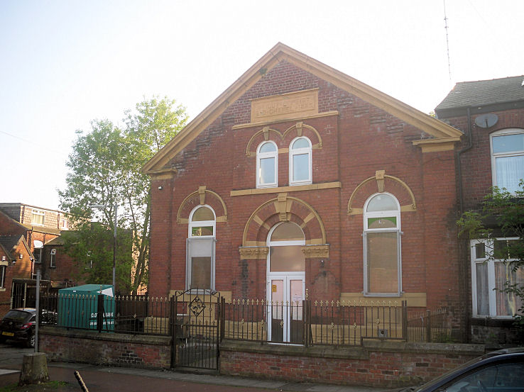
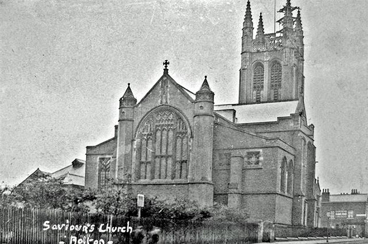
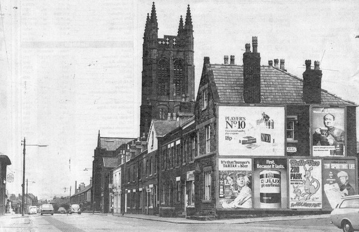
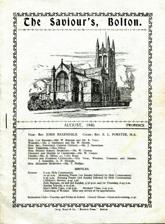
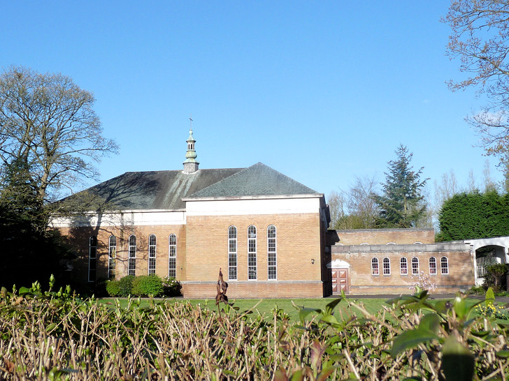
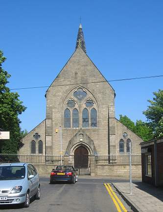
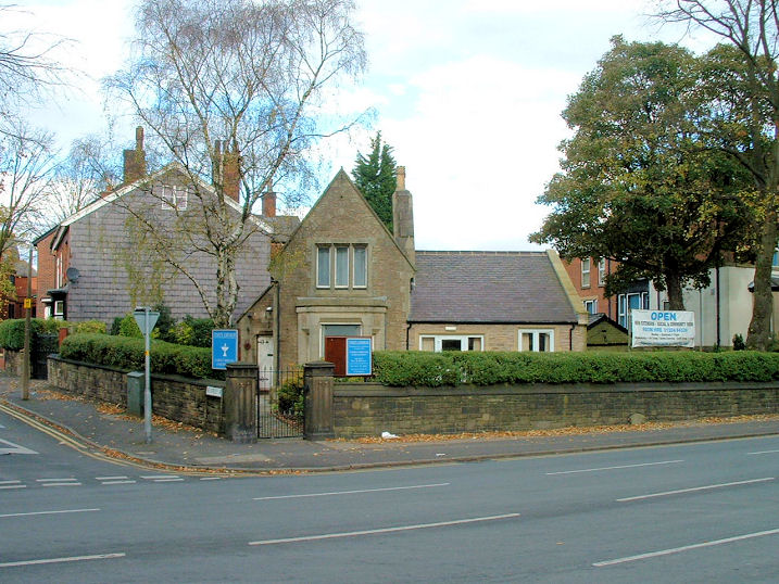
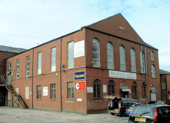
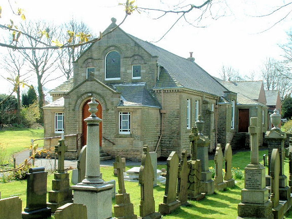
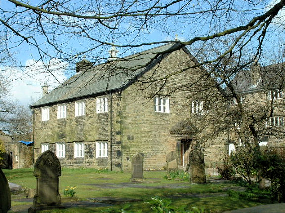
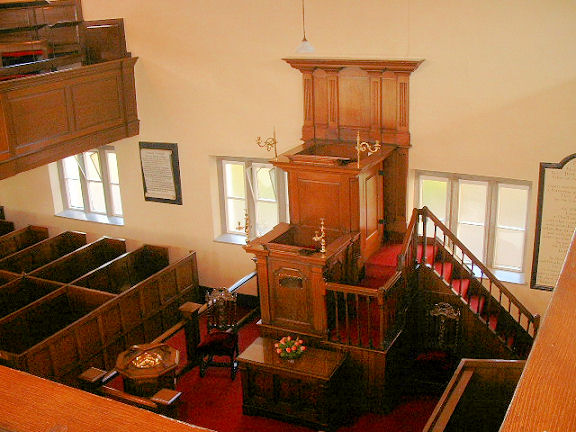
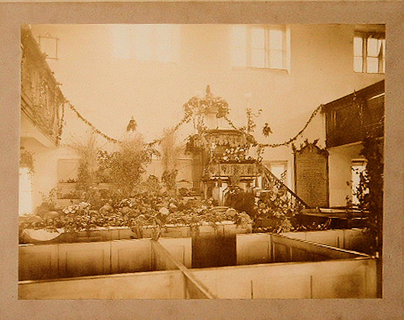
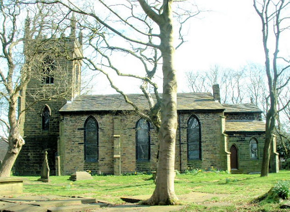
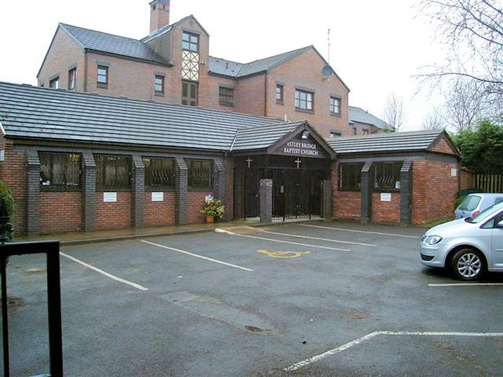
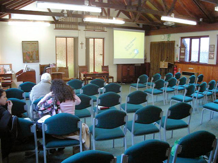
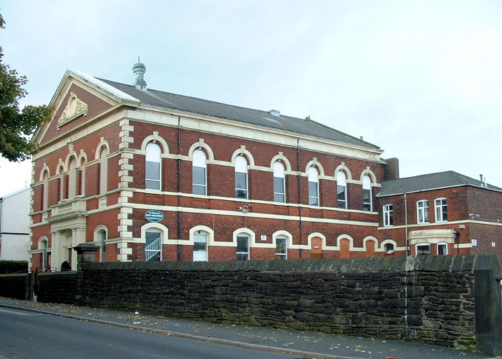
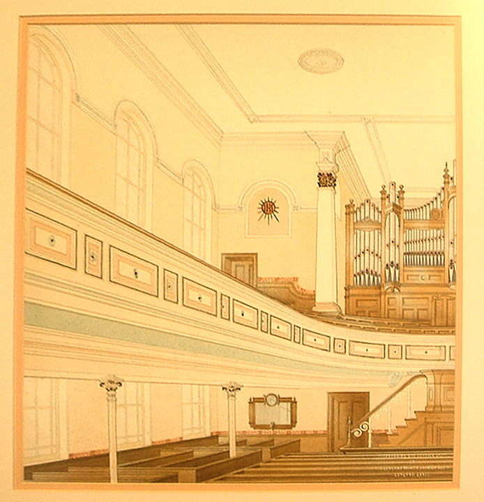
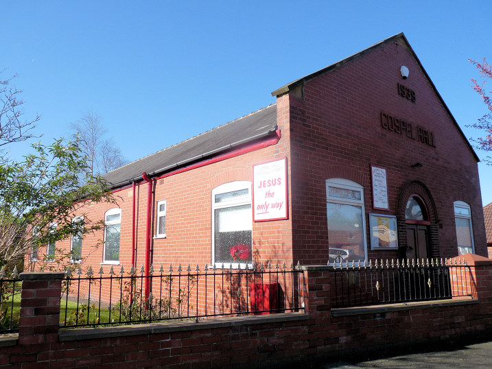
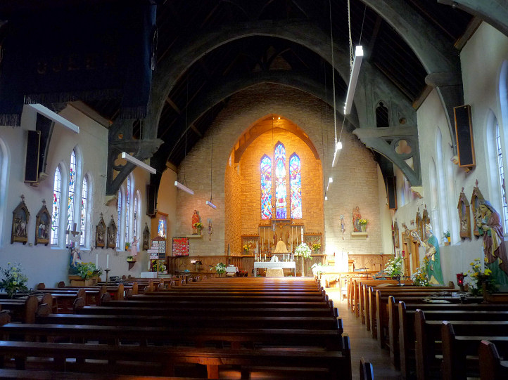
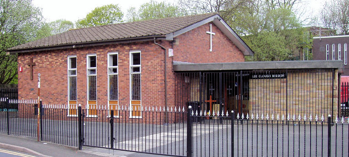
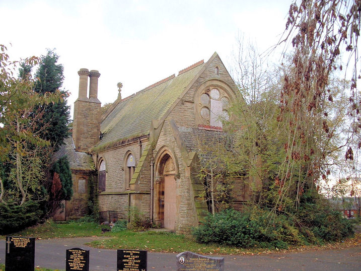
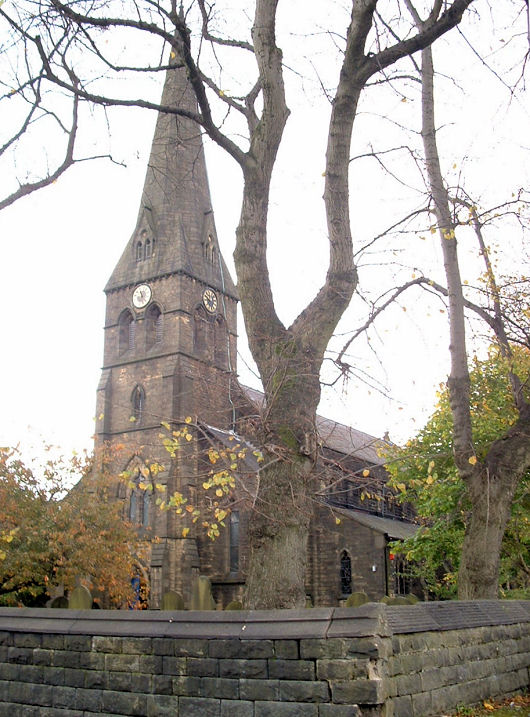
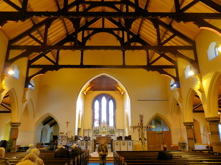
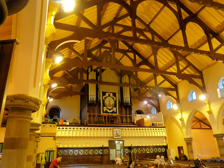
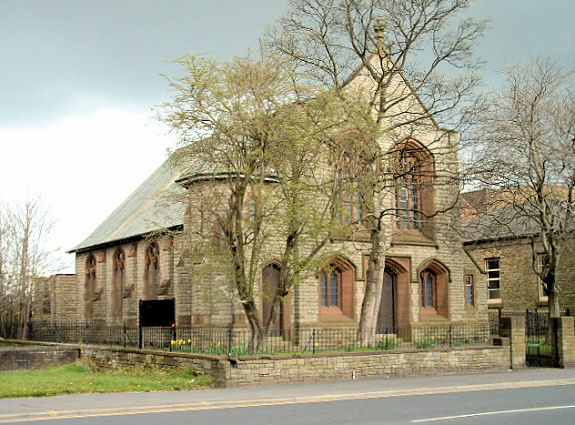
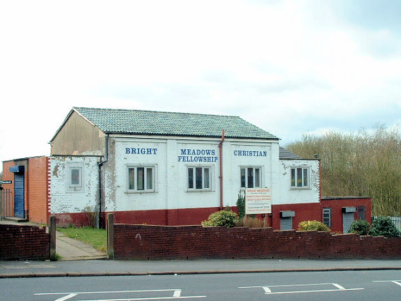
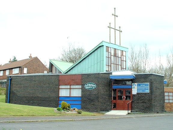
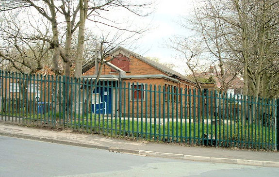
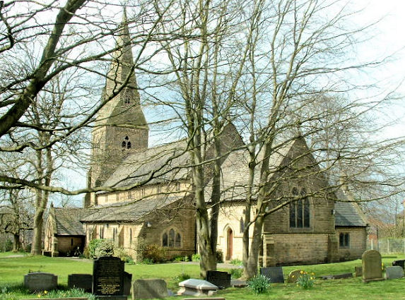
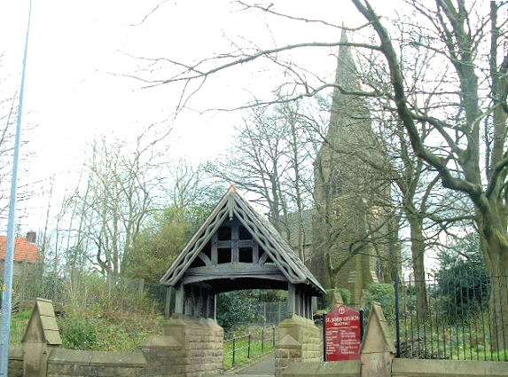
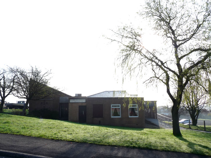
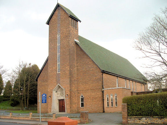
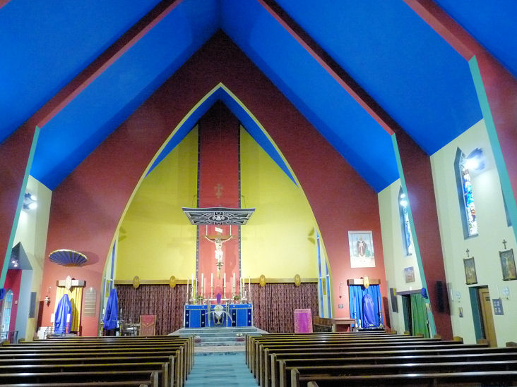
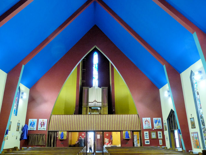
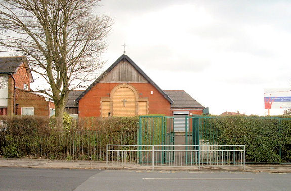
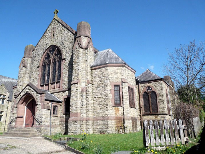
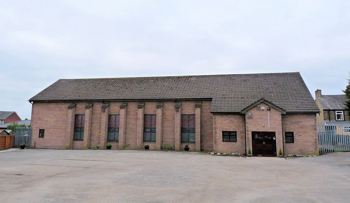
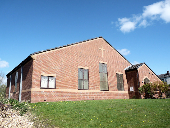
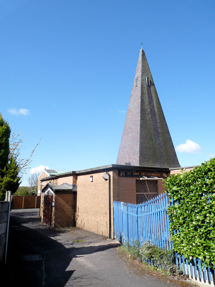
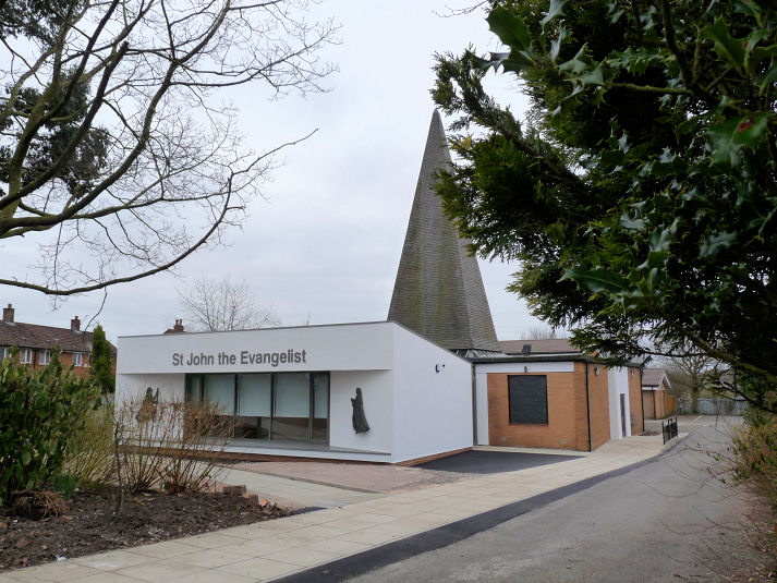
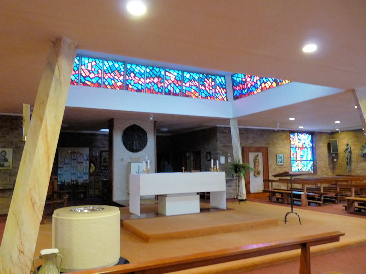
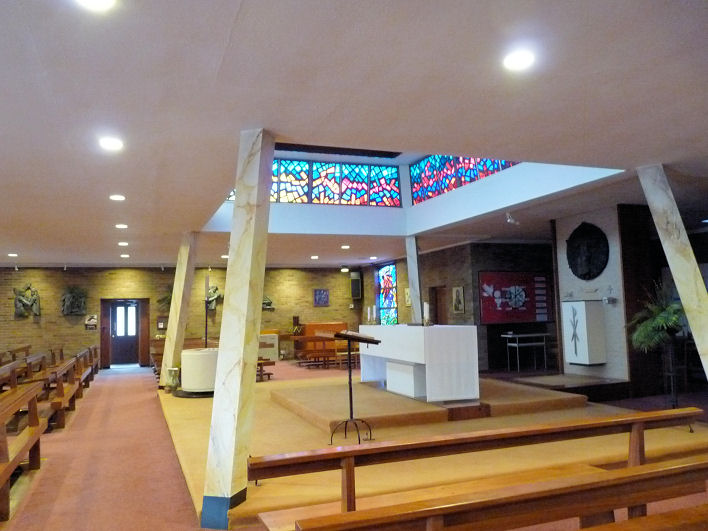
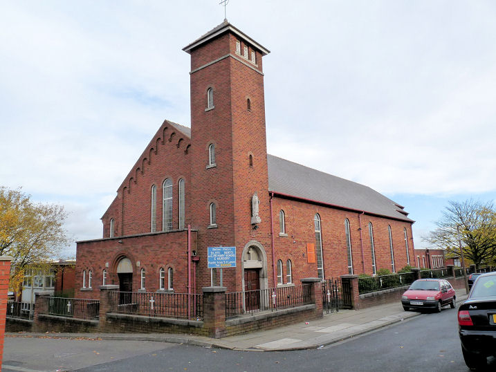
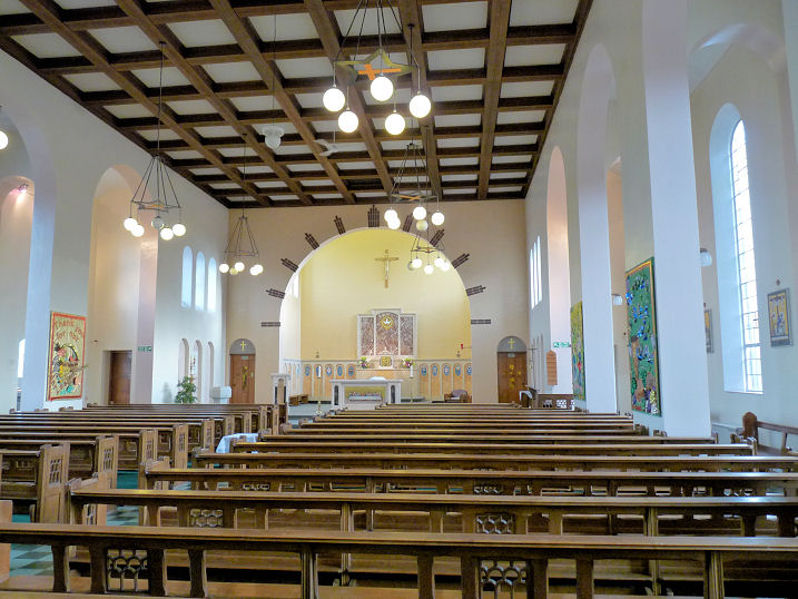
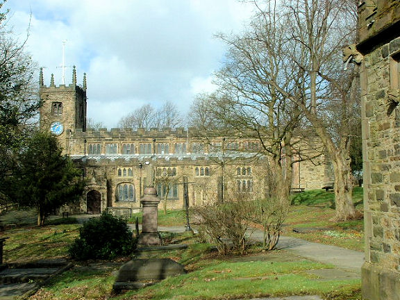
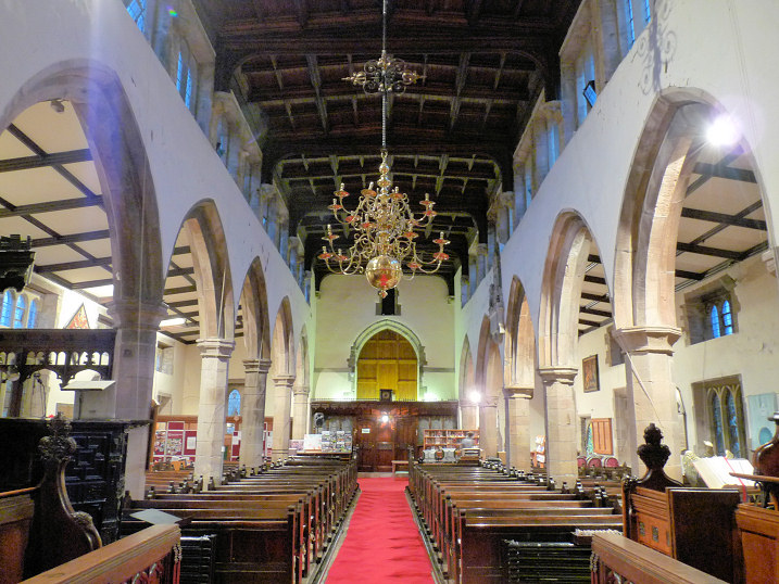
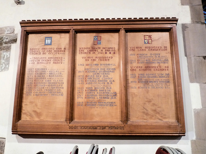
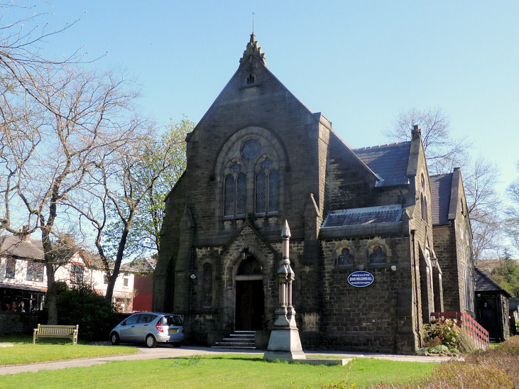
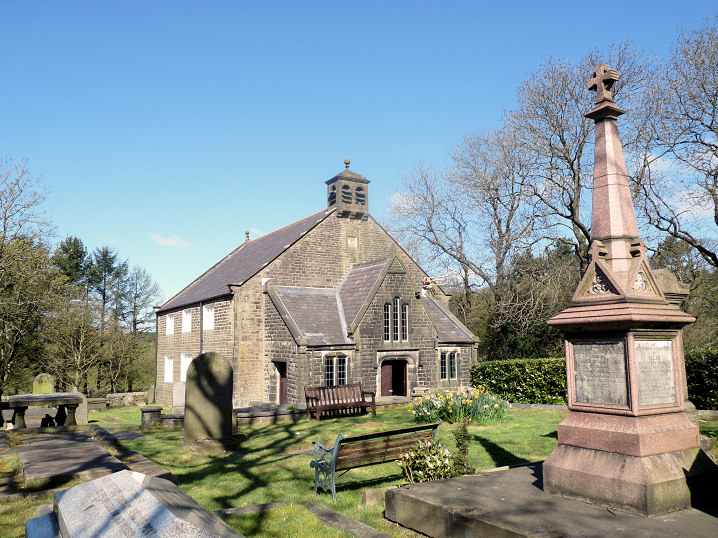
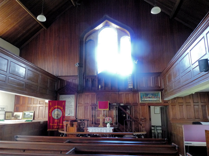
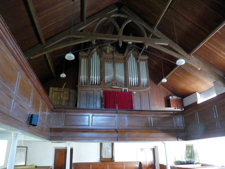
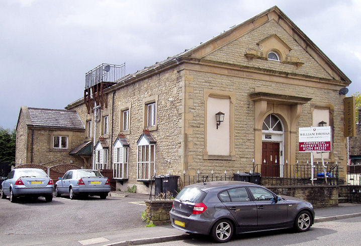
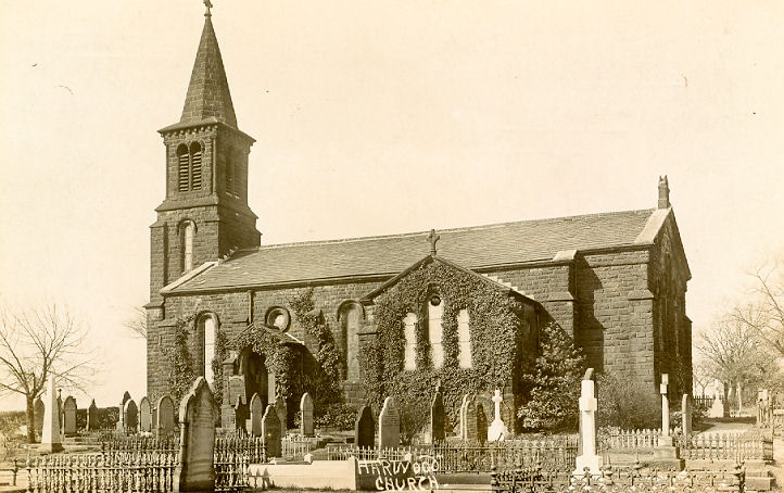
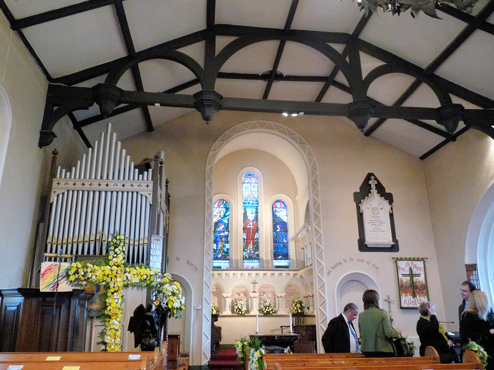
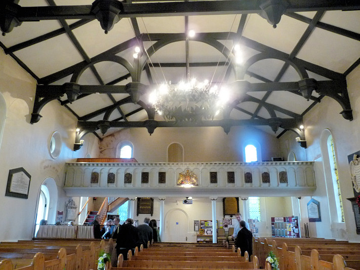
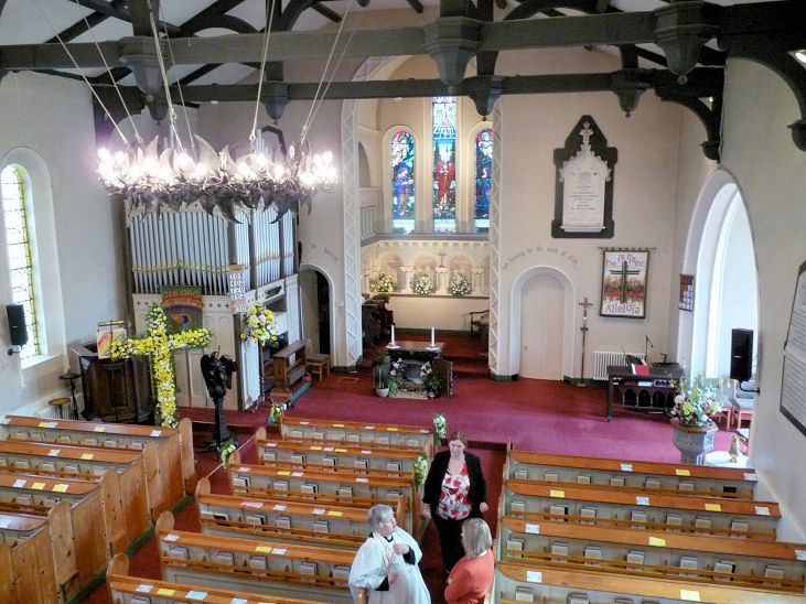
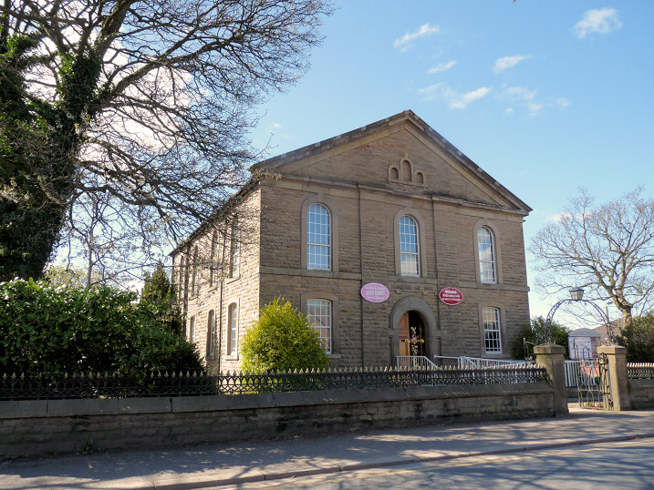
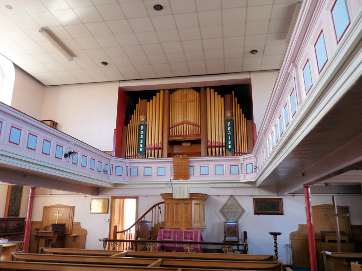
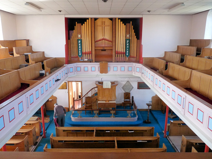
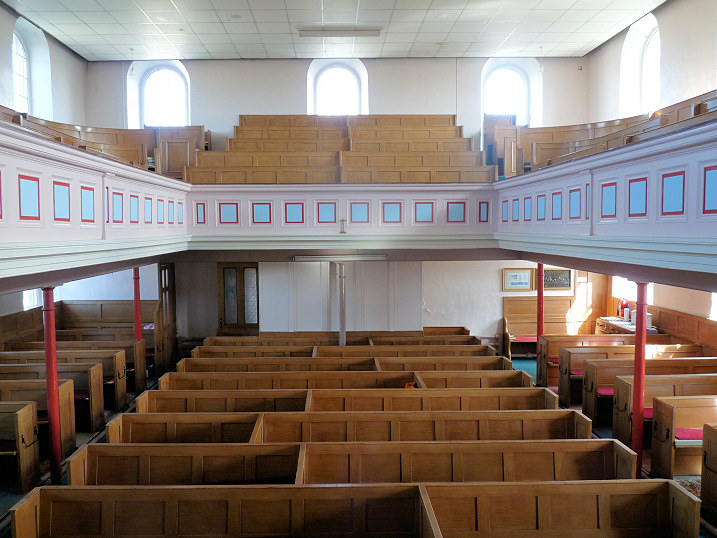
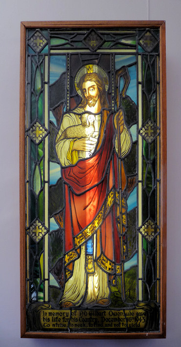
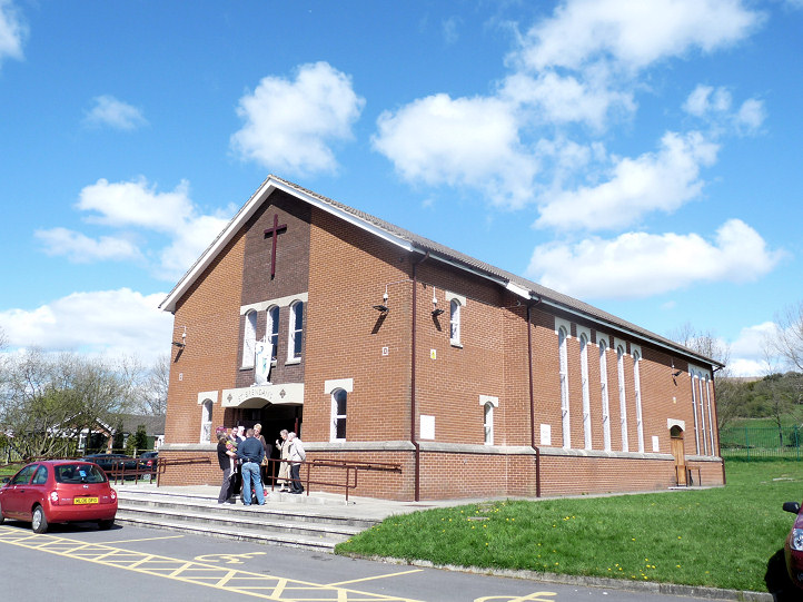
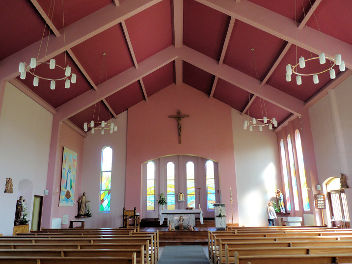
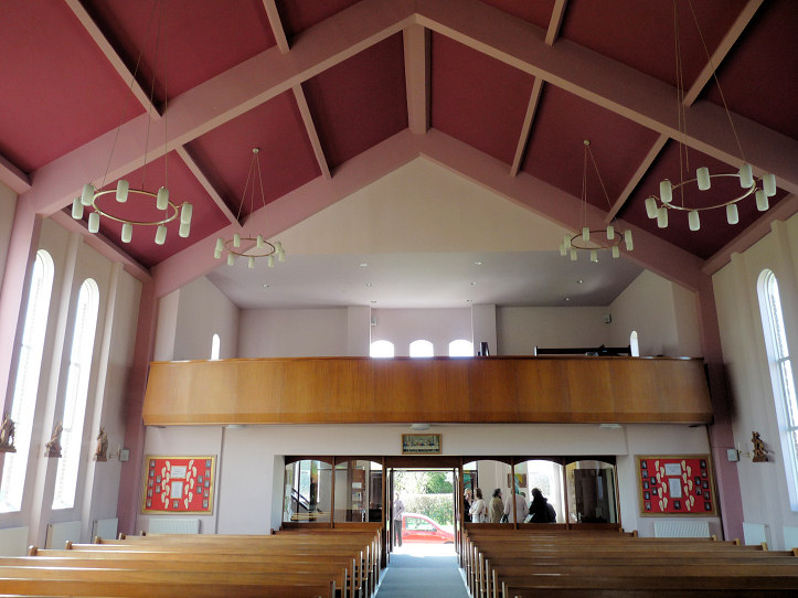
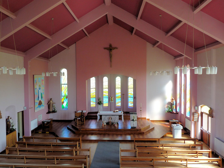
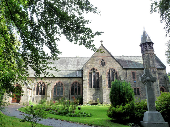
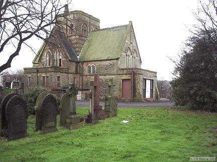
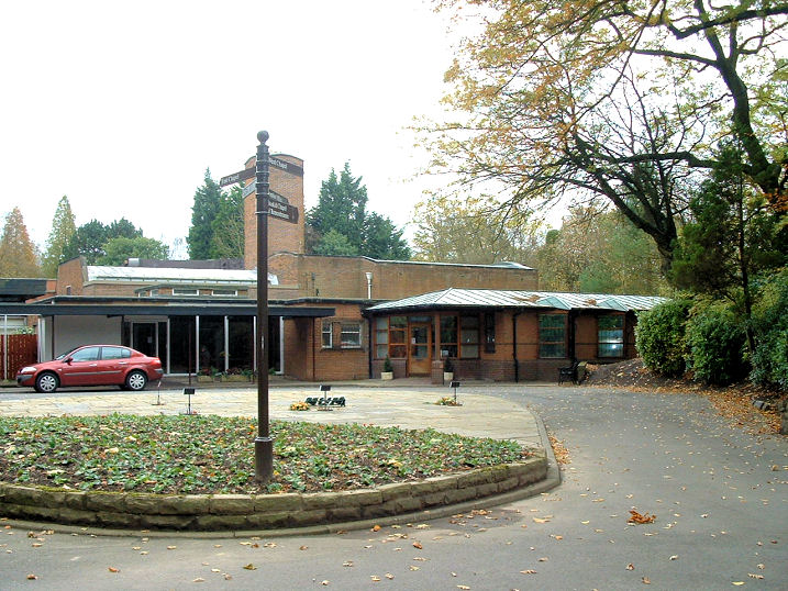
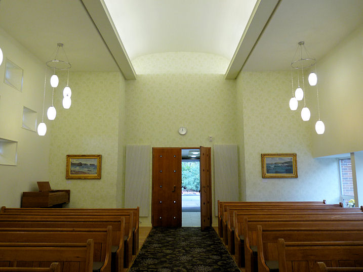
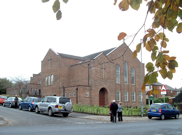
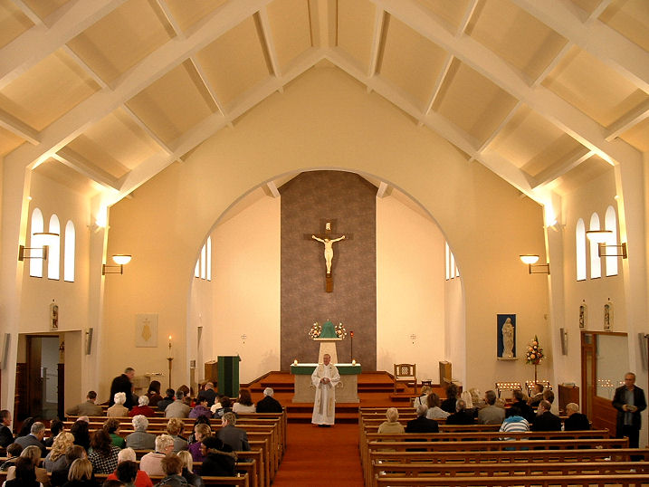
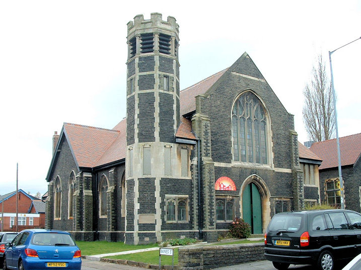
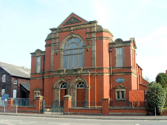
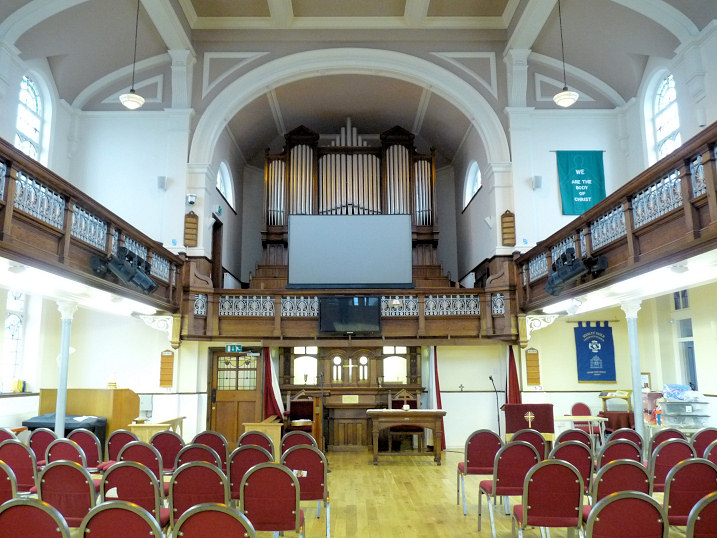
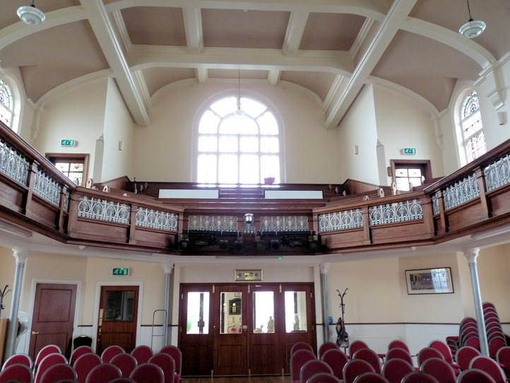
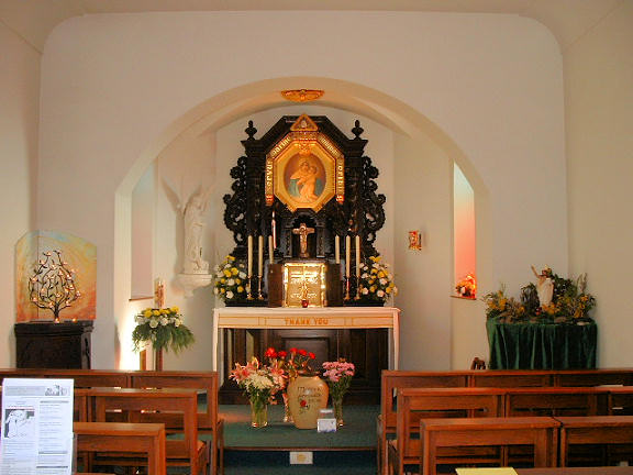
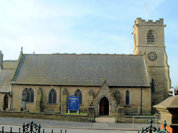
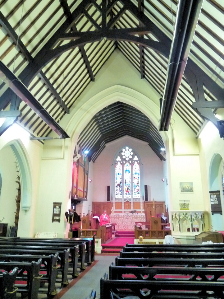
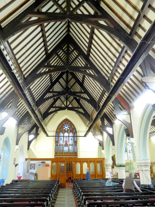
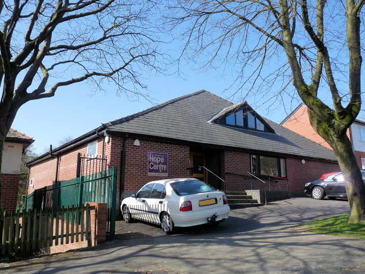
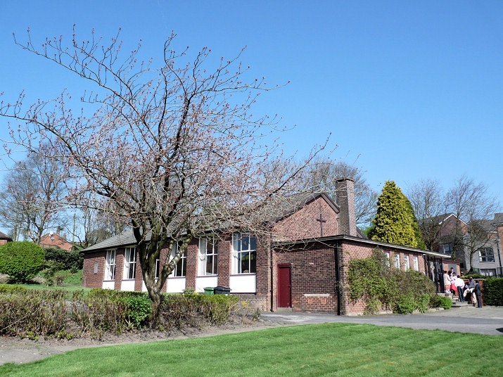
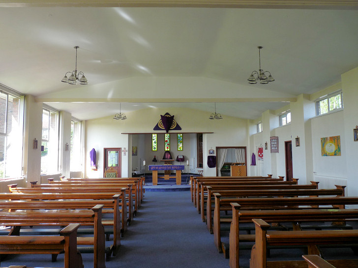
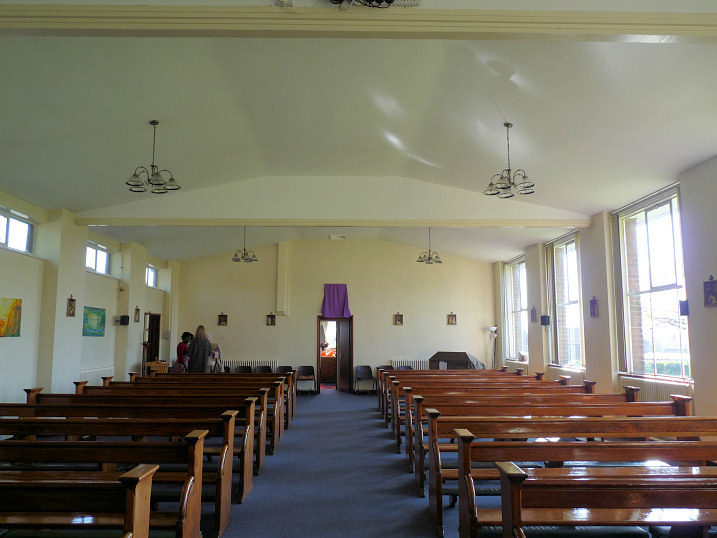
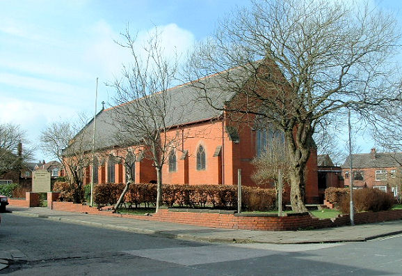
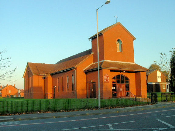
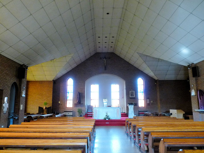
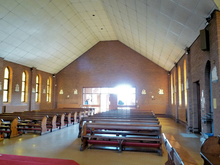
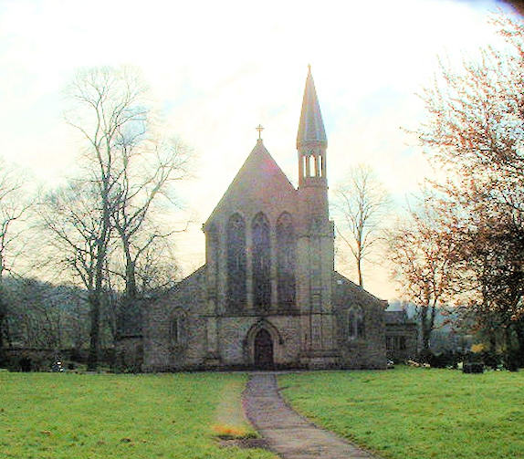
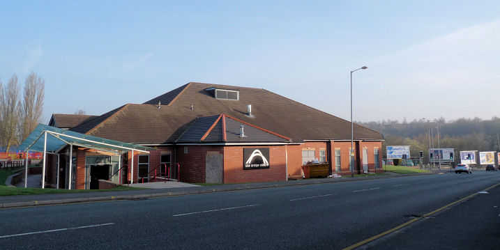
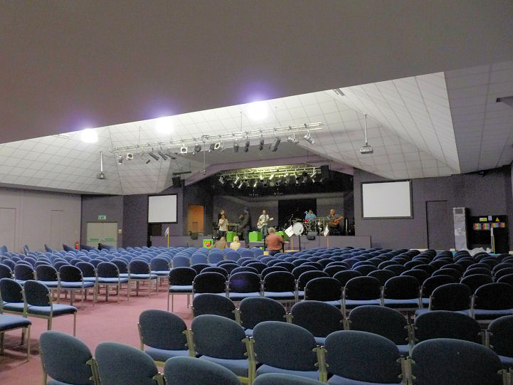
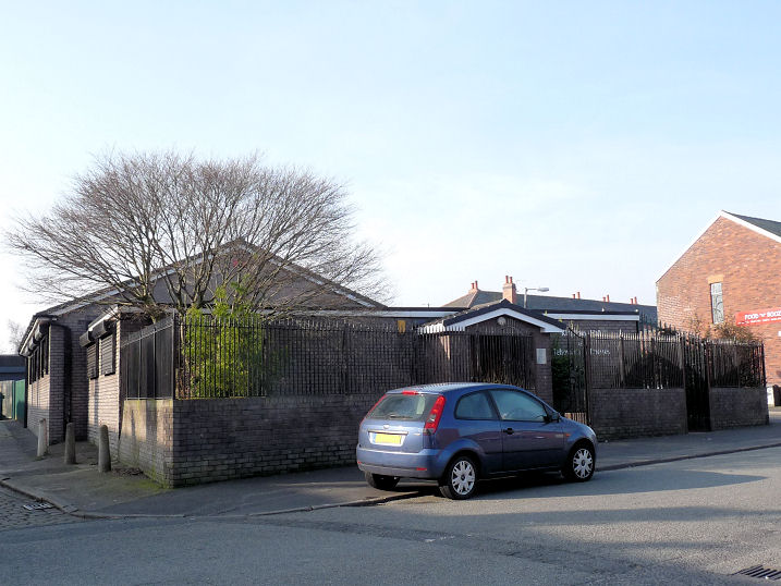
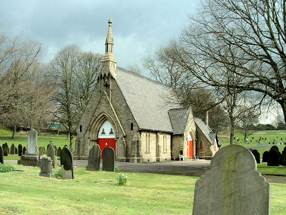
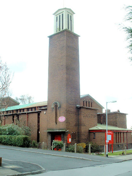
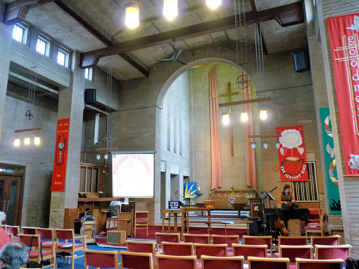
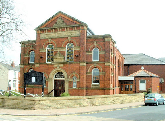
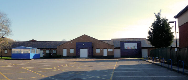
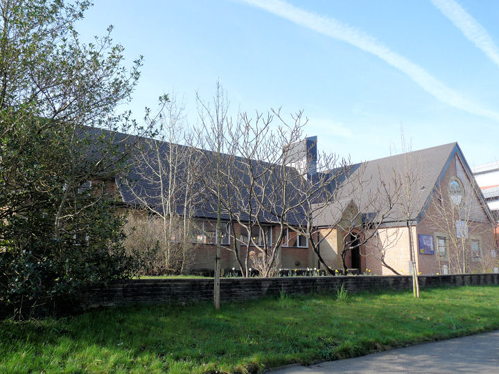
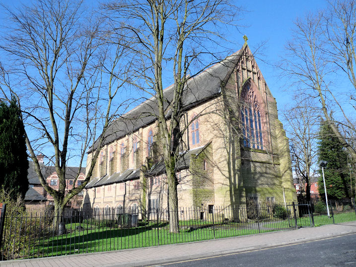
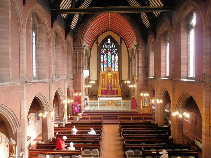
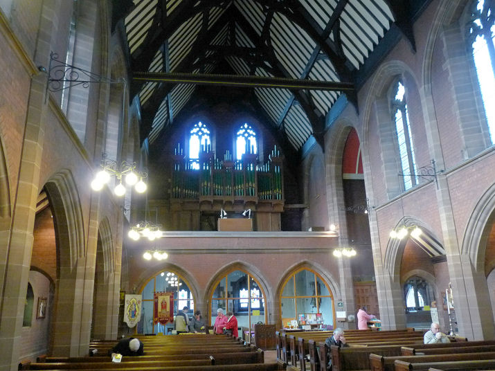
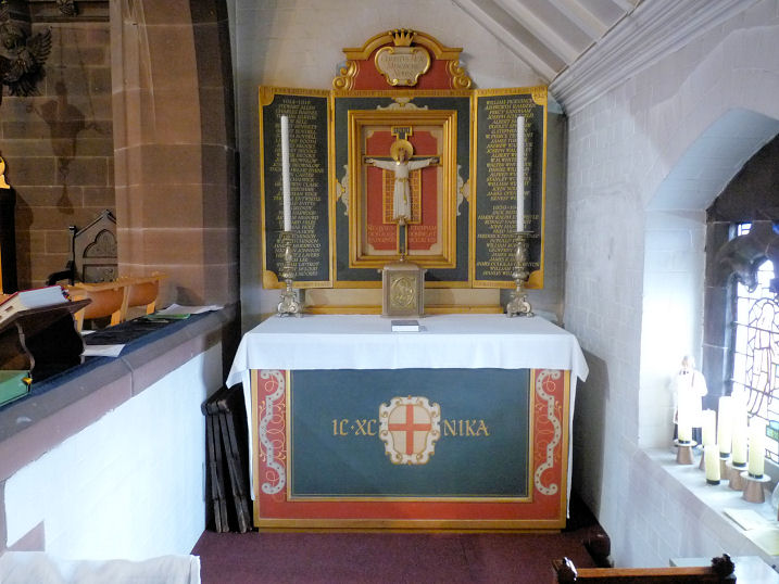
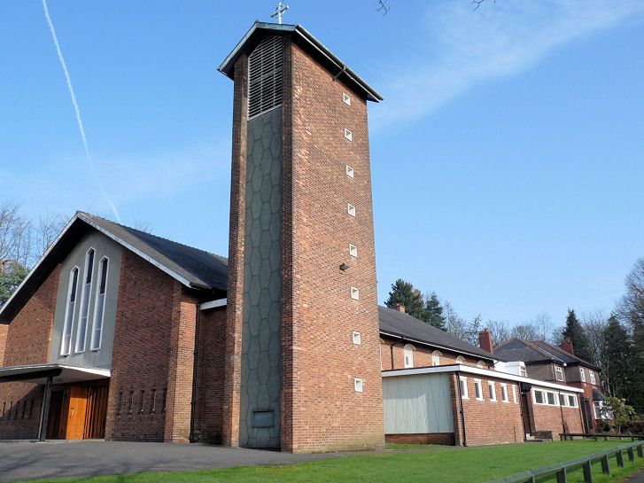
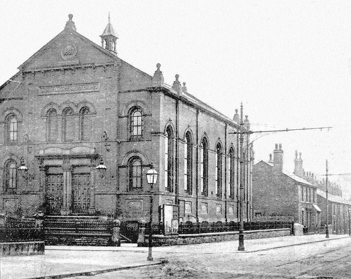
This first church is an unknown. Chris Hampson has asked for help in identifying a church shown here (as of 2026 the link is no longer working, and I haven't been able to find the photo anywhere. If you can advise me where it now is I'd be grateful) on the website of the University of Manchester Archive and Record Centre. The event is clearly shown as Lancashire Missionary Conference, Bolton, 1908, but where the picture was taken is a mystery. The railings (which, even if the building still stands, are unlikely to be there, as they will have been removed for the war effort) are quite ornamental. The regular (and probably architectural rather than functional) short buttresses are fairly distinctive. Chris has ruled out two possible locations - Hebron Hall which opened a year after the conference, and a Gospel Hall on Commission Street. Can you advise Chris of the location, or re-locate the image? Al-Falah Mosque on Salisbury Street. SD 7085 0870. © Mike Berrell. It pre-dates the first Streetview visit in 2009. Link. All Saints - see the Ukrainian Catholic Church entry below. All Souls (1881-1987) on Astley Street is redundant and in the care of the Churches Conservation Trust. Another view. SD 7138 1089. Both © Mike Berrell. Link dates it to 1880-1, by Paley and Austin. Grade II* listed. Since 2013 The Mission Parish of Our Lady and St Edward (Anglican Catholic Church) has met here, but in 2026 I've been unable to find any current references to this. Previously they had met at the former Congregational Church on Blackburn Road (see below), Ashrafia Masjid stands at the junction of Gibraltar Street and Cannon Street North, at SD 7074 0869. 2022 Streetview. Link. Bank Street Unitarian Chapel (1856). SD 7184 0939. © Martin Briscoe. It seems to have changed hands between late 2022 and August 2023, when signage for Bank Street Chapel was replaced by signage for Winners Chapel International. Link. Barrow Bridge Mission (CoE) on Barrow Bridge Road, Barrow Bridge. SD 6893 1171. © Mike Berrell (2012). Link. Bethel Church on Clarence Street. SD 7162 0971. © Martin Briscoe. Bolton Apostolic Church - see Breightmet, Red Lane U.R.C., below. Bolton Methodist Mission (Victoria Hall), on Knowsley Street, as seen by Streetview in 2022. SD 7158 0944. Link, which dates it to 1900. Bolton Salvation Army Citadel on St. George's Road. SD 7139 0953. © Rob Brettle. Its demolished predecessor stood on Great Moor Street, at SD 7185 0901. A photo of it can be seen here (scroll down). Old maps show that the narrow frontage led to a large building behind. It had been demolished before the first Streetview visit in 2008, building work had commenced by summer 2017, and judging by the still present hoardings, remains uncompleted in 2025. The former Bridge Street Wesleyan Methodist Chapel (1804) on St. George's Street and Higher Bridge Street, now in secular use. SD 7173 0964. © Mike Berrell. Link. Central Baptist Church on Snowden Street and Thomas Holden Street. SD 7105 0974. © Mike Berrell. As of 2026, Google Streetview is labelling it as "permanently closed". This source says it was last sold in 2017. The former Chalfont Street Independent Methodist Church (1888), on Chalfont Street and Keswick Street. SD 7169 1078. From "A Souvenir of the Hundredth Annual Meeting of the Independent Methodist Churches", 1905, in David Collier's Collection. A modern view, © David Collier (2015), who believes it is used by the Asian community, but for what purpose he isn't sure. The long-demolished Christ Church (1841-1933) stood on Deane Road. SD 7115 0869. © Bolton Council. Reproduced here by the efforts of Mike Berrell, and by kind permission of the Bolton Museum and Archive Service. David Collier has advised that the site is now occupied by "Christ Church Garden" - seen by Streetview in 2025. Christ Church on Blackburn Road, Walmsley. SD 7108 1422. © Martin Briscoe. Another view, © Mike Berrell (2012). Link1. Link2. Grade II listed. Church of Jesus Christ of Latter-day Saints on Gaskell Street. SD 7103 0989. © Mike Berrell (2012). Claremont Baptist Church (2020 Streetview) stands on St. George's Road at SD 7137 0950. Pevsner dates it to 1868-9. Link. The demolished Commission Street Unitarian Chapel and Sunday Schools, built in 1868. © unitarian.co.uk. This, and many other old engravings on this website, are reproduced from the downloadable books on the Unitarian Church Headquarters website here. The books are Pictures of Unitarian Churches by Emily Sharpe (1901) and the 1914 edition of Nonconformist Church Architecture by Ronald P. Jones M.A, (Oxon), and the images are reproduced by kind permission of James Barry of Unitarian Church Headquarters. My appreciation also to Mike Berrell for his efforts in this regard. While updating this page in 2026, I was unable to find any map which showed the chapel. AI locates it at SD 71158 08786, at a building which turn of the 19th-20th century large scale maps label as Hall. If this is accurate its site lies beneath the large round structure (part of Bolton College) seen in a 2024 Streetview. The former Congregational Church (1897 - 1990) on Blackburn Road, now in secular use. SD 7160 1065. © Mike Berrell. Two interior views - 1, 2, and the War Memorial. All © Mike Berrell (2012). Between 2011 and 2013 The Mission Parish of Our Lady and St Edward (Anglican Catholic Church) met in the vestry. They now meet in All Souls Church on Astley Street (see above). © Mike Berrell (2012). The former Delph Hill Wesleyan Methodist Church on Chorley Old Road, Delph Hill. SD 6870 1052. © Mike Berrell (2012). Another view, © Martin Briscoe. David Collier advises that this building has since been demolished, and The Triangle erected in its place, for the combined congregations of Delph Hill, Chorley Old Road Methodist (now in use as a nursery), and the Seymour Road Methodist Church. The latter, most recently known as the Theatre Church, was demolished in 2015. Two Streetviews - 1, 2, both from 2025. Notice in the latter image re-cycled date-stones in the wall to the right of the door, "Wesleyan 1848", "Extended 1881" and "Extended 1981". The former Elim Pentecostal Church on Moor Lane. SD 7131 0905. From an old newspaper clipping (1947) in David Collier's Collection. An old photo of it can be seen here (scroll down), showing it partially demolished in 1963. It gives its location as being at the junction of Moor Lane and Gas Street. Older maps show a Primitive Methodist Chapel on the same site, and even earlier, on a map of 1850, is shown a somewhat smaller Baptist Chapel. A commercial building has stood on the site since at least 2008, the year of the first Streetview visit. The former Emmanuel Parish Church (1839-1990) on Cannon Street, Vicarage Street, Edward Street and Jackson Street has been converted to flats - "Stone Church". SD 7081 0832. © Mike Berrell. This photo dates from 1988, before conversion work commenced, as does this photo of some charming carved heads. Both © David Collier. Another view, © Bob Thornley (2008). Faizan E Madina on Cannon Street, as seen by Streetview in 2025. SD 7081 0843. The long-demolished Folds Road Independent Methodist Church (? - 1888), was succeeded by a new building (1888-9). This in its turn was also demolished to make way for the town centre bypass. Both from "A Souvenir of the Hundredth Annual Meeting of the Independent Methodist Churches", 1905, in David Collier's Collection. SD 7100 0953. There used to be a Friends' Meeting House on Tipping Street (off Folds Road) at SD 7206 0957. It's dated here to 1920-1969, when it was demolished for a road scheme. An old illustration of it can be seen here, and its site today (the scrubby area) was seen by Streetview in 2025. A new building replaced it, on Silverwell Street, at SD 7198 0920 - 2025 Streetview. Link. The former Great Moor Street Congregational Church can be seen in an old newspaper clipping, looking along Mawdesley Street. Another partial view. Both from David Collier's Collection. A modern photo, showing the building erected on the site. SD 7177 0899. © David Collier (1988). Hebron Christian Church on Mayor Street. SD 7092 08694 © Mike Berrell (2008). Streetviews show that the church was demolished in 2022 or 2023, and as of the most recent Streetview in 2024, the site remained undeveloped. This source (which includes an old photo) says that it was still active in 2012. The former Holy Trinity on Trinity Street (1825 - 1993), now disused. SD 7184 0867. © Mike Berrell. It was subsequently converted into flats. Holy Trinity on Church Road, Prestolee. Interior view. Stained glass windows. SD 7554 0575. All © Mike Berrell. David Collier has advised that this has now been converted into flats, with the first lettings in 2014. Independent Methodist Chapel (1872) on Noble Street, Temperance Street and Baldwin Street. SD 7106 0839. © Mike Berrell (2007). Link. Jamia Alavia Bolton Mosque (Sufi - Bareilvi) on Bromwich Street and Rydley Street. This was previously First Church of Christ, Scientist. SD 7254 0880. © Mike Berrell (2012). Link. The latest Streetview (2023) shows major building works underway. Kingdom Hall of Jehovah's Witnesses on Noble Street. SD 7102 0839. © Mike Berrell. Krishna Temple on Beverley Road and Wyresdale Road. SD 7011 0952. © Mike Berrell. David Collier advises that this was built as Independent Methodist - it has a date-stone for 1901. Madina Mosque (2024 Streetview) on St. George's Road. SD 7130 0952. Masjid Al-Aleef, on Back Higher Swan Lane West, as seen by Streetview in 2023. SD 7087 0735. Masjid Al Aqsa on Gilnow Road, as seen by Streetview in 2025. SD 7021 0890. Facebook. Masjid-e-Ghosia (2023 Streetview) on Caroline Street. SD 7069 0770. Link. Masjid-e-Ibrahim on Carter Street, as seen by Streetview in 2025. SD 7237 0748. New Covenant Church (2022 Streetview) is on Brownlow Way. SD 7113 1036. Link. Former New Jerusalem Church (1844) on Higher Bridge Street - now in secular use. SD 7168 0969. © Mike Berrell. Grade II listed - says it was also latterly an Elim Pentecostal church. The former Peace Street Methodist Church (A map of 1910 labels it as U.M. Church - United Methodist) closed, David thinks in the 1970's, and re-opened shortly thereafter as a Mosque. Although it doesn't display a notice board, David thinks this is probably part of Jamia Zakariyya Masjid Mosque and Islamic Cultural Centre. David thinks this is still in use for teaching and meetings, but a new Mosque was built on an adjoining site in about 2006/8. SD 7079 0810. Both © David Collier (2010). Link. Potter's House Community Church, on Palace Street and St. George's Road, as seen by Streetview in 2025. SD 7164 0960. Link. A Primitive Methodist Chapel used to stand on Higher Bridge Street, at SD 7163 1008. A small P.M. chapel is shown on the site in 1850, extended or re-built before 1910 (a photo can be seen here), it still shows as a place of worship on a map of 1952, but it is no longer shown as one on a map of 1961. Since demolished (this source says 1954), its site was seen by Streetview in 2024. The former St. Andrew (Presbyterian) on Bowker's Road, as seen by Streetview in 2024 and 2022. Pevsner dates it to 1845-6. It's now in use as shops. SD 7178 0914. St. Andrew and St. George (U.R.C.) on St. George's Road and Knowsley Street. Older maps label it as Congregational, and Pevsner (who calls it St. George's Road Congregational Church) dates it to 1862-3. SD 7154 0954. © Mike Berrell. Link. St. Edmund (R.C.) on St. Edmund Street and Blundell Street. Interior view. SD 7136 0929. Both © Mike Berrell. A 2024 news story says that the church, opened in 1861, was to be demolished. The most recent Streetview of September 2025 shows that nothing has happened so far. The former St. George on St. George's Road is dated by Pevsner to 1794-6. SD 7157 0959. © Philip Kapp. Another view, © Mike Berrell. A 2025 Streetview shows it to now be Redeemed Christian Church of God, and earlier Streetviews show it to have been R.C.C.G. since at least 2012. In 2008 it was in use as shops. Facebook. The site of St. George Methodist (2024 Streetview) on St. George's Road and Duke Street. Older O.S. maps show it as United Methodist, and before that as Methodist New Connexion. A photo of the front of the building can be seen here. SD 7144 0954. Bolton Salvation Army Citadel can be seen to its left. The site of St. Mark, built in 1866 and demolished in 1973, on St. Mark's Street and Fletcher Street, as seen by Streetview in 2025. Its Genuki page, includes several church photos. SD 7165 0809. The former St. Mary of the Assumption (R.C.; 1847 - 1987) on Palace Street, now in secular use as a restaurant. SD 7163 0965. © Mike Berrell. The former St. Matthew on Mount Street, built 1874, closed 1982, and demolished in 1988 due to dry rot. This later photo shows it after the spire was taken down. SD 7107 1031. Both reproduced here by the efforts of Mike Berrell, and by kind permission of Halliwell Local History Society. Housing was built on its site, seen by Streetview in 2023. St. Patrick (R.C., 1861) on Great Moor Street and Johnson Street. SD 7180 0896. © Martin Briscoe. Interior view, © John Balaam (2012). Link1. Link2 dates it to 1861. The former St. Paul on Deansgate, of the 1860's. SD 7128 0917. © Mike Berrell. Thanks to Raymond Jarrett for advising the dedication, and that it's converted into flats. St. Paul with Emmanuel on Vicarage Street and Edward Street. Interior view. SD 7078 0827. Both © Mike Berrell. David Collier advises that when Emmanuel Parish Church (see above) closed, the congregation amalgamated with that of St. Paul's Deansgate. The present church was then built. Another view, © David Collier. Link. St. Peter on Churchgate. Pevsner says it stands on the site of a Norman predecessor, the present church dating from 1867-71. SD 7206 0929. © Elizabeth Clarke. Another view, © Martin Briscoe. Link. St. Stephen and All Martyrs (1842) on Hag End Brow, Lever Bridge, Darcy Lever. Mike advises it is nicknamed "The Pot Church". It is the UK's most famous terra cotta church. The architect was Edmund Sharpe. Even the pew ends and backs are produced from terra cotta. The church obviously has something missing. The spire was removed in 1939, and the splendid lantern tower (which had supported the spire), in 1966 by Fred Dibnah, who lived nearby. A 2024 news article includes a photo of the church with spire. Three interior views - 1, 2, 3. SD 7328 0848. All © Mike Berrell (2012). Link. Seventh-day Adventist Church on Deane Road and College Way. SD 7098 0868. © Mike Berrell (2008). Link. Shree Swaminaravan Mandir Temple on Deane Road and Cannon Street, formerly a Unitarian Church. Its Genuki entry provides dates of 1862-1996 (as Unitarian). SD 7079 0855. © Mike Berrell (2008). Link. Smithills Hall Chapel on Smithills Dean Road. SD 6998 1187. © Mike Berrell (2012). The grade I listing for the hall includes the chapel. Society of Friends (Quakers) on Silverwell Street, with St. Peter behind. SD 7198 0922. © Martin Briscoe. Link. The history page includes an old illustration of a predecessor Meeting House on Tipping Street (off Folds Road), of 1820. Tipping Street no longer exists but old O.S. maps show it running roughly along the line of the present Bury New Road. SD 7205 0957. An even earlier (1721) meeting place is mentioned, "roughly on the site of the Lloyds bank in the town centre". The only Lloyds Bank which Google currently throws up is on Hotel Street, but is this the correct site? 2024 Streetview. Spiritualist Church (SNU, 1872) on Bradford Street and Dorset Street. SD 7238 0897. © Mike Berrell (2012). Link. The former Strict Baptist Church which stands at the corner of Dorset Street and Back Bradford Street. Its date-stone is for 1885. SD 7236 0899. © Gerard Charmley (2023). Taiyabah Masjid & Islamic Education Centre (2024 Streetview) stands on Draycott Street and Blackburn Road, at SD 7155 1070. Link. Older O.S. maps show that it had been a Sunday School, perhaps for the former Congregational Church which stands across the road, and for which see the entry for Congregational Church above. The former The Saviour (1881, demolished 1973) stood on Deane Lane. SD 7035 0843. © Bolton Council. From the collections of Bolton Museum and Archive Service. Reproduced here by the efforts of Mike Berrell, and by kind permission of the Bolton Museum and Archive Service. David Collier has also sent in a an old photo, as reproduced in a local newspaper. Bob Harrison has an old church magazine dating from 1940, which has an illustration of the church. He has also advised of this link. Thornleigh Salesian College Chapel (R.C.) on Sharples Park, Sharples. Circa SD 7085 1175. © Mike Berrell (2012). Link. Ukrainian Catholic Church, formerly All Saints, on All Saints Street. Pevsner advises dates of 1869-71, on the site of a predecessor of 1726-43. SD 7182 0957. © Martin Briscoe. A 2017 Streetview provides another view. Older O.S. maps show a United Methodist Church on Clarence Street, at SD 7159 0971. It possibly pre-dates a map of 1850 (there's a label for Indt. Chapel and Sunday Sc, Albert Place, building not indicated), but there was certainly a church on the same site by 1890, and it lasted to the middle of the 20th century at least. Since demolished, it had gone by the time of the first Streetview visit in 2008 - it stood directly facing the camera, frontage about level with the white car, and heading backwards across the tree line. 2025 Streetview. Unity Church (Unitarian and Free Christian, 1866), The Gatehouse, Chorley New Road and Beverley Road. SD 7013 0945. © Mike Berrell. Link. The site (2017 Streetview, it was about where the white van is, frontage facing the camera) of the demolished Welsh Tabernacle Chapel (Methodist), which stood on Chapel Alley at SD 7154 0934. A photo of it can be seen here. Shown as Welsh Taber. on a map of 1910, a map of 1890 labels it as Congregational, and one of 1847 as Dukes Alley Cha. (Independent). It seems to have gone out of use in the mid-20th century. The former Wesleyan Methodist Chapel (dating from 1819) on Fletcher Street and Houghton Street, now in secular use. SD 7132 0847. © Mike Berrell.
Ainsworth
Astley Bridge
Breightmet
Bromley Cross
Deane
Egerton and Walmsley
Harwood
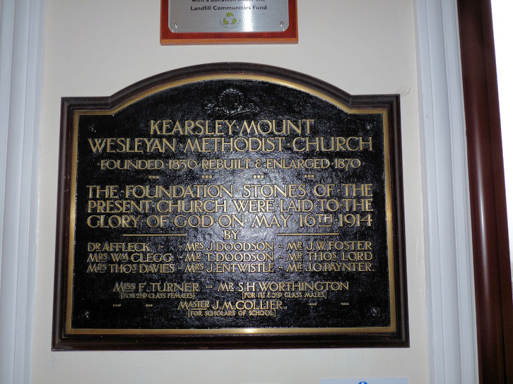
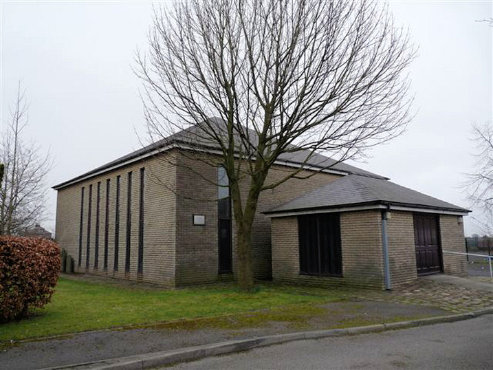
Kearsley and Kearsley Mount
Montserrat
Morris Green
Over Hulton
Ringley
Tonge Bridge
Tonge Fold
Tonge Moor
|
||
06/05/2026
© Steve Bulman