The Churches of Britain and Ireland
|
Blaenau Ffestiniog, Gwynedd
Blaenau
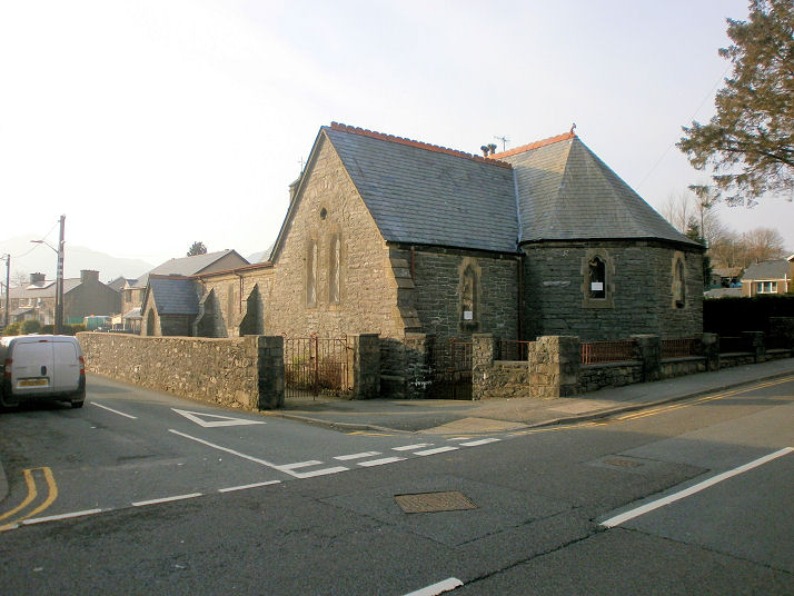
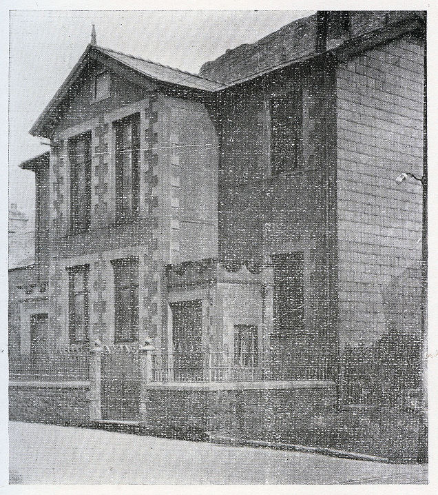
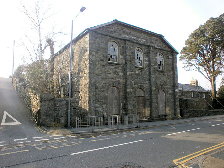
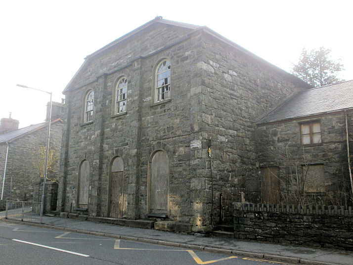
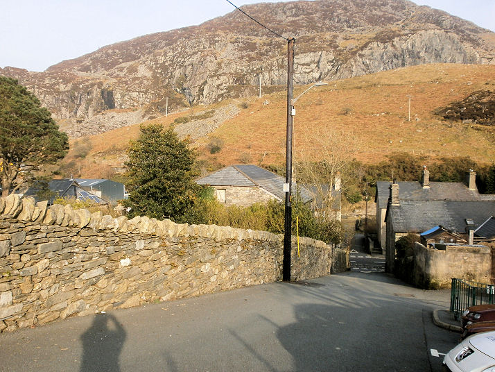
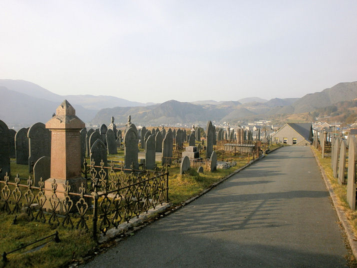
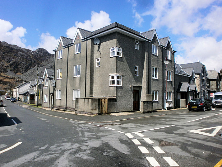
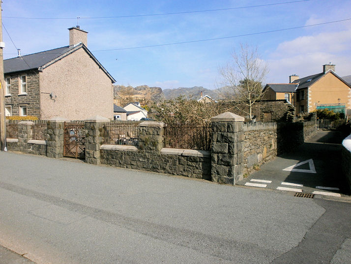
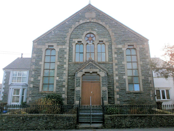
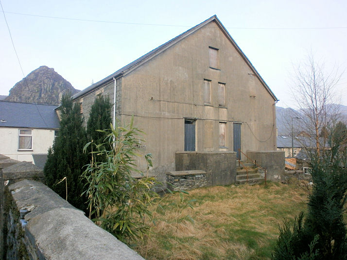
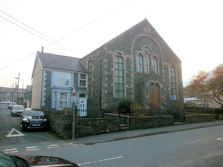
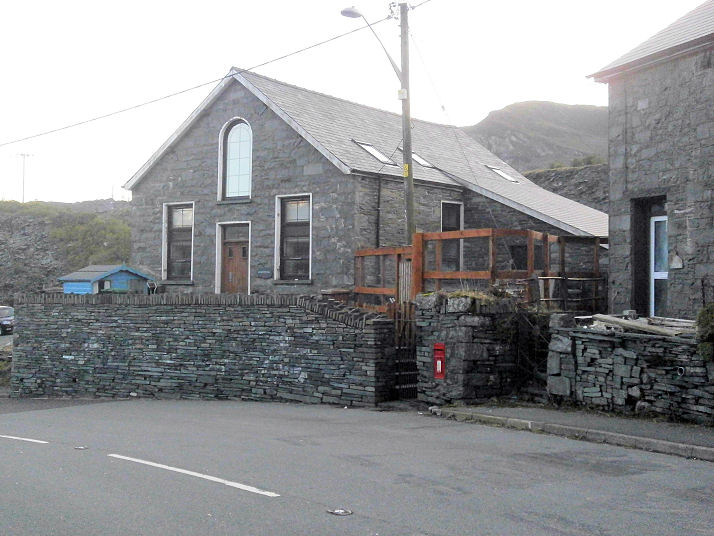
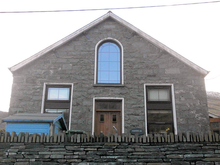
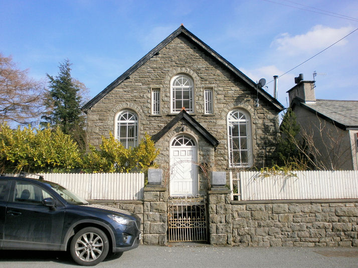
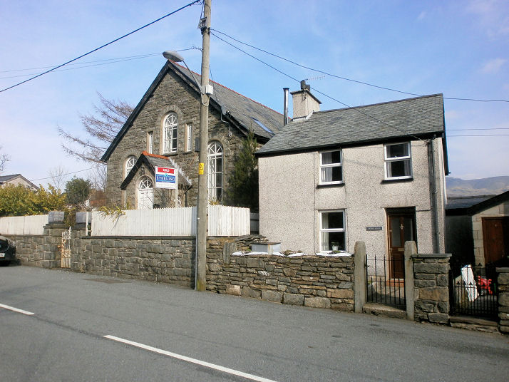
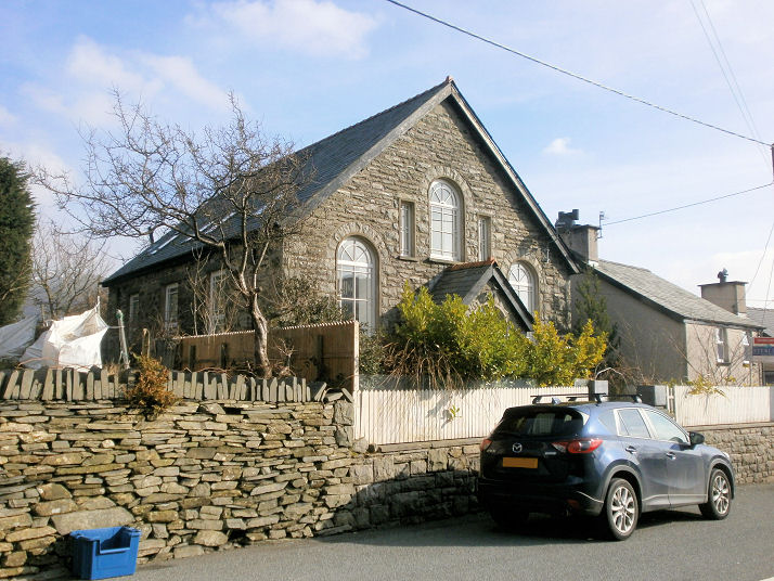
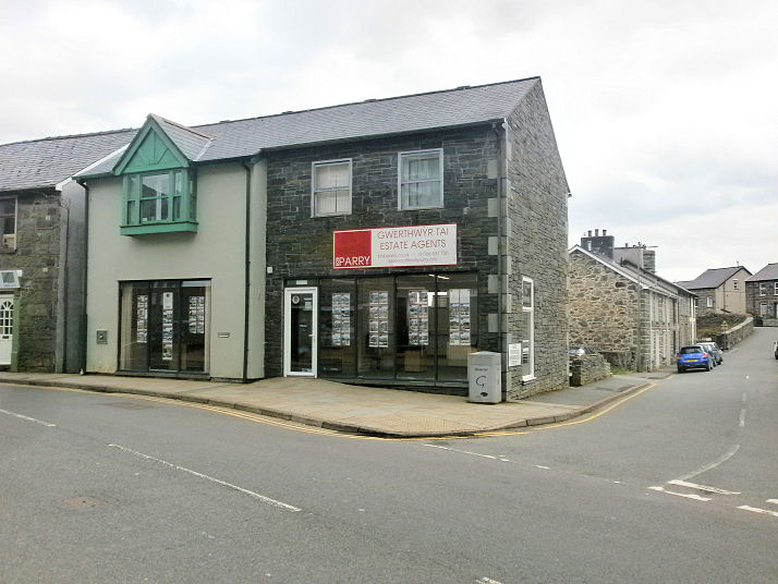
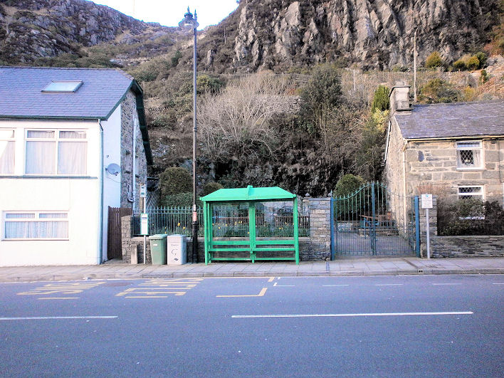
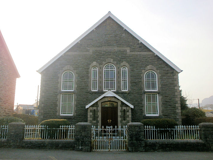
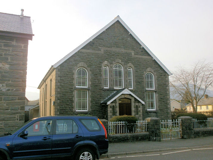
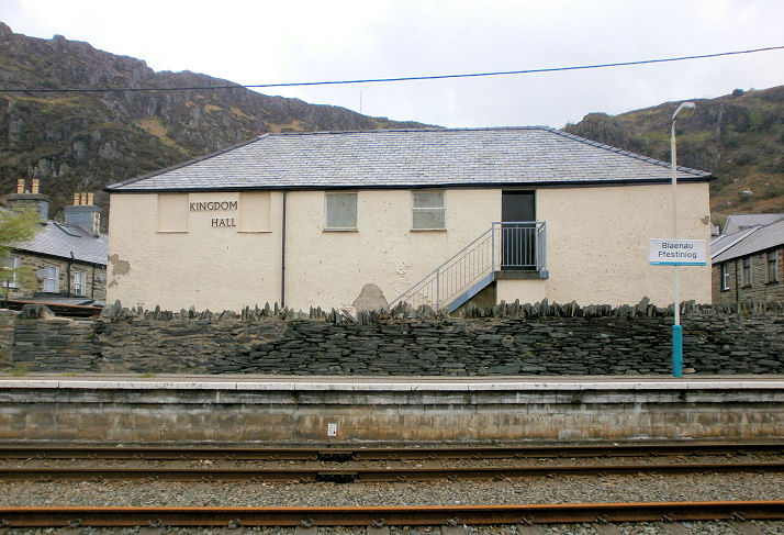
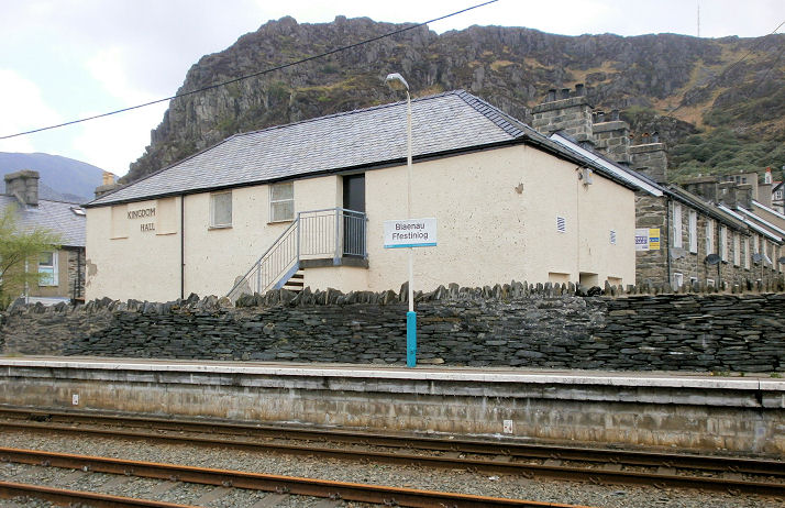
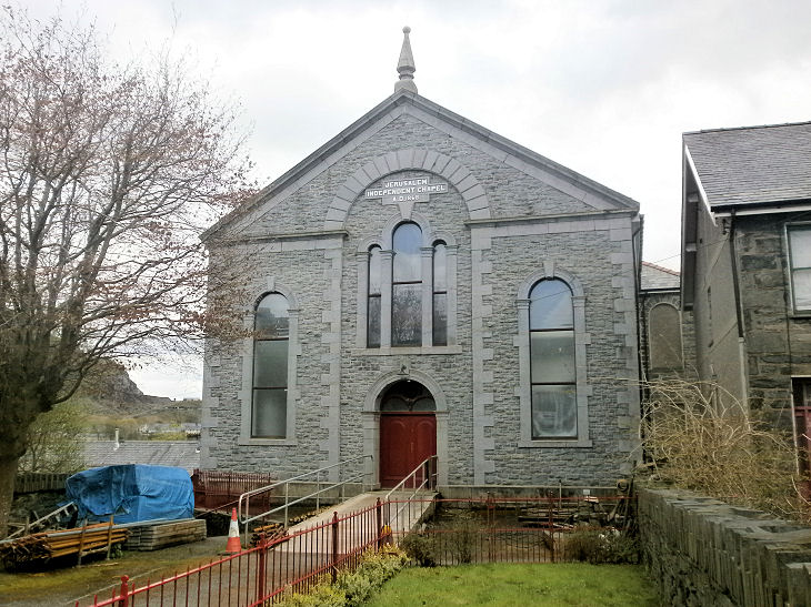
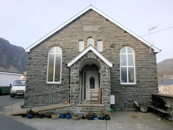
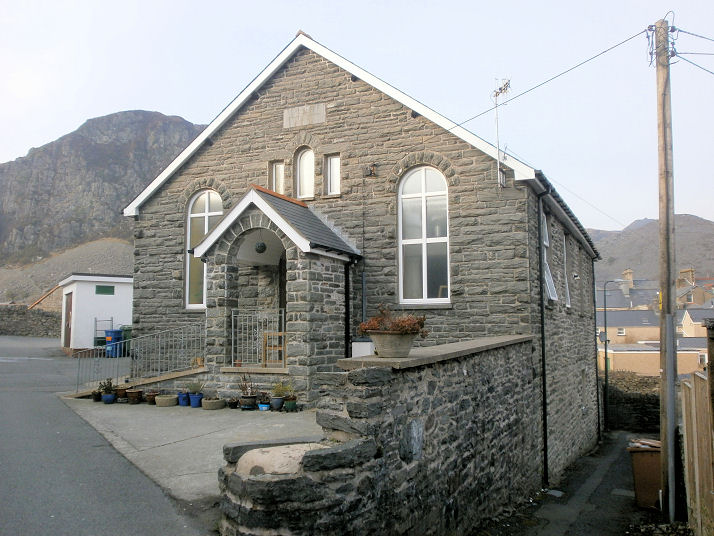
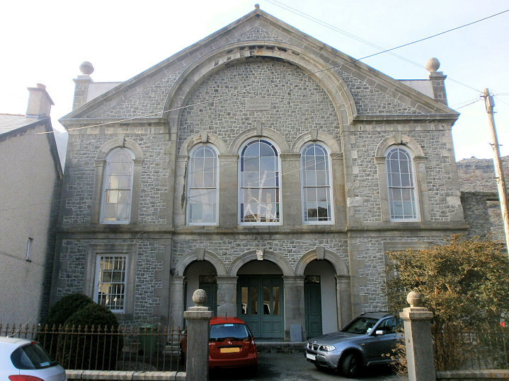
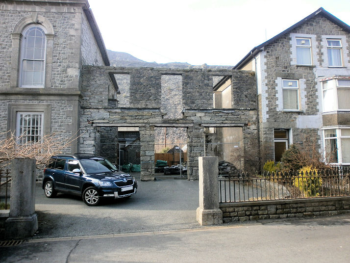
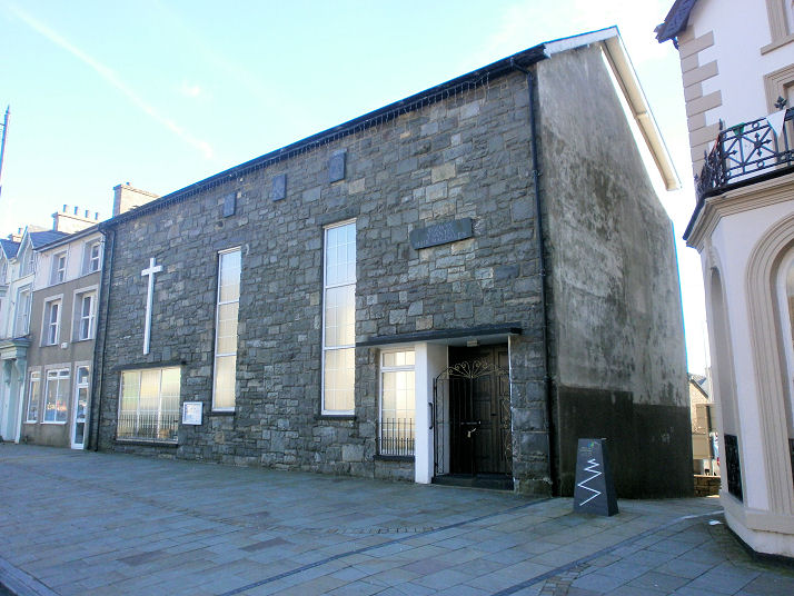
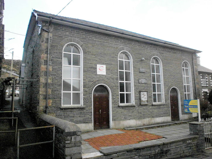
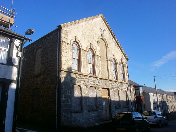
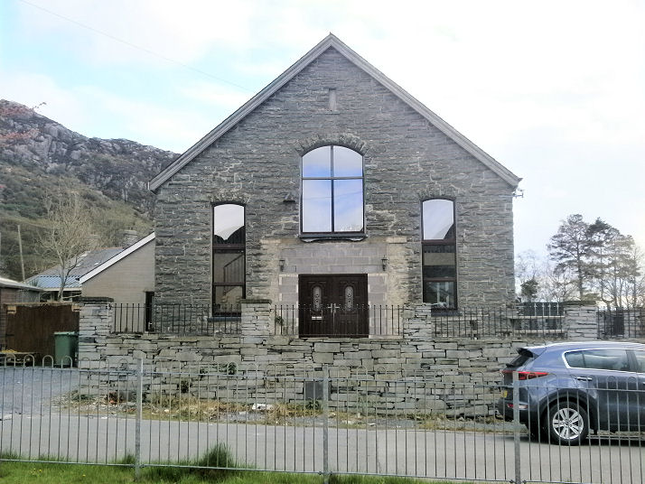
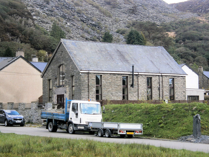
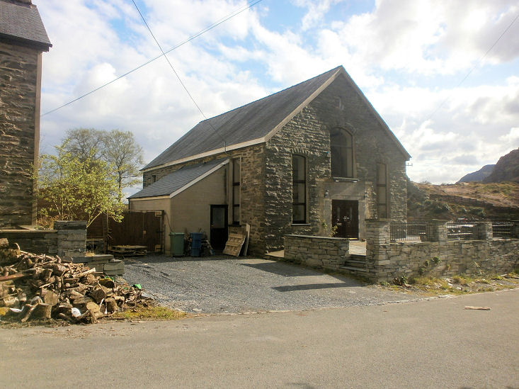
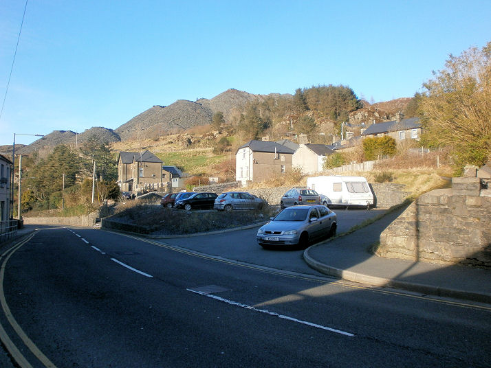
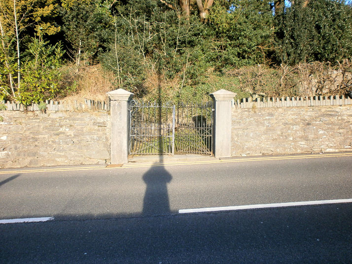
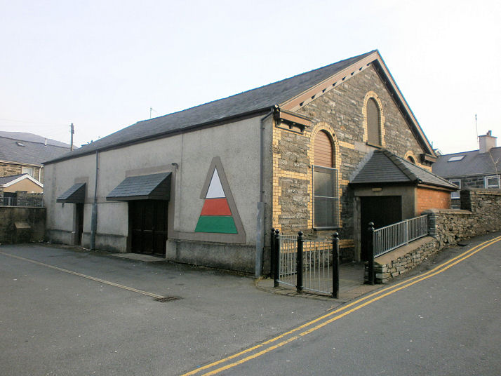
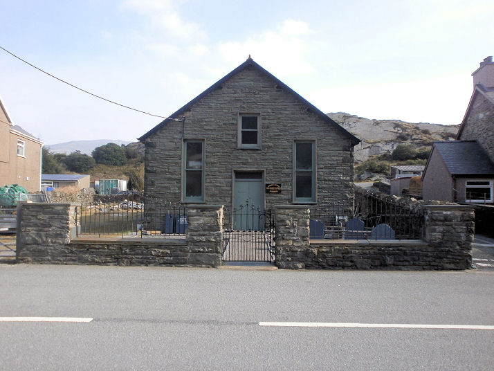
Ffestiniog on Wikipedia. All Saints (Welsh Orthodox), or more properly, The Orthodox Church of All Saints of Wales. This was originally St. Martha (Anglican), which pre-dated the 1st edition O.S. map of 1889. It must have closed on or before 1997, when a change of use application was made to the council to use it for storage, but it subsequently reverted to religious usage. Another view. SH 7053 4463. Both © Howard Richter (2016). Link. The demolished Bethania Independent Chapel (1818) stood on Manod Road. The site is at SH 7051 4515 and can be seen on Streetview, here. The chapel itself is shown here, taken from a photo in Undeb yr Annibynwyr Cymraeg - Blaenau Ffestiniog a'r cylch 1938, or, in English, "Union of Welsh Independent [churches] - Blaenau Ffestiniog and district 1938", a programme for a convention held in July 1938, it was printed by J.D. Davies of Blaenau, and is now in Howard Richter's Collection. Link. The derelict Bethesda Chapel (Calvinistic Methodist) on Manod Road. Another view, and a distant view of the rear of the building. SH 7054 4478. All © Howard Richter (2016). This source says that there have been three Bethesda chapels, of 1819, 1848, and 1870. The 1819 chapel is the one in the photos. Its grade II listing also dates it to 1819, however, the Archive Wales entry has it as built in 1826, extended 1848, and re-built 1869 (n.b. the Archive Wales link was unavailable when tested in 2023). The other, or one of the other, Bethesda's stood further north along Manod Road, at SH 7052 4487. Its site was seen by Streetview in 2016. The Bethesda congregation now meet in what was the Sunday School (view from adjacent graveyard, © Howard Richter (2016)). Bowydd Calvinistic Methodist Chapel (1882) on Newmarket Square. Another view. SH 6989 4575. Both © Howard Richter (2016). Link1. Link2. The site of the demolished Bryn-Bowydd Independent Chapel (1882), which stood at SH 6977 4584; now occupied by a block of flats. © Howard Richter (2018). Link. The chapel itself is shown here, taken from a photo in Undeb yr Annibynwyr Cymraeg - Blaenau Ffestiniog a'r cylch 1938, or, in English, "Union of Welsh Independent [churches] - Blaenau Ffestiniog and district 1938", a programme for a convention held in July 1938, it was printed by J.D. Davies of Blaenau, and is now in Howard Richter's Collection. The site of Caersalem Baptist Chapel on Tan-Y-Grisiau Road. Built in 1890, it was demolished in 1996-8, and is now in use as a chicken run. The wall and gate are original. SH 6916 4565. © Howard Richter (2016). Link. Calfaria General Baptist Chapel (1881) on Towyn Road. Two additional views - 1, 2. SH 6970 4584. All © Howard Richter (2016). Link. The former Capel Bach (Calvinistic Methodist) on the main road dates from 1872. This link says that "by 1998 the chapel had been converted for use as a gym". Two additional views - 1, 2. SH 6963 4742. All © Howard Richter (2016). The former Capel Horeb, for which dates and denomination are currently uncertain. Two further views - 1, 2. For sale in 2016, the Estate Agents notice (with photos) is here. It has been in use as a holiday let. SH 6917 4574. All © Howard Richter (2016). A map of 1888 marks a Chapel a little way north of Rhiw Chapel (for which see below) on the opposite side of Glanypwll Road. By the time of a map of 1901 it had been converted into a terrace of three houses (or three houses had been built on the site of it), and these can be seen here in a Streetview of 2011. Whether anything of the chapel survives in so far unknown, as is its name. SH 6956 4636. Disgwylfa Methodist Chapel (1899) has been converted for residential use. SH 7063 4504. Link. Streetview here. Ebeneser Methodist Chapel (1864) was demolished and replaced by shops in the early 1990's. It occupied a considerably larger area than today's shops; in this Streetview of 2009 the shops can be seen from behind, on the corner, and the chapel extended roughly as far as the low wall marking the extent of the car park. SH 7027 4584. © Howard Richter (2018). Link. The site of the demolished English Presbyterian Chapel at SH 6998 4602. It was built in 1882, and reportedly still in use in 1995, it was demolished on or before 2003. © Howard Richter (2016). Link, with sketches here. Garregddu Calvinistic Methodist Chapel (1878) was demolished in the first years of the present century, and replaced with a block of flats. SH 6999 4597. Streetview here. Gwylfa Calvinistic Methodist Chapel (1906) stood at SH 7055 4435. Link - note the old photo of the chapel under construction, and drawings of when it was in use as a garage. Streetview here - note the chapel date-stone now built into the wall to the left of the site entrance. Hyfrydfa Independent Chapel (1879). Another view. SH 7051 4441. Both © Howard Richter (2016). Link. The former Kingdom Hall of Jehovah's Witnesses on Leeds Street. Dates are presently uncertain, though it appears to have been active by 1977 when it is shown as "Kingdom Hall" on the OS map of that year. For sale in 2014, it seems to have closed quite recently, as it lodged its annual report with the charity commissioners for 2013 in January 2014. Another view. SH 699 459. Both © Howard Richter (2014). Jerusalem Independent Chapel (1868, enlarged in 1879) on Four Crosses. SH 7035 4580. © Howard Richter (2018). Link. The Sunday School of the demolished Maenofferen Chapel (Calvinistic Methodist, 1903). SH 7022 4567. © Howard Richter (2016). Link. The site of the chapel can be seen here. The former Pisgah Baptist Chapel (1899) is now a guest house (and has been since at least 2008). Another view. SH 7027 4575. Both © Howard Richter (2016). Link, which says that it been converted to residential use by 2002. Rhiw Chapel (Calvinistic Methodist, 1856). Was this skeletal structure abutting the former chapel originally part of it? SH 695 463. Both © Howard Richter (2016). Link, which advises of enlargement in 1859, a re-build in 1868, and conversion for residential use by 1999. St. David on Church Street. Another view. SH 6983 4596. Both © John Balaam (2014). Link. St. Mary Magdalene (R.C.) on the High Street. SH 7019 4588. © Howard Richter (2016). Link1. Link2. The former Salem Independent Chapel (1861) on Glanypwll Road. The building was converted to a rehearsal centre circa 1984. SH 6996 4561. © Howard Richter (2016). Sale notice with interior views. Seion General Baptist Chapel (1864 - date-stone, re-built 1879) on Lord Street. SH 7042 4588. Both © Howard Richter (2016). Link. Soar Wesleyan Methodist Chapel on Baltic Road had a relatively short active life of 1904 to 1939, and is now used as a store. Two additional views - 1, 2. SH 6967 4642. All © Howard Richter (2018). Howard has supplied me with a link to planning documents relating to the conversion. I've been unable to access the webpage on several occasions, but you may have more luck - link A distant view of the site of the demolished Tabernacl Calvinistic Methodist Chapel - it stood to the right of the house near the left edge of the photo. Built in 1864 and re-built in 1902, the final service was held in 1978. Old maps show that both chapels had the same footprint. A gate to a path to the chapel still stands a little way to the north-west. SH 7063 4554. Both © Howard Richter (2016). A 2011 Streetview shows the site more clearly, between the black car and the building beyond the white gate. A photo of the first and rather handsome chapel can be seen here. A former cinema, called Gramophone Hall, seems never to have been a chapel, despite appearances. © Howard Richter (2016). Link. Another building, now a monumental mason's, could easily be mistaken for a church, with gravestones in the "garden", but from map evidence IT seems never to have been a church. Built some time after 1891, the 1901 and 1919 maps show it as a Sunday School. SH 6928 4589. © Howard Richter (2016).
|
||
29 June 2023
© Steve Bulman