The Churches of Britain and Ireland
| Barnes, Greater London
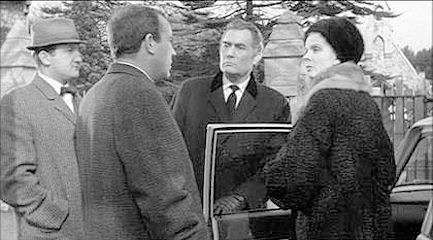
Older O.S. maps show a Baptist Chapel on Stanton Road at TQ 2168 7631. It pre-dates a map of 1898, and an earlier map of the 1870's shows an earlier Baptist on the same site, but aligned at right angles to the later church. It seems to have closed before the 1960's, and the site is now occupied by flats - 2022 Streetview. The website about us page for the present Baptist Church says the first Baptist Chapel in Barnes was built on or soon after 1866, with its replacement on the same site closing in or by 1934 when they moved into the present church (2022 Streetview) on Lonsdale Road. Curiously, it isn't labelled as a place of worship on available mid-20th century 1" O.S. maps. TQ 2179 7707. Link. After languishing for a long time on the long-term unsolved page, Jay Priest has resolved the following mystery. Greg Mishevski was interested in the location for a scene in the film "Girl in the Headlines" (1963), which shows a Cemetery Chapel. He'd provided two stills - 1, 2. Jay has identified it as the chapel in Barnes Cemetery in Greater London, and had provided this confirmatory link. TQ 2269 7614. The earliest map available on-line (1874, surveyed in 1866) shows a Chapel set well back from Castelnau, on its N.W. side, at TQ 2266 7771. Had it survived it would have stood on the later Jenner Place. Its site hasn't been seen by Streetview. I haven't been able to discover anything about it, but its proximity to the later Holy Trinity suggests that it may have been its predecessor. Can you provide any information about it? Holy Trinity (2022 Streetview) is on Caselnau and Trinity Church Road. It's dated in Pevsner to 1868. Another Streetview, from 2018. TQ 2275 7767. Link. St. Mary stands on Church Road. It isn't well seen by Streetview (this one is from 2018). Pevsner advises of a severe fire in 1978 which necessitated a re-build, except for a chapel and the tower. TQ 2220 7659. Link. Some interior photos here. Grade II* listed. The churchyard war memorial is also listed, at grade II. The rather large Methodist Church is on Station Road, and seen by Streetview in 2024. Pevsner, who dates it to 1906, says that a tower was included in the plans, but never finished. Older maps label it as Wesleyan. TQ 2188 7621. Link. St. Michael and All Angels (2021 Streetview) is on Elm Bank Gardens, and dated in Pevsner to 1891-3. TQ 2144 7608. Link. St. Osmund (R.C.) stands on Castelnau at TQ 2250 7720. It's dated in Pevsner to 1958, and was seen by Streetview in 2022. Link.
|
||
07 January 2026
© Steve Bulman