The Churches of Britain and Ireland
| Balsall Heath,
Birmingham
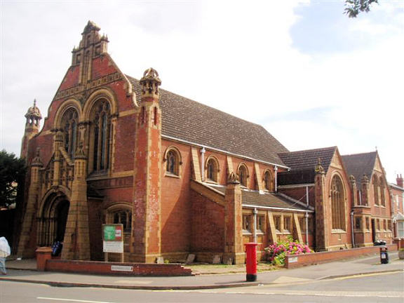
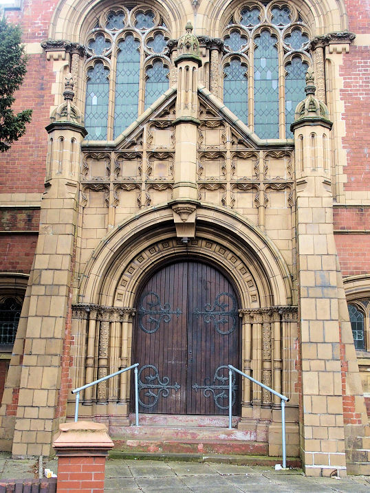
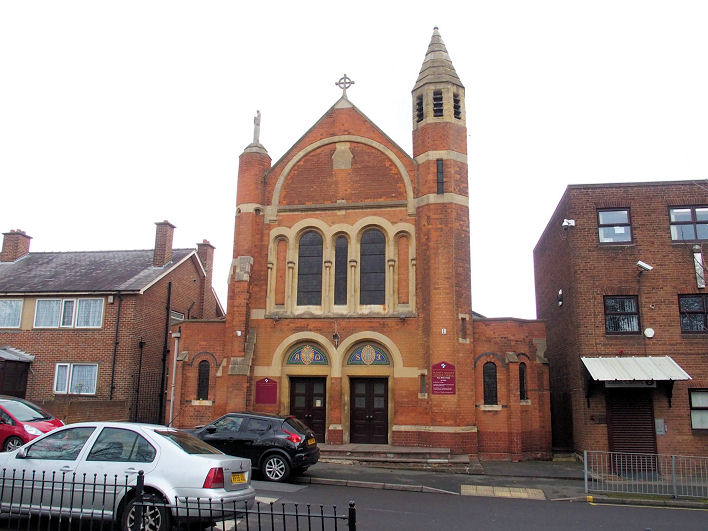
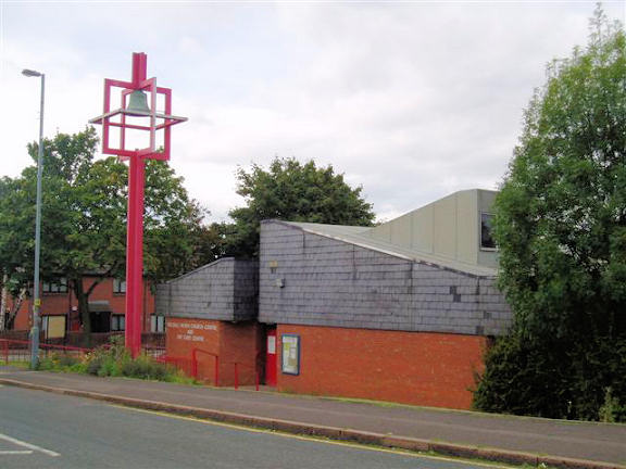
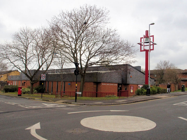
Adam Mosque and Dawah Academy (2021 Streetview) on Brunswick Road. Circa SP 0815 8435. Link dates it to 2012. Al-Abbas Islamic Centre (2022 Streetview) on Clifton Road. SP 0790 8426. Link. Al Falah Community Mosque on Tindal Street was seen by Streetview in 2022. SP 0758 8418. Facebook. Assemblies of the First Born on Alfred Street, as seen by Streetview in 2014. SP 0858 8438. Link (not working when I tried it). Baptist Church on Edward Road. It's dated here to 1900. SP 0708 8449. © Aidan McRae Thomson. Two additional views - 1, 2, both © Dennis Harper (2019). Link. Church of God in Christ (Pentecostal) on George Street, as seen by Streetview in 2014. SP 0751 8426. A Congregational Chapel used to stand at the junction of Moseley Road and St. John's Road (now Runcorn Road). Its site was seen by Streetview in 2021. It's dated here to 1862, and reports that in 1953, "not used for some years", and sold in 1955. Its Sunday School survives on Runcorn Road (2022 Streetview). The date-stone records an extension which was added in 1888. SP 0784 8422. The site (2022 Streetview) of a demolished Gospel Hall at the corner of Wenman Street and Knutsford Street. A photo of it is available here, where it says it was registered for public worship in 1870. Another source says it was still in active use in 1957. SP 0762 8470. Guru Gobind Singh Gurdwara on Mary Street and Hallam Street, as seen by Streetview in 2016. According to this source, they have been at these premises since 1960. SP 0739 8428. Gurdwara Guru Ramdas Singh Sabha on Moseley Road, as seen by Streetview in 2022. SP 0786 8444. Ladypool Road Congregational Church (according to the church website) or The Congregational Church of Sparkbrook (as per its sign seen by Streetview in 2022). According to this source, it was built in 1894 by Sparkbrook Gospel Mission, becoming "affiliated to Moseley Road Congregational church in 1901". SP 0850 8435. Markazi Jamia Masjid Bilal on Willows Crescent and Jakeman Street, as seen by Streetview in 2021. SP 0717 8419. A map of 1887 shows, on Vincent Street, a Meeting House (Plymouth Brethren) at SP 0784 8458. This seems to be the same building mentioned here as having been built by Wesleyans in 1839, who left in 1887, and apparently were temporarily replaced by a Methodist New Connexion congregation between 1870 to 1883. Its site now lies beneath Haden Way, and in this 2022 Streetview it would have faced the camera directly from about where the road starts to expand into the turning. The Methodist Church on Moseley Road dates from 1872 (as Wesleyan), closing in 2011 (source). This source says that "extensive reconstruction" was carried out in 1952, made necessary by war damage. A photo of the first chapel can be seen here, where it says that a new church was built, the foundation stone being laid in 1949. Certainly its appearance suggests a complete re-build - it was seen by Streetview in 2021. SP 0788 8441. A Mission Church stood on Alfred Street. The most recent Streetview was in 2022 when a restaurant (Shimlas) stood on the site. SP 0852 8440. Muslim Students Mosque (2022 Streetview) on Moseley Road is a former Church of Christ. It's dated here to 1912, a replacement for an earlier Church of Christ on Charles Henry Street. However, a map of 1904 shows an otherwise unidentified Church on this same site, so its possible that they moved into a pre-existing building. SP 0785 8437. A Particular Baptist Chapel used to stand at the junction of Balsall Heath Road, very close to its junction with Longbridge Road. The building's history can be seen here, but briefly, it was originally an "undenominational school-chapel" which was used by a Congregational Mission "shortly after 1858". Before too long a Wesleyan congregation took it over, and was succeeded in 1873 by a Baptist one which lasted till 1900, when they moved to their newly-built chapel on Edward Road. Its subsequent history isn't mentioned. The area has since been completely re-developed, but the site of the chapel was seen by Streetview in 2021. SP 0746 8491. Another vanished chapel was the Primitive Methodist on Balfour Street (previously King Street). It's stated here to have been opened in 1927, and had been preceded on the same site (though set further back) by a Mission Hall of 1874. This is curious as a map of 1889 shows a school here. In any event, it says that the P.M. Chapel was closed and sold after the Methodist union in 1932. Housing was built on the site (2022 Streetview). SP 0741 8460. Also long demolished is another P.M. Chapel on Thomas Street (now Highgate Road) and Queen Street, demolished (with many other buildings) to make way for a "tramway depot", shown on a map of 1904. This source dates it to a re-build (as P.M.) by 1892 of a Methodist New Connexion Chapel originally of 1849 (and sold to the P.M.'s in 1854). It's site was seen by Streetview in 2022. SP 0867 8456. St. Barnabas on Clifton Road, as seen by Streetview in 2022. It's described here as a Mission Church of 1890, from St. Paul. This source says the original tin tabernacle was replaced in 1904 by a permanent church (there is an illustration). It was bigger than the present church, extending to Ladypool Road, but it suffered bomb damage in WWII. The post-war remedial work can be seen in a photo here. SP 0846 8408. St. John and St. Martin (R.C.) on George Street. SP 0750 8421. © Dennis Harper (2019). Link. St. Mark (a mission from St. Paul's) used to stand on Wenman Street at SP 0760 8452. This source says it was "licensed for public worship from 1892 to 1926". A map of 1952, surveyed no earlier than 1937, suggests that the building survived until then at least. In this distant 2022 Streetview of its site, the church stood at about where the buff coloured housing is, its frontage facing the camera, and directly in line with the angle in the pavement in the foreground. St. Paul on Edward Road and Mary Street, also referred to as Balsall Heath Church Centre and The United Church of St. Paul's. SP 0745 8444. © Aidan McRae Thomson. Another view, © Dennis Harper (2019). Link. Its Wikipedia entry dates it to 1979 when the previous St. Paul (see below) and the Church of Christ U.R.C. (for which see Muslim Students Mosque above) joined forces. The site (2022 Streetview) of the demolished St. Paul, which stood at the junction of Moseley Road and St. Paul's Road. This source says it was consecrated in 1853. An old photo can be seen here. SP 0793 8458. The site of St. Thomas in the Moors as seen by Streetview in 2015. It stood on Lincoln Street at SP 0735 8467. Consecrated in 1883 (source), it shows as still active on a map of 1947, but not on a map of 1959. A photo of the church can be seen here. The site (2021 Streetview) of a demolished Salvation Army Mission Room on George Street. SP 0752 8437. It's known to have been active in 1892 (source). Sparkbrook Congregational Chapel stood on Stoney Lane at SP 0870 8369. Built in 1896, it fell victim to the Luftwaffe in 1940 (source). Its site was seen by Streetview in 2022. True Jesus Church on George Street, as seen by Streetview in 2018. In 2012 it was Church of God of Prophecy. SP 0748 8112. Link. The former United Methodist Church (2009 Streetview, when it was Kings Christian Centre) on Ombersley Road and Woodfield Road. It's dated here to 1896, as Methodist New Connexion, and was still active at least into the 1950's. On the most recent Streetview visit it was Bahu Centre. SP 0809 8473. A Wesleyan Methodist Mission Room used to stand on Knutsford Street at SP 0755 8470. This source notes its presence in 1875, and says that local directories stop mentioning it from 1933. In this 2020 Streetview, its site is just beyond the blue gates, on the right hand side of the road. Zawiya Mosque (2022 Streetview) on Edward Street. SP 0682 8457. Link.
|
||
10 February 2024
© Steve Bulman