The Churches of Britain and Ireland
| Ashford,
Kent
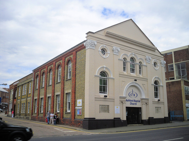
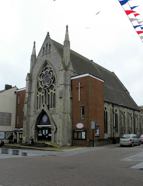
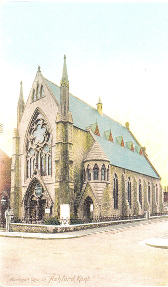
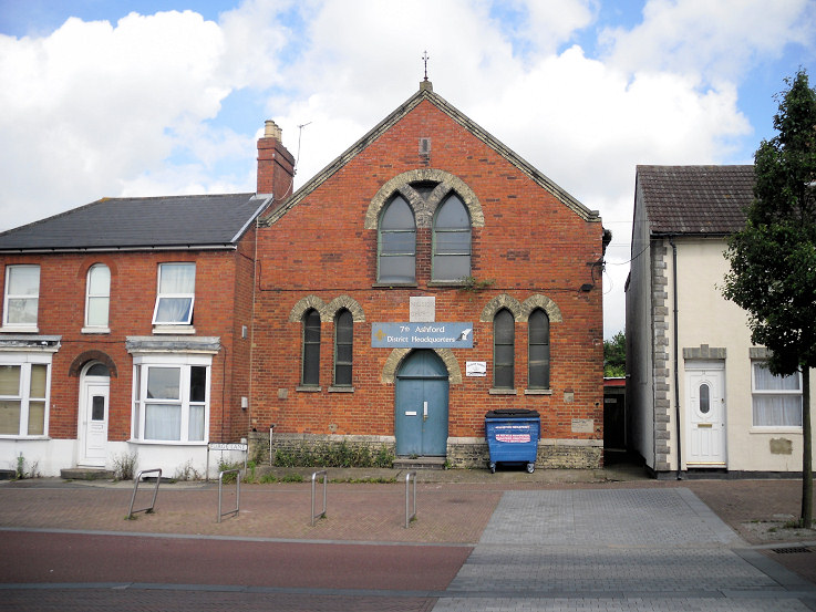
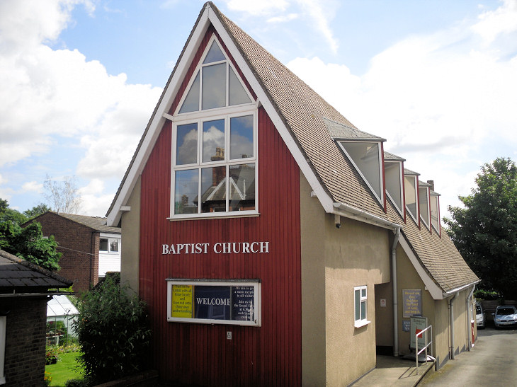
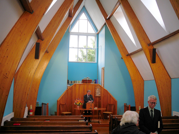
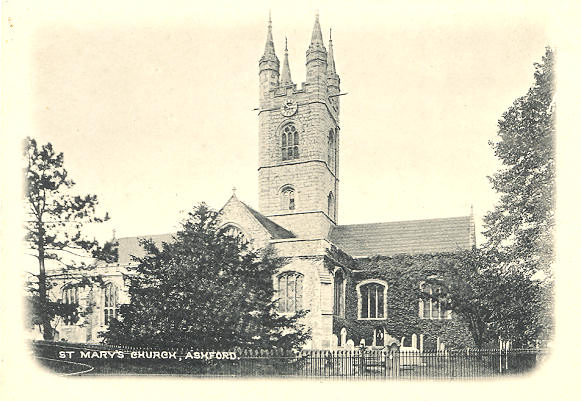
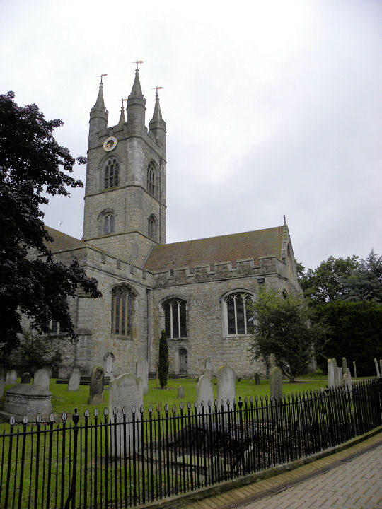
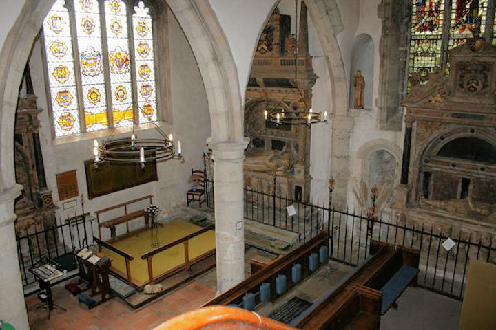
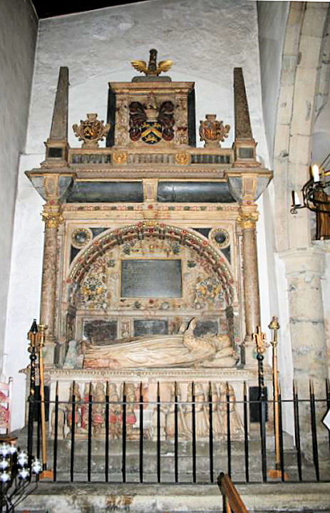
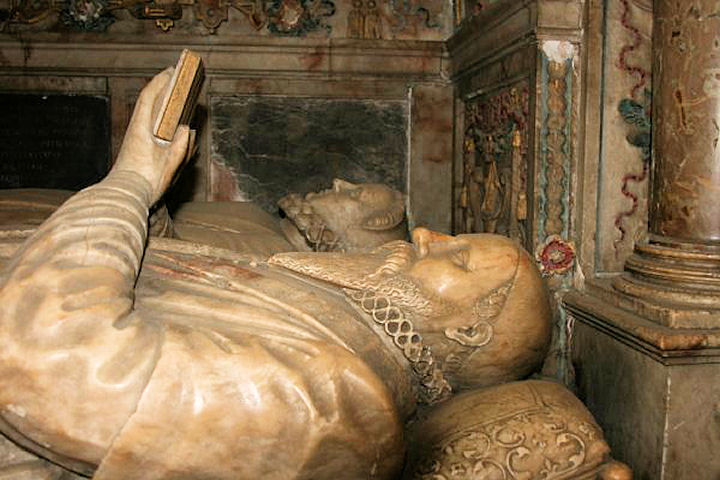
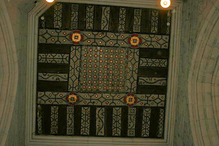
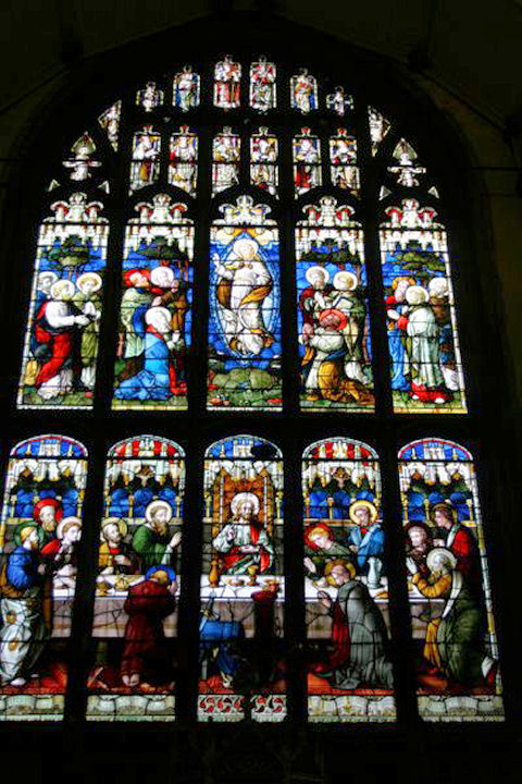
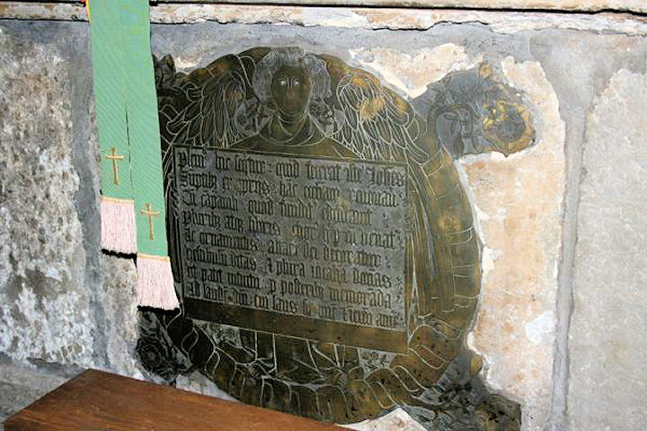
Churches in Willesborough. Ashford Community Church on Francis Road, as seen by Streetview in 2021. TR 0065 4158. Link. Ashford and Folkestone Quaker Meeting (2018 Streetview) is on Albert Road. TR 0104 4310. Link. Ashford Christian Spiritualist Church also meets here. Facebook. Ashford Reformed Baptist Church meets in Repton Manor Primary School (2016 Streetview) on Repton Avenue. TQ 9960 4366. Link. Baptist Church on Station Road. TR 0120 4273. © Gerard Charmley (2012). Link. A map of 1872 shows that the building shown was built on a graveyard for a predecessor General Baptist Chapel which stood further back from the road. Whether it was was demolished or incorporated into the later church is unclear, but this Streetview from 2021 shows the earlier chapel or its replacement to the left of the later build. Beulah Bible Christian Chapel shows on a map of 1871 at the corner of Lower Denmark Road and Torrington Road at TR 0100 4171. It has survived, and was seen by Streetview in 2023. It was still in active use at least into the 1950's. Centrepiece Church (Methodist and U.R.C.) on Bank Street and Middle Street was built as Wesleyan. TR 0085 4267. © John Balaam (2012). An old postcard view, from Geoff Watt's Collection. Streetview shows two subsequent name changes, to Ashford Christian Fellowship (2014), and Bright City Church (2021). Link. Christ Church (2021 Streetview) on Christchurch Road and Beaver Road. TR 0086 4174. Link. Grade II listed, wherein it's dated to 1866-7. Church of Jesus Christ of Latter-day Saints (2023 Streetview) on Canterbury Road. TR 0157 4385. A Congregational Chapel used to stand at the junction of Tufton Street and Church Road. Pre-dating a map of 1876, it survived in active use until 1959 at least. It is presumably this chapel shown here. On the site today is this building (2023 Streetview). TR 0101 4265. A map of 1873 show Ebenezer Chapel (Par. Baptist) on Norwood Street. TR 0095 4264. An active church is still shown on mid-20th century maps. The left end of this office block (2021 Streetview) now occupies its site. The former Forge Lane Mission Chapel, now used by the scouts. Gerard advises that it was built as Primitive Methodist. It pre-dates a map of 1876. TR 0066 4286. © Gerard Charmley (2012). Google Maps shows Fountain Church, meeting in Montpelier Business Park, but further details are unavailable as the supplied website doesn't work, and searching for it is unproductive. They do still have an active Facebook page however. Gateway Church meets in The Riverside Centre (2023 Streetview) on Clockhouse. TQ 9954 4236. Link. ICM Ashford Pentecostal Church is shown on Google maps on Godinton Road. However, the church website gives the location of services as Stanhope Parish Hall (2012 Streetview) on Otterden Close. Link. Older O.S. maps show two Mortuary Chapels in Bybrook Cemetery on Cemetery Lane. Neither survives. They stood at TR 0118 4332 (CoE) and TR 0117 4324 (Nonconformist). Mount Zion Strict Baptist Chapel on Canterbury Road. Interior view. TR 0109 4314. Both © Gerard Charmley (2012). Link. Marked on a map of 1871 is a Plymouth Brethren Chapel, on Whitfield Road, at TR 0095 4159. Active at least into the mid-20th century, it's now in commercial use. 2023 Streetview. Pneuma Church (2023 Streetview) on Brunswick Road. TQ 9971 4284. Link. St. Francis is on Cryol Road and Simons Avenue at TQ 9994 4116. Seen by Streetview in 2009, it's dated to the 1960's here. Link. St. Mary the Virgin, off High Street. TR 0102 4274. From an old postcard in Steve Bulman's Collection. A modern view, © John Balaam (2012). The following photos are all © Dave Godden - interior view, the Smythe monument and detail, decorated roof, window depicting the last supper, Sir John Fogge's brass. Link. Grade I listed. For related listed features, see here. St. Simon Stock (R.C.) on Brookfield Road. It was seen by Streetview in 2023. TQ 9997 4152. Link1. Link2. St. Theresa (R.C.) on Maidstone Road, as seen by Streetview in 2023. TR 0055 4313. Link. It stands on the site of a predecessor, also St. Theresa, shown on O.S. maps as far back as 1876. This source dates it to 1865, by E. E. Pugin, with demolition in 1990, with the present church opened in 1991. Some photos of it can be seen here, at the bottom of the page. South Ashford Baptist Church on Brookfield Road, as seen by Streetview in 20023. TQ 9985 4158. Link. The King of Glory Christian Assembly (2019 Streetview) on Wotton Road. TR 0063 4079. Link. United Church (2021 Streetview) on Cade Road and Kingsnorth Road is Methodist and U.R.C. TR 0047 4116. Link. The history page dates it to 1971-2. There was at one time a Wesleyan Methodist Chapel on Hemsted Street at TR 0084 4278. Chapel and street have both gone, and a large shopping centre now stands on the chapel site. It stood roughly at the far end of the road seen here (2021 Streetview), on the right side.
Willesborough
|
||
16 July 2025
© Steve Bulman