The Churches of Britain and Ireland
|
Ammanford, Carmarthenshire
Ammanford Churches (use the
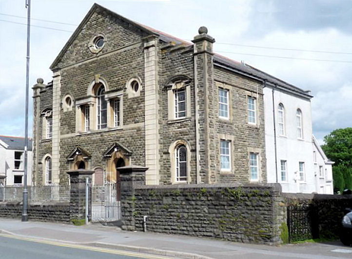
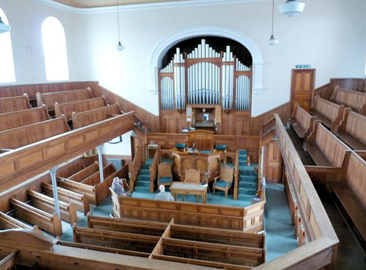
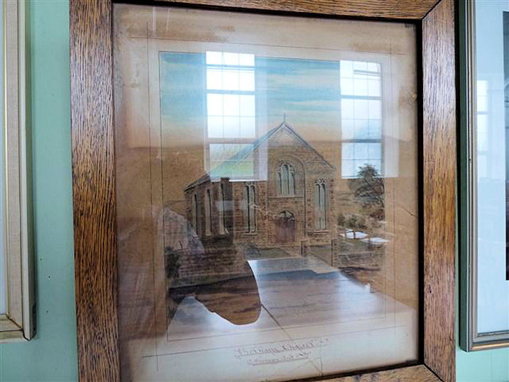
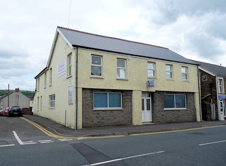
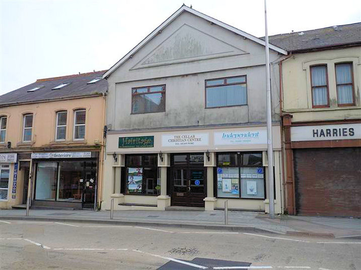
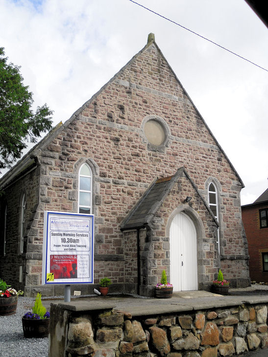
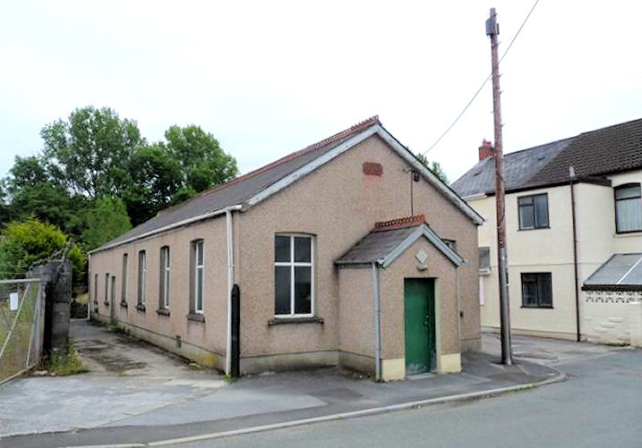
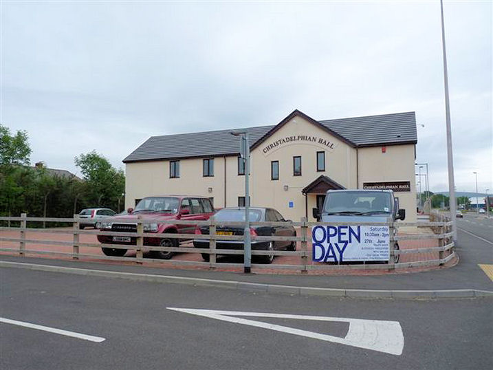
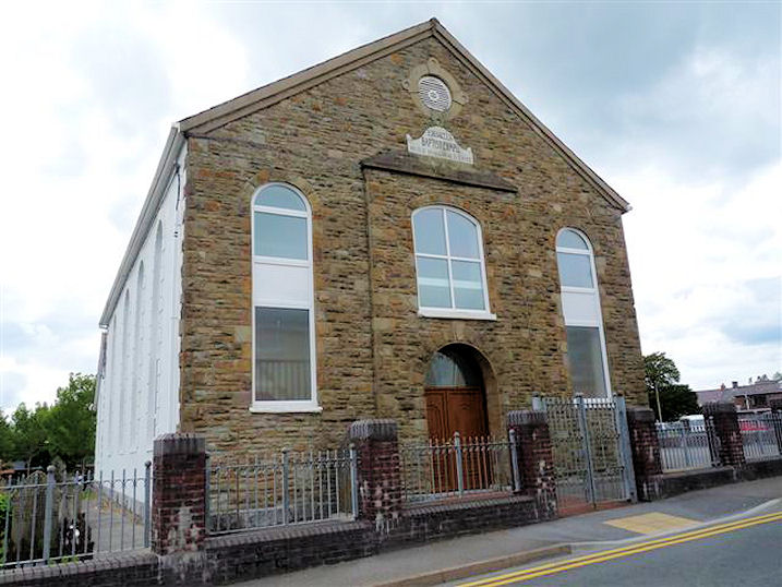
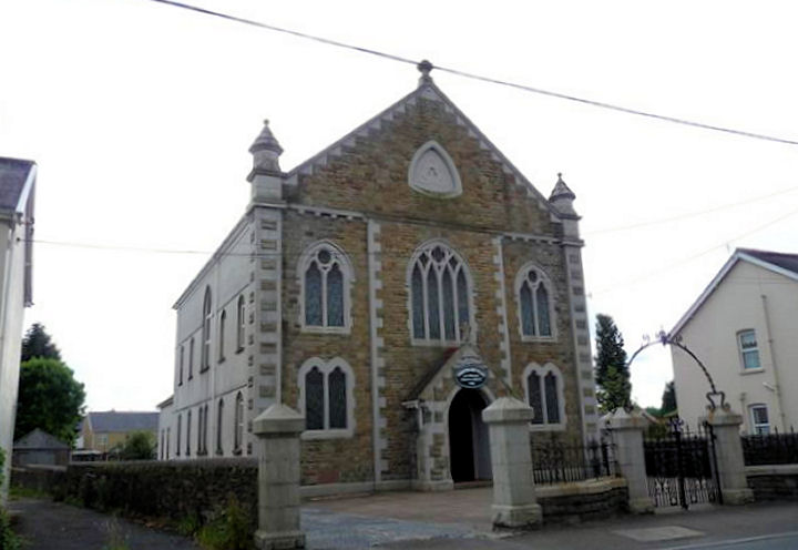
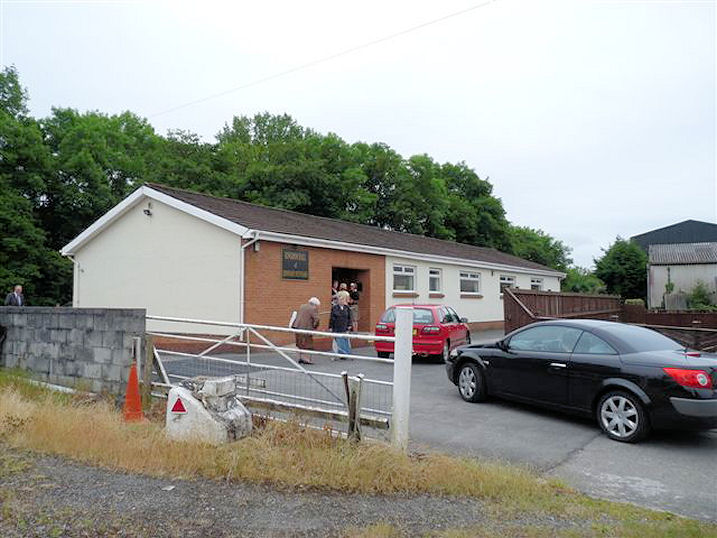
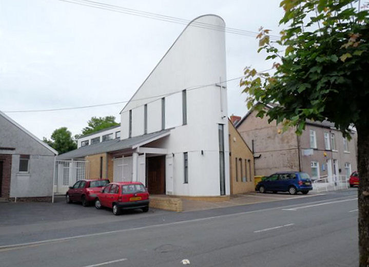
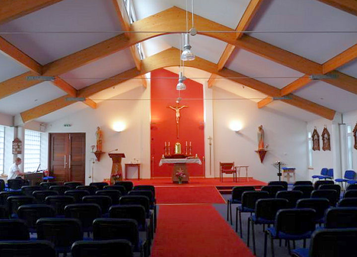
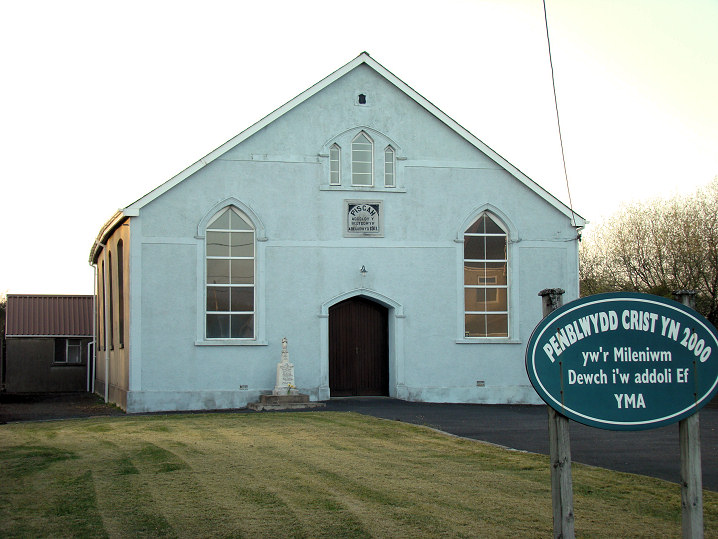
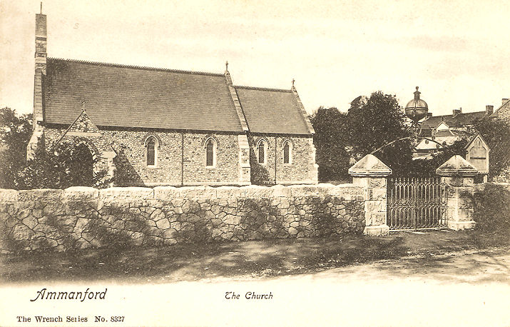
Churches and Chapels button). All Saints on Church Street. Its grade II listing dates it to 1911-15. SN 6294 1268. © Mike Berrell (2009). Link. Apostolic Church on Heol Iscennen, as seen by Streetview in 2021. Coflein says "probably built c.1913". SN 6274 1244. Link. Bethany Calvinistic Methodist (Welsh Presbyterian) Chapel on Wind Street. Two interior views - 1, 2. Although not a good photo (as Mike admits), this photo of the old chapel, reproduced by kind permission of the church elders, is worth including. SN 6281 1213. Both © Mike Berrell (2009). Its Wikipedia entry dates it to 1881-2023. Bible Church on Wind Street and Heol Las. SN 6269 1200. © Mike Berrell (2009). Link. The About Us page explains that it was founded in 1995 as Ammanford Bible Church (hence ABC) and that its name was changed to Calon in 2020. Cellar Christian Centre (Ammanford Church) on College Street. SN 6269 1200. © Mike Berrell (2009). At some point prior to October 2015 the church left this building as a Streetview shows it in commercial use. Link. The Directions page gives their main church building as Llandybie Memorial Hall (for which see the Llandybie entry on the Carmarthenshire page), and during the week, at Y Llusern (2021 Streetview) on Wind Street. Older maps show this to have originally been a Wesleyan Methodist Chapel. The brief Coflein entry for the Methodist dates it to 1875 to "before 1997". SN 6288 1220. Two other photos, both from 2009 - 1 (© Mike Berrell), and 2 (© Gerard Charmley). Both photographers identified it as an Evangelical Church. What was initially believed to have been Chapel (1921) on Pontamman Road. SN 640 126. © Mike Berrell (2009). My appreciation to Terry Norman (Secretary of the Ammanford and District Archaeology and History Society) for advising that this is the rehearsal room for the Ammanford Silver Band, and has been since it was built. Christadelphian Hall on Foundry Road. SN 6319 1215. © Mike Berrell (2009). Link. Ebenezer Baptist Chapel on Baptist Lane. Its Coflein entry dates it to a re-build in 1877 on the site of an earlier chapel of 1849. SN 6294 1217. © Mike Berrell (2009). Large scale older O.S. maps show Elim Chapel (Calv. Meth.) on Llandybie Road at SN 6261 1292. Its very brief Coflein entry dates it to 1906. Its appearance in 2021 (Streetview) demonstrates that it's now in residential use. English Baptist Church on Brynmawr Lane. According to its Coflein entry, it was originally a school building, and the church was established in 1905. SN 6285 1264. © Mike Berrell (2009). Gateway Elim Church on Pantyffynnon Road, as seen by Streetview in 2021. SN 6234 1122. Link. Gellimanwydd Christian Temple (Independent, built 1782, re-built 1836, with further building works in 1865 and 1910), on High Street and Hall Street. Coflein has a good history. SN 6315 1229. © Mike Berrell (2009). Gospel Hall (Plymouth Brethren) off Lloyd Street, as seen by Streetview in 2011. SN 6297 1225. Link dates it to 1911, having been preceded by meetings in the Ivorites Hall from about 1888, and later in the Rechabites Hall. Both of these have gone. Ivorites Hall is shown on large scale O.S. maps on Hall Street at SN 6309 1224. The building on the site today was seen by Streetview in 2022. Not labelled on any available maps, this source places the Rechabite Hall where the Railway Hotel (2021 Streetview) is today, so on Quay Street at SN 6309 1211. However, the 25" O.S. map of 1906 actually labels a Gospel Hall a short distance further south at SN 6312 1207, the site now lying beneath the grassed area by a roundabout (2021 Streetview). Gwynfryn Capel yr Annibynwyr (Independent) on College Street. Its Coflein entry dates it to 1903. SN 6271 1265. © Mike Berrell (2009). Kingdom Hall of Jehovah's Witnesses on Pontamman Road. SN 640 126. © Mike Berrell (2009). Our Lady of the Rosary (R.C.) on Margaret Street and Union Street. Coflein dates it to 2004, on the site of a predecessor. Interior view. SN 6338 1258. © Mike Berrell (2009). Link1. Link2. Pantyffynnon Gospel Hall (2021 Streetview) stands on Hoel Llwchwr. SN 6237 1128. Link. Pisgah Methodist Chapel (1911) at Pennybanc. It's dated to 1911 by Coflein. SN 6163 1187. © Peter Morgan (2012). St. Michael and All Angels on Wind Street. From an old postcard in Steve Bulman's Collection. A Streetview from 2021 provides a modern view. SN 6289 1230. Coflein dates it to 1885, and says that, proving too small, a church hall was built across the road to provide additional worship space. This must be it here in a 2021 Streetview. It's now in secular use. Link. Older O.S. maps show a Wesleyan Methodist Chapel at the junction of Harold Street and Station Road, at SN 6255 1277. Coflein identifies it as Tir-y-Dail Methodist Chapel, and dates it only to "the early twentieth century". It was certainly in place by 1906. Perhaps the building seen here in a Streetview from 2022 is the surviving modified chapel.
|
||
30 December 2023
© Steve Bulman
Contact Details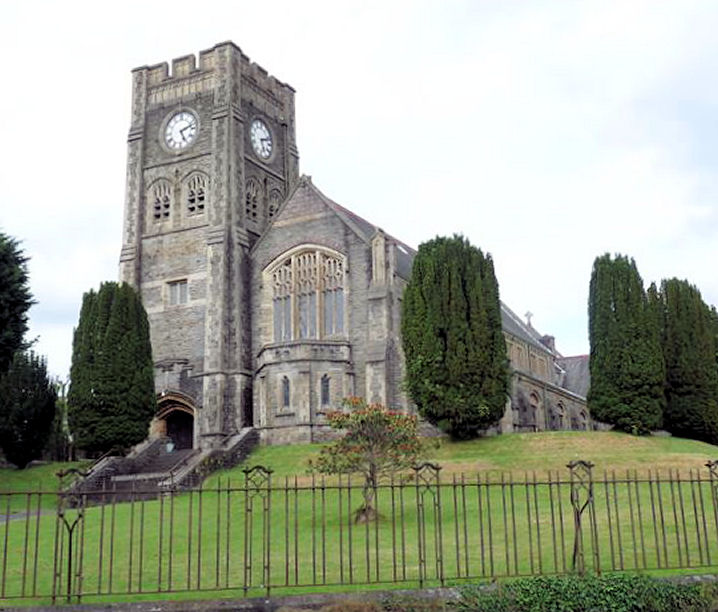