|
| East Dunbartonshire
East Dunbartonshire on Wikipedia.
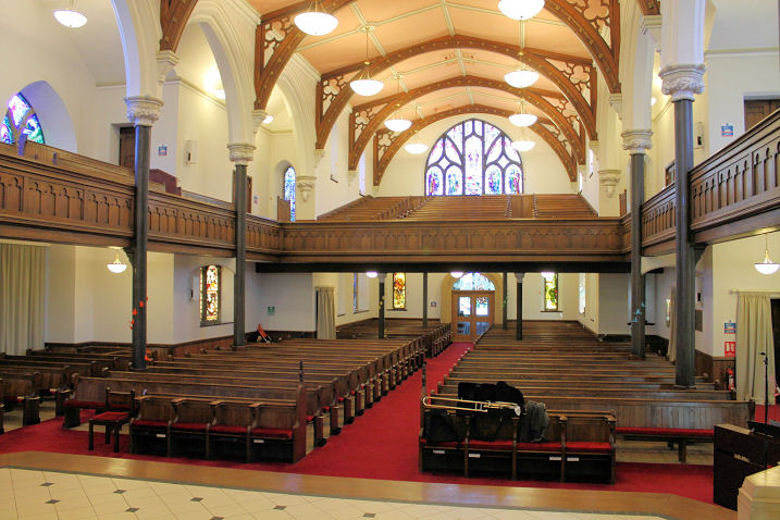
Bearsden, New Kilpatrick Church (CoS, 1807 or 1808). NS 5432 7226. © Martin Richter (2013).
Another view, and two interior views - 1,
2, all
© Charles Clegg (2013).
Link. A comprehensive history
can be read here. And
also see Our Windows for many photos of the fine
stained glass. Link2.
Category A listed.
PoWiS.
Bearsden Cross Parish Church on Drymen Road. According to its
PoWiS entry (which calls it Bearsden South Church of Scotland)
it was built on the site of (and perhaps foundations of) a church bombed
in WWII. It shows on older maps as a United Presbyterian Church. NS 5430
7189.
© Charles Clegg (2013).
Link.
The Baptist Church is on Roman Road, and
seen by Streetview
in 2019. NS 5459 7203. Link.
St. Andrew (R.C.)
on Roman Road, as seen by Streetview in 2012. NS 5437 7214.
Link. The former
Free Church
(2024 Streetview) on Thorn Road and Drymen Road. NS 5421 7209. Its
category B listing dates it to 1887-9. It had closed no later than
2014, when
Streetview saw its "to let" sign.
All Saints
(Episcopal, 2024 Streetview) is a little further north on Drymen Road,
at the corner of Glenburn Road. NS 5419 7218.
Link.
Baljaffray Parish Church is on Grampian Way and Grampian Close,
and was seen by
Streetview in 2023. NS 5335 7361.
Link.
Castlehill Baptist Church meets in
Castlehill Primary
School (2022 Streetview) on Rosslyn Road. NS 5303 7257.
Link.
|
|